The best running trails around Alpuente
194
runners
33
runs
Jogging around Alpuente offers diverse landscapes within the Serranía region of inland Valencia. The area features a network of trails and gravel roads, suitable for various running experiences. Terrain includes the Alpuente Gorge with its narrow paths and wider dirt roads, sections winding through forests, and paths leading past historical structures. The municipality is characterized by varied elevations, from flatter sections to routes with significant climbs.
Best jogging routes around Alpuente
- The most popular jogging route is Picón del Buitre…
Last updated: June 28, 2026
6
runners
Hard run. Very good fitness required. Mostly paved surfaces. Suitable for all skill levels.
34
runners
19.0km
02:49
810m
810m
Hard run. Very good fitness required. Sure-footedness, sturdy shoes and alpine experience required.

Sign up for free
16
runners
Hard run. Very good fitness required. Mostly paved surfaces. Suitable for all skill levels.
12
runners
27.7km
03:59
1,180m
1,180m
Hard run. Very good fitness required. Mostly paved surfaces. Suitable for all skill levels.
8
runners
18.8km
02:28
510m
510m
Hard run. Very good fitness required. Mostly paved surfaces. Suitable for all skill levels.
Get access to more routes and recommendations from other explorers.
Sign up for free
Already have an account?
Our route recommendations are based on thousands of hikes, rides, and runs completed by other people on komoot.
Start today with a free account
Your next adventure awaits.
Login or Signup
Tips from the Community

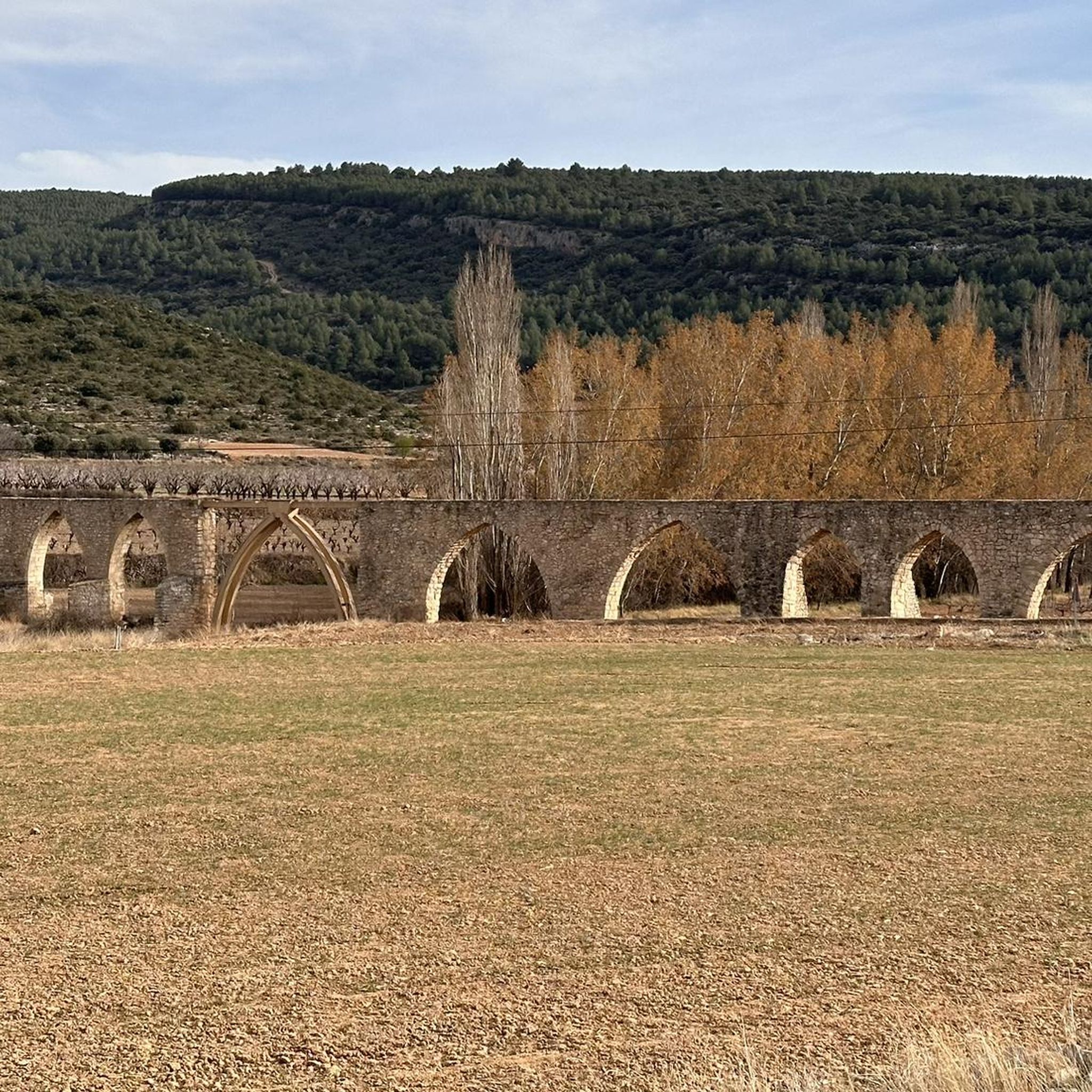
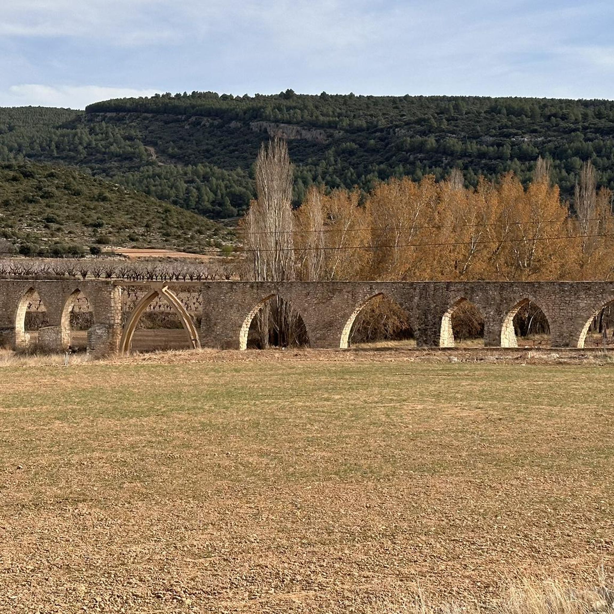
The Los Arcos aqueduct, located in Alpuente, is a 16th and 17th-century hydraulic structure that supplied water to the town and its orchards. With its thirteen pointed arches and a length of 265 meters, the arcade bridged the uneven level of the Reguero River, although the main arch was lost in a flood in 1880. Today, it is preserved as a Site of Cultural Interest and can be easily visited from the road to La Yesa. It is an interesting spot for combining history and hiking; good footwear is recommended to explore the surroundings.
2
0
Alpuente is a picturesque town in the Los Serranos region, surrounded by mountains and ravines, making it an ideal destination for hiking enthusiasts. Its historic center preserves remains of walls, towers, and the medieval castle, as well as an interesting paleontological museum with dinosaur fossils. From the town, you can take a 46-kilometer trail that connects its numerous villages, a good option for exploring its natural and rural surroundings. The terrain is rocky and uneven, so it's advisable to wear comfortable shoes and bring water, especially in summer.
1
0

From the parking lot, the trail is challenging. Despite the markings, it's not always easy to find. In some places, you'll need to use your hands to help you.
0
0

A very privileged site with amazing views on all sides, chosen by many athletes to challenge the demanding climb. The peak of Picón del Buitre is located at 1956 meters above sea level and was chosen to build the Astronomical Observatory given its remote location, altitude and low light pollution.
2
0
The top of Picón del Buitre at 1956 meters above sea level was chosen as the ideal site to build the Astronomical Observatory. Its remote location, altitude, and low light pollution from cities is all that is needed to be able to observe the stars at night. During the day it is a very privileged place with amazing views on all sides, chosen by many hikers and cyclists to challenge the demanding climb.
2
0
A very pretty town located in a very picturesque setting within the region of La Serranía. You can see very nice views both from the town and from the road to there. A highly recommended place to visit.
1
0

At the foot of Pico del Remedio we find this beautiful hermitage with a children's play area, a picnic area with tables, sinks and roasters.
0
0
descent something more than technical from the observatory to the Remedio hermitage following the PR.
0
0
Frequently Asked Questions
How many running routes are available around Alpuente?
There are over 15 dedicated running routes around Alpuente, offering a variety of experiences for different skill levels. These include easy paths, moderate trails, and challenging climbs through diverse landscapes.
What kind of terrain can I expect on the jogging trails in Alpuente?
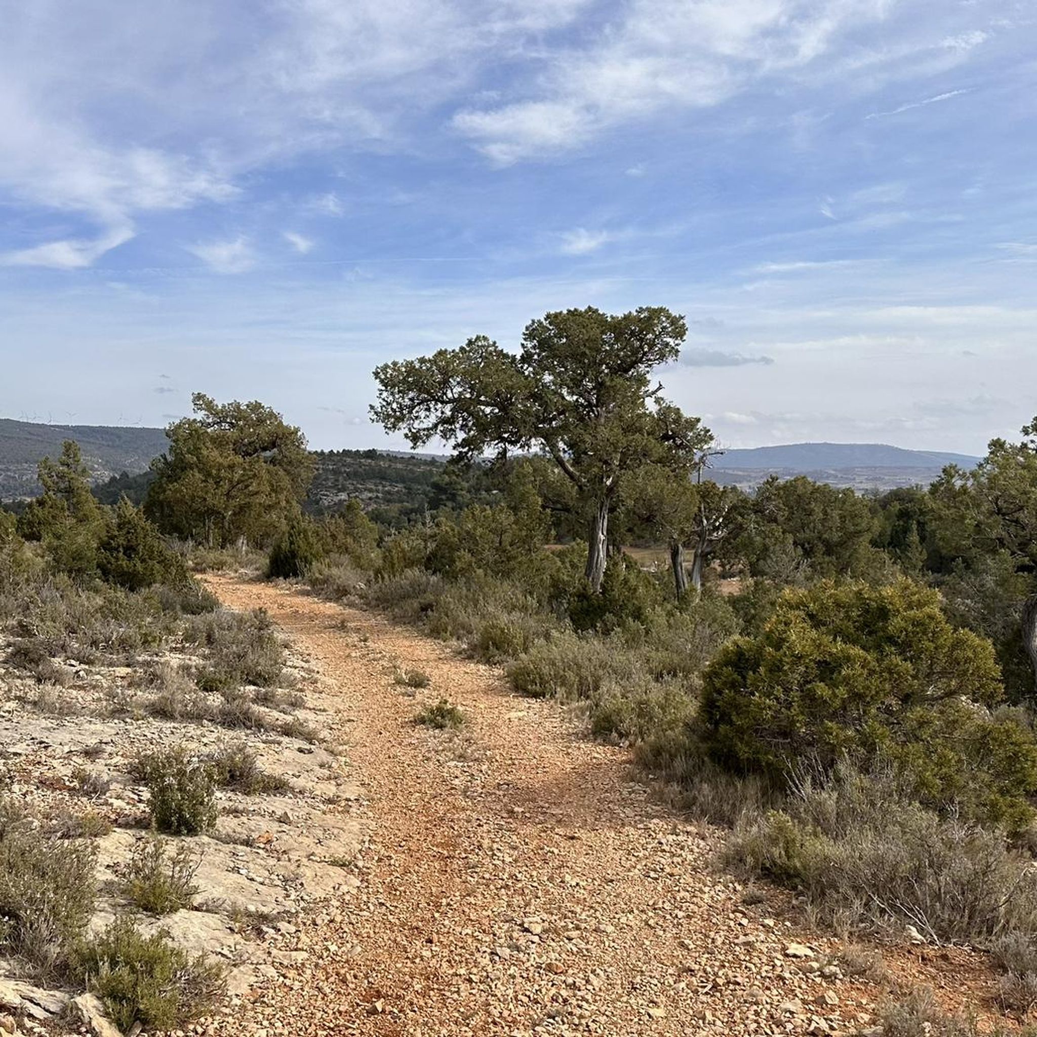
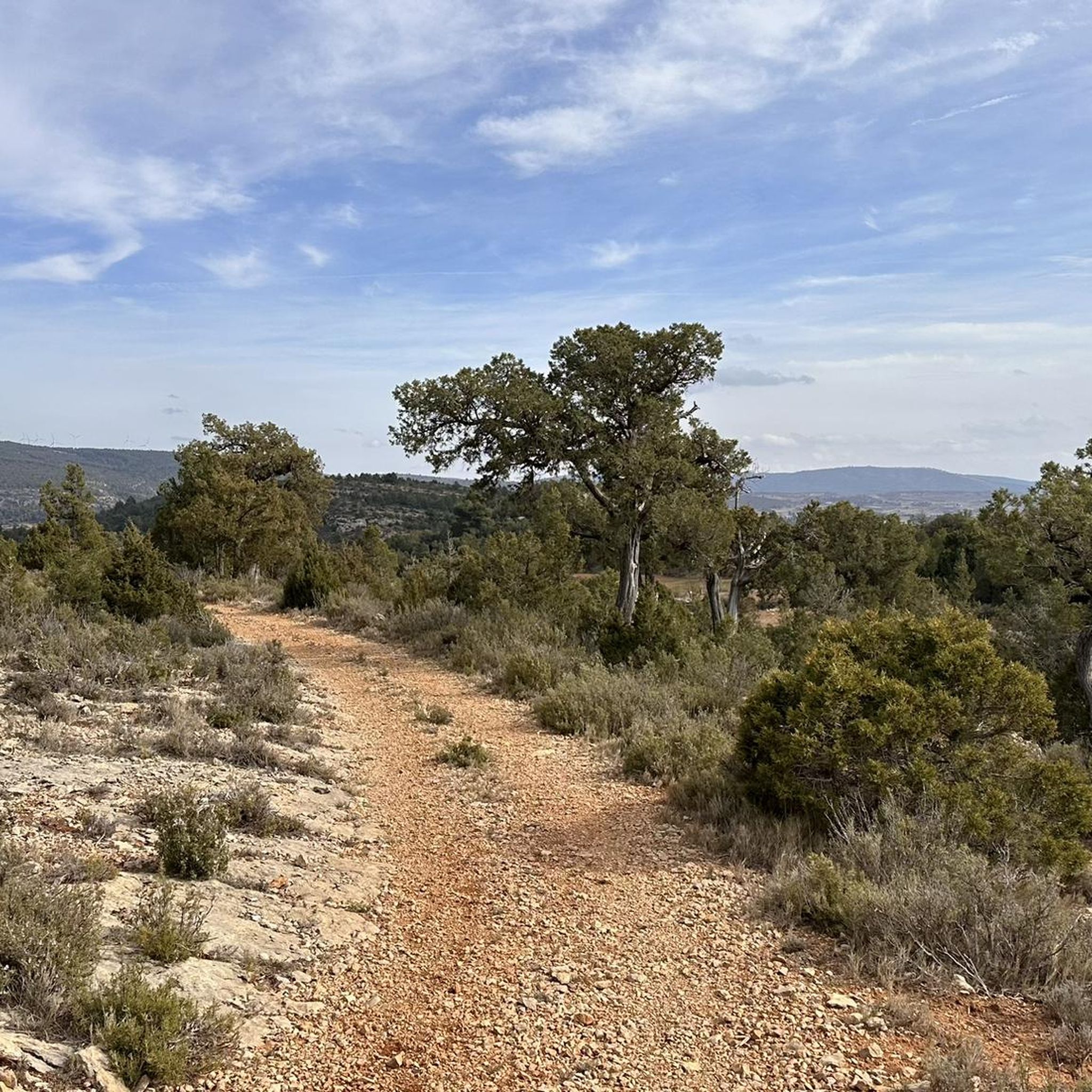
Jogging routes in Alpuente feature diverse terrain. You can expect narrow paths and wider dirt roads through the Alpuente Gorge, sections winding through forests, and paths lined with century-old juniper trees. Some routes may include steep descents and loose rocks, while others are flatter, offering a good mix of surfaces.
Are there easy running routes for beginners in Alpuente?
Yes, Alpuente offers at least one easy running route suitable for beginners. While many trails present moderate to difficult challenges, there are options for those looking for a less strenuous jog. These easier paths often wind through more gentle landscapes, allowing for a relaxed experience.
What natural features can I see while jogging in Alpuente?
While running in Alpuente, you can discover several natural attractions. The Alpuente Gorge itself is a prominent feature with interesting landscapes. You might also encounter the tranquil setting of Cañada Pastores with its ancient juniper trees, or even the beautiful Tuéjar River Waterfall on certain routes.
Are there historical landmarks to discover on the running paths near Alpuente?
Absolutely. Alpuente is rich in history. You can incorporate historical sites like the ruins of Alpuente Castle and its medieval town walls into your runs. Another notable landmark is the medieval aqueduct known as "Los Arcos" Aqueduct, located about two kilometers from the town center along the Yesa path.
Can I find routes with waterfalls in the Alpuente area?
Yes, the region offers opportunities to jog near waterfalls. The Tuéjar River Waterfall is a notable natural attraction accessible via certain routes, providing a refreshing sight during your run.
Are there any routes with panoramic viewpoints?
Yes, several routes in Alpuente offer rewarding panoramic views. From the ruins of Alpuente Castle, situated atop a large rock surrounded by cliffs, you can enjoy expansive vistas of the surrounding area. Challenging routes like Fuente de la Gitana – Descent from Pico del Remedio loop from Chelva also provide expansive views from higher elevations.
Are the jogging routes around Alpuente suitable for families?
Alpuente offers a variety of trails, and while many are challenging, there are easier sections and paths that can be suitable for families. Look for routes with less elevation gain and smoother terrain, often found winding through forests or along wider dirt roads, to ensure a pleasant experience for all.
Can I bring my dog on the running trails in Alpuente?
Many outdoor trails in the Alpuente region are dog-friendly, allowing you to enjoy your run with your canine companion. However, it's always advisable to keep your dog on a leash, especially in areas with wildlife or near livestock, and to check for any specific local regulations or signage on individual trails.
Is there parking available near the jogging routes in Alpuente?
Yes, parking is generally available in and around the town of Alpuente, as well as at various trailheads for the running routes. It's recommended to check specific starting points for routes you plan to tackle for the most convenient parking options.
What is the best time of year to go jogging in Alpuente?
The diverse landscapes of Alpuente make it suitable for jogging throughout much of the year. Spring and autumn offer pleasant temperatures and vibrant scenery, ideal for longer runs. Summer mornings and evenings can also be enjoyable, while winter provides a unique, tranquil experience, though some higher elevation trails might require more preparation.
Are there options for public transport to access running trails in Alpuente?
While Alpuente is a more rural area, there are limited public transport options, primarily bus services connecting to larger towns in the Valencia region. For direct access to specific trailheads, driving or carpooling is often the most convenient method. It's best to check local bus schedules if you plan to rely on public transport.
What is the typical difficulty level of running trails in Alpuente?
The running trails in Alpuente offer a good range of difficulty. Out of 15 routes, you'll find 1 easy route, 7 moderate routes, and 7 difficult routes. This means there are plenty of options for experienced runners seeking a challenge, as well as accessible paths for those looking for a more relaxed jog.
What do other runners say about the trails in Alpuente?
Over 150 runners have explored Alpuente's varied terrain using komoot. While specific ratings aren't available, the high number of visitors indicates a popular and well-regarded area for outdoor activities. Runners often praise the region's diverse landscapes, from the Alpuente Gorge to historical aqueducts, offering a unique blend of natural beauty and cultural interest.
Most popular attractions around Alpuente

Get inspired with the komoot mobile app


Explore more
Browse the best Running Trails & Routes in other regions.
