The best road cycling routes around Sedaví
4.4
(482)
28,880
riders
333
rides
Road cycling routes around Sedaví are primarily characterized by the flat to gently rolling terrain surrounding the Albufera Natural Park and the coastal plain of Valencia. The region offers a mix of agricultural landscapes, urban fringes, and scenic paths near the Mediterranean Sea. While generally low in elevation, some routes include gradual ascents to small hills or overpasses, providing varied cycling experiences. The area's proximity to the coast means many routes offer views of the sea or pass through port…
Last updated: July 8, 2026
4.6
(26)
1,044
riders
Moderate road ride. Great for any fitness level. Some segments of this route may be unpaved and difficult to ride.
5.0
(3)
154
riders
Moderate road ride. Great for any fitness level. Some segments of this route may be unpaved and difficult to ride.

Sign up for free
5.0
(1)
117
riders
69.4km
03:14
630m
630m
Moderate road ride. Good fitness required. Mostly well-paved surfaces and easy to ride.
121
riders
69.6km
02:57
480m
480m
Moderate road ride. Good fitness required. Mostly well-paved surfaces and easy to ride.
5.0
(2)
77
riders
118km
05:11
990m
990m
Hard road ride. Very good fitness required. Mostly well-paved surfaces and easy to ride.
Get access to more routes and recommendations from other explorers.
Sign up for free
Already have an account?
Our route recommendations are based on thousands of hikes, rides, and runs completed by other people on komoot.
Start today with a free account
Your next adventure awaits.
Login or Signup

Tips from the Community

Mareny Barraquetes (in Valencian and officially, Mareny de Barraquetes) is a minor local entity of the Valencian Community, Spain, belonging to the province of Valencia. Formerly a district of the municipality of Sueca, since 1999 it has been an entity of territorial scope below the municipality (EATIM) belonging to said municipal term. Mareny de Barraquetes is located in the heart of the Albufera natural park and next to the sea. The nearest towns are Sueca 7 km (kilometers) away, 28 km from Valencia and 9 km from Cullera. Its toponym mareny means ‘marshland’, that is, an area very close to the sea and easily flooded. For its part, the term barraquetes indicates the type of habitat that was frequent throughout the area, huts built with reeds and mud, materials from the marshes and the dune cordon. The historical origin of the first human settlements in this area dates back to the period of Roman domination, when the Phocaean colonies were established near Sicania, with El Mareny de Barraquetes being one of them. It survived through the centuries, as an alquería, thus reaching the first historical antecedents, which are found in the first census of inhabitants that was made in Sueca in 1795, by governmental order for the preparation of the conscription, as Spain was at war against Revolutionary France of the Directory (1793-1795). Likewise, until the 1845 census, we do not have a specific list of residents from El Mareny, with nine huts. Its inhabitants are mainly engaged in agriculture. In the last century, the population nucleus based its economy mainly on fishing. There were three fishing settlements where families lived who were dedicated to freshwater fishing (in the canals coming from the Júcar). Until recently, there was a fishing settlement where this work continued, but with modern facilities.
0
0

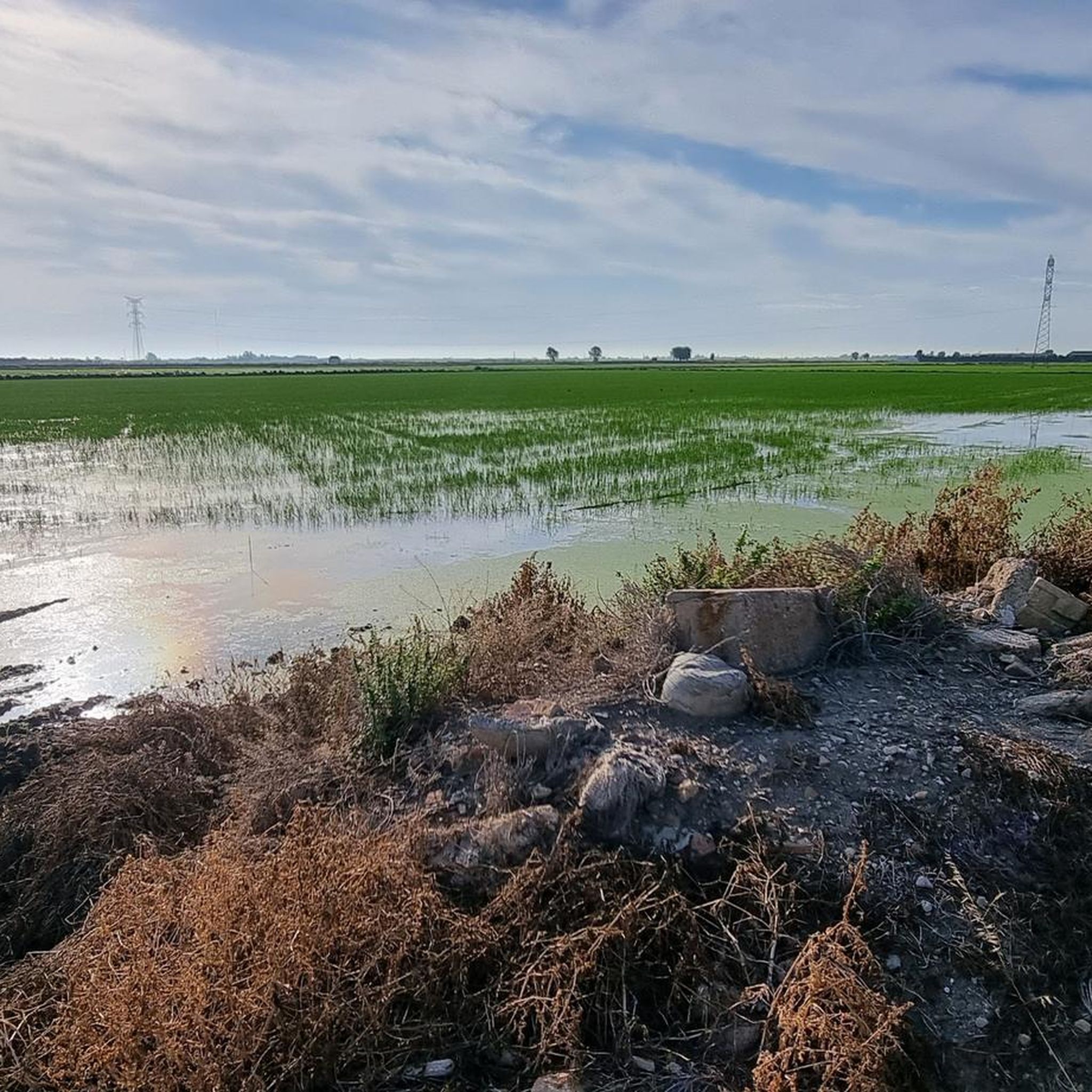
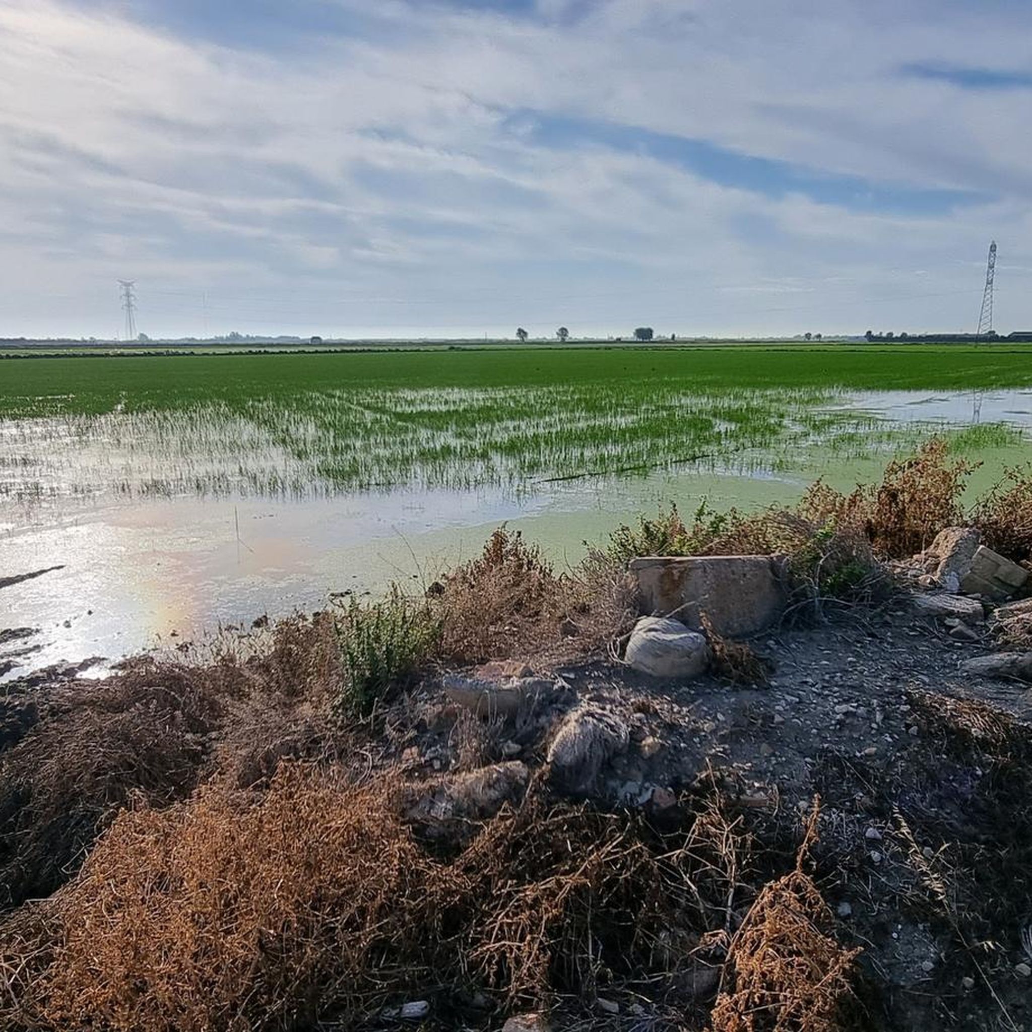
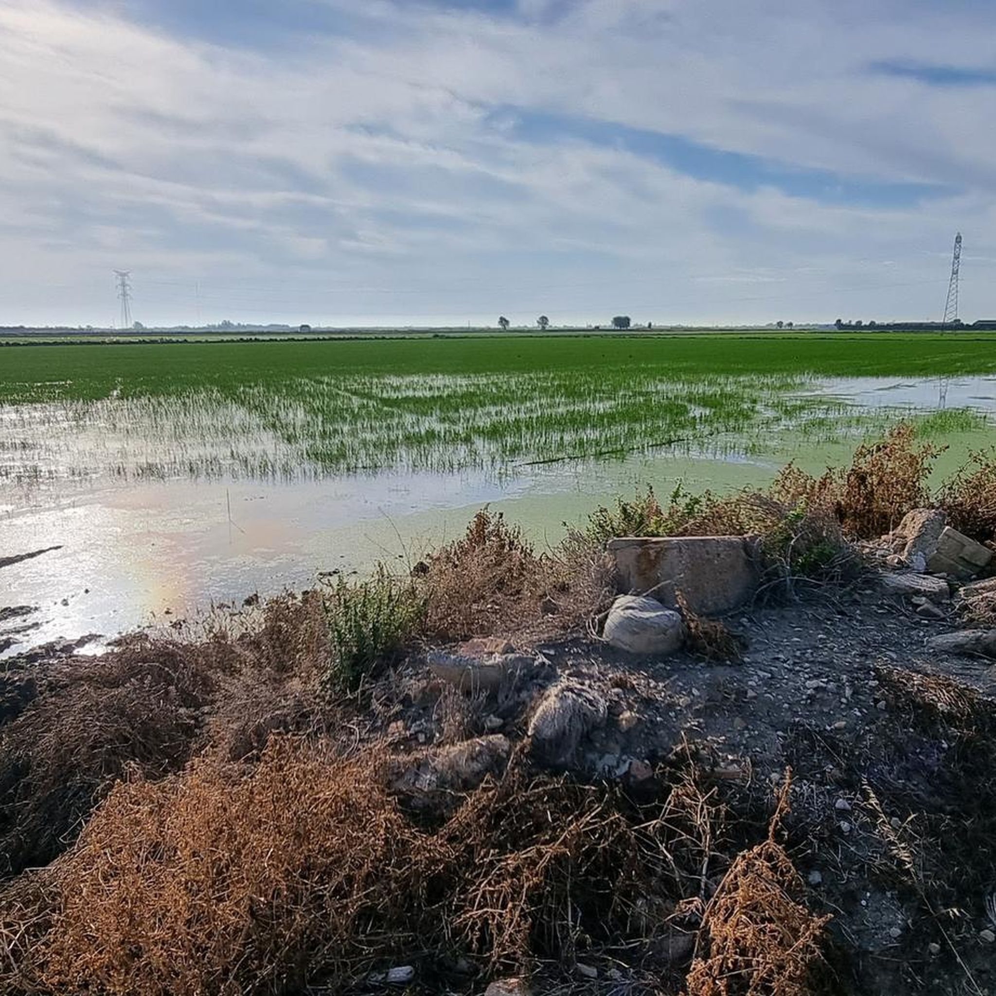
The Albufera lake was formed by the sinking of an approximately 30 km long coastal strip. The saltwater lake then became a freshwater lake due to the inflows. In the Estany del Pujol lagoon you can observe various water birds.
2
1

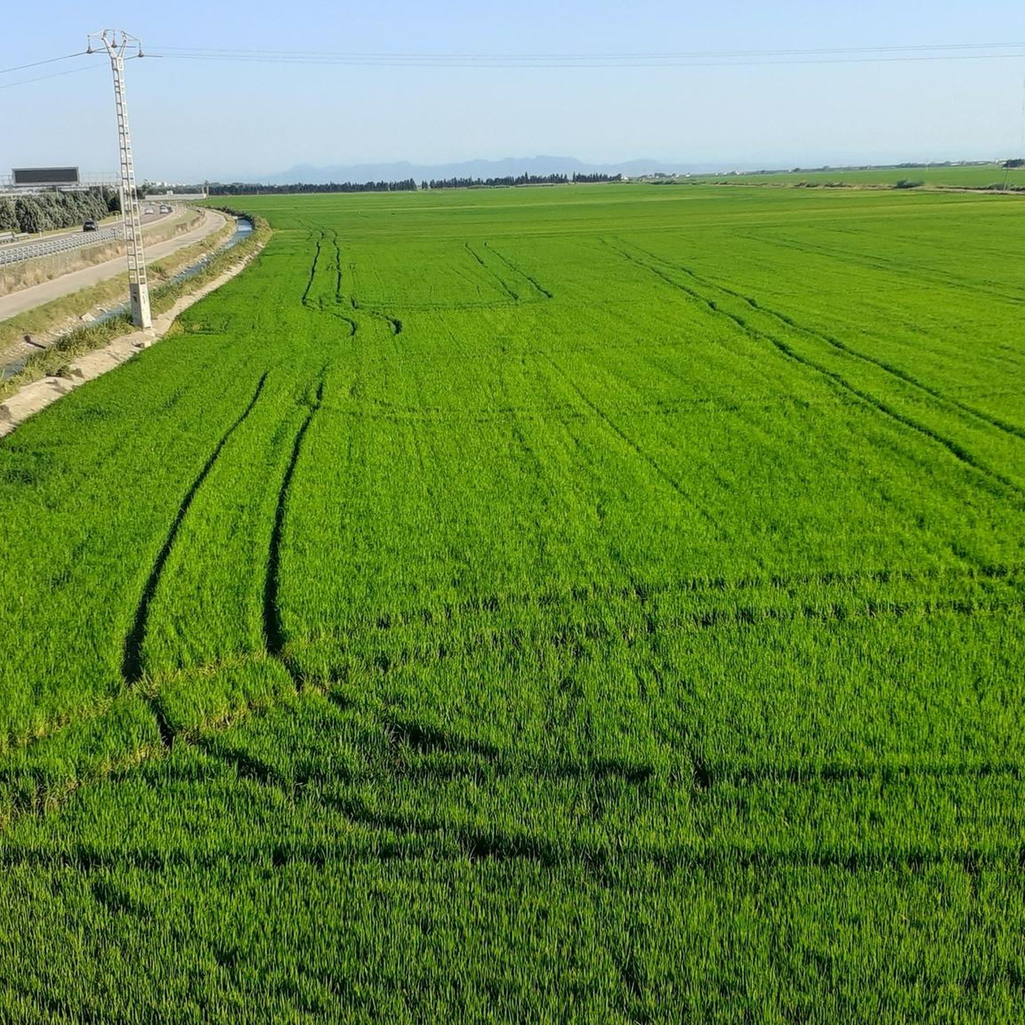
You should visit the area at different times of the year to enjoy completely different landscapes depending on the phase in which the rice cultivation is in.
1
0
One of the best landscape views very close to Valencia capital.
0
0
On many occasions, advertising encourages us to travel to other places to contemplate a spectacular sunset or a landscape worthy of a postcard. We Valencians have one of the most beautiful sunsets next to the capital.
1
0

I cannot cycle this. Got up until the start of the railway on the right side but then… ouch
1
0
Long mural with two distinct parts, one with characters and the other with a message.
1
0
The Moorish tower of Albal, popularly known as the Torre dels Moros, is the oldest building in the town and the only remaining remnant of the defensive fortifications of the original Islamic farmstead. It is of great symbolic importance to the town and forms part of its coat of arms.
0
0
Frequently Asked Questions
How many road cycling routes are available around Sedaví?
There are over 300 road cycling routes around Sedaví, catering to various skill levels. You'll find a wide selection, from easy, flat rides to more challenging routes with gradual ascents.
What is the typical terrain like for road cycling in Sedaví?
Road cycling routes around Sedaví are primarily characterized by flat to gently rolling terrain. The region features agricultural landscapes, urban fringes, and scenic paths near the Mediterranean Sea and the Albufera Natural Park. While generally low in elevation, some routes include gradual ascents to small hills or overpasses.
Are there easy road cycling routes in Sedaví suitable for beginners?
Yes, Sedaví offers many easy road cycling routes perfect for beginners or those looking for a relaxed ride. For example, the Roadbike loop from Alfafar - Benetússer is an easy 20.4-mile (32.9 km) path with flat sections.
Are there challenging road cycling routes or climbs in Sedaví?
While the region is largely flat, some routes incorporate gradual ascents and longer distances for a more challenging experience. The Venta Cabrera – Catarroja Port loop from Alfafar - Benetússer is a difficult 74.4-mile (119.7 km) route with significant elevation gain, offering a good test for advanced cyclists.
What kind of natural attractions can I see along the road cycling routes?
Many routes pass through or near the Albufera Natural Park, offering views of its unique ecosystem. You can also find highlights like the Pujol Pond, La Creu Beach, and the Albufera Viewpoint. Some routes also feature coastal paths with sea views.
Are most road cycling routes in Sedaví circular?
Yes, many of the road cycling routes around Sedaví are designed as loops, making it convenient to start and end your ride in the same location. Examples include the popular Venta Cabrera – Arab Tower of Albal loop from Alfafar - Benetússer and the Birds of the Albufera – Venta Cabrera loop from Alfafar - Benetússer.
What do other road cyclists enjoy most about road cycling in Sedaví?
The road cycling routes in Sedaví are highly rated by the komoot community, with an average score of 4.4 stars from over 380 reviews. Cyclists often praise the varied terrain, from flat agricultural lands to coastal paths, and the scenic routes around the Albufera lagoon.
Are there options for long-distance road cycling in Sedaví?
Yes, for those seeking longer rides, Sedaví offers routes that extend for considerable distances. The Venta Cabrera – Catarroja Port loop from Alfafar - Benetússer, for instance, covers nearly 75 miles (120 km), providing a full day's adventure.
Can I find routes that offer views of the sea?
Absolutely. Given Sedaví's proximity to the coast, many road cycling routes offer views of the Mediterranean Sea or pass through charming port towns. The View of the Sea – Venta Cabrera loop from Alfafar - Benetússer is a great option for coastal scenery.
What is the best time of year for road cycling in Sedaví?
The Mediterranean climate makes Sedaví suitable for road cycling for much of the year. Spring and autumn generally offer the most pleasant temperatures, avoiding the peak heat of summer and the cooler, potentially wetter days of winter. However, mild winters can still be good for cycling.
Are there any routes that explore the Albufera Natural Park?
Yes, the Albufera Natural Park is a central feature of the region's cycling landscape. Routes like the Birds of the Albufera – Venta Cabrera loop from Alfafar - Benetússer specifically lead through the natural park, allowing cyclists to experience its unique wetlands and birdlife.
Most popular attractions around Sedaví

Get inspired with the komoot mobile app


Explore more
Browse the best Road cycling routes in other regions.
