The best road cycling routes around Olmillos De Castro
45
riders
19
rides
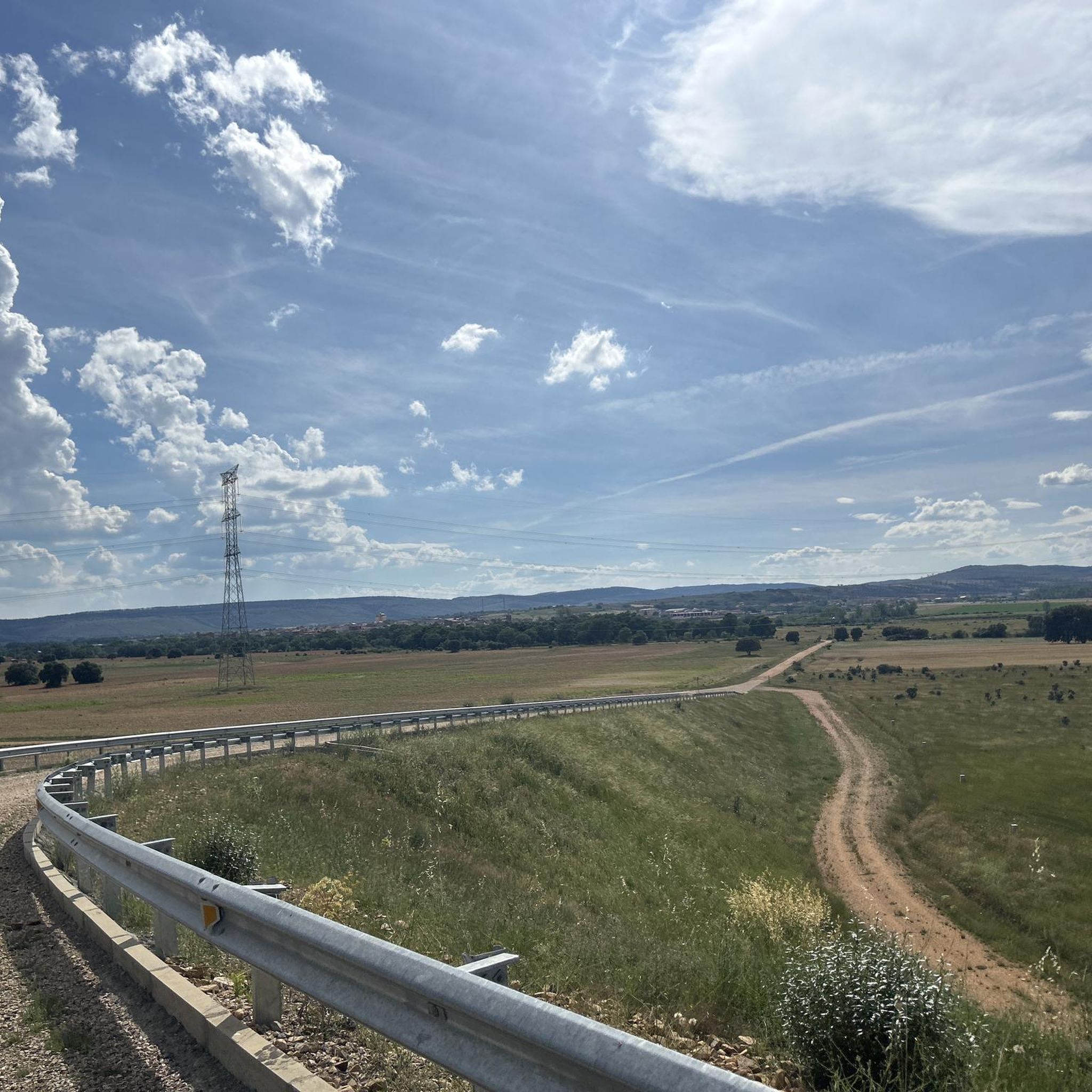
Road cycling around Olmillos De Castro offers diverse natural scenery and agricultural areas within the Zamora province of Spain. The region is characterized by varied terrain, including extensive farmlands and significant waterways like the Esla River and Ricobayo Reservoir. Cyclists can find routes on well-paved surfaces, suitable for different fitness levels. The landscape provides a tranquil and picturesque backdrop for road cycling.
Best road cycling routes around Olmillos De Castro
- The most popular road cycling route is Tábara – tour around Mózar – Manganeses de la Polvorosa – Benavente, a 64.9 miles (104.4 km) trail that takes 4 hours 10 minutes to complete. This route features moderate climbs and varied rural landscapes.
- Another top favourite among local road cyclists is Ricobayo Reservoir and Tierra de Alba Loop, a moderate 30.0 miles (48.4 km) path. This route offers views of the Ricobayo Reservoir and the surrounding Tierra de Alba region.
- Local road cyclists also love the Ricobayo Reservoir Loop, a 41.8 miles (67.3 km) trail leading through the Ricobayo Reservoir area, often completed in about 3 hours 15 minutes.
- Road cycling around Olmillos De Castro is defined by natural scenery, farmlands, and routes alongside the Esla River and Ricobayo Reservoir. The network offers options for different ability levels, from moderate to more challenging rides.
- The guide includes highly-rated routes that showcase the best of the region's landscape. More than 40 road cyclists have used komoot to explore Olmillos De Castro's varied terrain.
Last updated: July 12, 2026
2
riders
67.3km
03:15
790m
790m
Moderate road ride. Good fitness required. Mostly well-paved surfaces and easy to ride.
73.0km
03:36
960m
960m
Hard road ride. Very good fitness required. Mostly well-paved surfaces and easy to ride.

Sign up for free
10
riders
97.1km
04:37
1,310m
1,310m
Hard road ride. Very good fitness required. Some segments of this route may be unpaved and difficult to ride.
5
riders
54.7km
02:41
660m
660m
Moderate road ride. Good fitness required. Mostly well-paved surfaces and easy to ride.
5
riders
51.9km
02:22
530m
530m
Moderate road ride. Good fitness required. Mostly well-paved surfaces and easy to ride.
Get access to more routes and recommendations from other explorers.
Sign up for free
Already have an account?
Our route recommendations are based on thousands of hikes, rides, and runs completed by other people on komoot.
Start today with a free account
Your next adventure awaits.
Login or Signup
Popular around Olmillos De Castro

Tips from the Community

Tábara is a Spanish municipality of about 830-950 inhabitants located in the province of Zamora, within the autonomous community of Castile and León. This small village stands at an altitude of 749 meters and is the capital of the Tierra de Tábara comarca. It represents a center of great historical-cultural importance, as well as being a fundamental stop for pilgrims traveling the Camino Sanabrésl
1
0

It's located in the heart of the Arribes del Duero Natural Park, an area of great scenic beauty and biodiversity. Things to do nearby: Viewpoints: The viewpoint at the bridge itself and others nearby, such as the one in Villadepera. Hiking trails: Paths through the Arribes, ideal for photography and birdwatching. Charming villages: Villadepera, Pino del Oro, and other towns in the area. From the bridge, you can admire the granite cliffs of the Duero River and the deep riverbed that marks the natural border with Portugal.
2
0
The Requejo Bridge, also known as the Pino Bridge, is a jewel of historical engineering located in Villadepera (Zamora) over the Duero River, within the Arribes del Duero Natural Park. Year of inauguration: 1914. Designed by the engineer José Eugenio Ribera, a pioneer in the use of reinforced concrete in Spain. It was built to connect the Aliste and Sayago regions, facilitating communication between Zamora and Portugal.
2
0
What to see and do Viewpoints: There are scenic viewpoints along the road and in the surrounding area offering views of the dam and reservoir. Ricobayo Reservoir: Ideal for water sports, fishing, and hiking. Natural surroundings: Very close to the Arribes del Duero Natural Park, with its spectacular landscapes.
2
0
The Ricobayo Dam is located on the Esla River, in the province of Zamora (Castilla y León), and is part of the Iberdrola hydroelectric system. Completed in 1934, it was one of the major hydraulic engineering projects of the 20th century in Spain.
2
0
Tábara, located in the northwest of the province of Zamora (Castilla y León), is a town with a rich medieval history, a stunning natural setting, and a significant cultural heritage. Origins: These date back to the Bronze Age and Roman period. Middle Ages: It was an important monastic center with the Monastery of San Salvador de Tábara, founded by Saint Froilán in the 9th century at the behest of Alfonso III.
10
0

Visigothic church (7th century) of San Pedro de la Nave. It originally stood on the banks of the Esla River, but the construction of the Ricobayo reservoir threatened to flood it. Historian Manuel Gómez Moreno managed to have it dismantled from its original location and moved stone by stone between 1930 and 1932 to the nearest town: El Campillo, where it can be seen today.
0
0
The Church of San Pedro de la Nave is a 7th century Visigoth temple located in the town of El Campillo, municipality of San Pedro de la Nave-Almendra, in the province of Zamora, Spain. It was declared a National Monument on April 22, 1912. The construction of the temple dates back to the end of the 7th century and the beginning of the 8th century, possibly between the years 680 and 711, which makes it one of the last works of Visigothic art. Originally, it was located on the banks of the Esla River, but when the Ricobayo reservoir was built, it was moved stone by stone to the current location.
3
0
Frequently Asked Questions
How many road cycling routes are available around Olmillos de Castro?
There are over 20 road cycling routes available around Olmillos de Castro, offering a variety of options for different skill levels. These routes are part of a broader network within the Zamora province.
What kind of terrain can I expect on road cycling routes near Olmillos de Castro?
The region around Olmillos de Castro features diverse natural scenery, including extensive farmlands and picturesque landscapes. Routes often follow well-paved surfaces, with varied terrain that includes moderate climbs and sections alongside significant waterways like the Esla River and Ricobayo Reservoir.
What is the best time of year for road cycling in the Olmillos de Castro region?
The Zamora province, where Olmillos de Castro is located, is particularly popular for cycling during May and July. These months generally offer favorable weather conditions for exploring the routes.
Are there road cycling routes suitable for beginners or those seeking an easier ride?
While the guide primarily features moderate to difficult routes, the broader Zamora province offers easier options. For instance, the route from Monastery of Santa María de Moreruela to Laguna Salina Grande is an easy 42.8 km ride, and the Bretó to Lagunas de Villafáfila Nature Reserve route is an easy 47.7 km circular option.
Are there challenging road cycling routes for experienced cyclists?
Yes, there are challenging routes for experienced cyclists. For example, the Tabara - tour around Aliste river and Fonfria is a difficult 79.3 km route with significant elevation changes, offering a demanding ride.
What historical landmarks can I see along road cycling routes near Olmillos de Castro?
Several historical landmarks can be incorporated into your rides. You might encounter the ruins of Castrotorafe Castle or Alba Castle. The historic Camino de la Plata also passes through the area, offering a scenic and historical element to your journey.
Are there natural attractions or scenic viewpoints on road cycling routes?
Absolutely. Many routes offer views of the Ricobayo Reservoir, such as the Ricobayo Reservoir and Tierra de Alba Loop. The Lagunas de Villafáfila Nature Reserve is also a significant ecological area nearby, providing opportunities for birdwatching and enjoying the natural environment.
Are there any circular road cycling routes in the area?
Yes, circular routes are available. The Ricobayo Reservoir Loop is a popular 67.3 km circular trail. Another option is the Bretó to Lagunas de Villafáfila Nature Reserve, which is an easy 47.7 km circular route along the Esla River.
What do other road cyclists enjoy most about the routes around Olmillos de Castro?
Road cyclists frequently appreciate the tranquil and picturesque backdrop of the natural scenery and farmlands. The varied terrain, including routes alongside the Esla River and Ricobayo Reservoir, also receives positive feedback for offering diverse and engaging rides.
Are there places to eat or stay near the road cycling routes?
While specific cafes, pubs, or accommodations in Olmillos de Castro are not detailed in the route information, the broader Zamora province offers various options. Nearby towns and villages along the routes would typically provide amenities for cyclists.
Can I find family-friendly road cycling options in the Olmillos de Castro area?
The region offers a mix of routes. While some are moderate to difficult, the presence of easier, flatter sections, particularly along rivers and through farmlands, suggests that with careful planning, some routes could be adapted for families or those cycling with children. Always check the route difficulty and distance before setting out.
Where can I find parking for road cycling routes around Olmillos de Castro?
Specific parking locations are not detailed for individual routes. However, as Olmillos de Castro is a rural area, parking is generally available in village centers or near popular starting points for routes. It is advisable to check local information or maps for designated parking areas before your ride.
Most popular routes around Olmillos De Castro
Most popular attractions around Olmillos De Castro

Get inspired with the komoot mobile app


Explore more
Browse the best Road cycling routes in other regions.
