The best walks and hikes around La Bóveda De Toro
4.6
(8)
70
hikers
5
hikes
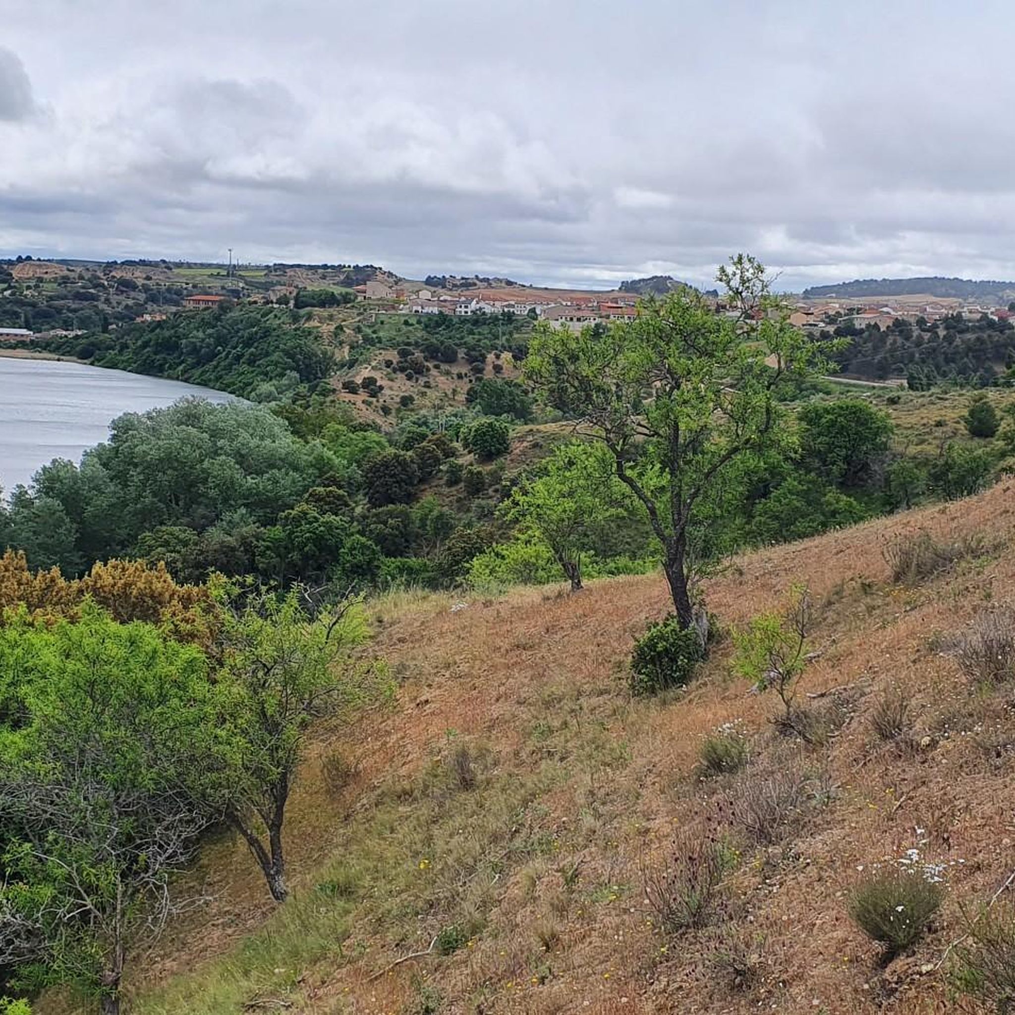
Hiking around La Bóveda De Toro offers exploration of a landscape characterized by agricultural areas, riverine environments, and gentle elevations. The region features extensive vineyards and garlic plantations, providing a unique backdrop for walks. The Duero River and its tributary, the Guareña River, are significant natural features, with several trails following their banks. Terrain includes mild slopes and ravines, with some gentle hills to the north.
Best hiking trails around La Bóveda De Toro
- The most popular hiking route is Almond Tree Trail, an easy 3.0 miles (4.9 km) trail that takes 1 hour 20 minutes to complete, offering views of the Duero River and almond groves.
- Another top favourite among local hikers is Villafranca de Duero on the banks of the Duero River — Castronuño Riverside Nature Reserve, a moderate 7.5 miles (12.1 km) path. This route features diverse natural surroundings along the river, requiring good fitness for its 3 hour 12 minute duration.
- Local hikers also love the San José Dam – Viewpoint loop from Castronuño, a 4.1 miles (6.6 km) trail leading through riverine landscapes, often completed in about 1 hour 47 minutes.
- Hiking around La Bóveda De Toro is defined by agricultural vistas, riverine paths along the Duero and Guareña rivers, and gentle hills. The network offers options for different ability levels, from easy circular walks to moderate routes.
- The routes in La Bóveda De Toro are highly rated by the komoot community with an average score of 4.6 stars from 8 reviews. More than 60 hikers have used komoot to explore La Bóveda De Toro's varied terrain.
Last updated: July 8, 2026
5.0
(1)
25
hikers
4.90km
01:22
90m
90m
Easy hike. Great for any fitness level. Easily-accessible paths. Suitable for all skill levels.
4.0
(2)
5
hikers
Moderate hike. Good fitness required. Easily-accessible paths. Suitable for all skill levels.

Sign up for free
5.0
(3)
26
hikers
11.3km
03:00
120m
120m
Moderate hike. Good fitness required. Easily-accessible paths. Suitable for all skill levels.
4.0
(1)
10
hikers
15.2km
04:04
170m
170m
Moderate hike. Good fitness required. Easily-accessible paths. Suitable for all skill levels.
5.0
(1)
4
hikers
7.19km
01:57
100m
100m
Easy hike. Great for any fitness level. Easily-accessible paths. Suitable for all skill levels.
Our route recommendations are based on thousands of hikes, rides, and runs completed by other people on komoot.
Start today with a free account
Your next adventure awaits.
Login or Signup
Popular around La Bóveda De Toro

Tips from the Community

It was built between the late 12th and early 13th centuries by Commander Fernán (Hernán) Rodríguez de Valbuena, becoming a funerary chapel for the Order. For centuries, it served as a fortified church overlooking the Duero River, and was linked to the now-vanished castle and other medieval chapels in the town. It suffered several collapses in the 19th and 20th centuries, until the original ruins had practically disappeared; the current structure is the one dedicated to Santa María del Castillo (Saint Mary of the Castle).
4
0
Hermitage of Santa María del Castillo (also known as the Hermitage of Santo Cristo or the Church of the Order of Saint John) in Castronuño: Located on Alto de la Muela, on the banks of the Duero River in Castronuño (Valladolid). A medieval building originally linked to the Military and Hospitaller Order of Saint John of Jerusalem, which established a commandery here.
4
0

You can cross over the dam without any danger, it is a road with little traffic...
0
1
The San José Reservoir and Dam, also known as the Castronuño Dam, is a hydroelectric engineering project located in the middle course of the Duero River, about 2 km from the town of Castronuño. Built between 1941 and 1945, the dam is a gravity type and has a height of 14.05 metres.
6
0
The San José Reservoir and Dam, also known as the Castronuño Dam, is a hydroelectric engineering project located in the middle course of the Duero River, about 2 km from the town of Castronuño. Built between 1941 and 1945, the dam is a gravity type and has a height of 14.05 metres.
6
0
The natural viewpoint of La Muela Park in Castronuño is an impressive place that you cannot miss. From this privileged balcony, you can observe the great meander that the Duero River draws as it passes through Castronuño. This meander is one of the largest in Europe and is located in the heart of the Riberas de Castronuño natural reserve. The landscape is idyllic, and the river has been a silent witness to the passage of time and the history of this region. If you visit Castronuño, you should definitely explore this viewpoint and enjoy the panoramic views. Also, if you like hiking, there are interesting routes in the area. I hope you have a wonderful experience there! 😊
3
0

A nice little dam that allows you to get to the other side of the river. It also has very nice views of the landscape.
1
1
The main point of interest in Castronuño is the Hermitage of Santo Cristo. Here you will find the Hermitage and a great panoramic view of the river landscape.
0
0
Frequently Asked Questions
What kind of terrain and landscapes can I expect on hikes around La Bóveda de Toro?
The hiking trails around La Bóveda de Toro offer a diverse landscape characterized by extensive agricultural areas, including vineyards and garlic plantations. You'll also find scenic riverine environments along the Duero and Guareña rivers, with some gentle hills and mild slopes to the north, such as La Nariz (807 m) and Picones (797 m). The natural vegetation includes holm oak forests and scrubland.
Are there easy hiking trails suitable for families in La Bóveda de Toro?
Yes, there are several easy trails perfect for families. For instance, the Almond Tree Trail is an easy 3.0-mile circular hike offering views of the Duero River and almond groves. Another accessible option is the San José Dam – Viewpoint loop from Castronuño, which is 4.1 miles long and leads through pleasant riverine landscapes.
Can I find circular hiking routes in the area?
Absolutely. Many routes in the region are designed as loops. The Almond Tree Trail is a popular easy circular hike. For a slightly longer option, consider the San José Dam – Viewpoint loop from Castronuño, which also forms a loop through riverine scenery.
What natural features or landmarks can I see along the hiking trails?
Hikers can enjoy several notable natural features and landmarks. The San José Dam is a prominent feature, and you can find stunning views of the Duero River, particularly from the View of the Duero River Meander from La Muela Park. The Ermita del Santo Cristo and Panoramic View of the River in Castronuño also offers beautiful vistas.
Are there any hiking trails that follow the Duero or Guareña rivers?
Yes, the Duero River is a central feature of many routes. The Villafranca de Duero on the banks of the Duero River — Castronuño Riverside Nature Reserve trail offers diverse natural surroundings along the Duero. The Guareña River, a tributary of the Duero, also contributes to the area's hydrological features, with various streams and barrancos feeding into it, creating a rich riverine landscape for exploration.
What is the best time of year to go hiking in La Bóveda de Toro?
The climate in La Bóveda de Toro is Mediterranean with continental influences. Spring and autumn are generally the most pleasant times for hiking, with milder temperatures. Summers can be hot, with average temperatures around 20-22°C in July, while winters are cooler, averaging 4-6°C in January. Annual precipitation is below 400 mm, so dry conditions are common.
What do other hikers enjoy most about hiking in La Bóveda de Toro?
The area is highly rated by the komoot community, with an average score of 4.6 stars from 8 reviews. Hikers often praise the serene agricultural landscapes, the unique views of vineyards and garlic plantations, and the peaceful riverine paths along the Duero and Guareña rivers. The variety of routes, from easy circular walks to moderate trails, is also appreciated.
Are the hiking trails around La Bóveda de Toro suitable for dogs?
While specific regulations for dogs on trails are not detailed, generally in rural Spanish areas, dogs are welcome on hiking paths, especially if kept on a leash. It's always advisable to ensure your dog is well-behaved and to carry waste bags to maintain the natural environment for everyone.
Are there any moderate difficulty trails for more experienced hikers?
Yes, there are moderate trails available. The Villafranca de Duero on the banks of the Duero River — Castronuño Riverside Nature Reserve is a moderate 7.5-mile path that requires good fitness. Another moderate option is the San José Dam loop from Castronuño, which is about 6.2 miles long.
What are the typical elevations and gradients like on the trails?
The terrain around La Bóveda de Toro features mild slopes and gentle hills rather than steep ascents. For example, the Almond Tree Trail has an elevation gain of about 91 meters, while the moderate Villafranca de Duero on the banks of the Duero River — Castronuño Riverside Nature Reserve route has an elevation gain of around 112 meters. Most trails involve manageable gradients suitable for a range of abilities.
Is there parking available near the trailheads?
While specific parking areas for every trailhead are not detailed, La Bóveda de Toro is a rural municipality. Hikers typically find parking in or near the villages where trails begin, such as Castronuño or Villafranca de Duero, which serve as common starting points for many routes in the region.
Most popular routes around La Bóveda De Toro
Most popular attractions around La Bóveda De Toro

Get inspired with the komoot mobile app


Explore more
Browse the best Hikes in other regions.
