The best walks and hikes around Tinieblas De La Sierra
4.6
(29)
296
hikers
32
hikes
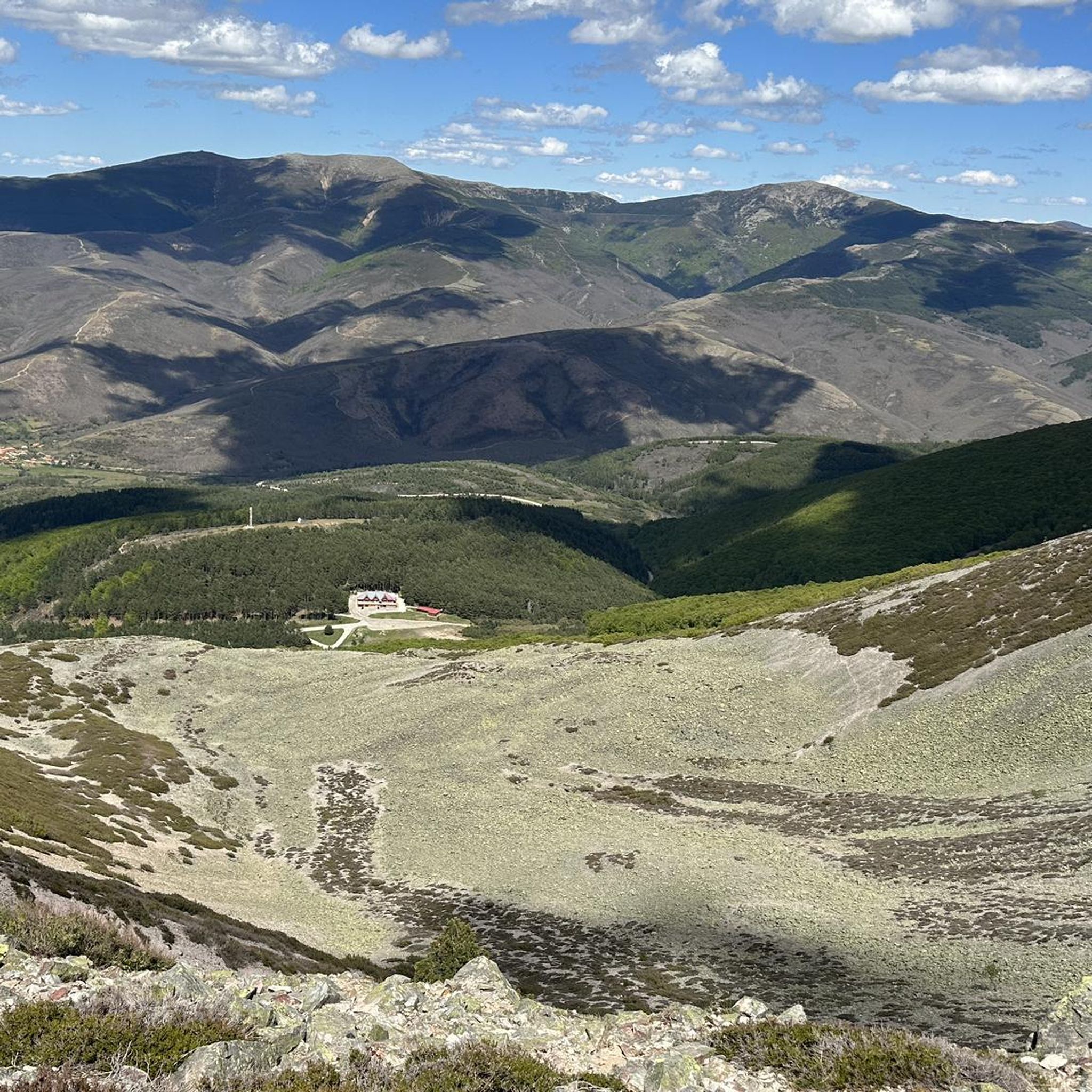
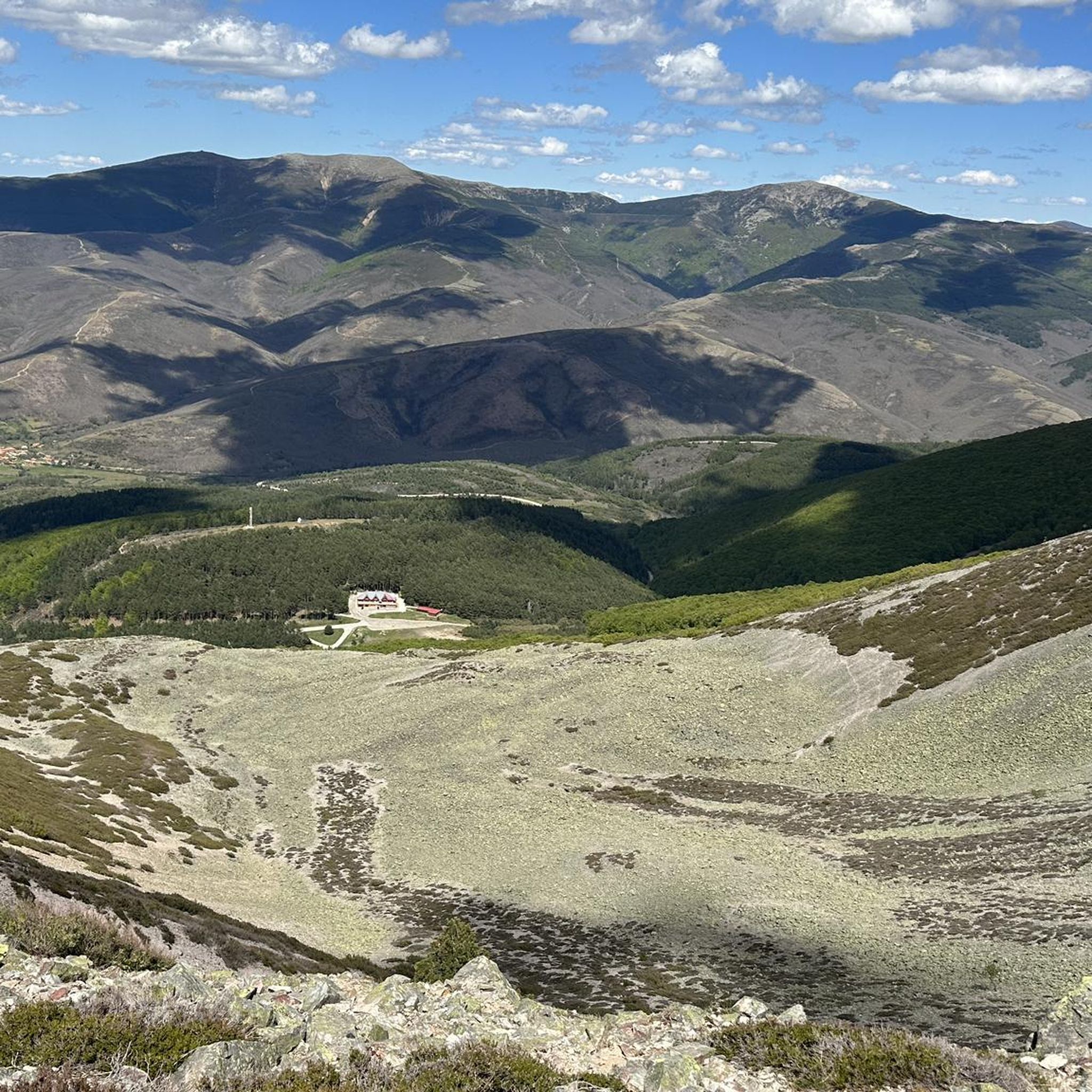
Hiking around Tinieblas De La Sierra offers access to diverse natural landscapes within the Sierra del Mencilla and the broader Sierra de la Demanda. The region is characterized by mountains, ravines, and streams, with extensive forests of junipers, holm oaks, and oaks. The Tinieblas River has carved a picturesque gorge, adding to the varied terrain. This area provides a tranquil environment for outdoor activities, featuring both challenging mountain ascents and comfortable river-side paths.
Best hiking trails around Tinieblas De La Sierra
- The most popular hiking route is Pico Mencilla by Pineda de la Sierra — circular through the Sierra de Mancilla, a 9.2 miles (14.8 km) trail that takes 5 hours 8 minutes to complete. This difficult route offers panoramic views of the Sierra del Mencilla.
- Another top favourite among local hikers is Climb to Castillo Infantes de Lara — circular from Aceña de Lara, a moderate 10.3 miles (16.5 km) path. This route explores the historical and natural surroundings, featuring varied terrain.
- Local hikers also love the Pico Mencilla loop from Valle del Sol, a 5.5 miles (8.8 km) trail leading through mountainous terrain, often completed in about 3 hours 15 minutes.
- Hiking around Tinieblas De La Sierra is defined by mountainous ascents, river gorges, and dense woodlands. The network offers options for different ability levels, from easy paths to difficult mountain trails.
- The routes in Tinieblas De La Sierra are highly rated by the komoot community with an average score of 4.5 stars from more than 20 reviews. More than 250 hikers have used komoot to explore Tinieblas De La Sierra's varied terrain.
Last updated: July 2, 2026
5.0
(1)
23
hikers
Hard hike. Very good fitness required. Mostly accessible paths. Sure-footedness required.
16.5km
04:29
240m
230m
Moderate hike. Good fitness required. Mostly accessible paths. Sure-footedness required.

Sign up for free
5.0
(4)
48
hikers
9.02km
03:19
520m
520m
Moderate hike. Good fitness required. Easily-accessible paths. Suitable for all skill levels.
5.0
(1)
28
hikers
18.7km
06:12
910m
910m
Hard hike. Very good fitness required. Easily-accessible paths. Suitable for all skill levels.
3.0
(1)
27
hikers
10.8km
04:08
730m
730m
Moderate hike. Good fitness required. Easily-accessible paths. Suitable for all skill levels.
Get access to more routes and recommendations from other explorers.
Sign up for free
Already have an account?
Our route recommendations are based on thousands of hikes, rides, and runs completed by other people on komoot.
Start today with a free account
Your next adventure awaits.
Login or Signup


Tips from the Community


Spectacular area for hiking routes
0
0

In the southwest of the town of Pineda de la Sierra. Impressive walls.
1
1
Crossing of the hill path with the path down to Tinieblas de la Sierra.
1
1
Right at the top of Campo de los Corros.
1
1
In an idyllic location, also with a recreational area.
2
1
Frequently Asked Questions
How many hiking trails are available in Tinieblas De La Sierra?
There are over 25 hiking routes documented around Tinieblas De La Sierra, offering a variety of experiences from easy strolls to challenging mountain ascents. The komoot community has explored these trails more than 250 times.
What kind of terrain can I expect on hikes around Tinieblas De La Sierra?
The terrain around Tinieblas De La Sierra is diverse, characterized by mountains, ravines, and streams. You'll find extensive forests of junipers, holm oaks, and oaks, as well as paths along the picturesque gorge carved by the Tinieblas River. Expect a mix of mountainous ascents and comfortable riverside paths.
What do other hikers say about the trails in Tinieblas De La Sierra?
The trails in Tinieblas De La Sierra are highly rated by the komoot community, with an average score of 4.5 stars from more than 20 reviews. Hikers often praise the tranquil environment, diverse landscapes, and the rewarding views from higher elevations like Pico Mencilla.
Are there easy hiking options suitable for beginners in Tinieblas De La Sierra?
Yes, there are a few easy hiking options available. While many routes are moderate to difficult, you can find paths suitable for beginners, particularly along the riverbanks or less steep sections. These trails offer a gentle introduction to the region's natural beauty.
Are there challenging routes for experienced hikers in Tinieblas De La Sierra?
Absolutely. For experienced hikers, the ascent to Pico Mencilla offers a challenging yet rewarding experience. A notable difficult route is Pico Mencilla by Pineda de la Sierra — circular through the Sierra de Mancilla, which covers nearly 15 km with significant elevation gain, providing panoramic views of the Sierra del Mencilla.
Can I find trails with scenic viewpoints in the area?
Yes, many trails offer scenic viewpoints. The ascent to Pico Mencilla provides panoramic views of the Sierra del Mencilla and surrounding mountains. Additionally, routes near the Arlanzón Reservoir, such as the old mining train path, offer incredible perspectives of the mountains and stunning reflections on the water. You can find beautiful views at Beautiful views over the Arlanzón reservoir.
Are there any trails that feature waterfalls or rivers?
Yes, the Tinieblas River is a central natural feature, and the Climb to Castillo Infantes de Lara — circular from Aceña de Lara follows its course. This path navigates a picturesque small gorge where the river's waters create charming small waterfalls, enhancing the natural and vegetated environment along the riverbanks.
Are there any circular hiking routes available?
Yes, several circular routes are available. For instance, the Pico Mencilla loop from Valle del Sol is a popular moderate trail, and the Pico Mencilla by Pineda de la Sierra — circular through the Sierra de Mancilla offers a more challenging circular option.
What is the best time of year to go hiking in Tinieblas De La Sierra?
The best times to visit Tinieblas De La Sierra for outdoor activities are typically spring and autumn. During these seasons, the weather is generally mild and pleasant, making for ideal hiking conditions amidst the vibrant natural landscapes.
Are there any family-friendly hiking trails in Tinieblas De La Sierra?
While specific family-friendly routes are not highlighted in detail, the region offers comfortable paths, particularly along the Tinieblas River, which can be suitable for families. Look for routes described as 'easy' or with minimal elevation gain for a more relaxed family outing.
Can I bring my dog on the hiking trails?
Generally, dogs are welcome on many hiking trails in natural areas like Tinieblas De La Sierra. However, it's always recommended to keep your dog on a leash, especially in areas with wildlife or livestock, and to check for any specific local regulations or protected areas that might have restrictions.
Are there any nearby attractions or points of interest to visit after a hike?
Yes, the area offers several points of interest. You can explore the traditional stone and wood architecture of Tinieblas de la Sierra village itself. Nearby, the Arlanzón Reservoir and the Sierra de la Demanda Greenway offer beautiful scenery. The charming village of Pineda de la Sierra is also worth a visit.
Is public transport available to reach Tinieblas De La Sierra for hiking?
Tinieblas De La Sierra is described as a 'little frequented' area, suggesting that public transport options might be limited. It's advisable to check local bus schedules or consider traveling by car for more flexibility in accessing trailheads.
Are there places to eat or stay near the hiking trails?
While the guide focuses on hiking, Tinieblas de la Sierra is a small village, and the broader region of Sierra de la Demanda offers rural accommodation and local eateries. For specific cafes, pubs, or accommodation, it's best to check local listings for the village and surrounding areas like Pineda de la Sierra.
Most popular routes around Tinieblas De La Sierra
Most popular attractions around Tinieblas De La Sierra

Get inspired with the komoot mobile app


Explore more
Browse the best Hikes in other regions.
