The best walks and hikes around Stapeler Moor und Umgebung
4.5
(1743)
6,420
hikers
528
hikes
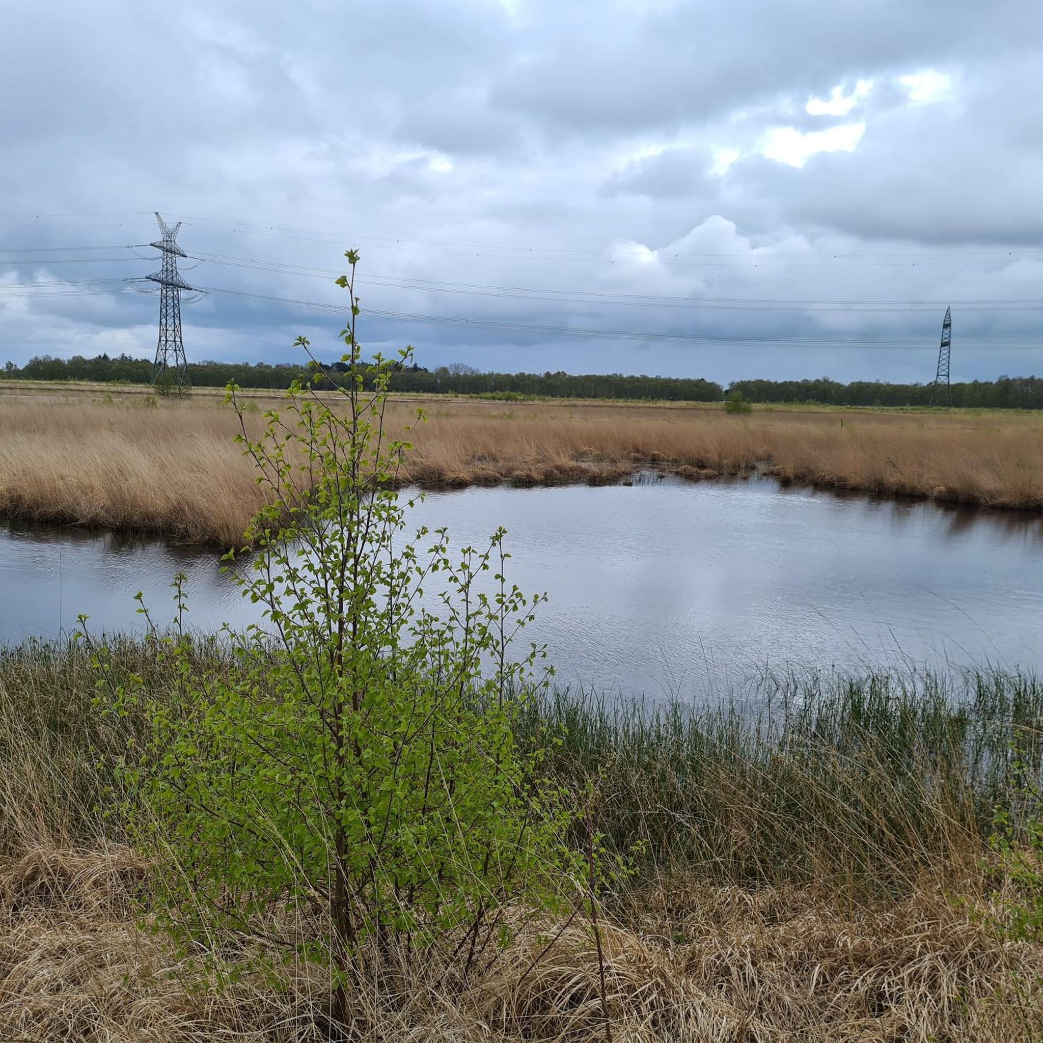
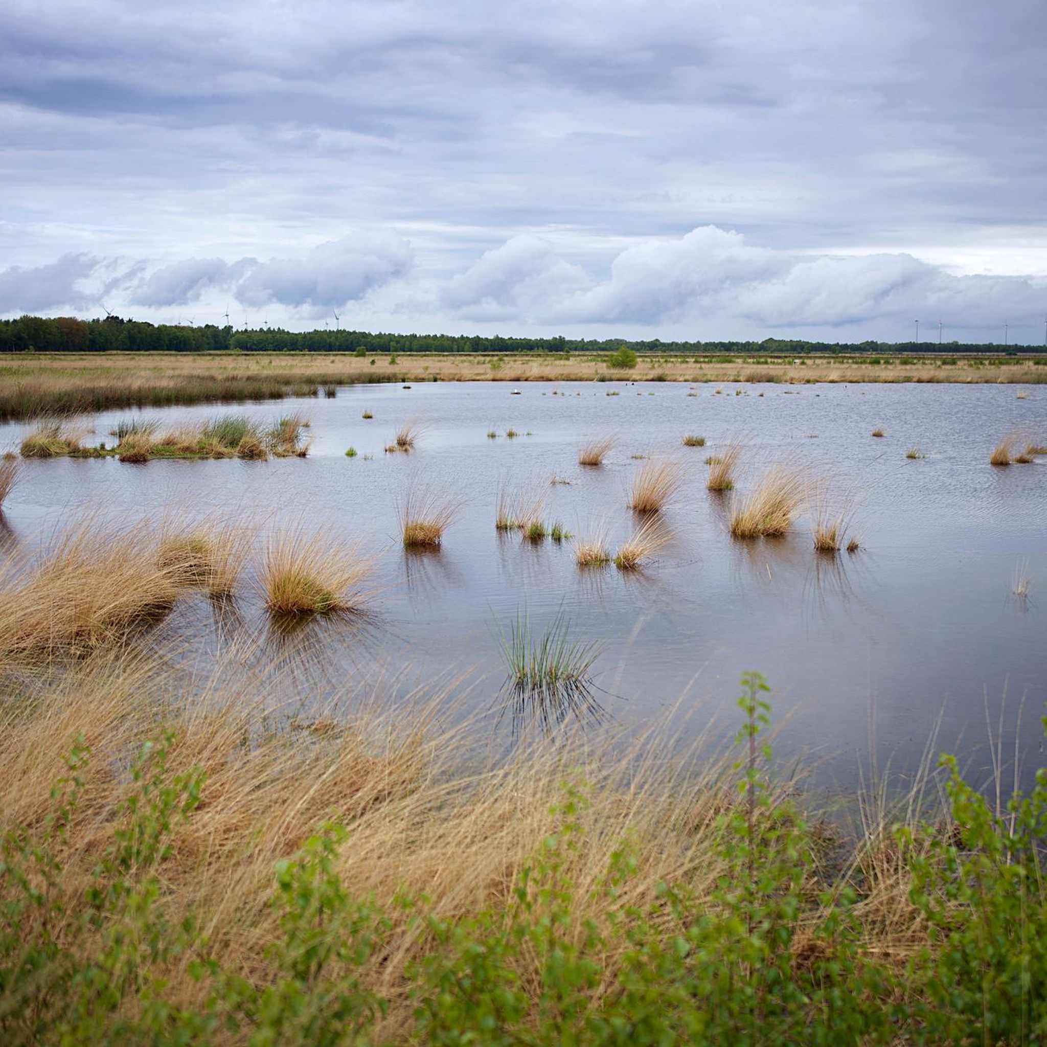
Hiking around Stapeler Moor und Umgebung offers trails through a flat, low-lying landscape characterized by moorland and peat bogs. The region features minimal elevation changes, making it accessible for various activity levels. This area is part of a nature reserve known for its distinctive high moor landscape, which has undergone rewetting and regeneration efforts. Hikers can experience diverse natural habitats, including moorland vegetation with peat mosses and heather, moor birch forests, and numerous small lakes such as Lengener Meer.
Best…
Last updated: August 25, 2026
4.7
(26)
101
hikers
1.53km
00:23
0m
0m
Easy hike. Great for any fitness level. Easily-accessible paths. Suitable for all skill levels.
5.0
(3)
19
hikers
Easy hike. Great for any fitness level. Easily-accessible paths. Suitable for all skill levels.

Sign up for free
5.0
(1)
1
hikers
Moderate hike. Good fitness required. Easily-accessible paths. Suitable for all skill levels.
3.0
(2)
3
hikers
Hard hike. Very good fitness required. Easily-accessible paths. Suitable for all skill levels.
3.0
(2)
3
hikers
Hard hike. Very good fitness required. Easily-accessible paths. Suitable for all skill levels.
Get access to more routes and recommendations from other explorers.
Sign up for free
Already have an account?
Our route recommendations are based on thousands of hikes, rides, and runs completed by other people on komoot.
Start today with a free account
Your next adventure awaits.
Login or Signup
Tips from the Community

Idyllic spot with a beautiful view of the Lengener Meer.
1
0

A beautiful spot of nature with a single track and a viewpoint. A great place to unwind and enjoy nature.
1
0

The ideal destination for cyclists, hikers and nature lovers. The adventure trail near Uplengen was completed at the end of 2008. This circular hiking trail with a lookout tower and a replica of an ancient plank path that led through the moor thousands of years ago gives visitors an idea of how the impassable moor was crossed back then. You can also take a break in the middle of the untouched nature or learn information about the flora and fauna from several information boards set up there. The trail is 1.6 km long. There is enough parking space.
3
0

Large moorland area with a great viewing platform. Information boards are available and the cycle path goes right past here.
1
0
Great large platform that offers a nice overview of the moor. With interesting information boards.
0
0

The lookout is visibly showing its age and needs maintenance but is still stable and the all-round view is very good
0
0
The actual road may be like a sand track but there is a good cycle path next to it
1
0

Very nice area to rest
2
0
Frequently Asked Questions
How many hiking trails are available in Stapeler Moor und Umgebung?
There are over 540 hiking trails in Stapeler Moor und Umgebung. The majority, around 380, are rated as easy, making the area very accessible for various fitness levels.
What kind of terrain can I expect when hiking in Stapeler Moor und Umgebung?
The region is characterized by a flat, low-lying landscape dominated by moorland and peat bogs. You can expect minimal elevation changes, open fields, and small water bodies, offering a unique natural environment typical of northern Germany.
Are there any easy circular walks suitable for beginners?
Yes, Stapeler Moor und Umgebung offers many easy circular walks. A good option for beginners is the Hiking loop from Lengener Meer, which is 3.6 km long and takes about 54 minutes to complete, leading through the flat, open landscape.
Are the hiking trails in Stapeler Moor und Umgebung suitable for families with children?
Absolutely. The flat terrain and numerous easy routes make Stapeler Moor und Umgebung very family-friendly. Many trails are short and have minimal elevation, perfect for walks with children. Consider the Hiking loop from Stapeler Moor und Umgebung, an easy 2.9 km path that provides great views of the characteristic landscape.
Can I bring my dog on the hiking trails?
Many trails in Stapeler Moor und Umgebung are suitable for dogs, but it's always recommended to keep them on a leash, especially in nature reserve areas to protect local wildlife and plants. The open landscape provides plenty of space for walks with your canine companion.
What are some scenic viewpoints or natural attractions to look out for?
The region offers several natural attractions. You can visit the Stapeler Moor itself, which is the heart of the area. For panoramic views, check out the Observation Platform at Lengener Meer or the Up Lengener Moor Path.
Are there any longer or more challenging routes for experienced hikers?
While the region is predominantly flat, there are options for longer hikes. For a moderate challenge, consider the Hiking loop from Ruttelerfeld, which covers 8.06 km. For a more difficult and extensive tour, the Neuenburgerfeld Peat Shed – Shelter at Stapeler Moor loop is a 24 km route.
What do other hikers enjoy most about hiking in Stapeler Moor und Umgebung?
The area is highly rated by the komoot community, with an average score of 4.5 stars from over 1,700 reviews. Hikers often praise the tranquil moorland landscapes, the well-maintained paths, and the opportunity to experience the unique nature of northern Germany.
Is there public transport available to reach the hiking areas?
Public transport options to specific trailheads within Stapeler Moor und Umgebung can be limited. It's advisable to check local bus schedules for connections from larger towns like Leer or Wiesmoor to the smaller villages surrounding the moor. Many visitors opt for personal vehicles.
Where can I find parking for the hiking trails?
Parking is generally available at the starting points of many popular trails and near villages bordering the moor. Look for designated parking areas or roadside parking where permitted. Specific parking information is often detailed on individual komoot Tour pages.
What is the best time of year to hike in Stapeler Moor und Umgebung?
Spring and autumn are particularly beautiful for hiking in Stapeler Moor und Umgebung. In spring, the landscape awakens with fresh greenery, while autumn brings vibrant colors to the moorland vegetation. Summer offers longer daylight hours, and winter can provide a unique, serene experience if conditions allow for safe walking.
Most popular routes around Stapeler Moor und Umgebung
Most popular attractions around Stapeler Moor und Umgebung

Get inspired with the komoot mobile app


Explore more
Browse the best Hikes in other regions.
