The best walks and hikes around Villaldemiro
4.3
(115)
813
hikers
5
hikes
Hiking around Villaldemiro offers routes through the gently rolling countryside of the region, often connecting historical villages and offering views of local landmarks. The terrain typically features open fields and paths that traverse agricultural areas, with moderate elevation changes. These hiking trails around Villaldemiro provide opportunities to explore the rural landscape and its cultural heritage.
Best hiking trails around Villaldemiro
- The most popular hiking route is The two towers: Torre de Mazuelo and de Arenillas de Muñó — circular from Mazuelo de Muñó, a 4.4 miles (7.1 km) trail that takes 1 hour 54 minutes to complete. This moderate route features historical towers and rural scenery.
- Another top favourite among local hikers is View of Castrojeriz – Entrance to Castrojeriz loop from Hontanas, a moderate 10.0 miles (16.1 km) path. This trail offers expansive views of the landscape leading towards Castrojeriz.
- Local hikers also love the To Castrojeriz – Castrojeriz loop from Castrojeriz, a 2.8 miles (4.5 km) trail leading through the immediate surroundings of Castrojeriz, often completed in about 1 hour 18 minutes.
- Hiking around Villaldemiro is defined by open countryside, historical village connections, and gentle ascents. The network offers options for various ability levels, from easy strolls to more challenging long-distance paths.
- The routes in Villaldemiro are highly rated by the komoot community with an average score of 4.4 stars from over 100 reviews. More than 700 hikers have used komoot to explore Villaldemiro's varied terrain.
Last updated: July 4, 2026
4.6
(79)
564
hikers
28.7km
07:31
230m
230m
Hard hike. Very good fitness required. Easily-accessible paths. Suitable for all skill levels.
4.5
(15)
140
hikers
16.1km
04:09
90m
90m
Moderate hike. Good fitness required. Easily-accessible paths. Suitable for all skill levels.

Sign up for free
4.7
(9)
60
hikers
29.6km
07:55
340m
340m
Hard hike. Very good fitness required. Easily-accessible paths. Suitable for all skill levels.
5.0
(1)
9
hikers
Moderate hike. Good fitness required. Easily-accessible paths. Suitable for all skill levels.
3.0
(1)
7
hikers
7.64km
02:00
60m
60m
Moderate hike. Good fitness required. Easily-accessible paths. Suitable for all skill levels.
Our route recommendations are based on thousands of hikes, rides, and runs completed by other people on komoot.
Start today with a free account
Your next adventure awaits.
Login or Signup
Popular around Villaldemiro
Tips from the Community

The chapel is very beautiful, the sisters unfortunately partly intrusive. You are touched without asking. A Catholic nun should actually know that only a priest has the authority to bless by laying on hands (except one's own parents) and even if she doesn't know that, there's still the normal human decency of asking strangers if they want to be touched.
0
0

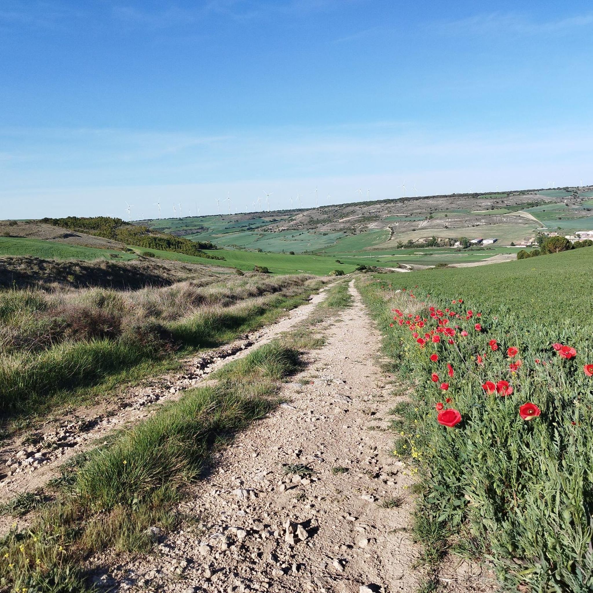
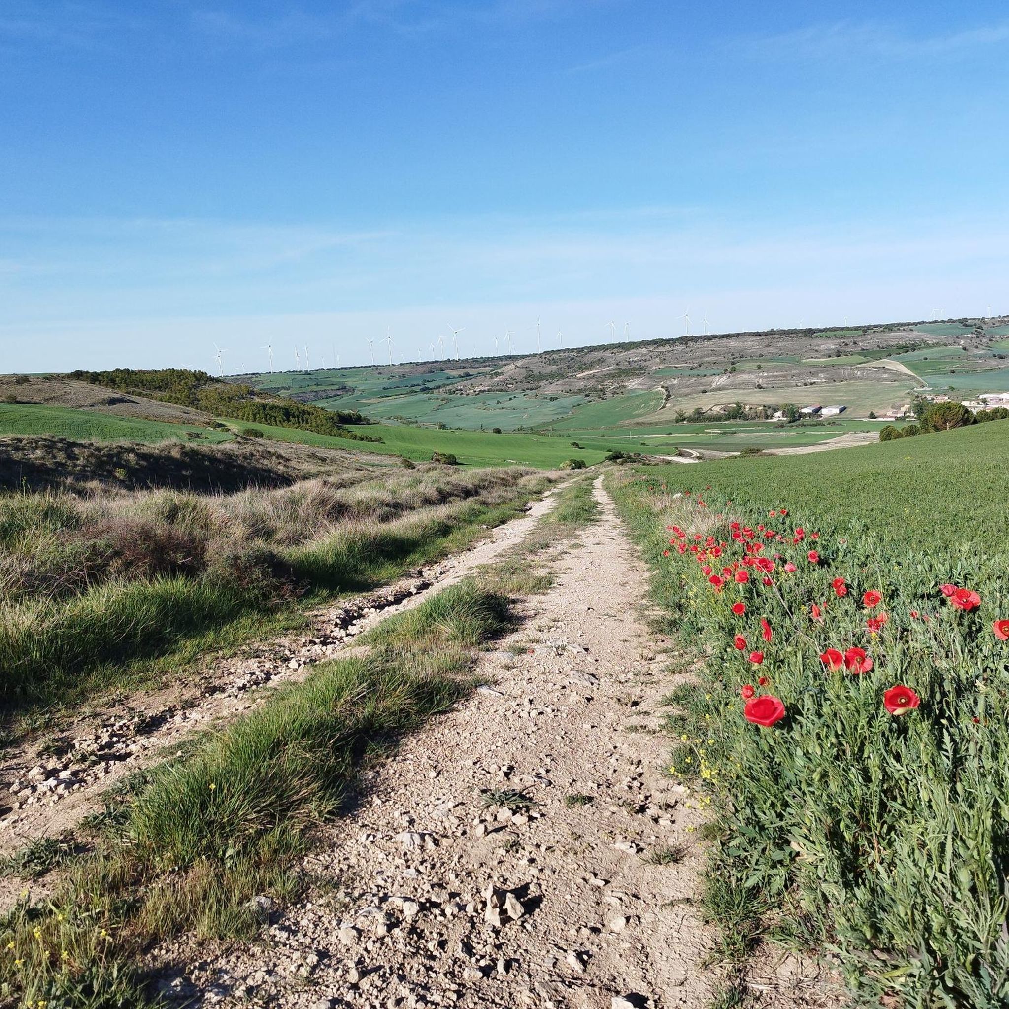
A view of infinity! Rolling hills, I feel like I'm walking through a beautiful landscape.
0
0

It represents the faces of Albert Einstein, Nelson Mandela, and Mahatma Gandhi, three universal figures of peace, science, and human rights. It is accompanied by the yellow arrow, the symbol of the Camino de Santiago, making it a visual reference point for walkers. It is located at the edge of the town, heading toward Hornillos del Camino, on a wall visible from the official Camino route.
1
0
The mural of Einstein, Mandela, and Gandhi in Rabé de las Calzadas (Burgos) is a well-known work among pilgrims on the French Way of St. James, especially for its symbolic location.
1
0
Castrojeriz, in the province of Burgos, is a monumental Jacobean town that forms part of the French Way of St. James. Its history, architecture, and natural surroundings make it a must-see stop for pilgrims and heritage lovers alike.
1
0
The fountain next to the church in Hontanas (Burgos) is a highly symbolic and functional element for pilgrims on the French Way of St. James. It is located at the foot of the Parish Church of the Immaculate Conception, right in the center of the town. It is a simple stone fountain, but much appreciated by hikers, especially in summer, when the heat of the Castilian plateau is intense.
1
0
If you have the opportunity to explore this trail, you'll enjoy the natural beauty and ecological richness of the area. Enjoy your hike! 🌿🚶♀️
1
0
The entrance to Castrojeriz via the Hontanas road is one of the most iconic routes along the French Way of St. James. Leaving Hontanas, the landscape is an open Castilian plain, and after a few kilometers, the impressive silhouette of Castrojeriz appears, dominated by its castle at the top of the hill.
2
0
Frequently Asked Questions
What is the general terrain like for hiking around Villaldemiro?
Hiking around Villaldemiro typically involves routes through gently rolling countryside, often connecting historical villages. The terrain features open fields and paths that traverse agricultural areas, with moderate elevation changes, offering a rural landscape experience.
How many hiking trails are available in the Villaldemiro area?
There are 5 hiking routes detailed in this guide for the Villaldemiro area, offering a variety of experiences from easy strolls to more challenging long-distance paths.
Are there any easy hiking trails suitable for beginners or a relaxed walk?
Yes, for an easier walk, consider the To Castrojeriz – Castrojeriz loop from Castrojeriz. This trail is 2.8 miles (4.5 km) long and can be completed in about 1 hour 18 minutes, leading through the immediate surroundings of Castrojeriz.
What kind of historical landmarks can I see while hiking near Villaldemiro?
The area is rich in historical sites. You can explore the Ruins of the Monastery of San Antón, the Convent of San Antón, or the impressive Collegiate Church of Santa María del Manzano. Many routes connect these historical points.
Are there any longer, more challenging hikes for experienced hikers?
Yes, for a more challenging experience, you might enjoy the View of Hontanas – Milestone loop from Iglesias, which is a difficult 17.8 miles (28.7 km) route. Another option is the Hornillos del Camino – View of Hornillos del Camino loop from Castellanos de Castro, a difficult 18.4 miles (29.6 km) trail.
What do other hikers enjoy most about the trails around Villaldemiro?
The area is highly rated by the komoot community, with an average score of 4.4 stars from over 100 reviews. Hikers often praise the open countryside, the connections between historical villages, and the gentle ascents that define the routes.
Are there any circular hiking routes available?
Yes, several routes are circular. For example, the The two towers: Torre de Mazuelo and de Arenillas de Muñó — circular from Mazuelo de Muñó is a moderate 4.4 miles (7.1 km) loop featuring historical towers. Another is the View of Castrojeriz – Entrance to Castrojeriz loop from Hontanas, a moderate 10.0 miles (16.1 km) path offering expansive views.
What kind of views can I expect on the hikes?
Many trails offer expansive views of the rural landscape, particularly towards significant landmarks like Castrojeriz. For instance, the View of Castrojeriz – Entrance to Castrojeriz loop from Hontanas provides excellent vistas. You can also find specific viewpoints like the View of Hontanas.
Is there a good time of year to visit Villaldemiro for hiking?
The gently rolling countryside and open fields suggest that spring and autumn would be ideal for hiking in Villaldemiro, offering pleasant temperatures and vibrant landscapes. Summers can be hot, and winters might be chilly, but the moderate elevation changes make it accessible year-round with appropriate preparation.
What are some notable religious buildings or churches I might encounter?
You can find several significant religious buildings in the vicinity. These include the Collegiate Church of Santa María del Manzano and the Church of the Immaculate Conception, Hontanas, which are part of the region's rich cultural heritage.
How long do the hikes around Villaldemiro typically take?
Hike durations vary significantly. Shorter routes like the To Castrojeriz – Castrojeriz loop from Castrojeriz can take around 1 hour 18 minutes. Longer, more difficult trails, such as the Hornillos del Camino – View of Hornillos del Camino loop from Castellanos de Castro, can take nearly 8 hours to complete.
Most popular routes around Villaldemiro
Most popular attractions around Villaldemiro

Get inspired with the komoot mobile app


Explore more
Browse the best Hikes in other regions.
