The best cycling routes around Santa Olalla
4.0
(2)
137
riders
55
rides
Touring cycling routes around Santa Olalla traverse a landscape characterized by gently rolling hills and agricultural plains. The region features open countryside interspersed with small towns and villages, offering varied terrain for cyclists. Elevation gains on routes are generally moderate, making for accessible yet engaging rides.
Best touring cycling routes around Santa Olalla
- The most popular touring cycling route is Torrijos a Carmena – circular route, a 24.4 miles (39.3 km) trail that takes 3 hours 1 minute to…
Last updated: June 24, 2026
39.3km
03:01
220m
220m
Moderate bike ride. Good fitness required. Mostly paved surfaces. Suitable for all skill levels.
7
riders
42.2km
03:37
230m
230m
Moderate bike ride. Good fitness required. Mostly paved surfaces. Suitable for all skill levels.

Sign up for free
5.0
(1)
8
riders
55.4km
04:22
370m
370m
Moderate bike ride. Good fitness required. Mostly paved surfaces. Suitable for all skill levels.
6
riders
34.6km
03:04
220m
220m
Hard bike ride. Good fitness required. You may need to push your bike for some segments of this route.
3
riders
43.4km
03:33
210m
210m
Moderate bike ride. Good fitness required. Mostly paved surfaces. Suitable for all skill levels.
Get access to more routes and recommendations from other explorers.
Sign up for free
Already have an account?
Our route recommendations are based on thousands of hikes, rides, and runs completed by other people on komoot.
Start today with a free account
Your next adventure awaits.
Login or Signup
Tips from the Community

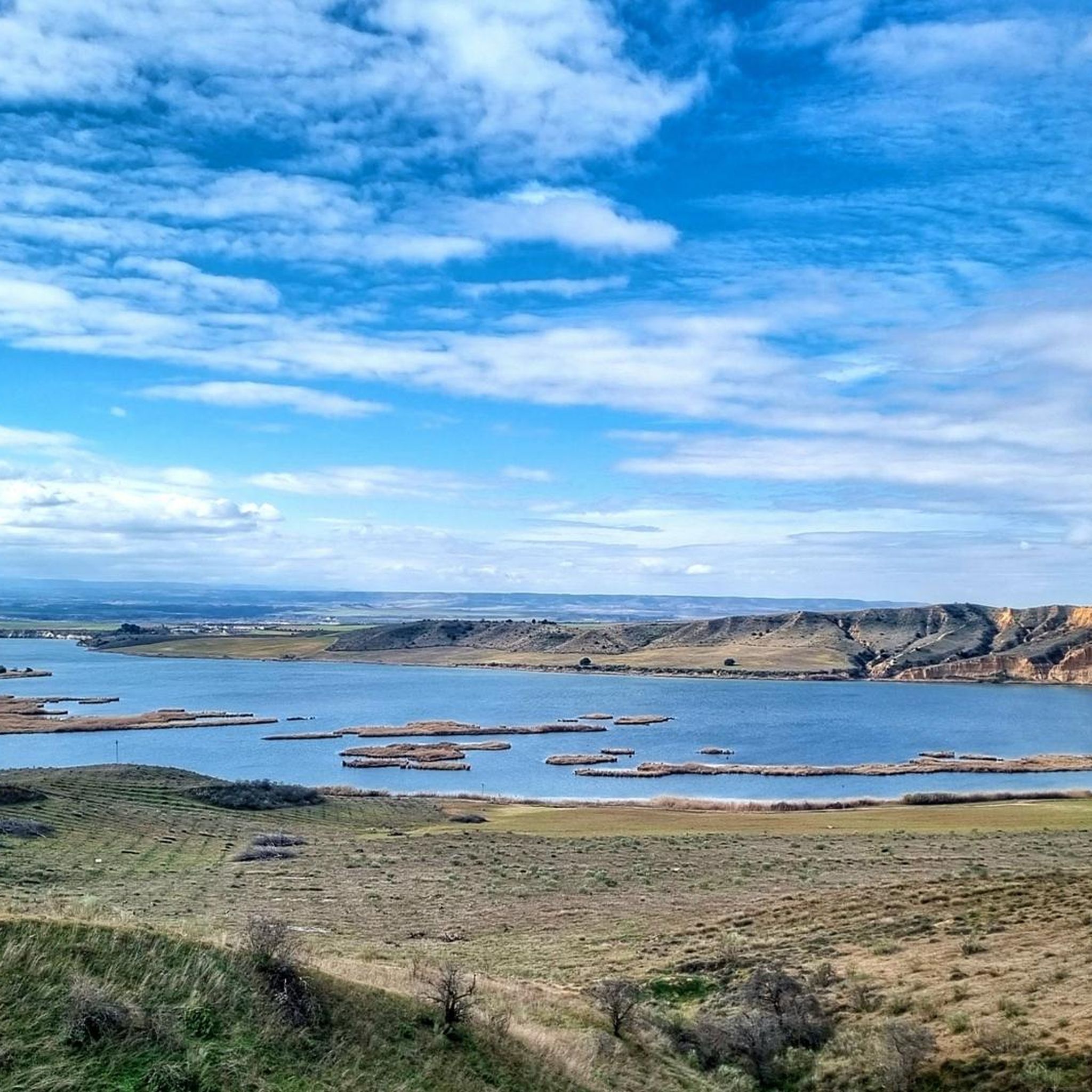
Views of the small Carpio de Tajo reservoir, connected to the Castrejon Canal. It is a popular fishing area.
0
1

Torrijos gives its name to its region in the plain between the Tajo and Alberche rivers. It is the natural center of trade in goods and services in this area of Toledo. With its population of almost 13,000 inhabitants, it has all the services of a small city and has direct communications by train and bus with the main cities of Toledo and Extremadura. Its monuments, such as the palace of Peter I or its collegiate church, testify to its historical importance since the Middle Ages.
1
0

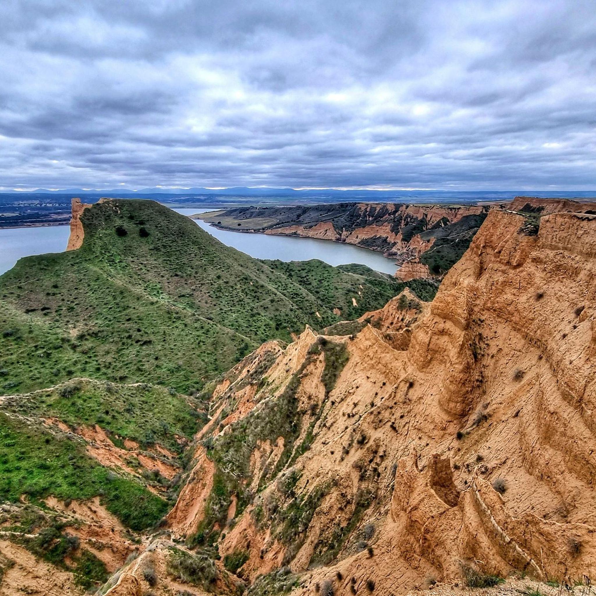
La Puebla de Montalbán is located in the province of Toledo, in the plains of the Tagus River and very close to the natural space of the Barrancas de Burujón. Its town center has a rich architectural heritage.
2
0
Albarreal de Tajo is a municipality in the province of Toledo. It is very close to the Tagus River and the Tagus Nature Trail passes through its urban area.
2
0

Rielves is a transit point for the Caminos de Santiago del Levante, on its way between Toledo and Ávila, the path being perfectly signposted.
7
0

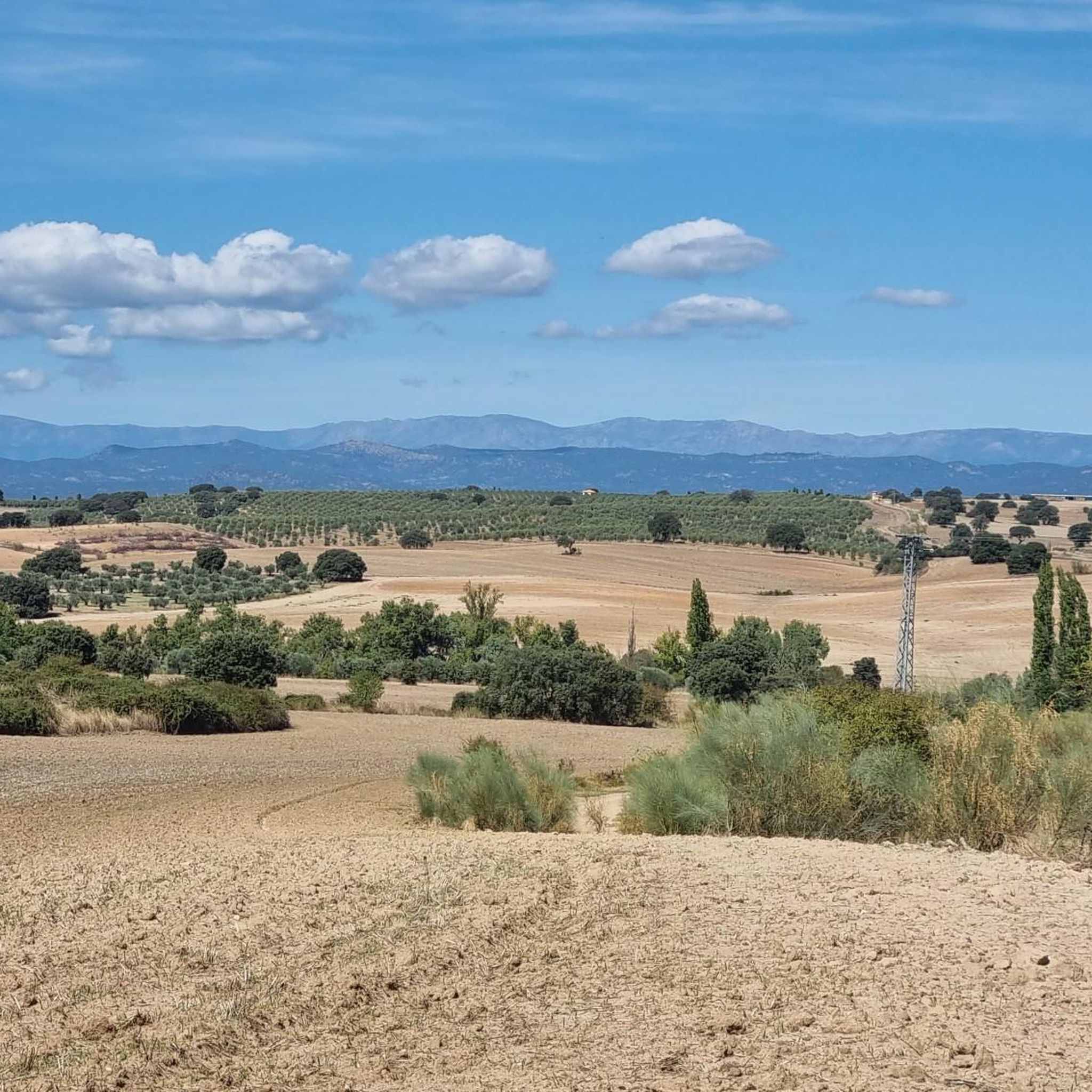
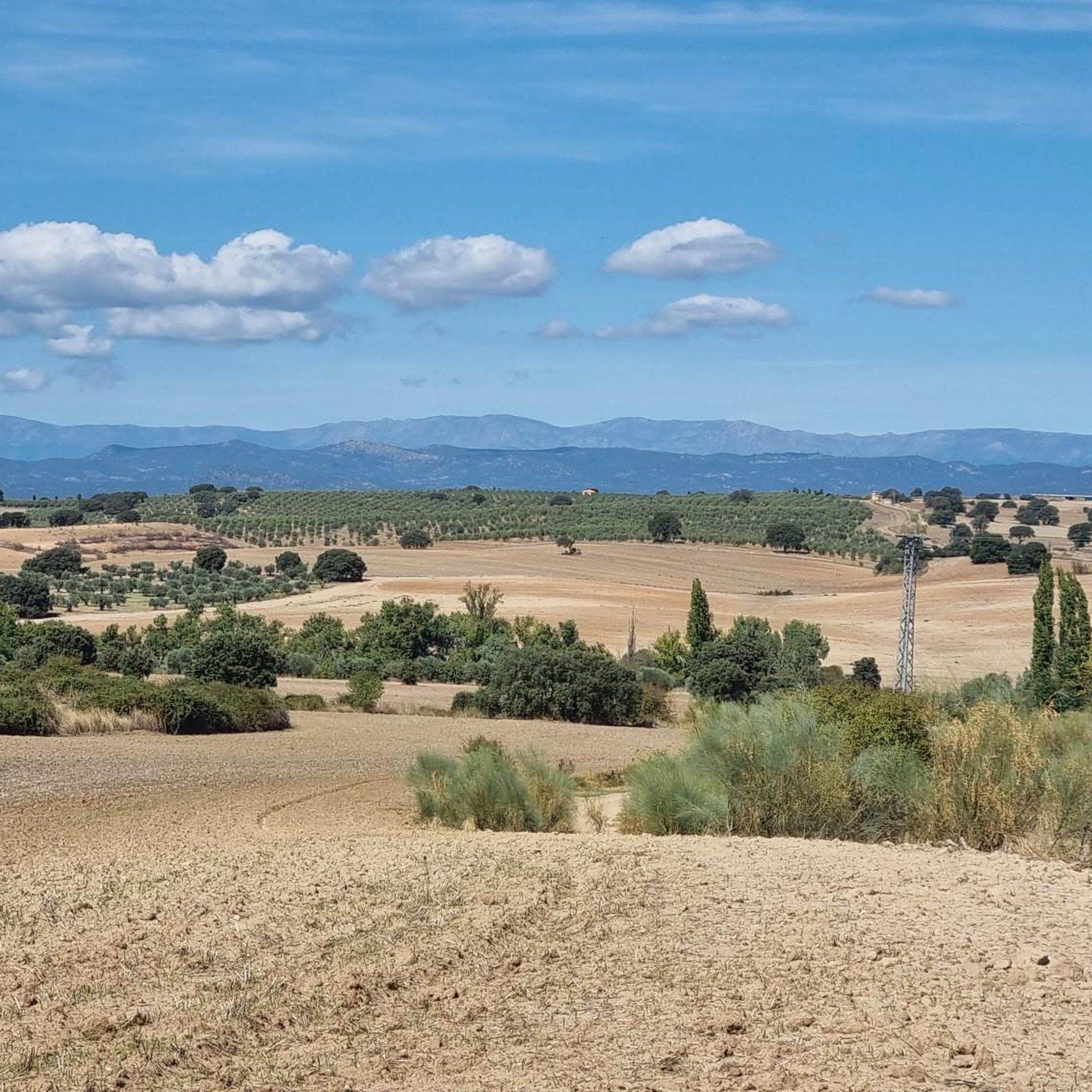
Beautiful gravel roads in the middle of endless fields of wheat. The scenery is spectacular and relaxing.
1
0

The council of this small and quiet town has carried out an interesting and exhaustive job of documenting the origin of the names of the town's streets, some of which are a perfect reflection of the town's history and customs. All this archive can be found on its website and it is worth taking a walk through its streets reading its history.
4
0
Torrijos has an enormous architectural heritage, among which it is worth highlighting the train station, the parish church (with a very old organ and elements brought from Medina Azahara), the palace of Pedro I or even its more contemporary Center for the Elderly.
4
0
Frequently Asked Questions
How many touring cycling routes are available around Santa Olalla?
There are over 60 touring cycling routes available around Santa Olalla, offering a wide range of options for different skill levels and preferences.
Are there any easy touring cycling routes suitable for beginners or families?
Yes, Santa Olalla offers 6 easy touring cycling routes. These routes typically feature gentler terrain and shorter distances, making them ideal for beginners or families looking for a relaxed ride. For a moderate option that is still accessible, consider the Torrijos a Carmena – circular route, which is 24.4 miles long and connects two towns through the countryside.
What are some challenging touring cycling routes for experienced riders?
For experienced riders seeking a challenge, there are 15 difficult touring cycling routes around Santa Olalla. One such route is the Church of Huecas – Torrijos Town Center loop from Torrijos, a 22.4-mile path that passes through historical points and offers varied terrain. Another demanding option is the Rielves – Torrijos Town Center loop from Torrijos, covering 27.2 miles with significant elevation changes.
Are there any circular touring cycling routes in the area?
Many of the touring cycling routes around Santa Olalla are circular, allowing you to start and end in the same location. Examples include the popular Torrijos a Carmena – circular route and the Torrijos Town Center – San Silvestre Castle loop from Torrijos, which leads through rural landscapes and past a historic castle.
What kind of scenery can I expect on touring cycling routes around Santa Olalla?
Touring cycling routes around Santa Olalla traverse a landscape characterized by gently rolling hills and open agricultural plains. You'll cycle through open countryside interspersed with small towns and villages, offering a mix of natural beauty and historical points of interest. The region's moderate elevation gains make for accessible yet engaging rides.
What historical landmarks or attractions can I explore along the routes?
The region around Santa Olalla is rich in history. You can explore several landmarks and attractions, often integrated into or near cycling routes. Notable sites include the Plaza de España and Monument to the Cross in Torrijos, the Parish Church of Our Lady of the Assumption, and the ruins of Cebolla Castle. The Torrijos Town Center – San Silvestre Castle loop from Torrijos specifically passes by San Silvestre Castle.
What is the best time of year for touring cycling in Santa Olalla?
The best time for touring cycling in Santa Olalla is typically during the spring (April to June) and autumn (September to October). During these months, the weather is generally mild and pleasant, with comfortable temperatures for cycling. Summers can be very hot, and winters, while generally mild, can be cooler and wetter.
Are there long-distance touring cycling options available?
While many routes are designed for day trips, you can combine routes or choose longer options for extended rides. For example, the Torrijos Town Center – La Puebla de Montalbán loop from Torrijos is a moderate 35-mile route, offering a longer journey through the region's landscapes.
What do other touring cyclists say about the routes in Santa Olalla?
The touring cycling routes around Santa Olalla are well-regarded by the komoot community, with an average rating of 4.0 stars. Cyclists often appreciate the varied terrain, the connection between historical towns, and the opportunity to explore the open agricultural plains.
Is public transport available to access the cycling routes?
Public transport options directly to the start of every route may be limited in some of the smaller villages. However, larger towns like Torrijos, which serve as starting points for several routes, often have bus connections from bigger cities. It's advisable to check local bus schedules for specific connections to your chosen starting point.
Where can I find parking for my car when cycling in Santa Olalla?
Parking is generally available in the towns and villages that serve as starting points for the cycling routes. Look for designated public parking areas within town centers, especially in places like Torrijos. These are usually free or have minimal charges, providing convenient access to the trails.
Most popular attractions around Santa Olalla

Get inspired with the komoot mobile app


Explore more
Browse the best Cycling routes in other regions.
