The best walks and hikes around Mazaleón
4.7
(8)
51
hikers
14
hikes
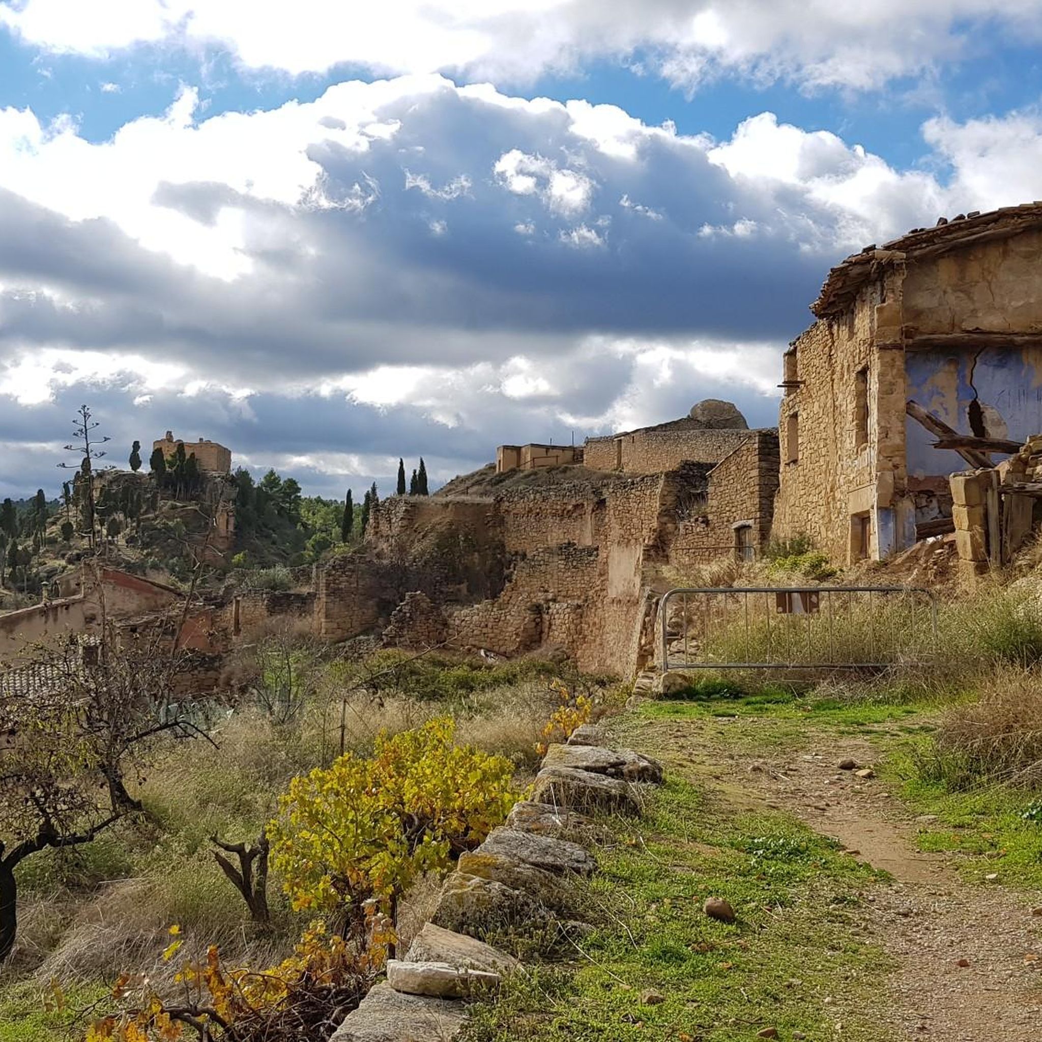
Hiking around Mazaleón offers routes through the Matarraña region, characterized by its river valleys, hilly terrain, and ancient Iberian settlements. The landscape features riparian vegetation along the Matarraña River and elevated positions providing views of the surrounding agricultural areas. This area, sometimes referred to as the "Spanish Tuscany," combines natural beauty with historical sites. The terrain includes gentle slopes and some more uneven sections, providing varied hiking experiences.
Best hiking trails around Mazaleón
- The most popular hiking route is Poblado…
Last updated: July 1, 2026
4.5
(2)
15
hikers
13.1km
03:34
190m
190m
Moderate hike. Good fitness required. Easily-accessible paths. Suitable for all skill levels.
4.0
(1)
8
hikers
3.28km
00:56
80m
80m
Easy hike. Great for any fitness level. Easily-accessible paths. Suitable for all skill levels.

Sign up for free
5.97km
01:35
80m
80m
Easy hike. Great for any fitness level. Easily-accessible paths. Suitable for all skill levels.
5.0
(2)
5
hikers
Moderate hike. Good fitness required. Easily-accessible paths. Suitable for all skill levels.
5
hikers
Moderate hike. Good fitness required. Easily-accessible paths. Suitable for all skill levels.
Get access to more routes and recommendations from other explorers.
Sign up for free
Already have an account?
Our route recommendations are based on thousands of hikes, rides, and runs completed by other people on komoot.
Start today with a free account
Your next adventure awaits.
Login or Signup
Tips from the Community

Enjoy a lovely swim followed by a cold beer at the bar!
0
0

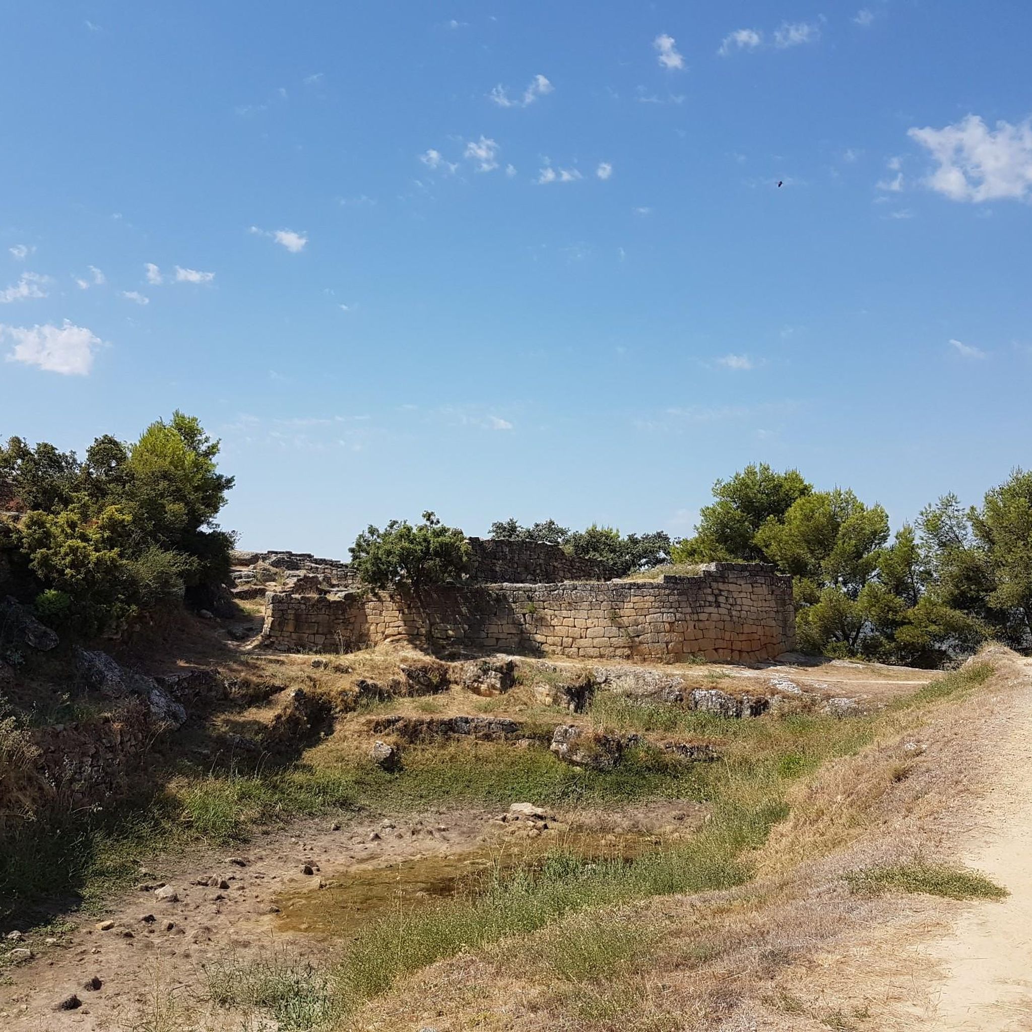
A nice place to reach by walk, or running (easy "trail") from Calaceite. The views on the region are great, the historic remainings are simple but great: you still feel the rooms, the alleys... Around 20m x 10m size. A great perspective towards the town of Calaceite when you look North. Worth the tour if you are spending some days in Calaceite.
0
0

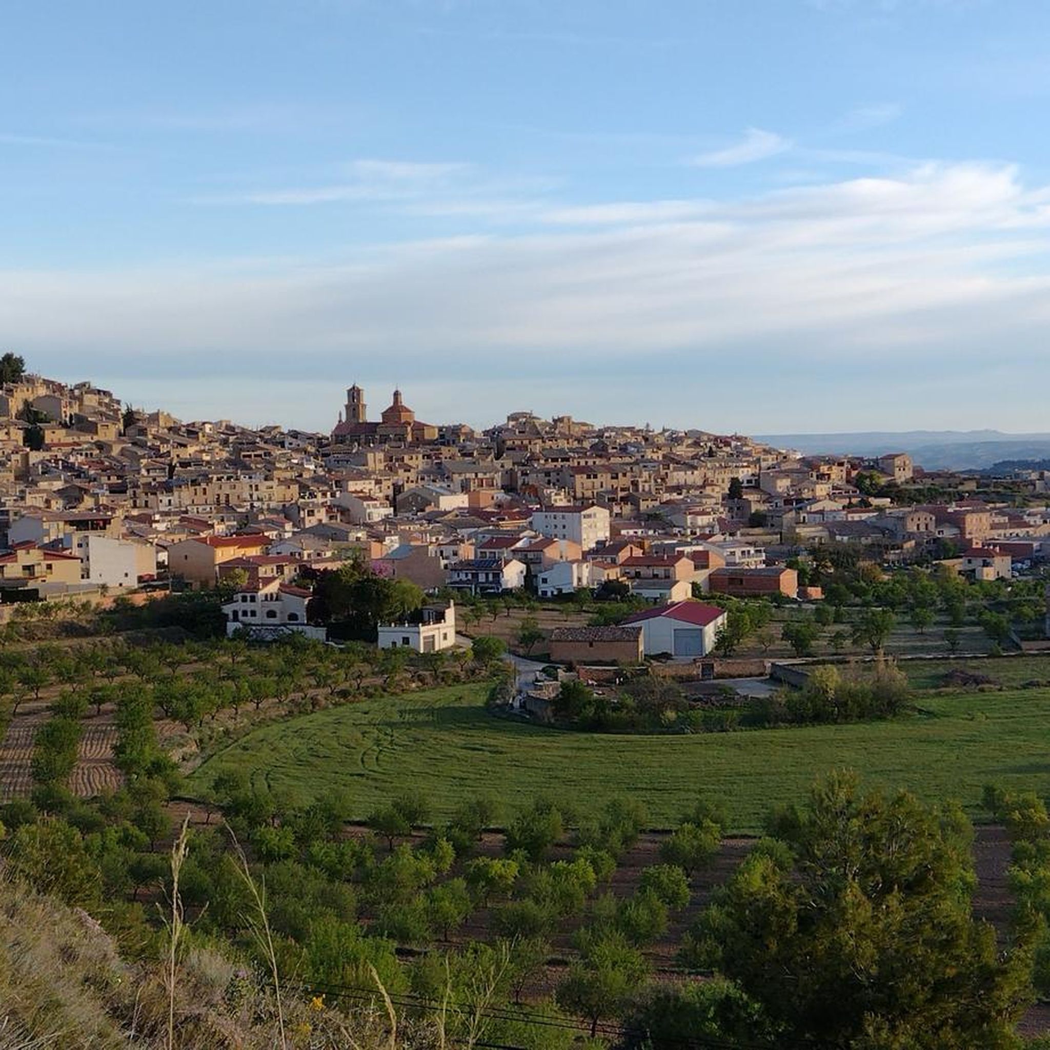
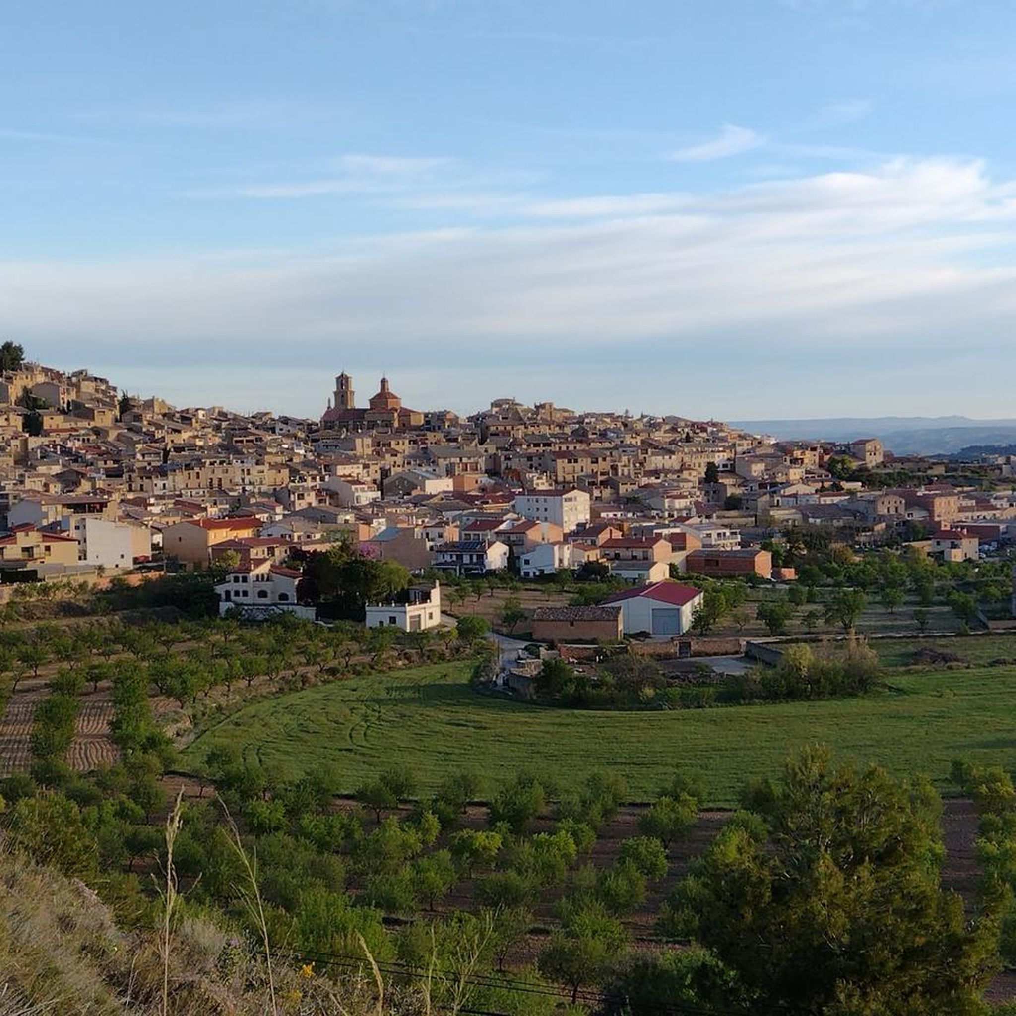
Viewpoint on the San Cristóbal hill near Calaceite, with excellent views of this town and its surroundings. It houses an imposing monument of the Sacred Heart.
1
0
A fantastic iberian town. Its access is easy by car. Inside the complex, you are well guided by indications, you can perfectly see the ancient walls and structures. Including a large pool.
1
0
Good quiet point of view. A few cars. Connection point to the top. Pretty
0
0
Iberian town that tops a hill. This is the one closest to Calaceite of many others found in the region. Surrounding hermitage. Good views over Calaceite and the region! Paved or more natural access roads, with direct connection to the town. Relevant tilt! A "must see" in Calaceite.
1
0

Beautiful population that is between borders and that when you walk through its streets you can see the years of history. There is an old castle called Castillo de Mealla and also a huge bell tower that can be seen when you arrive in the town.
0
0
From this tossal/hill that is located above the same town of Maella and from where you can see the whole of the nucleus.
0
0
Frequently Asked Questions
How many hiking trails are available around Mazaleón?
Mazaleón offers a selection of 14 hiking trails, catering to various preferences. Most routes are moderate, with 11 trails falling into this category, while 3 are considered easy.
Are there easy hiking trails suitable for families in Mazaleón?
Yes, Mazaleón has several easy trails perfect for families. An excellent option is the San Antonio Iberian Settlement and San Cristóbal Hill Trail, an easy 3.3 km path that explores historical sites overlooking the Matarraña River. Another family-friendly choice is the Matarraña Valleys Trail (PR-Z 162), a 6.0 km route along the scenic river.
Can I find circular hiking routes in Mazaleón?
Yes, many trails in the Mazaleón area are circular. For instance, the Poblado ibérico de San Antonio y Tossal Redó — circular desde Calaceite is a moderate 13.1 km circular route exploring ancient Iberian settlements. The San Antonio Iberian Settlement and San Cristóbal Hill Trail and the Matarraña Valleys Trail (PR-Z 162) are also circular options.
What kind of terrain can I expect on hikes around Mazaleón?
The terrain around Mazaleón is diverse, featuring river valleys, hilly landscapes, and agricultural areas. You'll encounter riparian vegetation along the Matarraña River, gentle slopes, and some more uneven sections, especially around the ancient Iberian settlements and the town's crag. The region is often referred to as the 'Spanish Tuscany' due to its picturesque and varied scenery.
Are there any historical sites or landmarks to see while hiking?
Mazaleón is rich in history. Many trails lead to ancient Iberian settlements, such as the San Antonio Iberian Settlement and Tossal Redó. The town itself has medieval heritage, with its urban core built on a crag and remnants of a fortress. You can also explore nearby attractions like the Torre del Compte Bell Tower or the Equinox Tunnel.
Are dogs allowed on the hiking trails in Mazaleón?
Generally, dogs are welcome on most hiking trails in the Mazaleón area. However, it's always advisable to keep them on a leash, especially when passing through agricultural areas or near wildlife, and to respect local regulations. Please ensure you clean up after your pet to maintain the natural beauty of the trails.
What are the best times of year to go hiking in Mazaleón?
The Matarraña region, including Mazaleón, is pleasant for hiking during spring and autumn when temperatures are mild. Spring brings lush greenery and wildflowers, while autumn offers beautiful colors. Summer can be hot, so early morning or late afternoon hikes are recommended, focusing on shaded routes or those along the river. Winter hiking is also possible, with cooler temperatures and fewer crowds.
Are there good viewpoints on the trails around Mazaleón?
Yes, Mazaleón's hilly terrain and its urban center built on a crag provide numerous opportunities for panoramic views. Trails like the Poblado ibérico de San Antonio y Tossal Redó — circular desde Calaceite offer expansive vistas of the surrounding valleys and agricultural landscapes. The Iberian Settlement of San Cristóbal also provides elevated perspectives of the Matarraña River.
What do other hikers say about the trails in Mazaleón?
The trails in Mazaleón are highly rated by the komoot community, with an average score of 4.7 stars from around 8 reviews. Hikers often praise the combination of natural beauty, historical sites, and the serene atmosphere of the Matarraña region. Many appreciate the varied landscapes, from river valleys to ancient settlements.
Is there parking available for hikers in Mazaleón?
While specific parking areas for each trailhead are not always signposted, Mazaleón and nearby villages typically offer public parking spaces. It's usually possible to find parking in or near the town centers from where many routes begin. For routes starting outside the village, look for designated parking spots or safe roadside areas.
How long do hikes around Mazaleón typically take?
Hiking durations vary depending on the trail's length and difficulty. Easy routes like the San Antonio Iberian Settlement and San Cristóbal Hill Trail (3.3 km) can be completed in under an hour. Moderate trails, such as the La Fresneda – Municipal Swimming Pool loop (9.0 km), might take around 2.5 hours. Longer moderate hikes like the La Fresneda – View of La Torre del Comte loop (9.3 km) can take up to 2 hours 35 minutes.
Are there any longer or more challenging hikes available?
While Mazaleón doesn't have 'difficult' graded trails, it offers several moderate routes that provide a good challenge. The Poblado ibérico de San Antonio y Tossal Redó — circular desde Calaceite is a moderate 13.1 km trail that takes over 3.5 hours to complete, offering a longer and more engaging experience. The broader Matarraña-Algars Natural Path also features extensive stages for those seeking multi-day treks.
Can I access hiking trails in Mazaleón using public transport?
Public transport options directly to trailheads in Mazaleón can be limited. While there might be bus services connecting Mazaleón to larger towns in the Teruel province, accessing specific starting points for hikes often requires a car. It's recommended to check local bus schedules if you plan to rely on public transport for your hiking trip.
Are there any natural features like rivers or valleys to explore?
Absolutely. The Matarraña River is a central natural feature, and its valley is a highlight for hikers. Routes like the Matarraña Valleys Trail (PR-Z 162) follow the river, showcasing its riparian vegetation, including poplars, ash, and willows. The region is characterized by picturesque valleys and hilly terrain, offering varied natural scenery.
Most popular attractions around Mazaleón

Get inspired with the komoot mobile app


Explore more
Browse the best Hikes in other regions.
