The best walks and hikes around Santa Inés
4.7
(13)
43
hikers
19
hikes
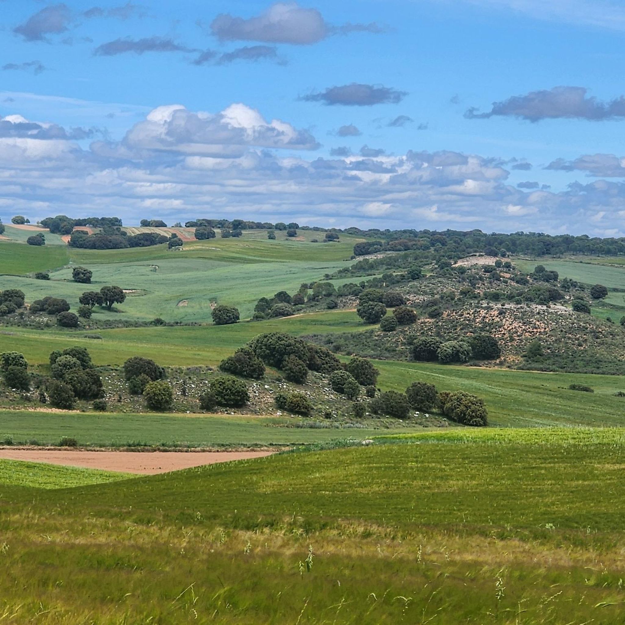
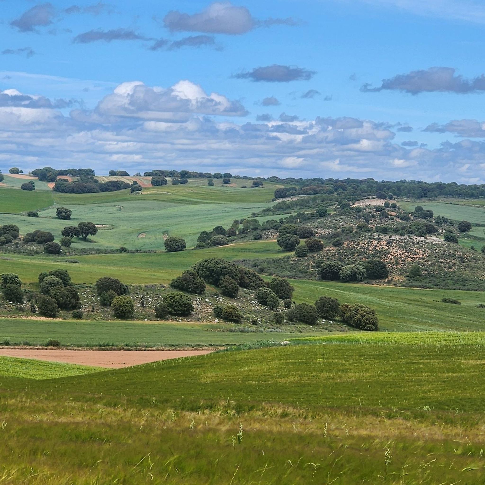
Hiking around Santa Inés offers diverse outdoor experiences, particularly in the vicinity of Lerma, Burgos, Spain. The region is characterized by holm oak forests, riverside paths along the Río Arlanza, and varied terrain. Hikers can explore landscapes featuring remnants of old barns and areas with historical significance. The elevation changes are generally moderate, providing accessible routes for various fitness levels.
Best hiking trails around Santa Inés
- The most popular hiking route is Río Arlanza Riverside Trail, an easy 3.9 miles (6.3 km) trail that takes 1 hour 39 minutes to complete, offering scenic views and historical charm.
- Another top favourite among local hikers is Trail of the Cradle of the Good Count, a moderate 4.1 miles (6.6 km) path that winds through varied terrain with historical points of interest.
- Local hikers also love the Sendero de las Grandes Encinas (PRC-BU 121) — circular desde Solarana, a 5.9 miles (9.4 km) trail leading through beautiful holm oak forests, often completed in about 2 hours 36 minutes.
- Hiking around Santa Inés is defined by riverside paths, holm oak forests, and varied terrain. The network offers options for different ability levels, from easy walks to more challenging hikes.
- The routes in Santa Inés are highly rated by the komoot community with an average score of 4.8 stars from over 10 reviews. More than 30 hikers have used komoot to explore Santa Inés's varied terrain.
Last updated: July 2, 2026
5.0
(2)
11
hikers
6.31km
01:39
50m
50m
Enjoy an easy 3.9-mile (6.3 km) circular hike along the Río Arlanza, offering scenic views and historic charm in Lerma.
4.3
(3)
6
hikers
6.56km
01:48
110m
110m
Hike the 4.1-mile Route Museo del Carbón circular from Mecerreyes, a moderate trail featuring forests, the Charcoal Museum, and views of Mue

Sign up for free
5.0
(1)
4
hikers
9.43km
02:37
170m
170m
Moderate hike. Good fitness required. Easily-accessible paths. Suitable for all skill levels.
5.0
(2)
1
hikers
15.4km
04:13
240m
240m
Moderate hike. Good fitness required. Easily-accessible paths. Suitable for all skill levels.
4.5
(2)
2
hikers
8.06km
02:15
150m
150m
Hike the moderate 5.0-mile Sendero del Montecillo (PRC-BU 130) circular route from Puentedura, exploring a mosaic landscape.
Get access to more routes and recommendations from other explorers.
Sign up for free
Already have an account?
Our route recommendations are based on thousands of hikes, rides, and runs completed by other people on komoot.
Start today with a free account
Your next adventure awaits.
Login or Signup


Tips from the Community

Ideal places for mountain biking and hiking routes
0
0

Powerful statue dedicated to El Cid, the largest on the entire route
2
0

El Montecillo is a beautiful place that gives its name to the trail that begins in the town of Puentedura.
0
0
The town of the famous Cura Merino, guerrilla during the War of Independence. In the town we can see his beautiful house and the parish church of San Vítores. The door that enters the church is decorated with a cheer in memory of the exploits of Cura Merino. The church is dedicated to San Vítores, a saint from Burgos who died beheaded. Next to the church is the Moral de Villoviado, a unique tree in the province of Burgos.
1
0
Interesting museum that explains how the charcoal burners worked. It has an outdoor exhibition and information panels.
1
0
Frequently Asked Questions
How many hiking trails are available around Santa Inés?
There are over 15 hiking trails in the Santa Inés area, offering a variety of experiences for different skill levels. You'll find routes ranging from easy riverside strolls to more challenging paths through holm oak forests.
What is the overall difficulty level of hiking trails in Santa Inés?
The trails around Santa Inés are predominantly moderate, with 12 routes falling into this category. There are also 4 easy trails perfect for a relaxed walk, and 1 more challenging option for experienced hikers.
Are there easy hiking options suitable for beginners in Santa Inés?
Yes, Santa Inés offers several easy hiking options. A great choice for beginners is the Río Arlanza Riverside Trail, which is 3.9 miles (6.3 km) long and provides scenic views with minimal elevation gain.
Are there any circular hiking routes in Santa Inés?
Yes, you can find several circular routes in the area. For example, the Sendero de las Grandes Encinas (PRC-BU 121) — circular desde Solarana is a 5.9-mile (9.4 km) loop that takes you through beautiful holm oak forests. Another option is the longer Sendero del Cura Merino (PRC-BU-124) — Fontioso circular desde Villoviado.
What kind of landscapes can I expect to see while hiking in Santa Inés?
Hiking in Santa Inés, particularly near Lerma, Burgos, Spain, means exploring diverse landscapes. You'll encounter beautiful holm oak forests, tranquil riverside paths along the Río Arlanza, and varied terrain that often includes remnants of old barns and areas with historical significance.
What do other hikers say about the trails in Santa Inés?
The trails in Santa Inés are highly rated by the komoot community, with an average score of 4.8 out of 5 stars from over 10 reviews. Hikers often praise the area's natural beauty, the variety of routes, and the well-maintained paths that make for enjoyable outdoor experiences.
Are there any historical or cultural points of interest along the hiking trails?
Yes, many trails in Santa Inés pass by or are near historical and cultural sites. The Trail of the Cradle of the Good Count, for instance, winds through varied terrain with historical points of interest. The region itself has a rich history, with remnants of old barns and a charcoal museum nearby, reflecting past local industries.
What are some notable attractions or landmarks to visit near the hiking areas?
Beyond the trails, you can explore several interesting landmarks. Consider visiting the Statue of El Cid in Mecerreyes, the historic Plaza Mayor and Ducal Palace of Lerma, or enjoy panoramic views from the Mirador de los Arcos. The Collegiate Church of Saint Peter the Apostle is also a significant religious site.
Are there any trails that offer views of the Río Arlanza?
Absolutely. The Río Arlanza Riverside Trail is specifically designed to showcase the scenic beauty of the river, offering charming views and a pleasant walk along its banks.
What is the best time of year to go hiking in Santa Inés?
The region around Santa Inés, near Lerma, Burgos, Spain, is generally pleasant for hiking during spring and autumn when temperatures are mild. Spring brings blooming landscapes, while autumn offers beautiful fall colors in the forests. Summer can be warm, so early morning or late afternoon hikes are recommended.
Are there any trails that pass through significant forests?
Yes, the area is known for its beautiful holm oak forests. The Sendero de las Grandes Encinas (PRC-BU 121), for example, leads you directly through these impressive woodlands.
Is there a trail that offers a good mix of forest and open views?
The El Montecillo Trail is a moderate 5-mile (8 km) hike that provides a varied experience, likely combining sections through wooded areas with more open stretches, offering diverse views of the surrounding landscape.
Most popular attractions around Santa Inés

Get inspired with the komoot mobile app


Explore more
Browse the best Hikes in other regions.
