The best walks and hikes around Royuela De Río Franco
4.3
(3)
9
hikers
5
hikes
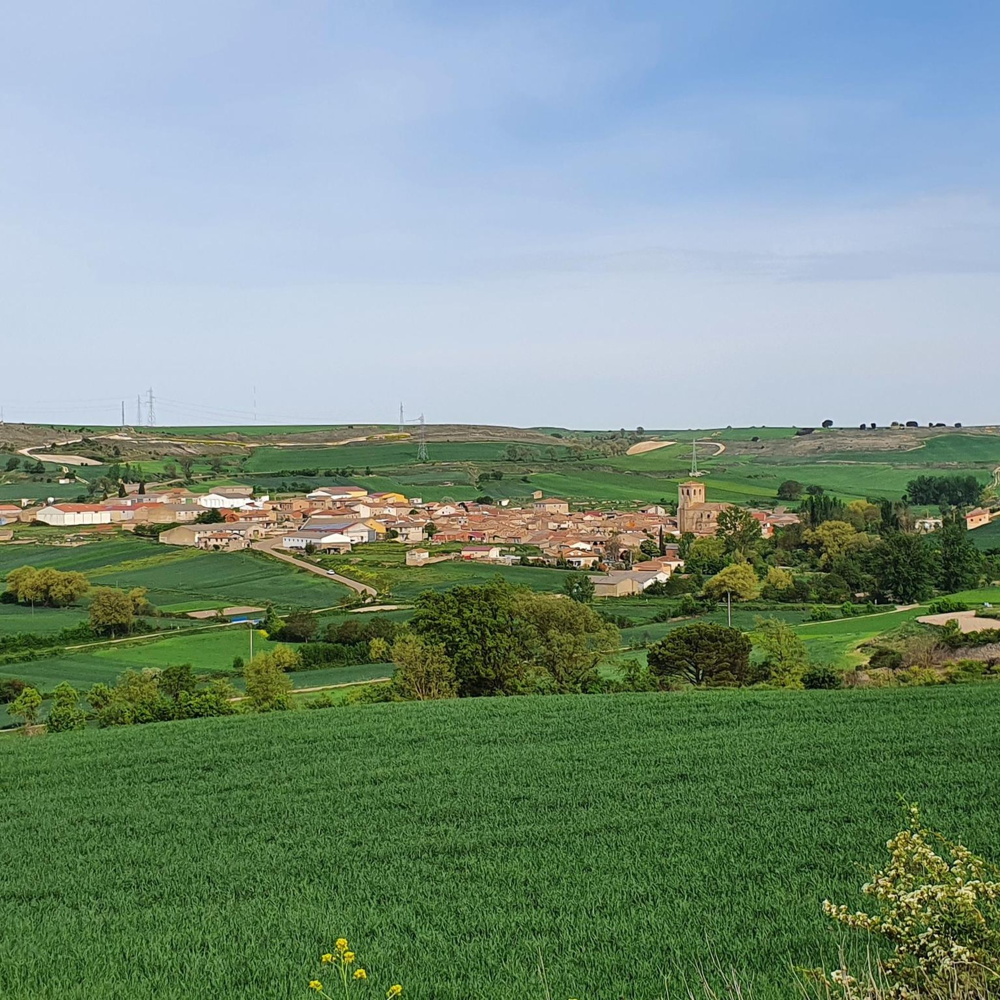
Hiking around Royuela De Río Franco offers exploration of the El Cerrato plain, characterized by extensive cultivated fields and rolling hills. The region is traversed by the Río Franco, providing varied terrain along its banks and contributing to the natural landscape. These features create a mix of relatively flat walking routes and more undulating paths, typical of the Spanish countryside.
Best hiking trails around Royuela De Río Franco
- The most popular hiking route is Río Arlanza y Villahoz — circular…
Last updated: May 16, 2026
3.0
(1)
3
hikers
17.4km
04:34
140m
140m
Moderate hike. Good fitness required. Mostly accessible paths. Sure-footedness required.
5.0
(1)
2
hikers
Moderate hike. Good fitness required. Mostly accessible paths. Sure-footedness required.

Sign up for free
Moderate hike. Good fitness required. Mostly accessible paths. Sure-footedness required.
5.0
(1)
2
hikers
5.80km
01:30
40m
40m
Easy hike. Great for any fitness level. Easily-accessible paths. Suitable for all skill levels.
2
hikers
9.26km
02:27
90m
90m
Moderate hike. Good fitness required. Easily-accessible paths. Suitable for all skill levels.
Our route recommendations are based on thousands of hikes, rides, and runs completed by other people on komoot.
Start today with a free account
Your next adventure awaits.
Login or Signup
Popular around Royuela De Río Franco
Tips from the Community

As we climb to the highest part of the Lower Arlanza Valley Trail along a dirt road, we can enjoy the views of the fields on one side and the forest on the other. A place that transmits peace and tranquility.
0
0
Part of the path that passes along the banks of the Arlanza, which are covered with a well-preserved riverside forest, with the presence of willows, poplars, poplars, alders and a great variety of birds.
1
0
Roman bridge over the Arlanza river, next to a small district of Escuderos. Beautiful views of the river, here the Lower Arlanza Valley trail begins.
0
0

Villahoz was founded towards the end of the 9th century, most likely by settlers of Mozarabic origin. During the Middle Ages it was a walled town of which some samples still remain. Among its main attractions is the church of Nuestra Señora de la Asunción, the Gothic Scroll, hermitage of Nuestra Señora de Madrigal and the Talamanca bridge.
1
0
Imposing medieval tower, built in stone, stands out for its defensive architecture and its sober beauty. The tower is located within Torrecitores del Enebral, a charming town of stone houses, narrow streets and rural tranquility.
1
0

The beauty of the town, both due to its nature and its rich heritage, led to its being declared an Asset of Cultural Interest in 1983. Some of the reasons that have made this category possible are the Church of Our Lady of the Assumption
0
0
Nucleus that is bathed by the Río Arlanza and from where it is crossed by an old Roman bridge that crosses the river itself. We also find the Iglesia de la Santa Cruz that rises above the rest of the population.
1
0
Frequently Asked Questions
What kind of terrain can I expect on hiking trails around Royuela De Río Franco?
Hiking around Royuela De Río Franco offers a mix of landscapes. You'll find extensive cultivated fields and rolling hills characteristic of the El Cerrato plain. The Río Franco also traverses the region, providing varied terrain along its banks. This creates a blend of relatively flat walking routes and more undulating paths, typical of the Spanish countryside.
Are there any easy hiking trails suitable for beginners or a relaxed walk?
Yes, there is one easy hiking trail available. For a relaxed walk, consider the Villahoz loop from Villahoz, which is 5.8 km long and takes about 1 hour 30 minutes to complete.
What are the most common trail difficulties in this region?
The majority of trails around Royuela De Río Franco are rated as moderate. Out of the five available routes, four are moderate, offering a good balance for hikers with some experience. There is also one easy route, but no difficult trails.
Are there any circular hiking routes in Royuela De Río Franco?
Yes, several routes are circular, allowing you to start and end in the same location. Examples include the moderate Río Arlanza y Villahoz — circular desde Tordómar (17.4 km) and the Sendero del Valle del Bajo Arlanza (PRC-BU 126) — circular desde Escuderos (9.8 km).
What is the best time of year to go hiking in Royuela De Río Franco?
The region experiences a Mediterranean climate with warm, dry summers and cool winters. This generally provides favorable conditions for outdoor activities for a significant part of the year. Spring and autumn are often ideal for hiking, offering pleasant temperatures and vibrant landscapes.
What do other hikers say about the trails in Royuela De Río Franco?
The trails in Royuela De Río Franco are highly rated by the komoot community, with an average score of 4.3 stars from over 3 reviews. Hikers often appreciate the varied terrain, from cultivated fields to riverine landscapes, and the tranquility of the Spanish countryside.
Are there any notable natural features or landmarks to see while hiking?
Yes, the area features the Río Franco itself, which provides picturesque trails and riparian ecosystems. You can also explore the Río Arlanza Riverside and cross the Arlanza River Bridge. For historical interest, the Prison Arch is also nearby.
How long do hikes typically take in this area?
Hike durations vary depending on the route and your pace. For example, the easy Villahoz loop from Villahoz takes about 1 hour 30 minutes, while the moderate Río Arlanza y Villahoz — circular desde Tordómar can take around 4 hours 33 minutes.
Are there any routes that pass through or near historical points?
Yes, the Torre de Torrecitores y Avellanosa de Muñó — circular from Iglesiarrubia is a moderate 7.7 km trail that leads through cultivated fields and past historical points, often completed in about 2 hours 3 minutes.
What kind of views can I expect on the trails?
The trails offer views typical of the El Cerrato plain, including extensive cultivated fields and rolling hills. Routes along the Río Franco provide picturesque riverine scenery, while higher points can offer panoramic vistas of the Spanish countryside.
How many hiking trails are available in Royuela De Río Franco?
There are 5 hiking trails available around Royuela De Río Franco, offering a range of options from easy walks to moderate excursions through the local landscape.
Most popular routes around Royuela De Río Franco
Most popular attractions around Royuela De Río Franco

Get inspired with the komoot mobile app


Explore more
Browse the best Hikes in other regions.
