The best road cycling routes around Valdoviño
4.1
(43)
1,953
riders
22
rides
Road cycling around Valdoviño offers diverse terrain along the Atlantic coast of Galicia, Spain. The region features a blend of wild beaches, forests, and dramatic cliffs, providing varied gradients and quiet roads for cyclists. This landscape composition includes coastal paths, forested sections, and significant elevation changes, making it suitable for different road cycling experiences.
Best road cycling routes around Valdoviño
- The most popular road cycling route is Road along cliffs – Climb to La Garita loop from Vilarrube, a 40.9 miles (65.8 km) trail that takes 3 hours 43 minutes to complete. This difficult route features significant elevation gain and coastal views.
- Another top favourite among local road cyclists is View of Praia de Vilarrube – Viewpoint over the Cedeira estuary loop from Zona húmida protexida Lagoa e areal de Valdoviño, a difficult 40.1 miles (64.5 km) path. This route offers panoramic views of the Cedeira estuary and Praia de Vilarrube.
- Local road cyclists also love the Xuvia Promenade – Castillo de Naraío loop from Zona Húmida Protexida Lagoa e Areal de Valdoviño, a 35.4 miles (57.0 km) trail leading through varied landscapes, often completed in about 2 hours 59 minutes.
- Road cycling around Valdoviño is defined by dramatic coastlines, forests, and varying gradients. The network offers options for different ability levels, from moderate rides to challenging climbs.
- The routes in Valdoviño are highly rated by the komoot community with an average score of 3.9 stars from over 20 reviews. More than 600 road cyclists have used komoot to explore Valdoviño's varied terrain.
Last updated: October 12, 2026
5.0
(2)
34
riders
Hard road ride. Very good fitness required. Mostly well-paved surfaces and easy to ride.
3.0
(2)
60
riders
Hard road ride. Very good fitness required. Mostly well-paved surfaces and easy to ride.

5.0
(1)
47
riders
62.7km
03:30
1,350m
1,350m
Hard road ride. Very good fitness required. Mostly well-paved surfaces and easy to ride.
28
riders
Hard road ride. Very good fitness required. Some segments of this route may be unpaved and difficult to ride.
4.5
(2)
29
riders
Hard road ride. Very good fitness required. Mostly well-paved surfaces and easy to ride.
Get access to more routes and recommendations from other explorers.
Already have an account?
Our route recommendations are based on thousands of hikes, rides, and runs completed by other people on komoot.
Start today with a free account
Your next adventure awaits.
Tips from the Community

beautiful beach areas directly at Cedeira
0
0

Good views of San Andrés de Teixido
0
0


This spectacular recreational area is located at about 360 meters above sea level and offers wonderful views of the coast and the sanctuary of San Andrés de Teixido in the distance.
1
2
This sober Baroque-style church was built in 1797 and has a rectangular plan. It is said that formerly there was a church on the Ferreira peak dedicated to San Vicente. Legend has it that they placed an image of said saint in the church of San Paio, but not liking his new house, he escaped every night to the mountains to sleep in his "bed". It is for this reason that in the image of the church of San Paio, San Vicente appears represented with the chains that they put on him so that he would not escape.
2
1

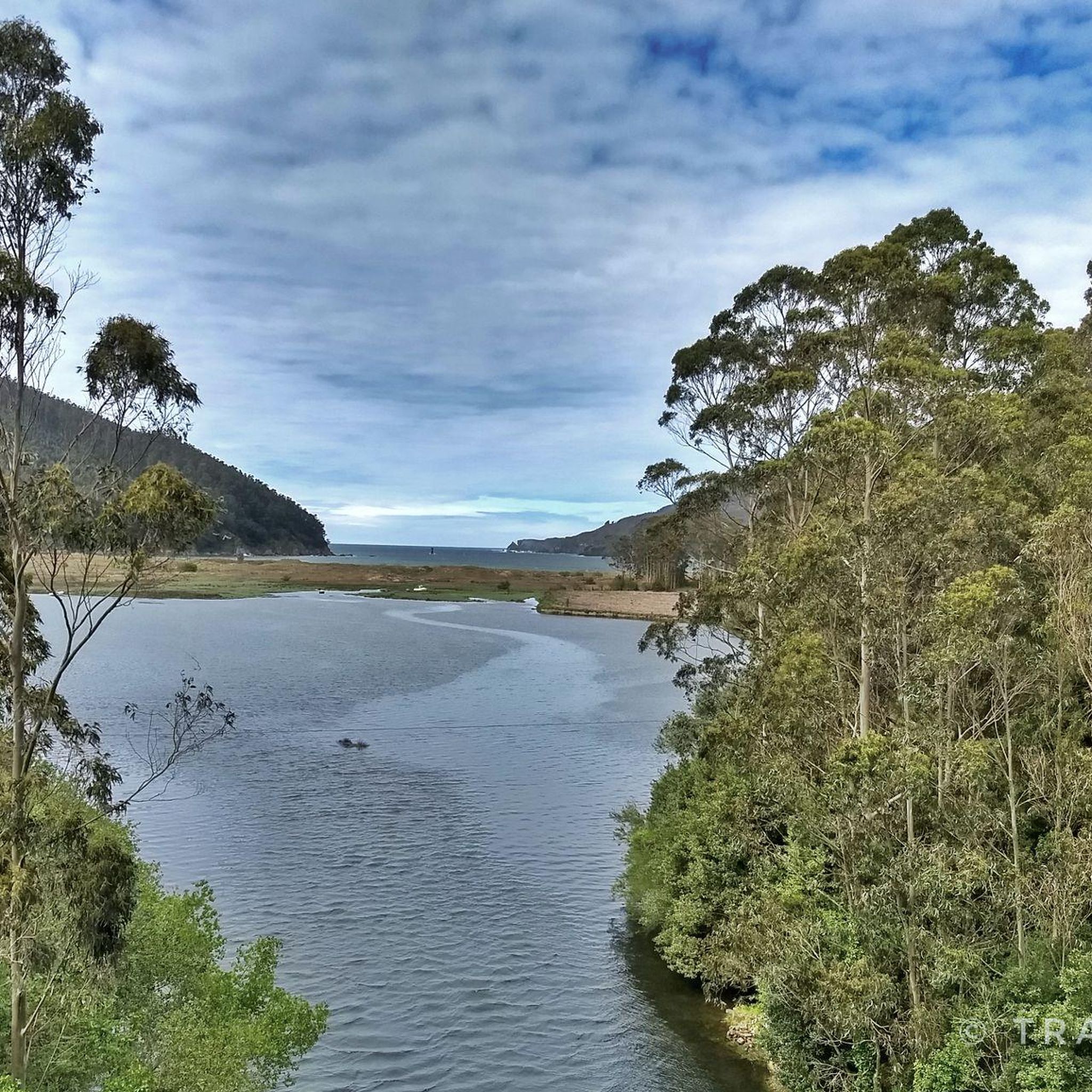
Traditional port and lonja of Cedeira located on the river channel Condomiñas on the peninsula of Robaleira that flows into the ria of Cedeira, Marine Reserve of Interest Pesquero since 2009
2
0

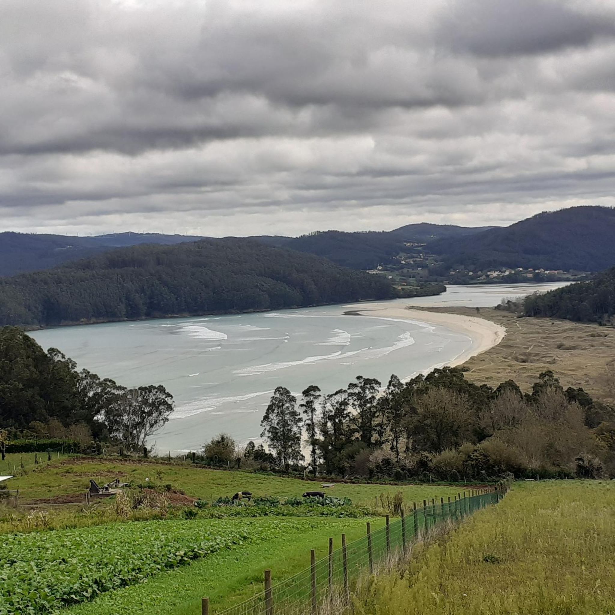
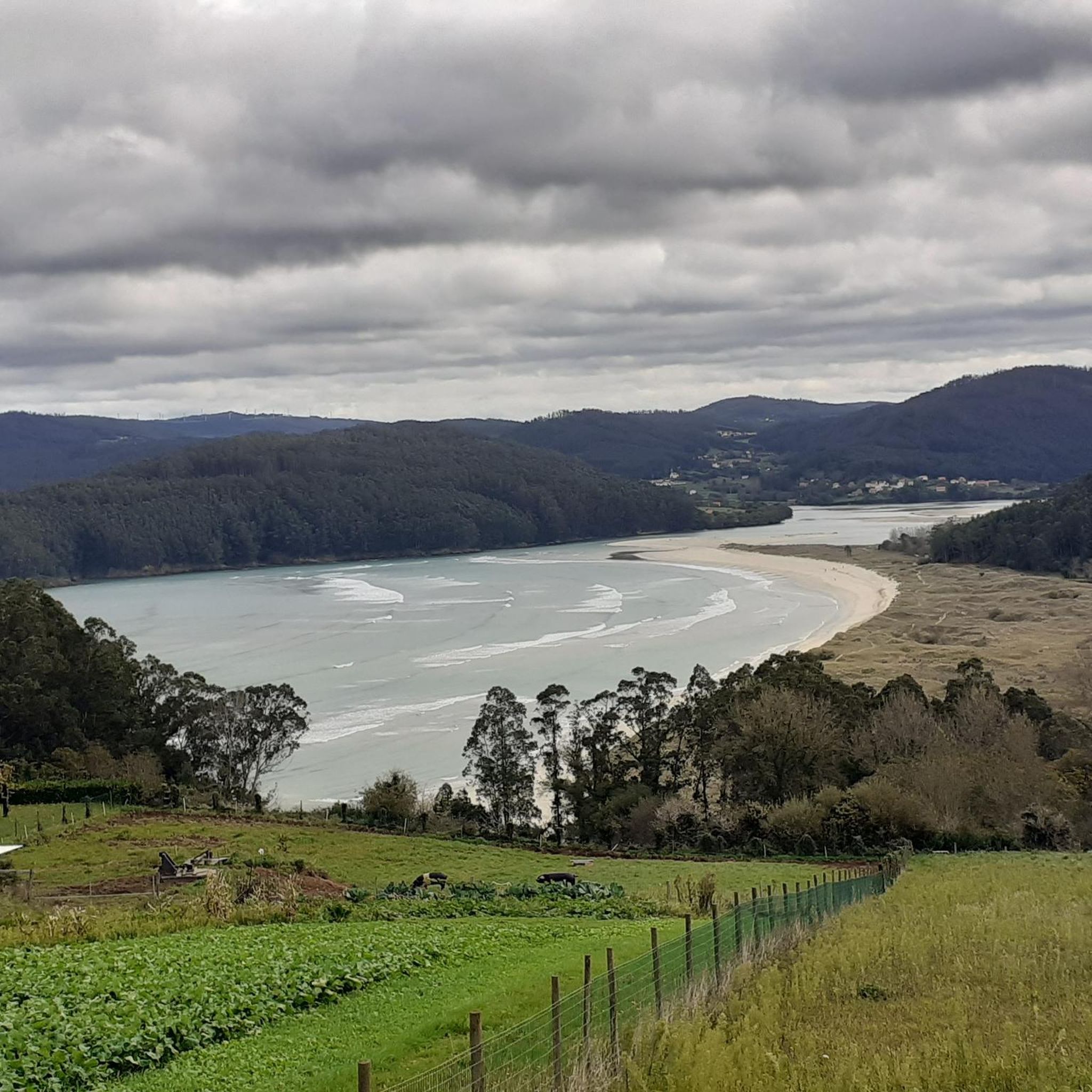
The viewpoint of the Cedeira estuary is one of the advantages of getting away from the main roads and pedaling with the aim of enjoying the road. From this high point next to the road, there is an unforgettable view of the estuary of the estuary and its cove.
1
0
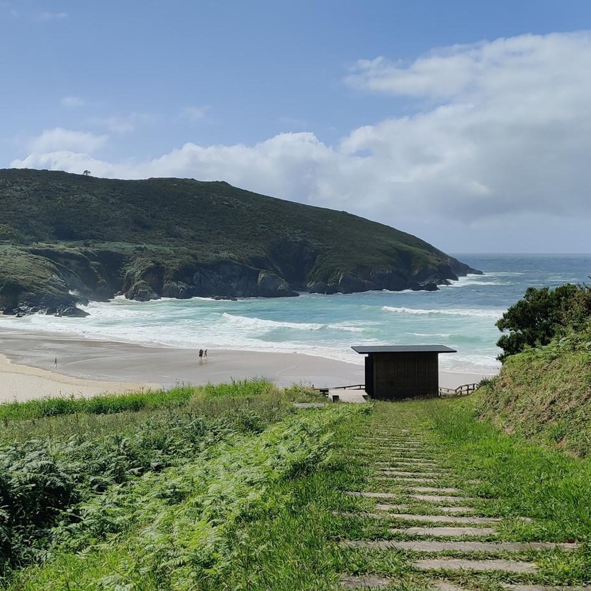
These stretches of road lost by the cliffs of the north coast of Spain are unknown to most cyclists. There are many kilometers of asphalt along routes away from traffic that lead you to discover landscapes far removed from the tourist circuits.
3
0
Frequently Asked Questions
What kind of terrain can I expect when road cycling in Valdoviño?
Valdoviño offers a diverse road cycling experience, blending wild beaches, dense forests, and dramatic cliffs along the Atlantic coast. You'll encounter varied gradients, from challenging climbs to more gentle coastal paths, ensuring a dynamic ride through different natural settings. The region's quiet roads are predominantly paved, making them ideal for road biking.
Are there challenging road cycling routes for experienced cyclists in Valdoviño?
Yes, Valdoviño provides several challenging routes for experienced road cyclists. For instance, the Road along cliffs – Climb to La Garita loop from Vilarrube is a difficult 65.8 km route with significant elevation gain, offering stunning coastal views. Another demanding option is the View of Praia de Vilarrube – Viewpoint over the Cedeira estuary loop from Zona húmida protexida Lagoa e areal de Valdoviño, a 64.5 km path with panoramic vistas.
What are some of the longer road cycling routes available in Valdoviño?
Many routes in Valdoviño offer substantial distances. The Road along cliffs – Climb to La Garita loop from Vilarrube covers 65.8 km, while the View of Praia de Vilarrube – Viewpoint over the Cedeira estuary loop from Zona húmida protexida Lagoa e areal de Valdoviño is 64.5 km. For a slightly shorter but still significant ride, the Xuvia Promenade – Castillo de Naraío loop from Zona Húmida Protexida Lagoa e Areal de Valdoviño spans 57.0 km.
What is the best time of year for road cycling in Valdoviño?
The months of July and August are particularly popular for road cycling in Valdoviño, indicating favorable weather conditions during this period. The mild climate of the Galician coast generally makes spring and early autumn also excellent choices for comfortable rides.
Are there any scenic viewpoints or landmarks to see along the road cycling routes?
Absolutely! Valdoviño's routes are rich with scenic spots. You can ride to the Punta Frouxeira Lighthouse, a modern and historically significant landmark with military tunnels beneath it. Many routes also offer breathtaking views of the Atlantic coastline and beaches like Praia da Frouxeira and Pantín. The area is also close to the Sierra de A Capelada, home to some of continental Europe's highest oceanic cliffs, providing spectacular vistas.
Can I find routes that pass by natural attractions like lagoons or waterfalls?
Yes, Valdoviño's natural beauty is accessible by bike. The Frouxeira Lagoon – Xuvia Promenade loop from Zona húmida protexida Lagoa e areal de Valdoviño is a moderate 55.6 km route that takes you past the Frouxeira Lagoon, a Special Protection Area for Birds. Additionally, you can find the Belelle River Waterfall and Belelle Waterfall nearby, offering beautiful natural sights.
What do other road cyclists say about their experience in Valdoviño?
The road cycling routes in Valdoviño are highly rated by the komoot community, with an average score of 3.9 stars from over 20 reviews. Cyclists often praise the dramatic coastlines, varied landscapes, and the blend of sea, forest, and cliffs that create a visually appealing and dynamic environment for riding.
Are there any cultural or historical sites accessible by road bike in the region?
Yes, you can combine your ride with cultural exploration. The Xuvia Promenade – Castillo de Naraío loop from Zona Húmida Protexida Lagoa e Areal de Valdoviño, for example, leads you through varied landscapes and past the Castillo de Naraío. You can also visit the Monastery of San Martiño de Xuvia or the Military Tunnels at Punta Frouxeira Lighthouse for a glimpse into the region's history.
How many road cycling routes are available around Valdoviño?
There are over 15 road cycling routes around Valdoviño documented on komoot, offering a wide range of options for different skill levels and preferences.
Are there any moderate road cycling routes suitable for a less intense ride?
Yes, Valdoviño offers several moderate routes. The Frouxeira Lagoon – Xuvia Promenade loop from Zona húmida protexida Lagoa e areal de Valdoviño is a moderate 55.6 km route, and the Paraño Viewpoint – Xuvia Promenade loop from Valdoviño is another moderate option covering 52.3 km, both providing enjoyable rides without extreme difficulty.
Can I find routes that offer views of estuaries or specific beaches?
Certainly. The View of Praia de Vilarrube – Viewpoint over the Cedeira estuary loop from Zona húmida protexida Lagoa e areal de Valdoviño offers panoramic views of the Cedeira estuary and Praia de Vilarrube. Many coastal routes also provide stunning vistas of other local beaches like Pantín and Vilarrube.
Most popular attractions around Valdoviño

Get inspired with the komoot mobile app


Explore more
Browse the best Road cycling routes in other regions.
