The best MTB trails around Salorino
5.0
(1)
79
riders
6
rides
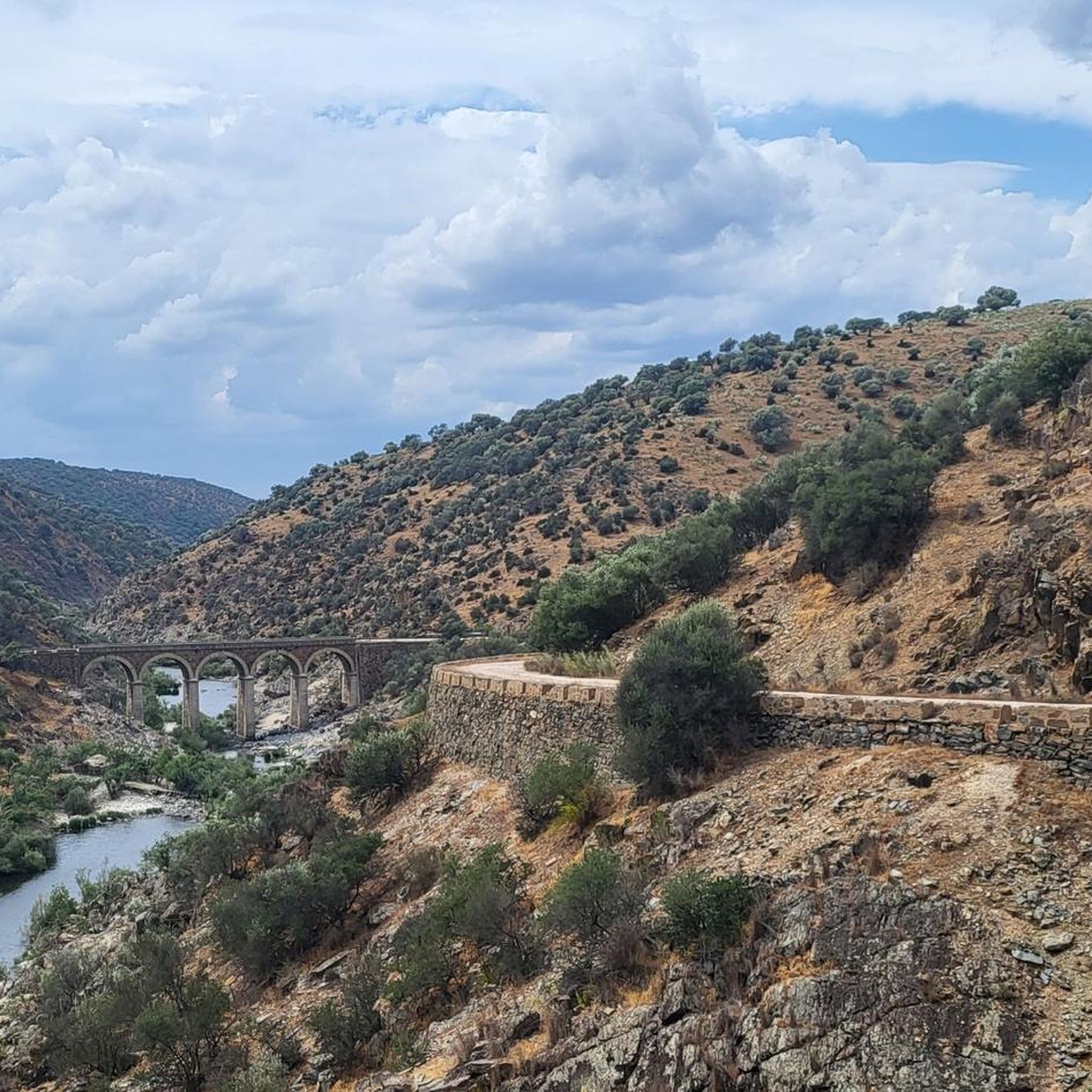
Mountain biking around Salorino offers diverse terrain within the Sierra de San Pedro region of Extremadura, Spain. This area is characterized by varied landscapes, including hills, valleys, and riverine environments along the Salor River. The natural setting provides opportunities for exploration amidst picturesque scenery, with routes often featuring challenging ascents and descents.
Best mountain bike trails around Salorino
- The most popular mountain bike trail is Dolmen Cajirón 1 – Dolmen Datas 1 and 2 loop from Estación de San Vicente…
Last updated: June 26, 2026
5.0
(1)
52
riders
63.0km
05:25
950m
950m
Hard mountain bike ride. Very good fitness required. Suitable for all skill levels.
17
riders
64.1km
05:54
1,220m
1,220m
Hard mountain bike ride. Very good fitness required. Suitable for all skill levels.

Sign up for free
4
riders
30.6km
02:29
350m
350m
Moderate mountain bike ride. Good fitness required. Suitable for all skill levels.
2
riders
Moderate mountain bike ride. Good fitness required. Suitable for all skill levels.
3
riders
Hard mountain bike ride. Very good fitness required. Suitable for all skill levels.
Our route recommendations are based on thousands of hikes, rides, and runs completed by other people on komoot.
Start today with a free account
Your next adventure awaits.
Login or Signup
Popular around Salorino

Tips from the Community

The Alpotrel Reservoir in San Vicente de Alcántara, located in the province of Badajoz, Extremadura, is a hydraulic infrastructure used primarily for irrigation and water supply. It is also a popular place for recreational activities such as fishing and hiking.
2
0
The Alpotrel Reservoir in San Vicente de Alcántara, located in the province of Badajoz, Extremadura, is a hydraulic infrastructure used primarily for irrigation and water supply. It is also a popular place for recreational activities such as fishing and hiking.
3
0
The Dolmen de la Tapada de Anta is one of the most outstanding megalithic monuments in the region of Valencia de Alcántara, in Extremadura. This dolmen is part of a route that includes several dolmens, known for their good state of conservation and easy access.
8
0
The Dolmen del Mellizo, also known as Aceña Borrega or Anta de la Marquesa, has a thousand-year history. Although its exact origin is lost in time, it is believed that it was built between the 4th and 3rd millennia BC. This megalith follows the megalithic model known as “anta” in neighboring Portugal. The dolmen chamber is covered by a horizontal slab that protrudes from the roof, and although it is quite worn, the corridor and access to the chamber are still well preserved. In an archaeological excavation carried out in 1985, remains of funerary goods, such as ceramic fragments and arrowheads, were found. The Dolmen del Mellizo is a fascinating place that connects us with the people who built it thousands of years ago. 🌟
7
0
The beauty of this Gothic temple, located in Valencia de Alcántara, earned it the declaration of a historical-artistic monument, a work that is also part of the historical ensemble of the town.
8
0

Among the religious buildings in Valencia de Alcantara, the Parish Church of Ntra stands out. Mrs. de Rocamador, built between the 16th and 19th centuries. XV and XVII. It is characterized by its basilical plan and three naves covered by multiple low-height cross vaults, the number and quality of construction of which make this building one of the most representative of Extremaduran architecture. Next to the castle in the historic area, it is a must-visit place for anyone who appreciates built historical heritage. in https://www.turismocaceres.org/pt/turismo-cultural/conjunto-historico-de-valencia-de-alcantara
1
0

The Alpotrel Reservoir supplies drinking water to the inhabitants of Valencia de Alcántara and San Vicente de Alcántara, collecting water from nearby streams. Remote and secluded place to bike.
2
0
San Vicente de Alcántara is a small town on the border with Portugal, located between the provinces of Cácares and Badajoz on the slopes of the Sierra de Santa María.
1
1
Frequently Asked Questions
What kind of terrain can I expect on mountain bike trails around Salorino?
Mountain biking around Salorino, nestled within the Sierra de San Pedro, offers a varied landscape. You'll encounter hills, valleys, and riverine environments along the Salor River. The trails often feature challenging ascents and descents, providing a diverse experience for riders.
How many mountain bike trails are available in the Salorino area?
There are 5 mountain bike trails documented around Salorino on komoot. These routes cater to different skill levels, ranging from moderate to difficult.
Are there any moderate mountain bike trails suitable for intermediate riders?
Yes, there are two moderate mountain bike trails. You could try the Alpotrel Reservoir loop from Estación de San Vicente de Alcántara, which is 19.0 miles (30.5 km) long, or the slightly longer Alpotrel Reservoir – Alpotrel Reservoir loop from Estación de San Vicente de Alcántara, at 22.7 miles (36.6 km).
What are some challenging mountain bike routes for experienced riders?
For experienced riders, the area offers several difficult trails. The Dolmen Cajirón 1 – Dolmen Datas 1 and 2 loop from Estación de San Vicente de Alcántara is a 39.1 miles (62.9 km) route with significant elevation gain. Another demanding option is the Peña Encina Dirt Trails loop from Estación de San Vicente de Alcántara, also 39.1 miles (62.9 km), known for its extensive dirt paths and challenging climbs.
What natural features or landmarks can I see while mountain biking near Salorino?
The region is known for its beautiful natural environment within the Sierra de San Pedro. You can expect picturesque scenery, riverine landscapes along the Salor River, and potentially views of the historic Old Stone Bridge over the Salor River. The trails also pass through areas with significant elevation, offering panoramic views.
Are there any circular mountain bike routes in Salorino?
Yes, all the mountain bike trails listed for Salorino are designed as loops. This includes routes like the Alpotrel Reservoir loop from Estación de San Vicente de Alcántara and the longer Dolmen Datas 1 and 2 – Dolmen Cajirón 1 loop from Estación de San Vicente de Alcántara.
What is the best time of year to go mountain biking in Salorino?
Given Salorino's location in Extremadura, Spain, the spring (March to May) and autumn (September to November) months are generally ideal for mountain biking. Temperatures are milder, making for more comfortable rides. Summer can be very hot, and winter might bring cooler, wetter conditions.
What do other mountain bikers enjoy most about the trails in Salorino?
The mountain bike trails around Salorino are highly rated by the komoot community, with an average score of 5.0 stars. Riders often praise the varied terrain, the challenging ascents, and the opportunity to explore the rugged beauty of the Sierra de San Pedro.
Are there any family-friendly mountain bike trails in Salorino?
The trails around Salorino are generally rated as moderate to difficult, with no easy trails specifically designated. While some moderate routes might be manageable for families with older, experienced children, beginners or young families might find the terrain challenging due to significant elevation changes and longer distances.
What is the longest mountain bike trail available in Salorino?
The longest mountain bike trail in the area is the Dolmen Datas 1 and 2 – Dolmen Cajirón 1 loop from Estación de San Vicente de Alcántara, which covers a distance of 41.6 miles (66.9 km) and is classified as difficult.
Are there any points of interest or towns near the mountain bike routes?
Yes, the region offers charming local towns and historical sites. For example, the picturesque town of Salorino itself features white houses with red roofs. You can also find the San Ildefonso Church in Salorino or explore the nearby settlement of Membrío.
Most popular routes around Salorino
Most popular attractions around Salorino

Get inspired with the komoot mobile app


Explore more
Browse the best MTB trails in other regions.
