The best road cycling routes around Cullera
4.7
(199)
7,117
riders
29
rides
Road cycling routes around Cullera offer a diverse terrain, from coastal paths along 15 kilometers of Mediterranean beaches to the challenging ascent of Muntanya les Raboses, which rises to 233 meters. The region is characterized by flat agricultural plains, including orchards and rice fields, particularly around the Júcar River and the Estany lagoon. This varied landscape provides options for road cyclists seeking both gentle, scenic rides and more demanding climbs with panoramic views.
Best road cycling routes around Cullera
- The most popular road cycling route is Pujol Pond – Docks of Albufera Lake loop from Cullera, a 41.8 miles (67.3 km) trail that takes 2 hours 40 minutes to complete. This route explores the flat, ecological environment near the Albufera Natural Park.
- Another top favourite among local road cyclists is Playa de Gandía – Cullera Lighthouse loop from Platja del Far, a moderate 37.6 miles (60.6 km) path. This route offers coastal scenery and views of the Cullera Lighthouse.
- Local road cyclists also love the Vall d'Ebo Pass – Pego–Sagra Road loop from Cullera, a 74.7 miles (120.2 km) trail leading through mountainous terrain with significant elevation gain, often completed in about 5 hours 17 minutes.
- Road cycling around Cullera is defined by coastal paths, flat river plains, and the prominent Muntanya les Raboses, offering both relaxed rides and challenging ascents. The network provides options for different ability levels.
- The routes in Cullera are highly rated by the komoot community with an average score of 4.8 stars from over 120 reviews. More than 2,600 road cyclists have used komoot to explore Cullera's varied terrain.
Last updated: August 22, 2026
4.8
(36)
1,215
riders
64.0km
02:35
90m
90m
Moderate road ride. Good fitness required. Some segments of this route may be unpaved and difficult to ride.
4.9
(77)
741
riders
Moderate road ride. Good fitness required. Some segments of this route may be unpaved and difficult to ride.

Sign up for free
5.0
(15)
336
riders
67.2km
03:01
600m
600m
Moderate road ride. Good fitness required. Mostly well-paved surfaces and easy to ride.
5.0
(3)
216
riders
68.6km
02:48
190m
190m
Moderate road ride. Good fitness required. Mostly well-paved surfaces and easy to ride.
4.3
(3)
214
riders
72.7km
02:52
140m
140m
Moderate road ride. Good fitness required. Mostly well-paved surfaces and easy to ride.
Get access to more routes and recommendations from other explorers.
Sign up for free
Already have an account?
Our route recommendations are based on thousands of hikes, rides, and runs completed by other people on komoot.
Start today with a free account
Your next adventure awaits.
Login or Signup

Other adventures around Cullera

Tips from the Community

El convent d'Aigües Vives, també anomenat Reial Monestir de Santa Maria d'Aigües Vives, és un antic monestir amb orígens que es remunten al segle XIII. L'edifici actual es va construir durant els segles XVI i XVII, amb els corresponents estils, renaixentista i barroc, si bé l'ala nord es va acabar en el segle XVIII. El monestir va pertànyer a l'orde dels agustins, orde que custodiava la imatge de la Mare de Déu d'Aigües Vives, patrona de la ciutat de La Barraca d'Aigües Vives. A mitjan segle XIX, a conseqüència de la desamortització de Mendizábal, els monjos hagueren d'abandonar el cenobi. Aquest va passar a mans dels barons de Casanova, que el destinaren com a habitatge rural. L'any 1977 el monestir fou adquirit i reformat per a destinar-lo a hotel residència per Antonio Vidal Bellver (fotògraf i empresari de Carcaixent). Actualment és propietat d'un empresari hoteler de Gandia. El 2024, la Generalitat Valenciana va instar els nous propietaris a fer obres per a mantenir aquesta obra major que ha patit un deteriorament progressiu com a conseqüència de robatoris, vandalisme i abandonament.
1
0

The port of Barx is a Valencian classic. Its horseshoe bends run over the panorama of the surrounding mountains and the Mediterranean coast.
3
0

Mareny Barraquetes (in Valencian and officially, Mareny de Barraquetes) is a minor local entity of the Valencian Community, Spain, belonging to the province of Valencia. Formerly a district of the municipality of Sueca, since 1999 it has been an entity of territorial scope below the municipality (EATIM) belonging to said municipal term. Mareny de Barraquetes is located in the heart of the Albufera natural park and next to the sea. The nearest towns are Sueca 7 km (kilometers) away, 28 km from Valencia and 9 km from Cullera. Its toponym mareny means ‘marshland’, that is, an area very close to the sea and easily flooded. For its part, the term barraquetes indicates the type of habitat that was frequent throughout the area, huts built with reeds and mud, materials from the marshes and the dune cordon. The historical origin of the first human settlements in this area dates back to the period of Roman domination, when the Phocaean colonies were established near Sicania, with El Mareny de Barraquetes being one of them. It survived through the centuries, as an alquería, thus reaching the first historical antecedents, which are found in the first census of inhabitants that was made in Sueca in 1795, by governmental order for the preparation of the conscription, as Spain was at war against Revolutionary France of the Directory (1793-1795). Likewise, until the 1845 census, we do not have a specific list of residents from El Mareny, with nine huts. Its inhabitants are mainly engaged in agriculture. In the last century, the population nucleus based its economy mainly on fishing. There were three fishing settlements where families lived who were dedicated to freshwater fishing (in the canals coming from the Júcar). Until recently, there was a fishing settlement where this work continued, but with modern facilities.
0
0

The Albufera lake was formed by the sinking of an approximately 30 km long coastal strip. The saltwater lake then became a freshwater lake due to the inflows. In the Estany del Pujol lagoon you can observe various water birds.
2
1
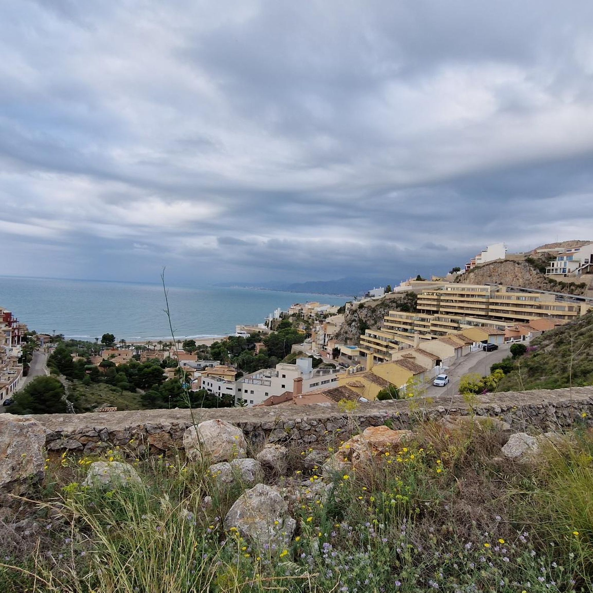
One of the best landscape views very close to Valencia capital.
0
0
On many occasions, advertising encourages us to travel to other places to contemplate a spectacular sunset or a landscape worthy of a postcard. We Valencians have one of the most beautiful sunsets next to the capital.
1
0


Because it's a place to take a walk, have breakfast and go home, but better.
0
0
Frequently Asked Questions
How many road cycling routes are available in Cullera?
Cullera offers a wide variety of road cycling routes, with over 25 distinct tours available on komoot. These routes cater to different skill levels, from easy coastal rides to challenging mountain ascents.
What kind of terrain can I expect on road cycling routes around Cullera?
The terrain around Cullera is incredibly diverse. You'll find flat, scenic routes through agricultural plains, including orchards and rice fields, especially near the Júcar River and the Estany lagoon. For those seeking a challenge, the prominent Muntanya les Raboses offers significant climbs and panoramic views of the coastline and the La Ribera plain.
Are there easy road cycling routes suitable for beginners in Cullera?
Yes, Cullera has several easy road cycling routes perfect for beginners or those looking for a relaxed ride. For example, the Cullera Lighthouse – Forn La Beata Inés loop from Cullera is an easy 22.3 km route with minimal elevation gain, offering pleasant coastal scenery.
What are some challenging road cycling routes for experienced cyclists in Cullera?
Experienced cyclists will find demanding routes in Cullera, particularly those involving the Muntanya les Raboses or extending into mountainous terrain. The Vall d'Ebo Pass – Pego–Sagra Road loop from Cullera is a challenging 120.2 km route with nearly 1,000 meters of elevation gain, typically taking over 5 hours to complete.
Are there family-friendly road cycling routes in Cullera?
While specific 'family-friendly' routes are not explicitly categorized, the flatter coastal paths and routes through the agricultural plains are generally suitable for families. These areas offer safer, less strenuous rides away from heavy traffic, allowing for a relaxed experience amidst nature.
Can I find circular road cycling routes in Cullera?
Yes, many of the road cycling routes in Cullera are designed as loops, allowing you to start and end at the same point. Examples include the Pujol Pond – Docks of Albufera Lake loop from Cullera and the Playa de Gandía – Cullera Lighthouse loop from Platja del Far, both offering diverse scenery.
What interesting landmarks or attractions can I see along the road cycling routes?
Cullera's routes offer a blend of natural beauty and historical sites. You can cycle past the unique transitional zone of the Estany lagoon, known for its biodiversity, or explore routes that offer views of the Cullera Castle, perched atop Muntanya les Raboses. Other natural highlights include the Lake Park and the Ullal de Baldoví.
What do other road cyclists enjoy most about road cycling in Cullera?
The road cycling experience in Cullera is highly rated by the komoot community, with an average score of 4.8 stars from over 120 reviews. Cyclists often praise the region's diverse terrain, which offers both serene coastal rides and challenging climbs with rewarding panoramic views, as well as the well-maintained paths through picturesque landscapes.
Are there routes that connect Cullera with nearby natural parks?
Yes, some routes allow you to explore areas connected to nearby natural parks. For instance, the Pujol Pond – Docks of Albufera Lake loop from Cullera takes you through the ecological environment near the Albufera Natural Park, a significant wetland known for its wildlife.
What are the typical distances and durations for road cycling routes in Cullera?
Route distances vary significantly, from shorter rides of around 20-30 km to longer, more demanding tours exceeding 120 km. Durations can range from just over an hour for easy routes to more than 5 hours for challenging, long-distance rides, depending on the route's difficulty and your pace.
Can I find routes that offer coastal views?
Absolutely. Cullera boasts 15 kilometers of diverse coastline, and many road cycling routes take advantage of this. The Playa de Gandía – Cullera Lighthouse loop from Platja del Far is a great example, offering scenic coastal views and passing by the iconic Cullera Lighthouse.
Most popular attractions around Cullera

Get inspired with the komoot mobile app


Explore more
Browse the best Road cycling routes in other regions.
