The best cycling routes around Berzocana
5.0
(1)
174
riders
9
rides
Touring cycling around Berzocana offers diverse landscapes within the UNESCO Global Geopark Villuercas-Ibores-Jara. The region is characterized by an "Appalachian relief" of mountains and valleys, with extensive holm oak and Mediterranean forests. Cyclists encounter prominent mountain ranges, rivers like the Guadarranque, and reservoirs such as Cíjara and Cancho del Fresno. The terrain includes both paved roads and unpaved sections, providing varied cycling experiences.
Best touring cycling routes around Berzocana
- The most popular touring cycling route is Aldeacentenera from Castillo de…
Last updated: July 2, 2026
Hard bike ride. Very good fitness required. Mostly paved surfaces. Suitable for all skill levels.
114
riders
Hard bike ride. Very good fitness required. Mostly paved surfaces. Suitable for all skill levels.

Sign up for free
8
riders
65.7km
04:38
1,310m
1,310m
Hard bike ride. Very good fitness required. Mostly paved surfaces. Suitable for all skill levels.
5.0
(1)
11
riders
Moderate bike ride. Good fitness required. Mostly paved surfaces. Suitable for all skill levels.
8
riders
46.8km
04:23
900m
900m
Hard bike ride. Very good fitness required. Mostly paved surfaces. Suitable for all skill levels.
Get access to more routes and recommendations from other explorers.
Sign up for free
Already have an account?
Our route recommendations are based on thousands of hikes, rides, and runs completed by other people on komoot.
Start today with a free account
Your next adventure awaits.
Login or Signup
Tips from the Community

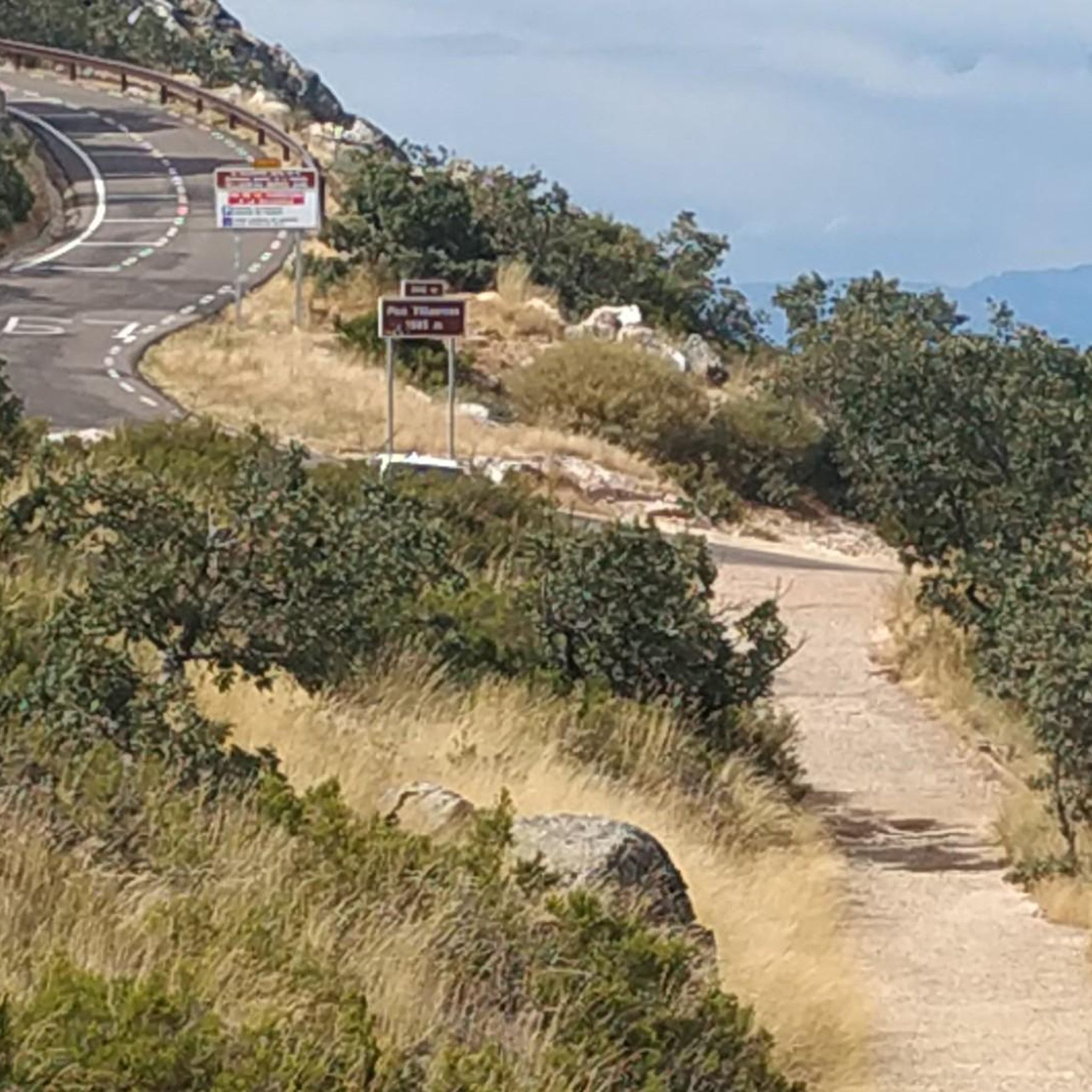
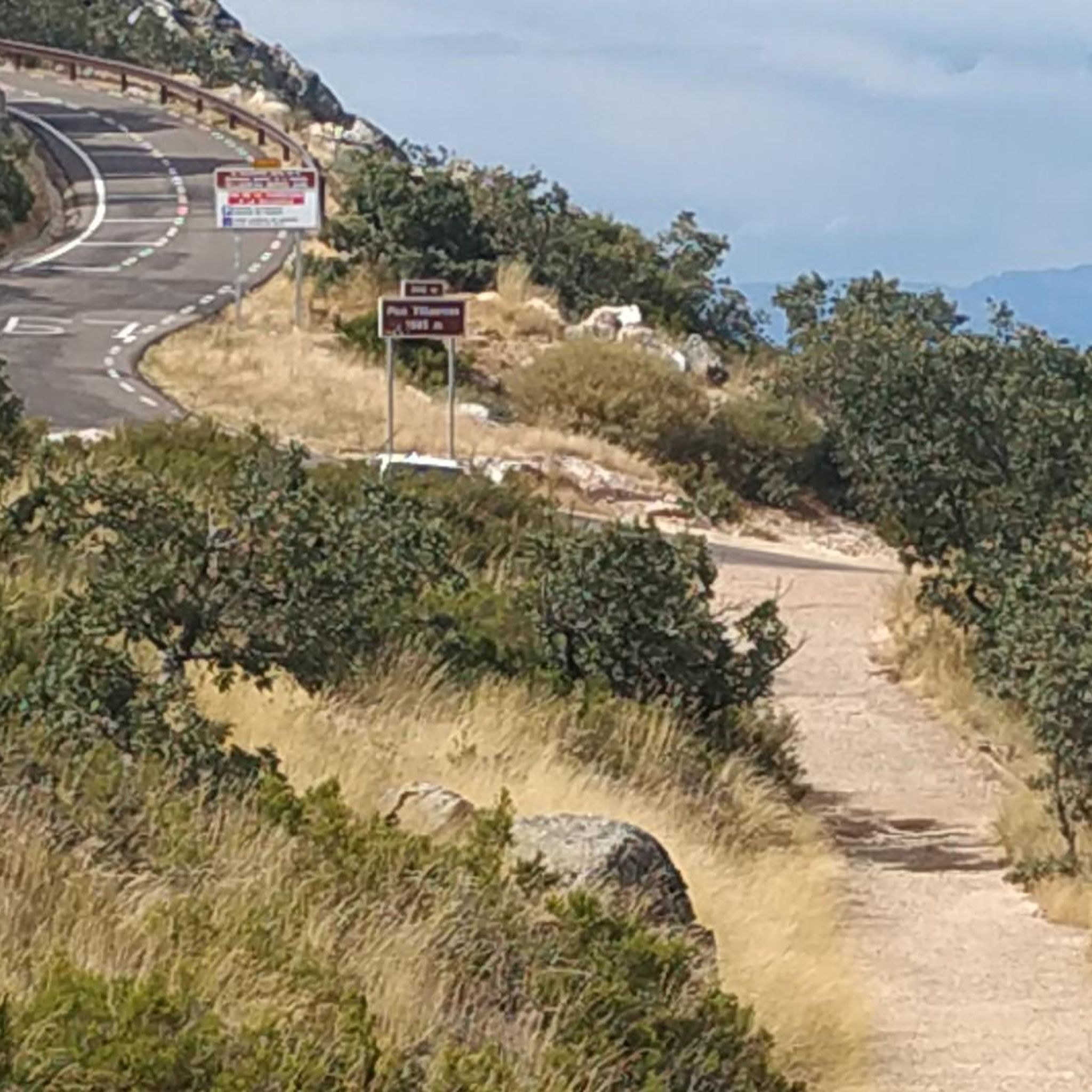
El Alto del Humilladero and Pico Villuercas, near Guadalupe (Cáceres), form one of the most spectacular mountain routes in Extremadura, within the Villuercas‑Ibores‑Jara UNESCO Geopark. It is the highest summit in Extremadura accessible by road.
2
0

Alto del Humilladero is a short but intense mountain pass, where the road climbs steeply through curves that test your legs. From its summit, you have a wide panoramic view that I'm sure you'll enjoy.
0
1

The route enters the Vegas del Jarama Greenway, and the journey takes on a completely new emotional state thanks to the serenity of the environment and the comfort of the road surface. The route of the old mining train runs through the dehesas or rañas of the Ruecas River valley, undisturbed, passing over several viaducts that span the river's meanders. From time to time, the old stations and halts appear, half-ruined and abandoned. The villages are off the track, and to get supplies or water, you have to detour several kilometers. Madrigalejo is the closest and most recommended town; it is three kilometers from the old local station and has shops and all kinds of services. The Greenway gradually enters a new landscape. The meadows of the Vegas Altas fade, and the curious "Appalachian" reliefs of Las Villuercas emerge, shaped by parallel ridges of slate and schist that appear to have been pounded and kneaded by a geological sculptor. Some authors have compared them to the Appalachian Mountains of North America and declared the Villuercas-Ibores-Jara Global Geopark by UNESCO. The Greenway ends at the old Logrosán station, and a new section of the Las Villuercas Nature Trail GR-116 begins, leading to La Puebla de Guadalupe. The pedaling pace slows due to the condition of the road surface, but it remains an impeccable cycle route. From Logrosán onward, the original route of the old railway is no longer maintained; the trail markers appear on rural roads and on some isolated stretches of the old railway used by local farmers. The Camino reaches the hamlet of Cañamero via the Santa Ana chapel and runs through the town center, famous for its Vegas del Guadiana Designation of Origin wines, made from mountain vines grown on rugged slate slopes. The exit from Cañamero is spectacular and somewhat unsettling, following the path of the Ruecas canyon. Pay attention on the descent; there's a short trial. It then continues along farm roads to the climb to the Martín Blasco pass, a good stretch before tackling the final stretch of the day through the solitary mountains of Las Villuercas and ending in Guadalupe, passing once again through the arch of the old mining railway, the last reminder of a project that confounded the era; it was built almost a hundred years before it was used.
0
0
Cañamero, in the province of Cáceres, Extremadura, is a charming destination that combines history, culture and nature. You can explore the church of Santo Domingo de Guzmán and the hermitage of Nuestra Señora de Belén, which are examples of local religious architecture.
7
0
Built in 1985, this reservoir has a capacity of 15 cubic hectometres and is known for its recreational activities such as carp, royal carp and black bass fishing. In addition, the reservoir has a beach that has been awarded the Blue Flag in 2023, making it an attractive destination for visitors.
7
0

Population that is located to the north of the Sierra del Pimpollar and to the south of the Sierra de Belén and that is known for being part of the type of pitarra wines, since the vineyards that are in the municipal area are part of the denomination of origin of the Ribera del Guadiana.
2
0
Within a set of mountain ranges such as the Sierra de Belén or Sancho where the Río Ruecas appears and at this point the Cancho del Fresno Reservoir appears.
1
0

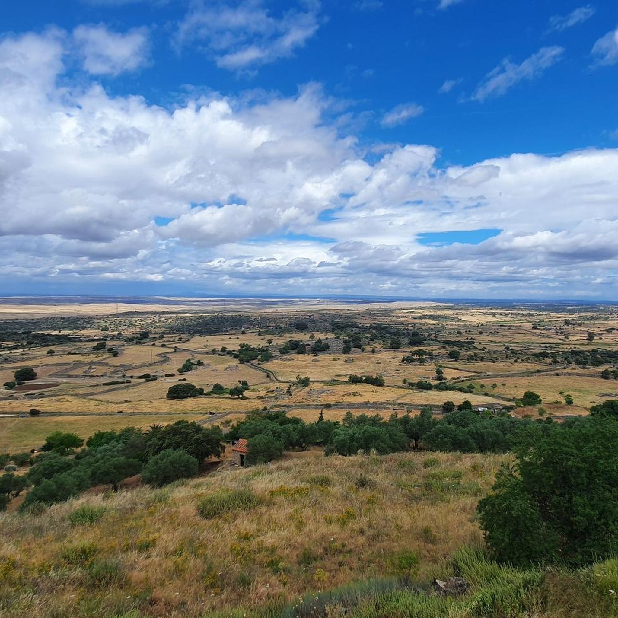
Located at the foot of the Sierra de las Villuercas, is the small town of Aldeacentenera. Gateway to the UNESCO Sierra de las Villuercas Biosphere Reserve.
1
0
Frequently Asked Questions
What kind of terrain can I expect on touring cycling routes around Berzocana?
Berzocana's touring cycling routes feature a diverse "Appalachian relief" landscape, combining paved roads with dirt tracks and gravel sections. You'll traverse through extensive holm oak and Mediterranean forests, encountering varying terrains from gradual ascents to challenging climbs up passes like Manzano and Puerto de San Vicente, often followed by rewarding descents.
Are there any easy touring cycling routes suitable for beginners or families in Berzocana?
While many routes in Berzocana are rated as difficult, there are options that cater to varying fitness levels. The region offers some mostly paved paths suitable for all fitness levels, though the guide data indicates most routes are moderate to difficult. For a moderate option, consider exploring routes like Aldeacentenera from Castillo de Cabañas – circular through Geoparque Villuercas-Ibores-Jara, which offers a good introduction to the area's landscapes.
What natural features and viewpoints can I discover along the cycling routes?
The region is rich in natural beauty. You can expect to see significant water elements like the Guadarranque River, the Cíjara reservoir dam, and the recreational Cancho del Fresno Reservoir. The area is also a Special Bird Protection Area, offering opportunities to spot griffon vultures, black storks, and eagles soaring above quartzite outcrops. For panoramic views, consider routes that pass near Risco Gordo.
Are there any circular touring cycling routes available in Berzocana?
Yes, there are circular touring cycling routes in the area. An example is the Aldeacentenera from Castillo de Cabañas – circular through Geoparque Villuercas-Ibores-Jara, which is a 29.8-mile (47.9 km) route traversing varied landscapes of the Geopark.
What historical or cultural attractions can I visit while cycling in Berzocana?
Beyond the natural landscapes, Berzocana offers several cultural and historical points of interest. You might encounter significant archaeological sites with prehistoric cave paintings and megalithic idols. A notable destination often included in cycling itineraries is the UNESCO World Heritage Site, the Royal Monastery of Santa María de Guadalupe, located a short distance from Berzocana.
What do other touring cyclists enjoy most about cycling in Berzocana?
The touring cycling routes around Berzocana are highly rated by the komoot community, with an average score of 4.0 stars. Cyclists often praise the diverse landscapes within the UNESCO Global Geopark Villuercas-Ibores-Jara, the challenging ascents, and the rewarding views from mountain passes.
How many touring cycling routes are there in Berzocana?
There are over 15 touring cycling routes around Berzocana documented on komoot, offering a variety of experiences for different skill levels. Most of these routes are considered difficult, with a few moderate options available.
Can I rent a bike in Berzocana?
Yes, for visitors, both hybrid and e-bikes are available for rent in the region, making the diverse terrain accessible to a broader audience and allowing you to choose a bike suitable for your preferred route and fitness level.
Are there any routes that offer significant elevation gain for a challenging ride?
Absolutely. Many routes in Berzocana feature significant elevation gains. For instance, the Guadalupe Viaduct – View of Guadalupe loop from Navezuelas is a difficult 39.8-mile (64.1 km) path with over 1500 meters of elevation gain, offering expansive views and a demanding ride.
What kind of wildlife can I expect to see while cycling in the area?
Berzocana is part of a Special Bird Protection Area, making it an excellent spot for birdwatching. Cyclists might spot various species of vultures, such as griffon and black vultures, as well as Egyptian vultures, black storks, eagle owls, and golden eagles soaring above the quartzite outcrops and forests.
Are there any routes that follow river gorges or natural water features?
Yes, several routes incorporate the region's water elements. The Río Ruecas Gorge – Bridge Over the Almonte River loop from Cañamero is a 40.8-mile (65.7 km) trail that leads through river gorges and other natural areas, providing scenic views of the waterways.
What is the best time of year to go touring cycling in Berzocana?
While the region offers cycling opportunities year-round, the extensive holm oak and Mediterranean forests provide natural shade, which can be particularly welcome during warmer months. Spring and autumn generally offer milder temperatures, making them ideal for exploring the diverse landscapes.
Most popular attractions around Berzocana

Get inspired with the komoot mobile app


Explore more
Browse the best Cycling routes in other regions.
