The best cycling routes around Navaquesera
4.5
(2)
105
riders
18
rides
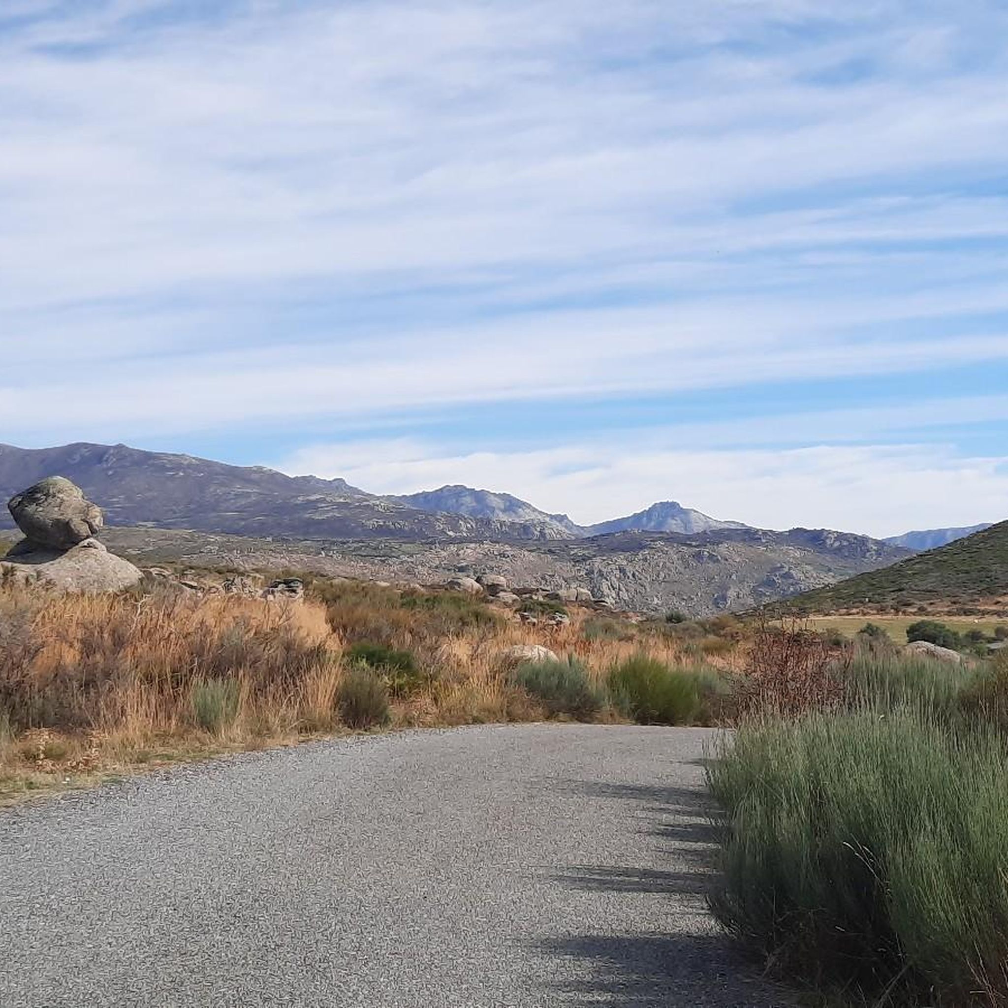
Touring cycling around Navaquesera offers routes within the Sierra de Gredos mountain range, characterized by rugged, pine-covered landscapes and deep ravines. The region is situated at over 1,500 meters above sea level, providing significant elevation gains and panoramic vistas. The terrain features large, autonomous rocks and the River Alberche, which contributes to the diverse ecosystem. This area is known for its challenging mountain passes and dramatic scenery.
Best touring cycling routes around Navaquesera
- The most popular touring cycling route is…
Last updated: July 8, 2026
10
riders
47.9km
03:23
920m
930m
Hard bike ride. Very good fitness required. Mostly paved surfaces. Suitable for all skill levels.
10
riders
52.4km
03:58
1,340m
1,340m
Hard bike ride. Very good fitness required. Mostly paved surfaces. Suitable for all skill levels.

Sign up for free
9
riders
27.8km
01:55
520m
510m
Hard bike ride. Very good fitness required. Mostly paved surfaces. Suitable for all skill levels.
9
riders
27.5km
01:57
560m
560m
Hard bike ride. Very good fitness required. Mostly paved surfaces. Suitable for all skill levels.
7
riders
Hard bike ride. Very good fitness required. Mostly paved surfaces. Suitable for all skill levels.
Get access to more routes and recommendations from other explorers.
Sign up for free
Already have an account?
Our route recommendations are based on thousands of hikes, rides, and runs completed by other people on komoot.
Start today with a free account
Your next adventure awaits.
Login or Signup



Tips from the Community

The Serranillos Pass is one of the most iconic mountain passes in the Sierra de Gredos, famous for its beauty and for being a historic stage in the Vuelta a España (Hinault's legendary stage in 1983). Views of the Cinco Villas Valley and the Gredos peaks. Spectacular scenery throughout the climb. Signage with gradient and remaining distance information. Ideal for linking up with Puerto del Pico, Pedro Bernardo, and Mijares for an epic stage.
1
0

Delicious coffee on the terrace of the Puente Seco bar, with views of Torozo, Serranillos and Puerto de Pedro Bernardo
0
0

The Serranillos pass is one of the great classics of the Tour of Spain as it passes through the Sierra de Gredos. As the Vuelta has almost always ended in Madrid, the Gredos and Guadarrama mountain ranges offered very interesting alternatives to trace mountain stages in the last stages. The port of Serranillos is very iconic in the Sierra de Gredos for several reasons: type of port (long and long), rough and irregular road (but in good condition) and dryland landscape with little vegetation (very typical of this inland area of the Iberian Peninsula). The Serranillos port presents many climbing alternatives: - On its eastern side, there are 2 alternatives: from Burgohondo (the classic one, along the main highway AV-913) and from Navalosa along the AV P-419 highway, which joins the previous one in Navarrevisca. - on its west side, is where we will find more alternatives. I have come to count up to 5 alternatives. They are the following: (1) climb through Santa Cruz del Valle, starting from the N-502 and taking the AV p-706 highway, to later reach San Esteban del Valle and from there to the top; (2) leaving Mombeltrán on the AV-922 highway towards San Esteban del Valle and from there to the top; (3) starting from Cuevas del Valle and passing through Villarejo del Valle on the AV P-706 highway, reaching San Esteban del Valle and from there to the top; (4) starting from the N-502, in the middle of the climb to the Pico pass, taking a road that takes us to the Mirador de la Carretera del Sidrillo and to Esteban del Valle, and from there to the top; (5) previously crossing the Pedro Bernardo port on the AV-922 highway Although I have only done alternative 4 on the eastern slope by bike, they are all very similar. The slopes are gentle and the views, as there is little vegetation, cover a lot of territory.
0
0

San Esteban del Valle is a picturesque Spanish municipality located in the province of Ávila. It is located in the Tiétar Valley region, at the foot of the Gredos mountain range, which makes it an attractive destination for nature lovers. Among the most notable monuments are: the church of San Esteban Protomártir from the 15th century, the hermitage of San Pedro Bautista and the hermitage of San Andrés, the jurisdictional roll or pillory.
2
0


Population further north of this small valley that forms the Ramacastañas river and which is the easternmost part of the Valle del Tiétar. The nucleus, small, is governed by the church of San Esteban Protomártir and other small hermitages in the same municipality.
1
0
Villanuerva de Ávila is a town famous for its neighborhoods, some of which still have traditional architecture. The center is located in the Albarchete Valley.
1
0
Go down the Calle Mayor from the Plaza Mayor de Burgohondo, crossing the Carretera Nacional, and follow the little road to the end
0
0
Frequently Asked Questions
What is the typical difficulty level for touring cycling routes around Navaquesera?
Touring cycling routes around Navaquesera are predominantly challenging. The region is characterized by the rugged Sierra de Gredos mountains and high-altitude terrain, leading to significant elevation gains. Out of the 12 routes available, 11 are classified as difficult, with only one moderate option.
What kind of landscapes can I expect to see while cycling around Navaquesera?
You can expect dramatic and varied landscapes. The routes traverse the Sierra de Gredos mountain range, offering rugged, pine-covered mountains, deep ravines, and panoramic vistas from over 1,500 meters above sea level. You'll also encounter large, autonomous rocks and the River Alberche, which contributes to the diverse ecosystem.
Are there any notable landmarks or attractions along the touring cycling routes near Navaquesera?
Yes, the region offers several points of interest. Cyclists often encounter challenging mountain passes like Puerto de Serranillos and Puerto de Mijares, known for their scenic beauty. You might also pass through traditional settlements such as Villanueva de Ávila or near natural features like Pico Zapatero.
Are there many circular touring cycling routes available in Navaquesera?
Yes, many of the touring cycling routes around Navaquesera are designed as loops. For example, you can explore the Plaza Mayor de Burgohondo loop from Burgohondo or the Serranillos Pass – San Esteban del Valle loop from Navarrevisca, both offering a complete circular experience.
What is the average length and duration of touring cycling routes in this region?
The touring cycling routes around Navaquesera typically range from 27 to 43 miles (44 to 69 km) in length. Most difficult routes, such as the Villanueva de Ávila – Plaza Mayor de Burgohondo loop from Villanueva de Ávila, can take around 3 to 4 hours to complete, depending on your pace and the elevation changes.
When is the best time of year to go touring cycling in Navaquesera?
The best time for touring cycling in Navaquesera is generally during the spring and autumn months. The high altitude means summers can be warm, but the traditional stone trough in Plaza de los Caños offers a refreshing dip. Winters can be cold and challenging due to the mountain environment.
Are there family-friendly touring cycling options around Navaquesera?
Given the region's challenging terrain, most touring cycling routes around Navaquesera are classified as difficult, featuring significant elevation gains. There is only one moderate route available, so options specifically designed as 'family-friendly' for younger or less experienced cyclists are limited.
Can I bring my dog on touring cycling routes in Navaquesera?
While specific regulations for dogs on cycling routes are not detailed, the Sierra de Gredos is a natural environment. It's generally advisable to keep dogs on a leash, especially in areas with wildlife or livestock, and to ensure they are fit enough for the challenging terrain and distances. Always carry water for your pet.
What do other touring cyclists enjoy the most about touring cycling in Navaquesera?
The area is highly rated by the komoot community, with an average score of 5.0 stars from 1 review. Cyclists often praise the dramatic scenery, the challenge of the mountain passes like Puerto de Serranillos and Puerto de Mijares, and the panoramic views offered by the high-altitude terrain.
Is public transport available to access touring cycling routes in Navaquesera?
Information regarding direct public transport specifically for accessing the cycling routes in Navaquesera is not readily available. It is generally recommended to plan your journey by car, especially if you are bringing your own touring bicycle, to ensure convenient access to the starting points of the routes.
Are there places to eat or stay near the touring cycling routes in Navaquesera?
Navaquesera and the surrounding villages within the Sierra de Gredos, such as Navarrevisca and Villanueva de Ávila, offer local amenities. While specific cafes, pubs, or accommodations directly on the routes are not listed, these settlements typically provide options for refreshments and overnight stays for cyclists.
What are the characteristics of the Puerto de Mijares pass mentioned in some routes?
The Puerto de Mijares pass is highly valued by cyclists for its length, significant elevation gain, and scenic beauty. It features a maximum gradient of 11% on short ramps, with several steep sections as you pass through villages and near the Horcajo area, making it a demanding but rewarding climb.
Most popular attractions around Navaquesera

Get inspired with the komoot mobile app


Explore more
Browse the best Cycling routes in other regions.
