The best road cycling routes around Bosco/Gurin
4.8
(24)
511
riders
18
rides
Road cycling routes around Bosco/Gurin are characterized by challenging ascents through high alpine terrain in Ticino, Switzerland. Nestled at over 1500 meters above sea level, the region features demanding climbs with significant elevation changes, offering a rigorous experience for road cyclists. The mountainous landscape is defined by magnificent peaks and lush woods, providing a dramatic backdrop for rides. Cyclists should be prepared for sustained climbs and rewarding vistas across the Maggia Valley.
Best road cycling routes around Bosco/Gurin
- The most popular road cycling route is Discovering Lago di Naret, a 39.9 miles (64.2 km) difficult trail that takes 4 hours 14 minutes to complete. This route features substantial elevation gain as it leads towards the scenic Lago di Naret.
- Another top favourite among local road cyclists is From Cevio to Lago del Sambuco, a difficult 29.4 miles (47.3 km) path. This route involves a significant climb from Cevio, culminating at the picturesque Lago del Sambuco.
- Local road cyclists also love the From Bignasco to Cimalmotto, a 24.8 miles (39.9 km) trail leading through a side valley, often completed in about 2 hours 33 minutes.
- Road cycling around Bosco/Gurin is defined by demanding climbs, alpine landscapes, and mountainous terrain. The network offers options primarily for experienced cyclists, with some moderate routes also available.
- The routes in Bosco/Gurin are highly rated by the komoot community with an average score of 4.8 stars from over 20 reviews. More than 700 road cyclists have used komoot to explore Bosco/Gurin's varied terrain.
Last updated: July 5, 2026
5.0
(9)
74
riders
64.2km
04:14
2,030m
2,030m
Hard road ride. Very good fitness required. Mostly well-paved surfaces and easy to ride.
5.0
(1)
60
riders
47.3km
02:50
1,200m
1,200m
Hard road ride. Very good fitness required. Mostly well-paved surfaces and easy to ride.

Sign up for free
5.0
(1)
20
riders
39.9km
02:33
1,140m
1,130m
Cycle from Bignasco to Cimalmotto, a difficult 24.8-mile (39.9 km) road cycling route with a challenging alpine climb and stunning Vallemagg
4
riders
14.6km
00:53
380m
380m
Moderate road ride. Good fitness required. Mostly well-paved surfaces and easy to ride.
5.0
(1)
5
riders
21.7km
01:21
600m
600m
Moderate road ride. Good fitness required. Mostly well-paved surfaces and easy to ride.
Get access to more routes and recommendations from other explorers.
Sign up for free
Already have an account?
Our route recommendations are based on thousands of hikes, rides, and runs completed by other people on komoot.
Start today with a free account
Your next adventure awaits.
Login or Signup

Other adventures around Bosco/Gurin

Tips from the Community

If you're driving up from Cevio, Cerentino is a good first stop. After a few nasty climbs, you can decide which valley end you'd like to head to: Cimalmotto in the Valle di Campo or Bosco Gurin in the Valle di Bosco Gurin. Both valleys are beautiful!
0
0

This is such a nice spot to rest, take a swim and ideal for camping but alas.... there is a 'no camping' sign. For camping, one can go right to the other end of the road.
0
0
As others have already said: It's tough, steep, and beautiful here! It's best to split the climb into shorter stages, so the 2,000 meters of elevation gain over 30 kilometers from Bignasco aren't quite as terrifyingly daunting. From Bignasco to Prato Sornico, it's rarely very steep. There are a few flat sections where you can pick up a decent pace. After Mogno (visit the church in Botta) and up to Fusio, things really get going for the first time. Many hairpin bends soften the incredibly nasty ramps, but your legs will still be tested here! Up to the Sambucco reservoir, it becomes truly idyllic, green, and quiet. There are a few tough climbs, but even here, the difficulty is still manageable. There's a fountain at the summer restaurant: fill up your bidons again, because there are only streams and gullies here. After the relaxing flat section by the lake, the final and most strenuous part of the climb follows. The scenery is stunning, but it's steep all the way to the top! Wow!
1
0

the fairytale village 🏘️ of Riale🏔️
1
0


Fraction of Formazza (VB) at 1750m above sea level
0
0


A beautiful lake, I was lucky enough to photograph it with the snow-capped mountains.
22
1
Frequently Asked Questions
How challenging are the road cycling routes around Bosco/Gurin?
The road cycling routes in Bosco/Gurin are primarily characterized by demanding climbs and significant elevation changes, making them suitable for experienced cyclists. For example, the ascent from Cevio to Bosco Gurin alone features over 1000 meters of elevation gain. While most routes are difficult, there are also some moderate options available.
Are there any easier road cycling routes in the Bosco/Gurin area?
Yes, while many routes are challenging, there are some moderate options available. Out of the 19 road cycling routes in the area, 6 are rated as moderate, offering a less strenuous experience while still enjoying the beautiful alpine scenery.
What kind of landscapes can I expect to see while road cycling near Bosco/Gurin?
You can expect stunning alpine landscapes with magnificent peaks, lush woods, and expansive views across the Maggia Valley. The region is characterized by its mountainous terrain, offering dramatic backdrops and tranquil natural environments with diverse flora and fauna.
Are there any notable natural attractions or landmarks along the road cycling routes?
Yes, the region offers several natural attractions. You might encounter glacier lakes like Schwarzsee and Üssera See in higher elevations, or discover unique geological features. For specific points of interest, consider exploring highlights such as Toce Waterfall or the Scatta Minoia Pass and Ettore Conti Shelter.
Can I see any waterfalls while road cycling in the region?
Yes, the area around Bosco/Gurin is home to several impressive waterfalls. A notable one is the Toce Waterfall, which is a significant natural monument. You can also find the Foroglio village and waterfall, offering a picturesque stop.
When is the best time of year for road cycling in Bosco/Gurin?
Given Bosco/Gurin's high alpine location at over 1500 meters above sea level, the best time for road cycling is typically during the warmer months, from late spring to early autumn. During this period, the mountain passes are generally clear of snow, and the weather is more favorable for sustained climbs and outdoor activities.
What do other road cyclists enjoy the most about road cycling in Bosco/Gurin?
The road cycling routes in Bosco/Gurin are highly rated by the komoot community, with an average score of 4.8 stars from over 20 reviews. Cyclists often praise the challenging yet rewarding climbs, the spectacular alpine terrain, and the rewarding vistas across the Maggia Valley.
Are there any circular road cycling routes available around Bosco/Gurin?
Many of the road cycling routes in the region are designed as point-to-point or out-and-back journeys due to the mountainous terrain. However, routes like Discovering Lago di Naret offer a substantial loop, providing a comprehensive experience of the high alpine environment.
What cultural insights can I gain while visiting Bosco/Gurin on a road cycling trip?
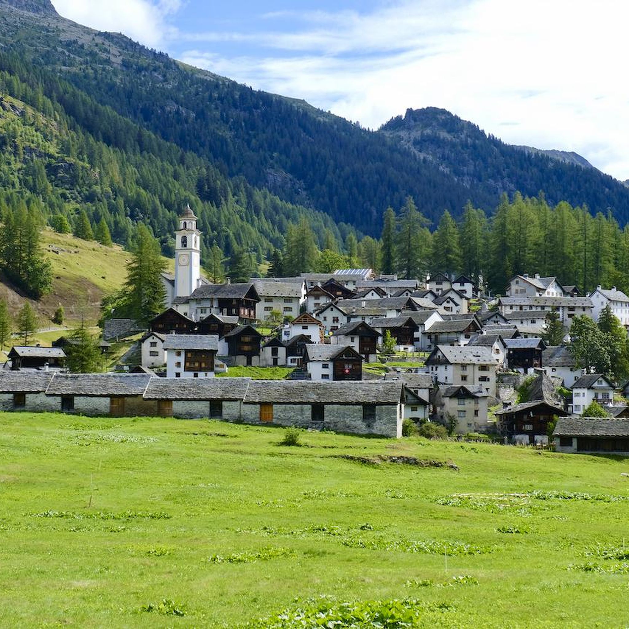
Bosco/Gurin is unique as the only German-speaking Walser village in Ticino, preserving centuries-old customs and architecture. You can explore traditional wooden and stone houses, visit the Walserhaus Museum for insights into the settlers' lives, or follow the 'Sentiero Walser' themed trail to understand their history. The village itself offers a charming cultural immersion.
Are there any specific challenging ascents popular among road cyclists in the region?
Absolutely. The 16 km ascent from Cevio to Bosco Gurin, featuring over 1000 meters of elevation gain, is a notable challenge popular among the road cycling community. Other demanding routes include From Cevio to Lago del Sambuco and From Bignasco to Cimalmotto, both offering significant climbs.
What is the highest point I can reach on a road bike around Bosco/Gurin?
While specific highest points vary by route, many routes lead into high alpine terrain. For instance, the route Discovering Lago di Naret involves substantial elevation gain as it leads towards the scenic Lago di Naret, situated in a high mountain pass area, offering a true high-alpine cycling experience.
Can I find places to eat or stay in Bosco/Gurin after a ride?
Bosco/Gurin, as a charming village, offers amenities for visitors. While specific establishments are not detailed, the village's unique cultural identity and status as a destination suggest options for refreshments and accommodation, including Switzerland's smallest Coop supermarket for essentials.
Most popular attractions around Bosco/Gurin

Get inspired with the komoot mobile app


Explore more
Browse the best Road cycling routes in other regions.
