The best running trails around La Guingueta D'Àneu
4.1
(17)
1,693
runners
11
runs
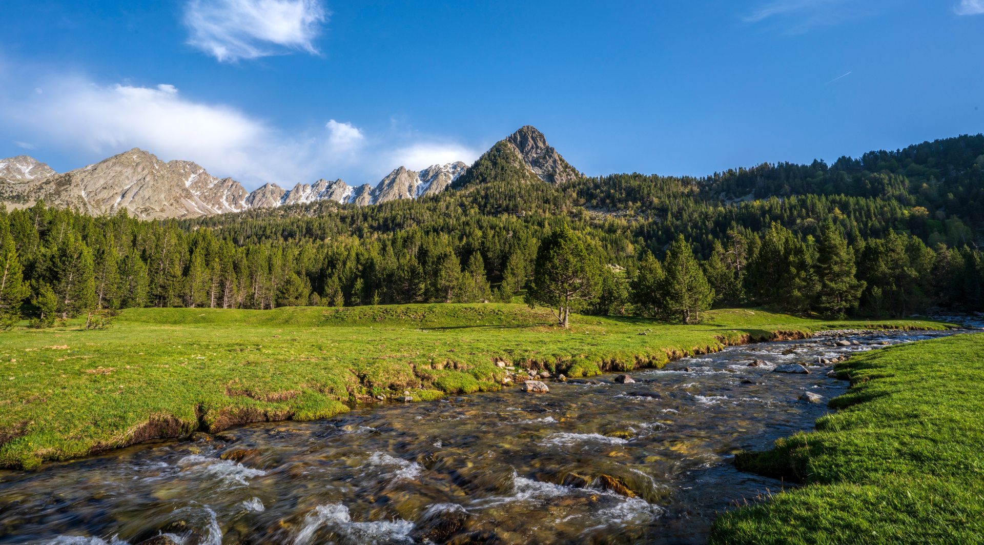
Jogging routes around La Guingueta D'Àneu traverse a diverse landscape characterized by river valleys, rolling hills, and the mountainous terrain bordering the Aigüestortes i Estany de Sant Maurici National Park. The region features a mix of forested paths, open meadows, and trails that lead to high-altitude lakes. Elevation changes vary from gentle inclines along valley floors to significant climbs in the higher reaches, offering a range of challenges for runners.
Best jogging routes around La Guingueta D'Àneu
- The most popular jogging route is Estany de Sant Maurici y Estany Negre de Peguera — circular desde Espot en el Parque Nacional de Aigüestortes i Estany de Sant Maurici, a 17.3 miles (27.8 km) trail that takes 4 hours 36 minutes to complete. This challenging route offers significant elevation gain through a national park, featuring stunning high-mountain lakes.
- Another top favourite among local runners is La Mola Trail, an easy 2.7 miles (4.3 km) path. This shorter route provides a gentle running experience with minimal elevation, suitable for a quick workout.
- Local runners also love the Sant Martí d'Escalarre Church loop from la Guingueta d'Àneu, a 5.5 miles (8.9 km) trail leading through local villages and past historic landmarks, often completed in about 57 minutes.
- Jogging around La Guingueta D'Àneu is defined by river valleys, forested trails, and mountain lake views. The network offers options for different ability levels, from beginner jogging trails to more demanding mountain runs.
- The routes in La Guingueta D'Àneu are highly rated by the komoot community with an average score of 4.3 stars from over 15 reviews. More than 1300 runners have used komoot to explore La Guingueta D'Àneu's varied terrain.
Last updated: October 20, 2026
4.5
(2)
106
runners
8.86km
00:58
70m
70m
Moderate run. Good fitness required. Mostly paved surfaces. Suitable for all skill levels.
16
runners
19.3km
03:37
1,340m
1,340m
Hard run. Very good fitness required. Sure-footedness, sturdy shoes and alpine experience required.

12
runners
7.50km
00:52
190m
190m
Moderate run. Good fitness required. Mostly paved surfaces. Suitable for all skill levels.
8
runners
4.65km
01:06
510m
510m
Hard run. Very good fitness required. Sure-footedness, sturdy shoes and alpine experience required.
10
runners
8.52km
01:16
370m
380m
Hard run. Very good fitness required. Mostly paved surfaces. Suitable for all skill levels.
Get access to more routes and recommendations from other explorers.
Already have an account?
Our route recommendations are based on thousands of hikes, rides, and runs completed by other people on komoot.
Start today with a free account
Your next adventure awaits.


Other adventures around La Guingueta D'Àneu

Tips from the Community

Challenging hike to the top. We did the GR route up and then descended via the Vertical La Bandera. I wouldn't recommend it because it's a real scramble. The idea is to do the Vertical from the bottom up. There are only arrows pointing in that direction. We didn't know that before we started. It does offer one of the most beautiful views, though.
0
0

If we spend a day with little air we will see the mountains perfectly reflected, impressive!
1
0

A great place to spend the day. You can rent a kayak and there are good trails to walk or bike.
1
0

Only one person lives in this almost abandoned mountain town. Although it is accessible by car, it is much better to visit it during a hike or by mountain bike.
0
0
The top of this mountain is bald as the name implies. This means that you have a 360 degree view of the mountains around you. There's a radio antenna here and a nice clear area. Perfect for a few photos.
1
0

We are in a quiet place in Pallars Sobirà, in the Romanesque parish church of the town of Escalarre. Popular part of hiking routes and bike rides.
0
0
Jou, town of the municipal term of Guingueta de Aneu in the Pallars Sobirá. In the town is the Church of Sant Pere de Jou. Very pretty both day and night. Accompanied by the stone houses with the typical slate roofs that give us the feeling of already being in a mountain place.
0
0
Old abandoned village of Dorve. Located at an altitude of 1,380m. It has a resident.
0
0
Frequently Asked Questions
How many running routes are available in La Guingueta D'Àneu?
There are over 100 running routes around La Guingueta D'Àneu, offering a wide variety of options for different skill levels. You'll find everything from easy paths to challenging mountain runs.
Are there easy running routes suitable for beginners in La Guingueta D'Àneu?
Yes, La Guingueta D'Àneu offers several easy running routes perfect for beginners. For instance, the La Mola Trail is a gentle 2.7-mile (4.3 km) path with minimal elevation, ideal for a quick and easy run.
What kind of elevation changes can I expect on running trails in La Guingueta D'Àneu?
The elevation changes vary significantly. You can find relatively flat paths along river valleys, such as the Sant Martí d'Escalarre Church loop with only about 71 meters of ascent. However, many routes, especially those venturing into the national park, feature substantial climbs, with some difficult trails exceeding 1,400 meters of elevation gain.
Are there circular running routes available in La Guingueta D'Àneu?
Yes, many running routes in the area are circular, allowing you to start and finish at the same point. An example is the View of the Àneu Valley loop from Esterri d'Àneu, which offers scenic views on a moderate 6.7 km path.
What are some notable viewpoints or natural attractions along the running trails?
The region is rich in natural beauty. Many trails offer stunning views of the Àneu Valley and lead to beautiful high-mountain lakes. You can find attractions like Lake Sant Maurici, Ratera Lake, and the impressive Ratera Waterfall. Some routes also pass by mountain refuges like the Josep Maria Blanc Refuge.
Is parking readily available near the running routes in La Guingueta D'Àneu?
Parking is generally available in and around La Guingueta D'Àneu, especially in villages and at popular trailheads. However, during peak season, some popular spots, particularly those leading into the Aigüestortes i Estany de Sant Maurici National Park, might have limited spaces, so it's advisable to arrive early.
How accessible are the running trails in La Guingueta D'Àneu by public transport?
Public transport options to reach trailheads directly can be limited in this mountainous region. While there are bus services connecting major towns, accessing more remote starting points often requires a car. It's best to check local bus schedules if you plan to rely on public transport.
Can I bring my dog on the running trails around La Guingueta D'Àneu?
Many trails outside the national park boundaries are dog-friendly, but it's crucial to keep your dog on a leash. Within the Aigüestortes i Estany de Sant Maurici National Park, specific regulations apply, and dogs are generally not allowed on trails to protect wildlife. Always check local signage and park rules before heading out with your pet.
What do other runners enjoy the most about jogging in La Guingueta D'Àneu?
The running routes in La Guingueta D'Àneu are highly rated by the komoot community, with an average score of 4.3 stars. Reviewers often praise the stunning natural landscapes, the variety of terrain from river valleys to high-mountain lakes, and the well-maintained paths that cater to different fitness levels.
What is the best time of year for running in La Guingueta D'Àneu?
The best time for running is typically from late spring (May/June) through early autumn (September/October). During these months, the weather is generally mild, trails are clear of snow, and the natural scenery is vibrant. Summer can be warm, especially at lower elevations, while winter brings snow and requires specialized gear for higher routes.
Are there any running routes suitable for winter in La Guingueta D'Àneu?
In winter, many higher-elevation trails become snow-covered and may require snowshoes or cross-country skis. Lower-lying paths along the valley floors might remain accessible for running, but conditions can be icy. Always check local weather and trail conditions before attempting a winter run, and be prepared for colder temperatures and potential snow.
Are there any hidden gem running routes in the area?
While popular routes offer incredible scenery, exploring some of the less-trafficked paths can reveal hidden gems. Look for trails that connect smaller villages or follow lesser-known river tributaries for a more secluded running experience away from the main tourist hubs. The komoot community often shares local favorites that might not be widely advertised.
Most popular routes around La Guingueta D'Àneu
Most popular attractions around La Guingueta D'Àneu

Get inspired with the komoot mobile app


Explore more
Browse the best Running Trails & Routes in other regions.
