Top 6 Mountain Passes around Les Valls D'Aguilar
Best mountain passes around Les Valls D'Aguilar are found in the Alt Urgell region of the Catalan Pyrenees, offering rugged terrain and scenic routes. This municipality is characterized by its natural landscapes and significant high points, including the Serra de Taús. The area provides diverse opportunities for scenic drives, challenging cycling routes, and rewarding hiking experiences, set against the backdrop of the majestic Pyrenean landscape.
Best mountain passes around Les Valls D'Aguilar
- The most popular mountain passes is Port del…
Last updated: October 13, 2026
Port del Cantó (1,721 m)
Highlight • Mountain Pass
Translated by Google •
Tip by

Coll de Creus
Highlight • Mountain Pass
Translated by Google •
Tip by

Sign up now to discover places like this
Get recommendations on the best single tracks, peaks, & plenty of other exciting outdoor places.
Coll d'Arnat
Highlight • Mountain Pass
Translated by Google •
Tip by

Port Ainé
Highlight • Mountain Pass
Translated by Google •
Tip by

Les Valls d'Aguilar
Highlight • Settlement
Translated by Google •
Tip by

Sign up for free to discover even more mountain passes around Les Valls D'Aguilar.
Already have an account?
Start today with a free account
Your next adventure awaits.
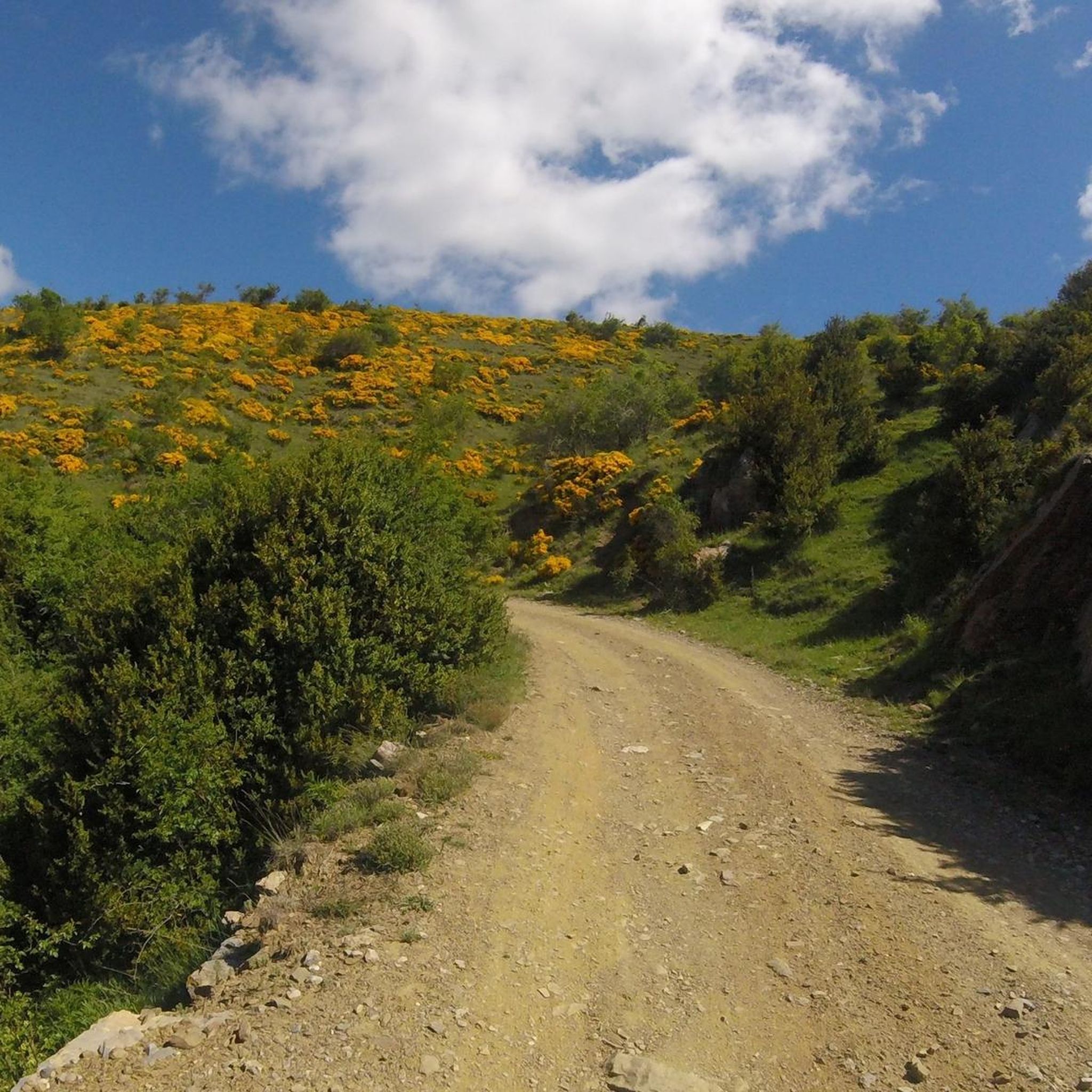
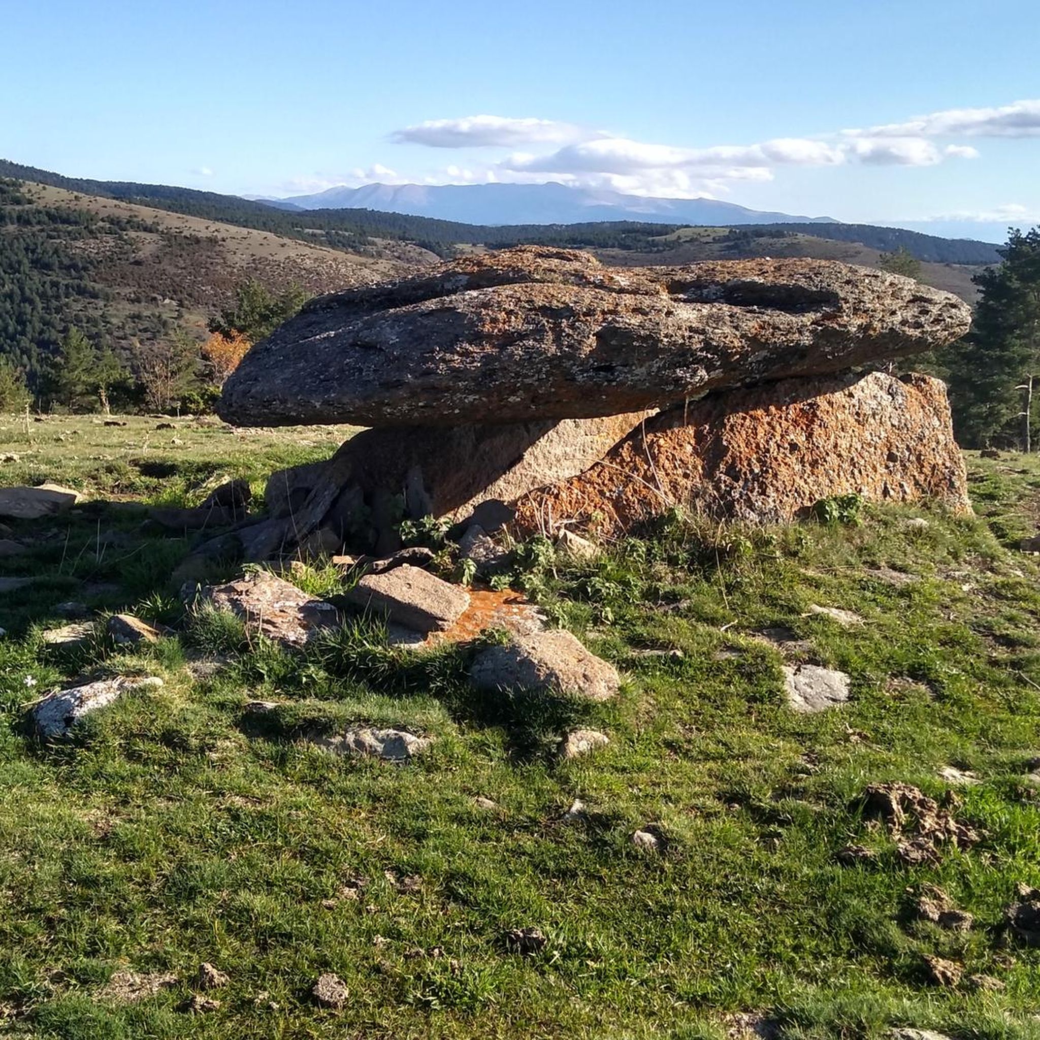
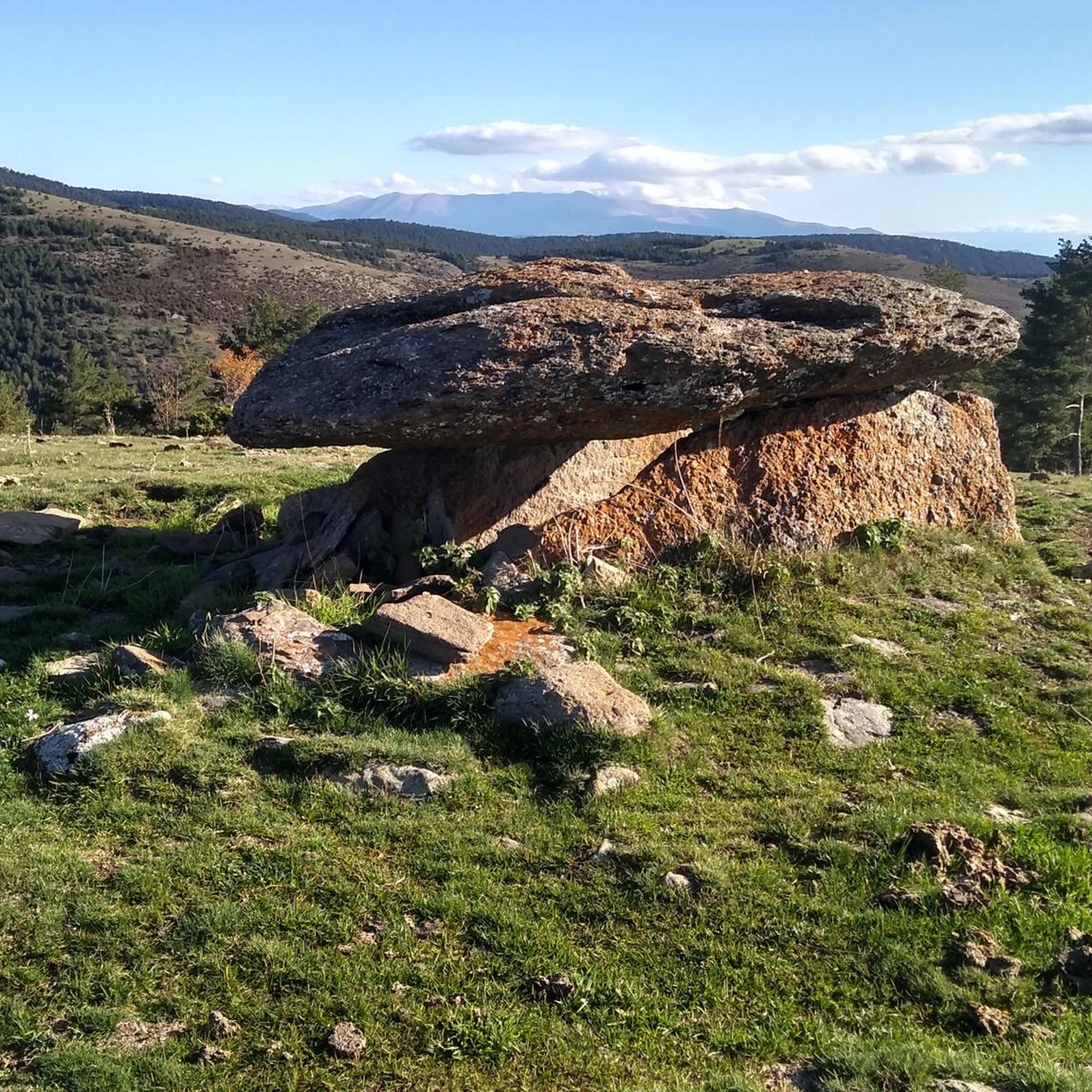
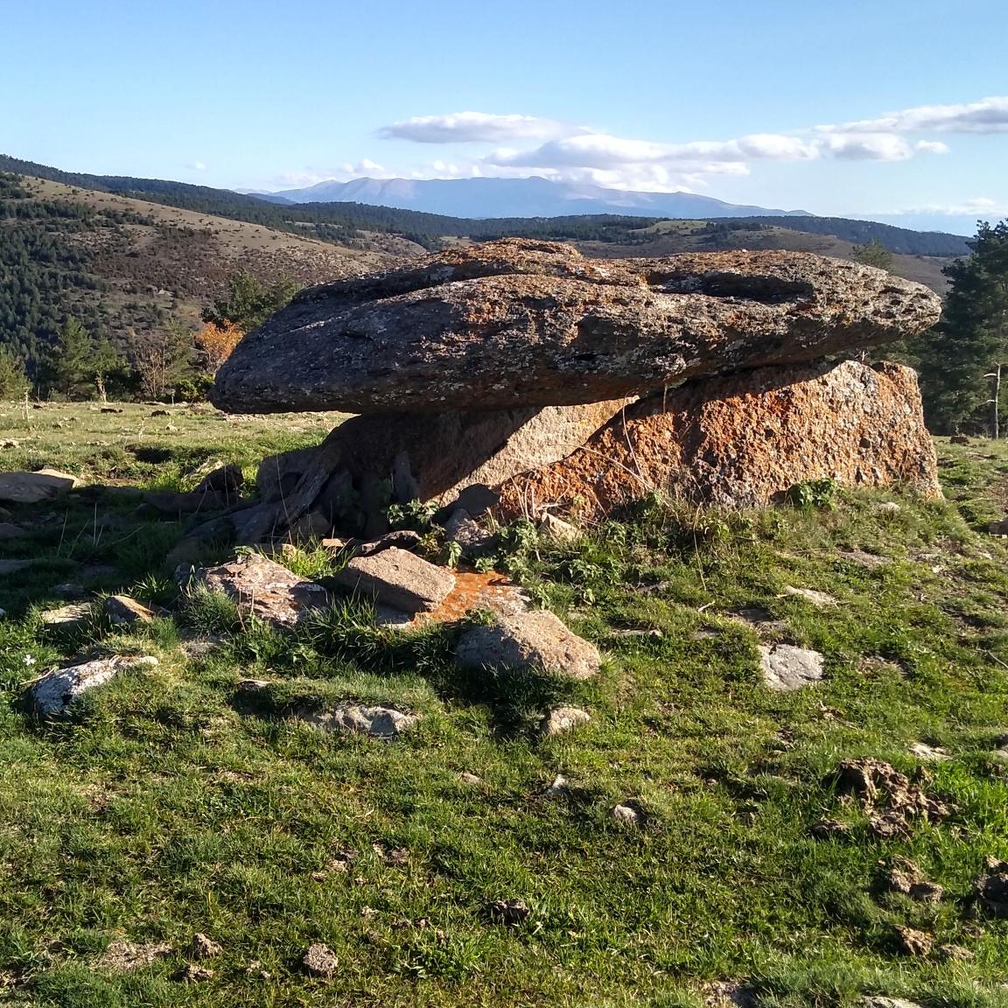

Tips from the Community

The pass summit has been reached. The climb is pleasant!
1
0
The pass summit has been reached
0
0
Poblar de Segur, the pass on the marked beautiful route
0
0

Ridden from Sort, it’s a good steady climb, with enough small variations in gradient to provide moments of relief. Great bar half way up too. The descent back to Sort is excilerating.
0
1

Spectacular and hard climb. Until Roní is the hardest part, although we can't let our guard down, the last km are unforgiving. The asphalt leaves a lot to be desired, especially going down, but still 100% recommendable.
0
0
Spectacular harbor with incredible views of Alt Urgell and Pallars Sobirà. From Sort: Long and constant climb that does not forgive but that is allowed to be done. From Adrall: Pending to do it ;)
0
0

The Coll de Creus is a difficult milestone if you have gotten here by bike. Of course, the effort is fully rewarded with the impressive views of the reddish environment, very interesting from the geological point of view as well as aesthetic Here, in addition, the GR 7 crosses at the PR-C 122.
0
0

The Coll de Creus, located at 1437 meters above sea level, is part of the Coll de Creus Geological Itinerary. This point is a crossroads that joins two official routes: the GR 7 and the PR-C 122. It is very interesting to see the characteristic landscape of this place, which stands out for the reddish rocks and their layered arrangement.
1
0
Frequently Asked Questions
What are some notable mountain passes to explore in Les Valls d'Aguilar and its surroundings?
The region offers several significant mountain passes. Key ones include Port del Cantó (1,721 m), known for its spectacular panoramic views and as a challenging cycling destination. Within Les Valls d'Aguilar, the Serra de Taús features high points like Les Piques Altes de Taús along the historic Camí Vell. Nearby, you can find Coll de Josa, offering tranquil high mountain landscapes, and Coll de Port, a historic route with stunning vistas and recreational opportunities.
What kind of natural features can I expect to see at these mountain passes?
You can expect breathtaking natural beauty. Port del Cantó provides spectacular panoramic views of the Pyrenean mountains and valleys. Coll de Creus is notable for its unique reddish rock formations and geological interest. Passes like Coll de Josa and Coll de Port offer tranquil high mountain environments with magnificent viewpoints.
Are there any historical or cultural sites near the mountain passes?
Yes, the region has historical significance. The Camí Vell (Old Road) within the Serra de Taús is a restored ancient network of paths reflecting traditional life. Along these routes, particularly near Biscarbó, you can discover impressive dolmens and other prehistoric funerary monuments. Coll de Port was also part of a royal road connecting important towns in medieval times.
What are the best outdoor activities to do around these mountain passes?
The mountain passes around Les Valls d'Aguilar are ideal for various outdoor activities. Cycling is very popular, with passes like Port del Cantó being a challenging yet rewarding climb. Hiking is also prominent, especially along the Camí Vell in Serra de Taús. You can find many routes for cycling, road cycling, and gravel biking in the area.
What is the difficulty level of the mountain passes in Les Valls d'Aguilar?
The mountain passes offer a range of difficulties. Port del Cantó is considered an intermediate to challenging climb, frequently featured in major cycling tours. Coll de Creus is described as a difficult milestone for cyclists, while Coll d'Arnat involves gravel roads, making gravel tires recommended. Many routes in the area are rated as difficult, catering to experienced outdoor enthusiasts.
When is the best time to visit the mountain passes in Les Valls d'Aguilar?
The best time to visit generally depends on your activity. For cycling and hiking, spring through autumn offers pleasant conditions. During winter months, passes like Port del Cantó can be challenging due to snow and extreme temperatures, sometimes leading to road closures. Always check local weather conditions before planning your trip.
Are there specific passes recommended for cycling?
Absolutely. Port del Cantó is a highly recommended and challenging climb for cyclists, known for its consistent slope and significant elevation gain. It's even been featured in major cycling tours. For gravel biking, Coll d'Arnat offers a beautiful high plateau, though gravel tires are recommended for its roads.
What makes Coll de Creus a unique mountain pass?
Coll de Creus stands out for its distinctive reddish environment, which is geologically very interesting. It's also a significant crossroads, joining two official routes: the GR 7 long-distance trail and the PR-C 122, making it a key point for hikers and a visually striking location.
What can I expect from Coll d'Arnat?
Coll d'Arnat offers a beautiful, deserted high plateau with a fantastic panorama. It's particularly appreciated by the komoot community for its scenic views. If you plan to visit, gravel tires are recommended due to the nature of the gravel road leading to it.
What do visitors enjoy most about the mountain passes in Les Valls d'Aguilar?
Visitors frequently praise the spectacular panoramic views and the rewarding challenge of the climbs. The winding roads offer scenic driving or cycling experiences, and the effort is often rewarded with impressive vistas. The unique geological features, like the reddish rocks at Coll de Creus, and the tranquil high mountain environments are also highly appreciated.
Are there any long-distance hiking trails that pass through these areas?
Yes, the region is home to parts of long-distance trails. The GR 7 long-distance hiking trail passes through the area, notably crossing at Coll de Creus. Additionally, the historic Camí Vell offers a circular route of approximately 60 kilometers, allowing hikers to explore ancient paths and discover less-known areas of the Pyrenees.
What are the characteristics of Coll de Josa?
Coll de Josa, located at 1,620 meters, offers a tranquil and spectacular high mountain environment. It's situated near the Pedraforca massif and within the Cadí-Moixeró Natural Park. The road leading to it is generally in good condition, providing a picturesque drive or cycling route with low traffic, and the viewpoint offers magnificent views.
What amenities or facilities are available at Coll de Port?
Coll de Port, at 1,668.7 meters, is known for its serene high mountain atmosphere. It's accessible by road (LV-4012) and is part of the GR 7 long-distance hiking trail. There is also a refuge at the pass, offering accommodation and dining options, making it a convenient stop for travelers and hikers.
Most popular routes around Les Valls D'Aguilar
Most popular attractions around Les Valls D'Aguilar

Get inspired with the komoot mobile app


Explore more
See even more epic mountain passes by checking out these guides around Les Valls D'Aguilar:
