The best mountain hikes around Vilaller
5.0
(2)
20
hikers
3
hikes
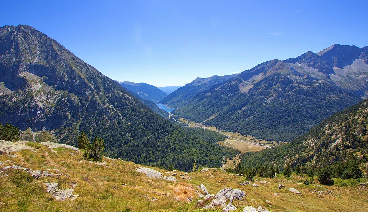
Mountaineering routes Vilaller are set within the dramatic landscapes of the Spanish Pyrenees, characterized by majestic peaks, extensive glacial lakes, and diverse terrain. The region offers a challenging environment for mountaineers, with high-altitude ascents and rugged natural features. Notable areas include the surroundings of Pico de Aneto and the glacial cirque near Lake Mayor de Colomers, featuring peaks exceeding 2,500 meters. The terrain also supports various climbing disciplines, including bouldering and rock climbing on granite formations.
Best mountaineering routes around…
Last updated: July 4, 2026
5.0
(1)
11
hikers
11.5km
05:53
930m
930m
Hard mountaineering route. Very good fitness required. Sure-footedness, sturdy shoes and alpine experience required.
6
hikers
Moderate mountaineering route. Good fitness required. Mostly accessible paths. Sure-footedness required.

Sign up for free
5.0
(1)
2
hikers
12.4km
05:38
640m
640m
Hard mountaineering route. Very good fitness required. Sure-footedness, sturdy shoes and alpine experience required.
1
hikers
8.50km
02:58
410m
410m
Moderate mountaineering route. Good fitness required. Mostly accessible paths. Sure-footedness required.
Our route recommendations are based on thousands of hikes, rides, and runs completed by other people on komoot.
Start today with a free account
Your next adventure awaits.
Login or Signup

Other adventures around Vilaller

Tips from the Community

The path is wheelchair accessible
0
0

This refuge is named after the Restanca lake, next to which it is located. It is located at an altitude of 2010 metres in the Alto Arán. It has capacity for 80 guests, divided into six rooms. It also has hot water showers, food service and a bar.
1
0

Lake Obago is a lake of glacial origin located at 2,236 m in the municipality of Alto Arán, in the Valle de Arán region. Lake Obago is one of the largest lakes in the Cirque de Colomers, a glacial cirque of more than 50 lakes crowned by peaks that exceed 2,500 meters, such as the Tuc de Ratera (2,861 m) or the Gran Tuc de Colomers (2,933 meters).
0
0
Lake Mayor de Colomers is a lake of glacial origin located at 2128 m in the municipality of Alto Arán, in the Valle de Arán region. Lake Mayor de Colomers is one of the largest lakes in the Cirque de Colomers, a glacial cirque of more than 50 lakes crowned by peaks that exceed 2,500 meters, such as the Tuc de Ratera (2,861 m) or the Gran Tuc de Colomers (2,933 meters). ). The Colomers refuge is located near the lake.
0
0

The lake of Còth de Baish can be seen from the pass of the same name, at an altitude of 2,190 metres. From the pass it is possible to descend to the lake to admire it up close.
0
0

One of the smallest, but also very flirtatious.
3
0
In my opinion, the most beautiful lake on the tour.
2
0
Frequently Asked Questions
How many mountaineering routes can I explore around Vilaller?
There are over 10 dedicated mountaineering routes around Vilaller, with 12 of them rated as difficult, offering significant challenges for experienced mountaineers. One route is considered moderate.
What kind of terrain and challenges can I expect on mountaineering routes near Vilaller?
Mountaineering routes around Vilaller are characterized by dramatic landscapes, majestic peaks, and extensive glacial lakes. You can expect high-altitude ascents, rugged natural features, and diverse terrain. The region is also known for various climbing disciplines, including bouldering and trad climbing on granite formations, particularly around Punta Alta Summit – Presa de Caballers loop from Pantà de Cavallers.
Are there any circular mountaineering routes in the Vilaller area?
Yes, several routes offer a circular experience. For example, the Collado de Molières – Ibones de Molières loop from Espitau de Vielha is an 8.5-mile (13.6 km) difficult route exploring high mountain passes and glacial lakes. Another option is the Llauset Reservoir and Tunnel – Tuca de Vallibierna (3,058 m) loop from Llauset, which ascends to a prominent peak with views of the Llauset Reservoir.
What are some notable natural features or landmarks I might encounter on these routes?
The region is rich in natural beauty. You might encounter stunning glacial lakes like Lake Major of Colomers, part of a vast glacial cirque, or Restanca Lake within the Aigüestortes i San Maurici Natural Park. The Nere River also contributes to the scenic beauty. Peaks like Pico de Aneto, the highest in the Pyrenees, offer demanding climbs.
Are there any waterfalls along the mountaineering trails near Vilaller?
While the mountaineering routes themselves focus on high-altitude ascents, the broader Vilaller area is home to beautiful waterfalls. You can find highlights such as Uelhs Deth Joeu Waterfall, Salenques Falls, and Molières Waterfall nearby.
What is the best time of year for mountaineering in Vilaller?
The Spanish Pyrenees, including Vilaller, are best explored for mountaineering during the warmer months, typically from late spring to early autumn (June to September). During this period, snowmelt allows access to higher elevations, and weather conditions are generally more stable, though mountain weather can change rapidly.
Are there any refuges or huts available for multi-day mountaineering trips?
Yes, the region provides several refuges that serve as excellent bases for multi-day excursions. Notable ones include Colomèrs Refuge near Lake Mayor de Colomers and Restanca Refuge, located within the Aigüestortes i San Maurici Natural Park. The Besiberri New Refuge loop from Noguera Ribagorçana also incorporates a refuge.
What do other mountaineers say about the routes in Vilaller?
The mountaineering routes in Vilaller are highly regarded by the komoot community, holding an average rating of 5.0 stars from over 10 reviews. Mountaineers often praise the challenging ascents, the stunning high alpine terrain, and the breathtaking views of glacial lakes and prominent peaks.
Are there any routes suitable for beginners or those new to mountaineering?
While most routes around Vilaller are rated as difficult, there is one moderate route available. However, the region is primarily geared towards experienced mountaineers seeking challenging ascents. It's advisable for beginners to gain experience on less demanding trails before attempting these routes.
What are the typical lengths and elevation gains for mountaineering routes in Vilaller?
The mountaineering routes in Vilaller vary in length and elevation. For example, the Restanca Refuge – Montardo Summit Cairn loop from Refugi de la Restanca covers about 7.9 miles (12.8 km) with over 1,100 meters of elevation gain. Another route, the Collado de Molières – Ibones de Molières loop from Espitau de Vielha, is 8.5 miles (13.6 km) long with over 1,300 meters of ascent.
Is public transport available to reach the starting points of these mountaineering routes?
Access to the starting points of many high-alpine mountaineering routes in the Pyrenees often requires private transport due to their remote locations. While Vilaller itself has some public transport connections, reaching specific trailheads might necessitate a car or local taxi services. It's recommended to check local transport options for your chosen route in advance.
Most popular attractions around Vilaller

Get inspired with the komoot mobile app


Explore more
Browse the best Mountain Hikes & Routes in other regions.
