The best walks and hikes around Puerto Seguro
5.0
(1)
28
hikers
5
hikes
Hiking around Puerto Seguro offers trails through a landscape characterized by river valleys, rolling hills, and rural paths. The region, located in the province of Salamanca, Spain, features routes that often follow streams and cross historical bridges. Hikers can expect varied terrain with moderate elevation changes, providing opportunities to explore the natural and cultural heritage of the area.
Best hiking trails around Puerto Seguro
- The most popular hiking route is Puente de los Franceses loop from San Felices de los…
Last updated: July 2, 2026
5.0
(1)
10
hikers
10.5km
03:05
280m
280m
Moderate hike. Good fitness required. Easily-accessible paths. Suitable for all skill levels.
6
hikers
14.0km
04:20
470m
470m
Moderate hike. Good fitness required. Easily-accessible paths. Suitable for all skill levels.

Sign up for free
5
hikers
10.4km
02:58
230m
230m
Moderate hike. Good fitness required. Easily-accessible paths. Suitable for all skill levels.
5
hikers
3.90km
01:23
230m
230m
Easy hike. Great for any fitness level. Easily-accessible paths. Suitable for all skill levels.
2
hikers
3.62km
01:04
100m
100m
Easy hike. Great for any fitness level. Easily-accessible paths. Suitable for all skill levels.
Our route recommendations are based on thousands of hikes, rides, and runs completed by other people on komoot.
Start today with a free account
Your next adventure awaits.
Login or Signup
Popular around Puerto Seguro

Tips from the Community

A small sleepy village near the Portuguese border. From here you can take a great hike to the Puente de los franceses. The walk there is worth it! 🙂
0
0
A small river with a bridge that connects the villages of Puerto Seguro and La Bouza. Warning! The path there has a gradient of up to 15% in places.
1
0

On the Camino del Fuerte, which connects the municipalities of Aldea del Obispo, Puerto Seguro and Villar de Ciervo, the Puente de los Franceses represents the historical, cultural and landscape union between these three places
4
0
The bridge lies in a valley on the Águeda River. It is particularly worth hiking there in spring or autumn as the surrounding area is beautifully green. Danger! The path there is steep and has scree.
3
0

In the lands of the west of Salamanca this fortress stands, a clear example of the ups and downs and border disputes. According to the chronicles, it was built in the 13th century by the Portuguese king Don Dinis. With the character of a fortress palace, it is located at one end of the urban area.
0
0
Small, but beautiful town, where the nucleus is created from the parish church of San Sebastián, which is located in the middle of the town!
0
0

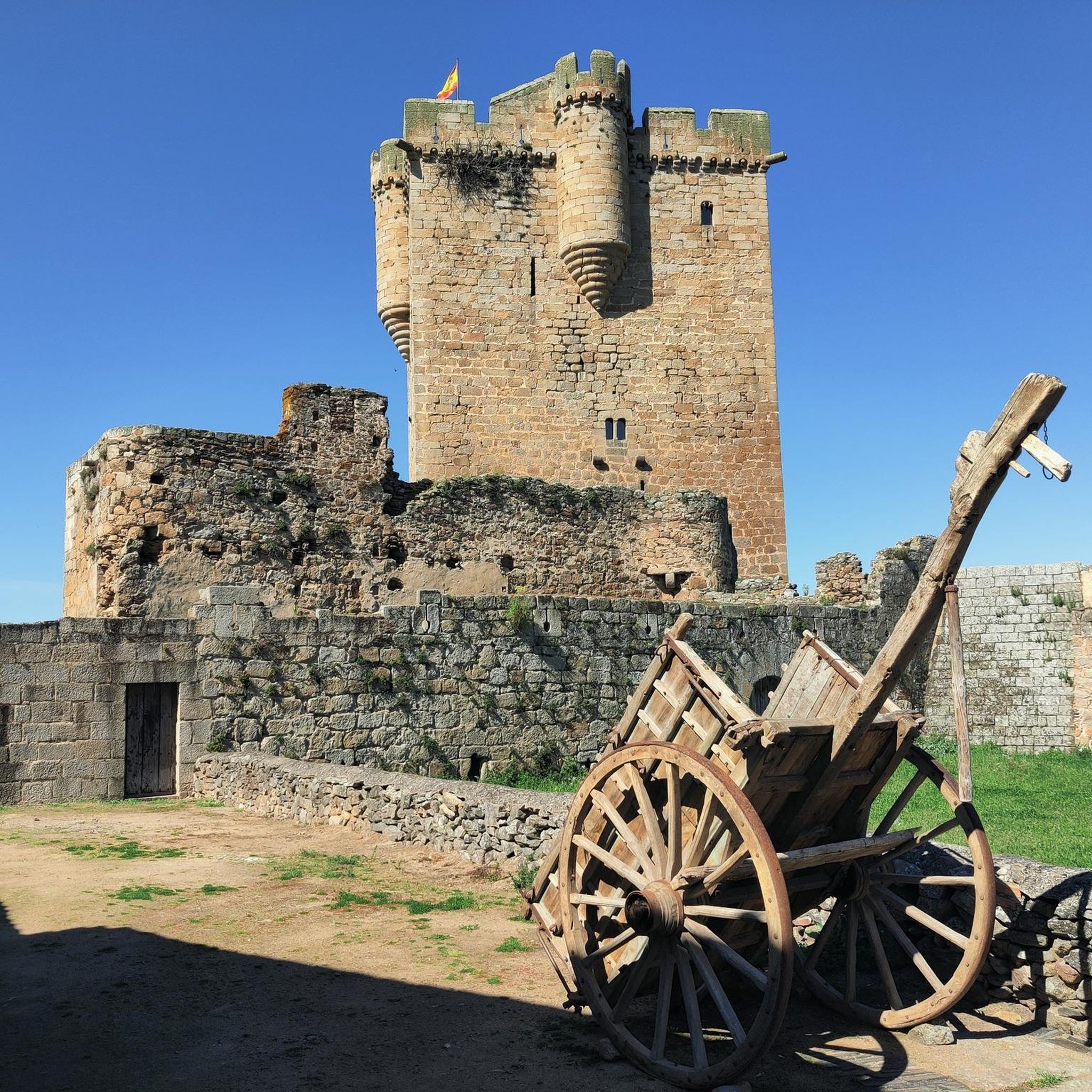
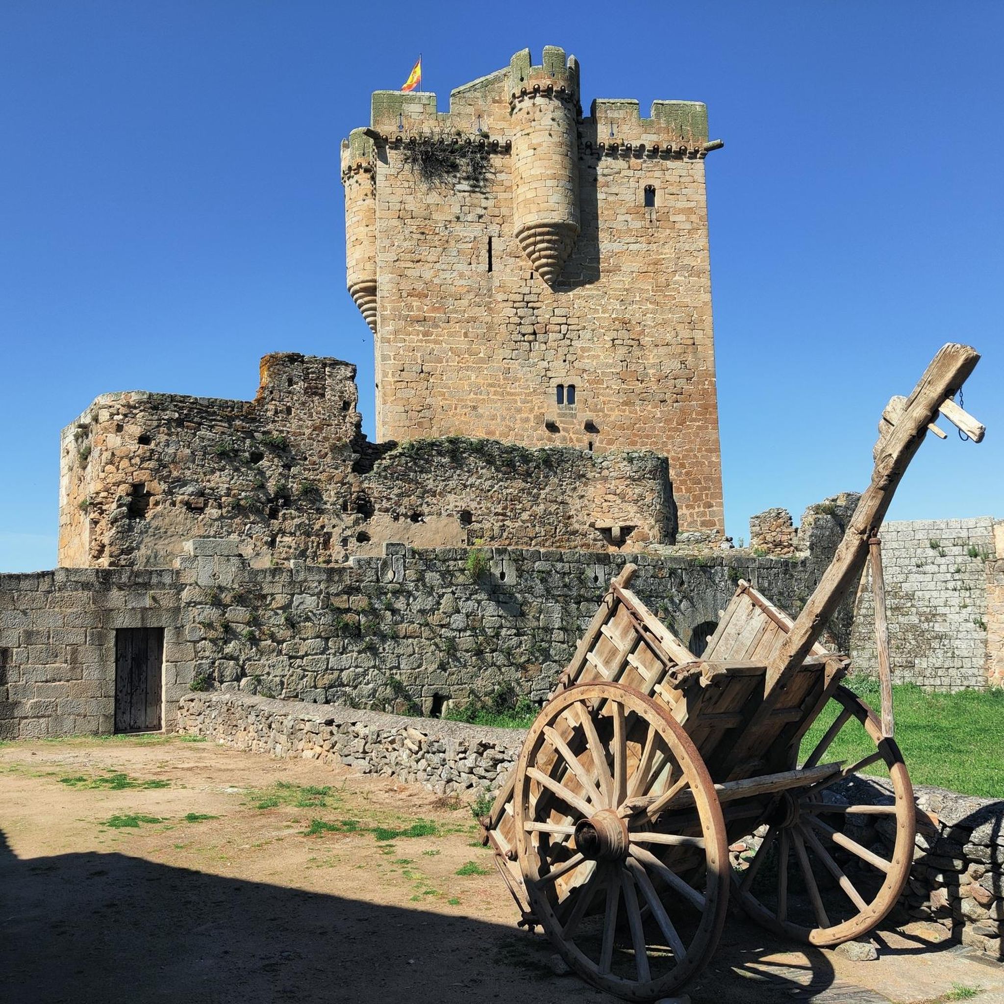
The castle tower that still stands was part of the fortress built in the 13th century by the Portuguese king Don Dinis to protect the lands in the area. It is advisable to visit the tower inside, it houses a Historical Interpretation Classroom and a permanent exhibition on the Border Fortifications. In addition, from the top floor you can enjoy beautiful views of the entire area, including neighboring Portuguese lands.
1
0
A symbol of the town of Sobradillo, the tower was built in the 15th century and was part of the network of defensive fortifications and castles that made it possible to monitor and secure the border against Portuguese attacks. This particular tower belonged to the fortification of the castle of San Felices de los Gallegos.
1
0
Frequently Asked Questions
What kind of terrain can I expect on hiking trails around Puerto Seguro?
Hiking around Puerto Seguro primarily features river valleys, rolling hills, and rural paths. Many routes follow streams and cross historical bridges, offering varied terrain with moderate elevation changes.
How many hiking trails are available around Puerto Seguro?
There are 5 hiking routes available around Puerto Seguro, offering a range of options from easy riverside strolls to more challenging loops with notable elevation changes.
Are there any circular hiking routes in Puerto Seguro?
Yes, several circular routes are available. For example, the Puente de los Franceses loop from Puerto Seguro is an easy 2.4-mile (3.9 km) trail, and the Rivera de Dos Casas Stream – Puerto Seguro loop from Puerto Seguro is another easy option.
What are some easy hiking options in Puerto Seguro?
For easier hikes, consider the Puente de los Franceses loop from Puerto Seguro, which is 2.4 miles (3.9 km) long, or the Rivera de Dos Casas Stream – Puerto Seguro loop from Puerto Seguro, covering 2.2 miles (3.6 km). Both are rated as easy and lead through river valleys and past historical structures.
What can I see along the hiking trails in Puerto Seguro?
Hikers can explore historical structures and natural features. Along the trails, you might encounter landmarks such as the Puente de los Franceses or the Puente Quebrá. The routes often follow river valleys, providing scenic views of the surrounding countryside.
Are there any historical sites or castles near the hiking routes?
Yes, the region is rich in history. Nearby attractions include the Castle of San Felices de los Gallegos, the Real Fuerte de la Concepción, and the Fort of the Concepción and Redoubt of San José, offering glimpses into the area's past.
What do other hikers enjoy most about hiking in Puerto Seguro?
The komoot community highly rates the routes in Puerto Seguro, with an average score of 5.0 stars. Hikers often praise the varied terrain, the peaceful river valleys, and the opportunity to explore both natural beauty and historical structures.
Are there any longer or more challenging hikes available?
For a more challenging experience, the Hiking loop from Sobradillo is a moderate 8.7-mile (14.0 km) path with significant elevation gain, leading through expansive rural landscapes.
Is there parking available near the trailheads in Puerto Seguro?
While specific parking information for each trailhead is not detailed, routes often start from villages like Puerto Seguro or San Felices de los Gallegos, where local parking options are typically available.
What is the best time of year to go hiking in Puerto Seguro?
The guide describes the region as having a pleasant climate, suggesting that hiking can be enjoyed throughout much of the year. For specific weather conditions, it's always best to check a local forecast closer to your visit.
Are there any trails that offer good viewpoints?
Many routes in Puerto Seguro traverse rolling hills and rural landscapes, providing expansive views of the surrounding countryside, particularly on trails with notable elevation changes like the Hiking loop from Sobradillo.
Most popular attractions around Puerto Seguro

Get inspired with the komoot mobile app


Explore more
Browse the best Hikes in other regions.
