The best walks and hikes around Pulnoy
4.4
(444)
3,510
hikers
362
hikes
Hiking around Pulnoy offers access to diverse natural landscapes, primarily centered around the expansive Forêt de Haye. This region features a network of forest paths, varied terrain with gentle to significant elevation changes, and connections to broader regional trail networks. The area provides opportunities to explore woodlands, observe local flora and fauna, and encounter historical elements.
Best hiking trails around Pulnoy
- The most popular hiking route is Nancy dam – Méchelle footbridge loop from Saint-Max, a 3.1 miles (5.0…
Last updated: June 25, 2026
4.3
(4)
17
hikers
10.7km
03:01
220m
220m
Moderate hike. Good fitness required. Easily-accessible paths. Suitable for all skill levels.
4.0
(2)
14
hikers
7.57km
02:02
90m
90m
Moderate hike. Good fitness required. Easily-accessible paths. Suitable for all skill levels.

Sign up for free
4.3
(3)
9
hikers
19.6km
05:46
550m
550m
Hard hike. Very good fitness required. Easily-accessible paths. Suitable for all skill levels.
4.0
(1)
8
hikers
6.51km
01:48
110m
110m
Easy hike. Great for any fitness level. Easily-accessible paths. Suitable for all skill levels.
3.0
(1)
14
hikers
5.33km
01:28
90m
90m
Easy hike. Great for any fitness level. Easily-accessible paths. Suitable for all skill levels.
Get access to more routes and recommendations from other explorers.
Sign up for free
Already have an account?
Our route recommendations are based on thousands of hikes, rides, and runs completed by other people on komoot.
Start today with a free account
Your next adventure awaits.
Login or Signup


Tips from the Community

Malzéville plateau relay antenna
0
0

Very beautiful village with a huge tree in front of the church and a great view over the countryside.
1
0

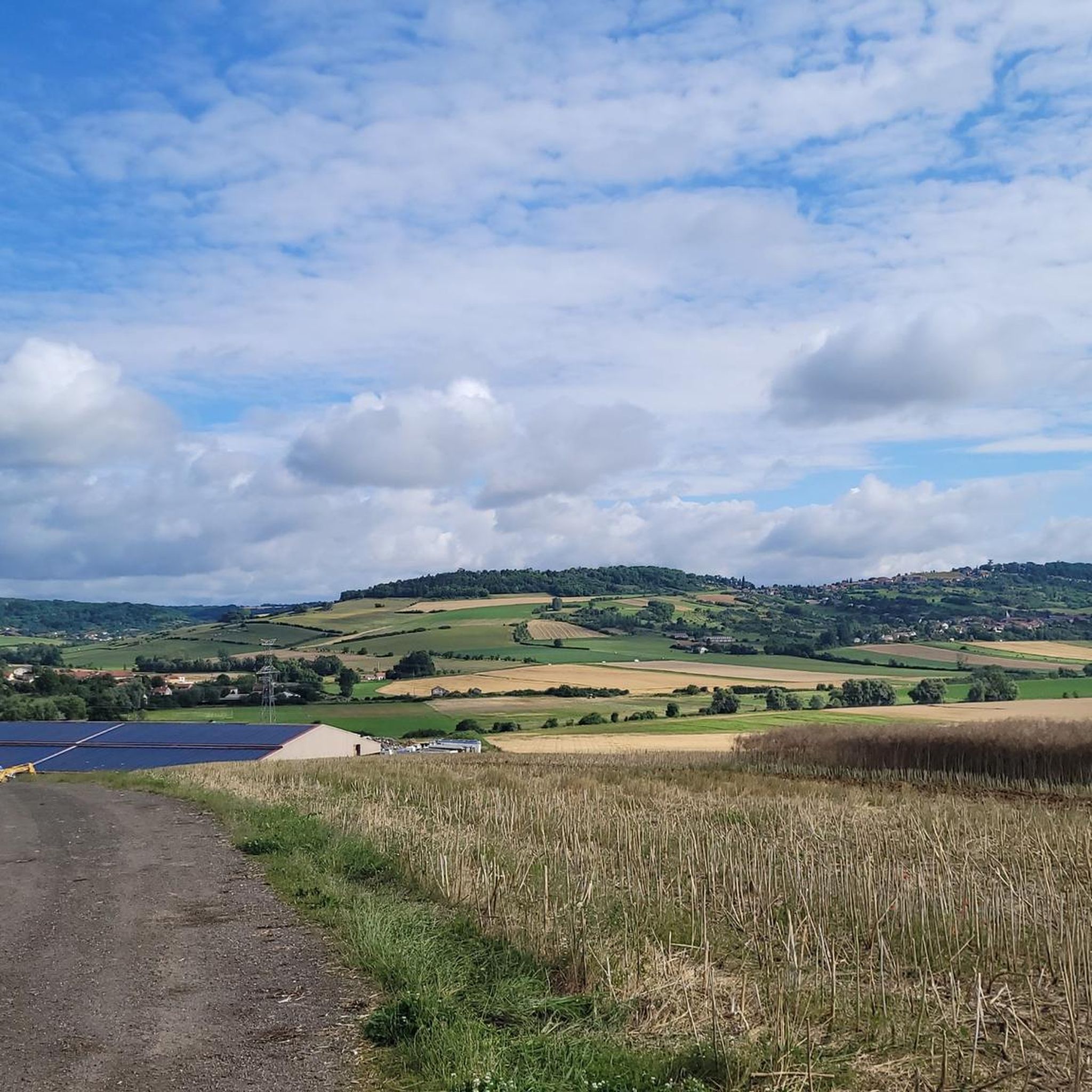
The Plateau de Malzéville, located at the gates of Nancy, offers an exceptional panoramic view of the Meurthe valley and the city below. This natural site, surrounded by meadows and forests, is a popular place for walks, with paths winding through green landscapes. At the top of the plateau, the calm and serenity allow you to fully enjoy nature while admiring the unobstructed view.
0
1

cross of the soldiers of the 1st war struck by lightning
4
0

This airport is a great place to watch gliders take off and land. Keep an eye out when passing by.
2
0
The plateau is a Natura 2000 classified site. Enjoy the panoramas while running on the summit.
2
0
As you race around the plateau, this vantage point is worth stopping for a brief break.
2
0

Amance is a small village built around a hill on which a castle was once built. From now on, the bare hill offers a generous view of the neighboring valleys. On either side of the village, the small and large Mont d'Amance (385 and 407 meters above sea level) enjoy equally pleasant views.
3
0
Frequently Asked Questions
How many hiking trails are available around Pulnoy?
Pulnoy offers a wide variety of hiking opportunities, with over 350 routes available for exploration. These trails cater to different preferences, ranging from easy strolls to more challenging treks through the diverse landscapes.
What kind of terrain can I expect on hikes near Pulnoy?
The terrain around Pulnoy is primarily characterized by the extensive Forêt de Haye, offering a mix of forest paths covered with fallen leaves and moss. You'll find varied landscapes, from relatively flat sections to areas with short but significant elevation changes. The region also connects to the broader Lorraine Regional Natural Park, providing even more diverse natural environments.
Are there easy hiking options suitable for beginners or families in Pulnoy?
Yes, Pulnoy is very welcoming for beginners and families, with over 180 easy routes. An excellent option is the French army remains – Plateau de Malzéville loop from Dommartemont, an easy 3.7-mile (6.0 km) path that explores historical remnants within the landscape.
Can I find challenging hikes with significant elevation around Pulnoy?
While many routes are moderate, there are also more challenging options. For those seeking a greater ascent, the Malzéville Airfield – Plateau de Malzéville loop from Dommartemont is a difficult 12.1-mile (19.4 km) hike with over 540 meters of elevation gain, offering a substantial workout.
Are there any circular hiking routes available in the Pulnoy area?
Yes, many routes around Pulnoy are designed as circular paths, allowing you to start and end at the same point. For example, the Hiking loop from Saulxures-lès-Nancy is a moderate 4.7-mile (7.6 km) circular trail that offers a pleasant experience through the local scenery.
What natural features or landmarks can I see while hiking near Pulnoy?
Beyond the natural beauty of the Forêt de Haye, you can encounter various points of interest. Some routes pass by historical vestiges, such as remnants of an old air base. In the wider region, you might explore significant cultural sites like Stanislas Square or the Place de la Carrière, both renowned for their historical significance.
Is Pulnoy a good destination for dog-friendly hikes?
The extensive forest paths of the Forêt de Haye and the general outdoor-friendly nature of the region make Pulnoy a good place for hiking with dogs. Many trails offer ample space for pets to enjoy the natural environment. However, always ensure your dog is under control and check for any specific local regulations regarding pets in certain areas or nature reserves.
How can I reach the hiking trails around Pulnoy using public transport, or where can I park?
Pulnoy is well-integrated into the local infrastructure. While specific public transport routes to every trailhead may vary, the commune's proximity to Nancy means there are often bus connections. For drivers, parking is generally available near trailheads, especially at popular access points to the Forêt de Haye or in the villages surrounding Pulnoy. It's advisable to check local signage for parking restrictions.
What is the best time of year to go hiking in Pulnoy?
Pulnoy offers enjoyable hiking experiences throughout the year. Spring brings lush greenery and blooming flora, while autumn transforms the Forêt de Haye with vibrant fall colors. Summer is ideal for long days on the trails, and even winter can be beautiful, with opportunities for cross-country skiing in the forest. Always check local weather conditions before heading out.
What do other hikers enjoy the most about hiking in Pulnoy?
The hiking trails around Pulnoy are highly rated by the komoot community, with an average score of 4.5 stars from over 480 reviews. Hikers frequently praise the quiet woodlands, the varied terrain, and the well-maintained paths within the Forêt de Haye, making it a popular choice for outdoor enthusiasts.
Are there any long-distance trails accessible from Pulnoy?
Pulnoy's location near the Lorraine Regional Natural Park provides access to a vast network of trails, including sections of long-distance paths like the GR5 (Mediterranean-Holland) and regional walking routes (GRP and PR). These offer opportunities for multi-day hikes or longer excursions into the wider natural park. For more information on the regional park's extensive network, you can visit Coeur de Lorraine Tourisme.
Can I find places to eat or stay near the hiking trails in Pulnoy?
Pulnoy and its surrounding towns offer various amenities for hikers. You can find local cafes and restaurants in the commune itself or in nearby villages. For accommodation, there are options ranging from hotels to guesthouses, particularly in the larger conurbation of Nancy, which is easily accessible from Pulnoy, providing convenient bases for exploring the hiking trails.
Most popular attractions around Pulnoy

Get inspired with the komoot mobile app


Explore more
Browse the best Hikes in other regions.
