The best cycling routes around Saint-Bonnet-De-Valclérieux
4.1
(25)
291
riders
64
rides
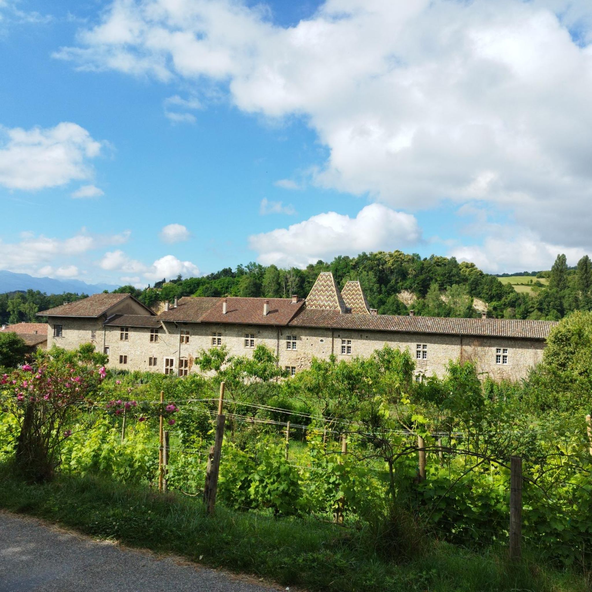
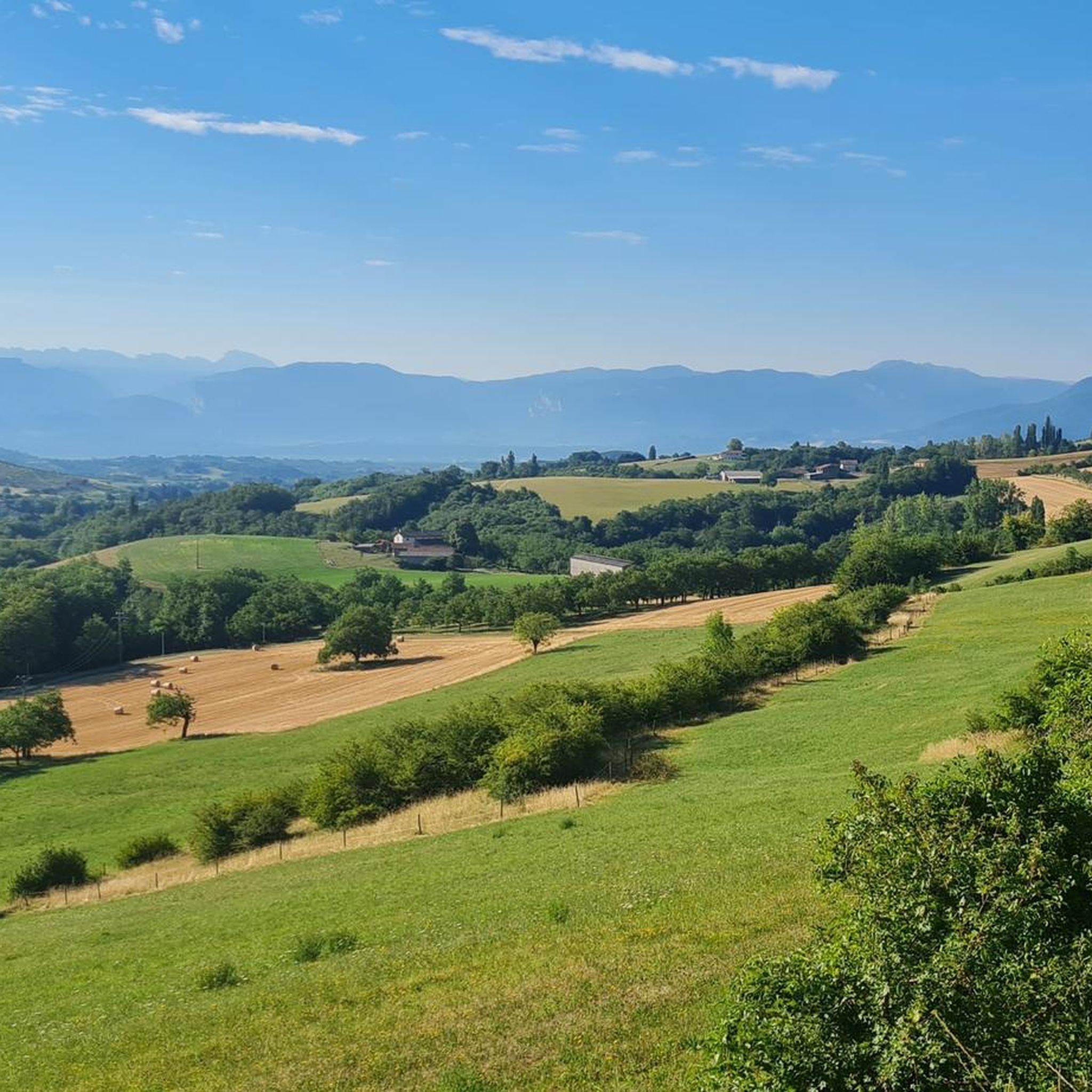
Touring cycling routes around Saint-Bonnet-De-Valclérieux traverse rolling hills and valleys within the Drôme des Collines. The landscape features mixed woods of chestnut, oak, and beech, providing varied scenery. Elevations range from 357 to 532 meters, with an average altitude of 405 meters, offering a mix of ascents and descents. Higher points provide panoramic views that can include the Vercors mountains and the Ardèche mountains.
Best touring cycling routes around Saint-Bonnet-De-Valclérieux
- The most popular touring cycling route is Saint-Antoine Abbey Church…
Last updated: July 1, 2026
10
riders
Hard bike ride. Very good fitness required. Mostly paved surfaces. Suitable for all skill levels.
8
riders
Moderate bike ride. Good fitness required. Mostly paved surfaces. Suitable for all skill levels.

Sign up for free
3.0
(1)
3
riders
Hard bike ride. Very good fitness required. Mostly paved surfaces. Suitable for all skill levels.
5.0
(1)
6
riders
30.5km
02:49
750m
750m
Hard bike ride. Very good fitness required. Mostly paved surfaces. Suitable for all skill levels.
4.0
(1)
3
riders
24.8km
01:34
290m
290m
Moderate bike ride. Good fitness required. Mostly paved surfaces. Suitable for all skill levels.
Get access to more routes and recommendations from other explorers.
Sign up for free
Already have an account?
Our route recommendations are based on thousands of hikes, rides, and runs completed by other people on komoot.
Start today with a free account
Your next adventure awaits.
Login or Signup



Tips from the Community

Roof is not in the best condition but better than nothing Hammock compatible
0
0

Listed among the Most Beautiful Villages in France, Saint-Antoine-l'Abbaye surprises with the richness of its medieval heritage. The Gothic abbey church overlooks a collection of cobbled streets, half-timbered houses, and terraced gardens.
1
0

Along the V63
0
0

An exceptional site in a green, quiet setting with an exceptional heritage
0
0

The Canal de la Bourne was and still is routed along here. Further upstream, this river is responsible for the incredibly beautiful Gorges de la Bourne. This is a must-see
0
0


The former abbey church of Saint-Antoine was built in the 14th century on the site of a previous Romanesque church. With its dimensions of 61 meters long, 32 meters wide and a 22 meter high nave, it is on a par with the great Gothic cathedrals. In 1840, the church of the Abbey of Saint-Antoine-l'Abbaye, the mother monastery of the Antoniter order, was included in the list of monuments (Base Mérimée) in France as a monument historique.
1
1
Frequently Asked Questions
How many touring cycling routes are available around Saint-Bonnet-De-Valclérieux?
There are over 60 touring cycling routes available around Saint-Bonnet-De-Valclérieux. These routes traverse the rolling hills and valleys of the Drôme des Collines, offering diverse scenery for cyclists.
What kind of terrain and difficulty can I expect on touring cycling routes in this region?
The terrain around Saint-Bonnet-De-Valclérieux is characterized by rolling hills and valleys, with elevations ranging from 357 to 532 meters. This ensures a mix of ascents and descents. While there are options for various ability levels, many routes are classified as 'difficult', featuring significant elevation gain. For example, the Saint-Antoine Abbey Church – Saint-Antoine-l'Abbaye loop from Saint-Antoine-l'Abbaye covers 64.1 km with over 600 meters of elevation gain.
Are there any touring cycling routes that offer notable viewpoints or natural features?
Yes, the region is known for its panoramic views. Higher vantage points often overlook the Vercors mountains, the distant Alps, and the Ardèche mountains. Routes like the Montmiral church – Génissieux Church loop from Montmiral - Le Saladot offer views of the surrounding hills and countryside. The landscape is also rich in mixed woods of chestnut, oak, and beech, providing a visually engaging backdrop.
What attractions can I explore along or near the touring cycling routes?
Beyond the cycling paths, you can explore several attractions. The historic Saint-Antoine-l'Abbaye is a significant cultural stop. You might also encounter the Col de la Madeleine (Chambarans), a notable mountain pass. The region is also close to the Regional Natural Park of Vercors, known for its wild, mountainous terrain.
Are there any circular touring cycling routes available?
Yes, many touring cycling routes in the area are designed as loops, allowing you to start and end at the same point. An example is the Route des Crêtes – Madeleine Pass loop from Valherbasse, which is a challenging 46.5 km circular route.
What is the best time of year to go touring cycling in Saint-Bonnet-De-Valclérieux?
The Drôme department generally offers pleasant cycling conditions from spring through autumn. Spring brings blooming landscapes, while autumn showcases vibrant foliage in the mixed woods. Summer can be warm, but the rolling hills and wooded sections provide some shade. Always check local weather forecasts before heading out.
What do other touring cyclists enjoy most about cycling in Saint-Bonnet-De-Valclérieux?
The area is highly rated by the komoot community, with an average score of 4.0 stars from around 40 reviews. Reviewers often praise the varied terrain, the scenic beauty of the Drôme des Collines, and the challenging yet rewarding ascents and descents through mixed woods and valleys.
Are there any longer touring cycling routes for experienced cyclists?
Yes, for experienced cyclists looking for longer distances, routes like the Saint-Antoine-l'Abbaye – Saint-Antoine Abbey Church loop from Saint-Antoine-l'Abbaye offer a substantial challenge. This route covers nearly 40 km with over 750 meters of elevation gain, providing a demanding and scenic experience.
Is public transport available to access the cycling routes, especially if I'm bringing my bike?
While Saint-Bonnet-De-Valclérieux itself is a smaller commune, the broader Drôme region has public transport options. It's advisable to check with local transport providers regarding bike carriage policies, especially for regional buses or trains connecting to larger towns near the cycling routes. The nearest train stations would likely be in larger towns in the Drôme department.
Are there any specific routes that lead through the 'Drôme des Collines' region?
All touring cycling routes around Saint-Bonnet-De-Valclérieux are situated within the 'Drôme des Collines' (Hills of Drôme) region. This area is defined by its characteristic rolling hills, valleys, and diverse woodlands, making every route an exploration of this picturesque landscape.
Where can I find parking if I drive to start a touring cycling route?
Parking availability varies by starting point. Many villages and towns in the Drôme des Collines, including Saint-Bonnet-De-Valclérieux and nearby communities like Saint-Antoine-l'Abbaye, offer public parking areas. It's recommended to check specific route starting points for designated parking facilities.
Most popular routes around Saint-Bonnet-De-Valclérieux
Most popular attractions around Saint-Bonnet-De-Valclérieux

Get inspired with the komoot mobile app


Explore more
Browse the best Cycling routes in other regions.
