The best walks and hikes around Saint-Barthélemy
4.6
(200)
1,563
hikers
37
hikes
Hiking around Saint-Barthélemy offers diverse topography, including coastal paths, rocky landscapes, and hills. The island features wild, rugged terrain with volcanic soil contrasting with lush vegetation. Trails often lead to secluded beaches, coves, and natural pools, providing varied scenery for outdoor exploration. Morne de Vitet, the island's highest point, offers expansive views.
Best hiking trails around Saint-Barthélemy
- The most popular hiking route is Circuit des Barthes Hautes, a 7.5 miles (12.1 km) trail that takes 3 hours 10 minutes to complete. This moderate route features varied terrain.
- Another top favourite among local hikers is Gravel Path Along the River – Fitness Trail loop from Urt, a moderate 6.8 miles (10.9 km) path. This route follows a gravel path alongside a river.
- Local hikers also love the Fitness Trail – Gravel Path Along the River loop from Urcuit, a 4.5 miles (7.3 km) trail leading through a fitness trail area, often completed in about 1 hour 53 minutes.
- Hiking around Saint-Barthélemy is defined by coastal paths, rocky landscapes, and hills. The network offers options for different ability levels, from easy strolls to more demanding ascents.
- The routes in Saint-Barthélemy are highly rated by the komoot community with an average score of 4.5 stars from over 150 reviews. More than 1200 hikers have used komoot to explore Saint-Barthélemy's varied terrain.
Last updated: October 10, 2026
3.9
(7)
22
hikers
12.1km
03:10
90m
90m
Moderate hike. Good fitness required. Easily-accessible paths. Suitable for all skill levels.
5.0
(6)
32
hikers
11.4km
02:55
50m
50m
Moderate hike. Good fitness required. Easily-accessible paths. Suitable for all skill levels.

4.4
(5)
30
hikers
8.36km
02:10
50m
50m
Moderate hike. Good fitness required. Easily-accessible paths. Suitable for all skill levels.
5.0
(4)
45
hikers
6.14km
01:33
10m
10m
Easy hike. Great for any fitness level. Easily-accessible paths. Suitable for all skill levels.
4.7
(3)
18
hikers
7.77km
02:07
110m
110m
Moderate hike. Good fitness required. Easily-accessible paths. Suitable for all skill levels.
Get access to more routes and recommendations from other explorers.
Already have an account?
Our route recommendations are based on thousands of hikes, rides, and runs completed by other people on komoot.
Start today with a free account
Your next adventure awaits.

Tips from the Community

Small restaurant with an excellent kitchen. Not exactly cheap, but worth the money. Anyone who likes to take a break for a meal on their bike tours is in good hands here. Seating on the terrace overlooking the parking lot/bicycles are available. Reservations recommended.
0
0

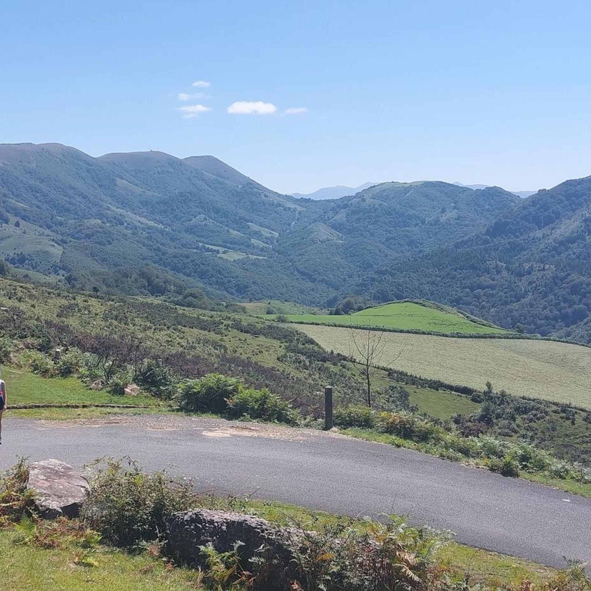
Enjoy breathtaking views of the start of the Pyrenees in the distance.
2
0


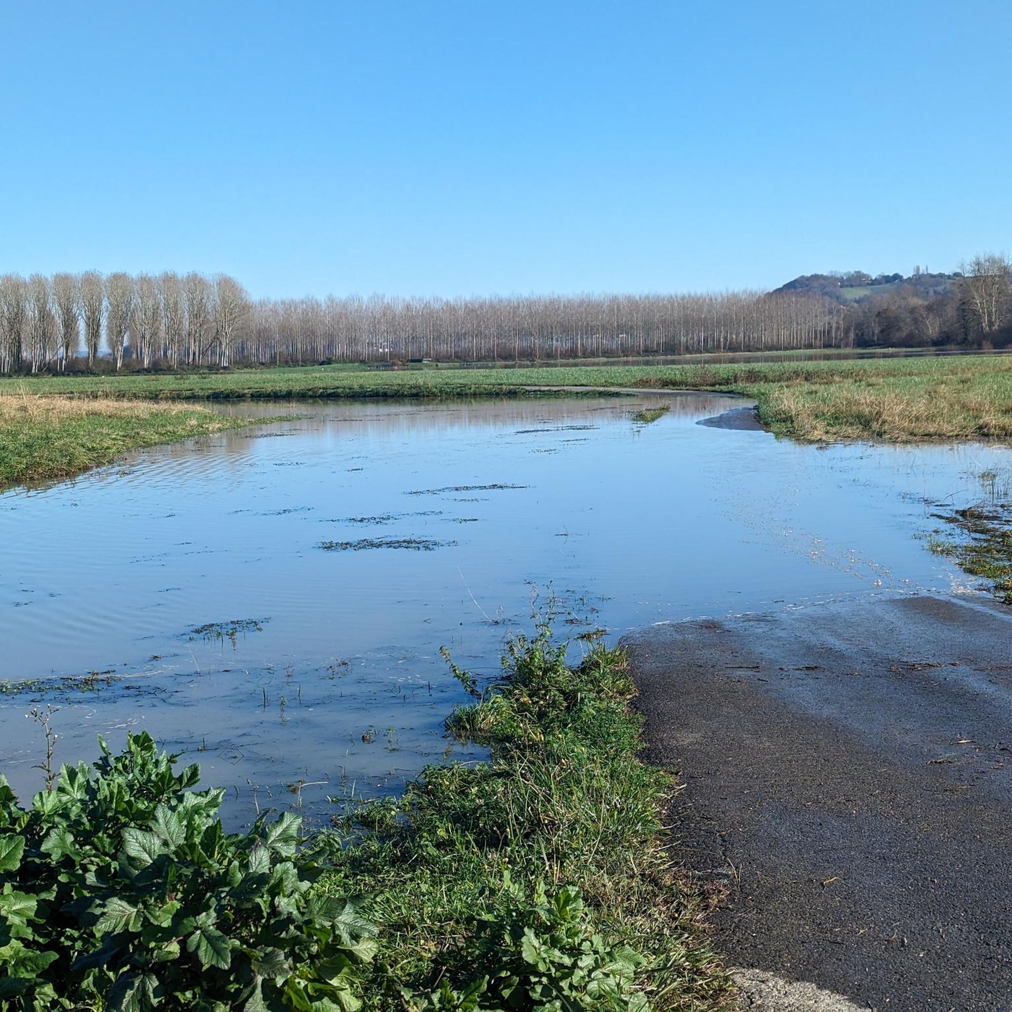
Small road in the Barthes along the Adour.
0
0
Frequently Asked Questions
How many hiking trails are available in Saint-Barthélemy?
Saint-Barthélemy offers a diverse network of over 30 hiking trails. These routes range from easy strolls to more demanding ascents, catering to various skill levels.
What kind of terrain can I expect on hikes in Saint-Barthélemy?
You can expect a varied landscape, including coastal paths with ocean views, rugged and rocky terrain often characterized by dark volcanic soil, and hills. Trails wind through lush vegetation, dense shrubland, and even cactus patches, leading to secluded beaches, coves, and natural pools.
Are there trails suitable for beginners or families?
Yes, Saint-Barthélemy has 15 easy hiking routes. For example, the Fitness Trail – Gravel Path Along the River loop from Urcuit is a 4.5-mile trail that takes less than two hours, making it a good option for a leisurely walk. The island's varied terrain ensures options for different ability levels.
Are there more challenging hikes available in Saint-Barthélemy?
For those seeking a challenge, there are 17 moderate routes. The ascent to Morne de Vitet, the island's highest point, offers cross-country paths through dense vegetation and rewards hikers with expansive 360-degree panoramic views. While not listed as difficult in our data, these routes can be demanding.
What do other hikers enjoy most about hiking in Saint-Barthélemy?
The hiking routes in Saint-Barthélemy are highly rated by the komoot community, with an average score of 4.5 stars from over 150 reviews. Hikers often praise the stunning coastal vistas, the wild and rugged natural beauty, and the opportunity to discover secluded beaches and natural pools.
Are there any circular hiking routes in Saint-Barthélemy?
Yes, many routes are designed as loops. A popular circular route is the Circuit des Barthes Hautes, which is 7.5 miles long and takes approximately 3 hours and 10 minutes to complete. Another option is the Gravel Path Along the River – Fitness Trail loop from Urt.
What kind of wildlife can I see while hiking in Saint-Barthélemy?
The trails wind through diverse vegetation, offering chances to spot various bird species such as pelicans, egrets, herons, and gannets. You might also encounter wild goats, especially along coastal walks like the Toiny Beach Walk. The Saint-Barth Nature Reserve is a sanctuary for local wildlife and plant life.
Are there hikes with great viewpoints in Saint-Barthélemy?
Absolutely. Many trails offer incredible views of the azure ocean and dramatic coastlines. The ascent to Morne de Vitet provides expansive 360-degree panoramic views of the island and neighboring islands. The short walk to Fort Karl from Gustavia Harbor also offers panoramic views of the harbor.
Are there specific trails that lead to beaches or natural pools?
Yes, several hikes lead to secluded natural attractions. The popular Colombier Beach Hike, for instance, leads to a pristine white sand beach accessible only by foot or boat. The Grand Fond area is renowned for its wild, rocky landscape and hidden natural pools, which can be reached via the Grand Fond Trail (The Washing Machine Hike).
What interesting places can I explore near the hiking trails?
Near the hiking trails, you can explore various points of interest. These include the town of Urt, the Marshes d'Orx reserve, and the Marais d'Orx Nature Reserve. There are also dedicated paths like the Cycle path to avoid the main road and the Cycle Path Along the Adour for alternative exploration.
How long do hikes in Saint-Barthélemy typically take?
Hike durations vary significantly. Shorter, easy trails like the La Galupe Restaurant – Ardanavy pedestrian bridge loop from Urt can take around 1 hour 25 minutes. Longer, moderate routes such as the Circuit des Barthes Hautes can take over 3 hours. It's advisable to check the estimated duration for each specific route.
What should I wear or bring for hiking in Saint-Barthélemy?
Given the rocky and uneven paths, sturdy footwear is highly recommended. Light, breathable clothing is suitable for the tropical climate. It's also wise to bring plenty of water, sun protection (hat, sunscreen), and perhaps a swimsuit if you plan to visit any secluded beaches or natural pools.
Most popular routes around Saint-Barthélemy
Most popular attractions around Saint-Barthélemy

Get inspired with the komoot mobile app


Explore more
Browse the best Hikes in other regions.
