The best MTB trails around Saint-Georges-De-Luzençon
4.3
(412)
2,621
riders
157
rides
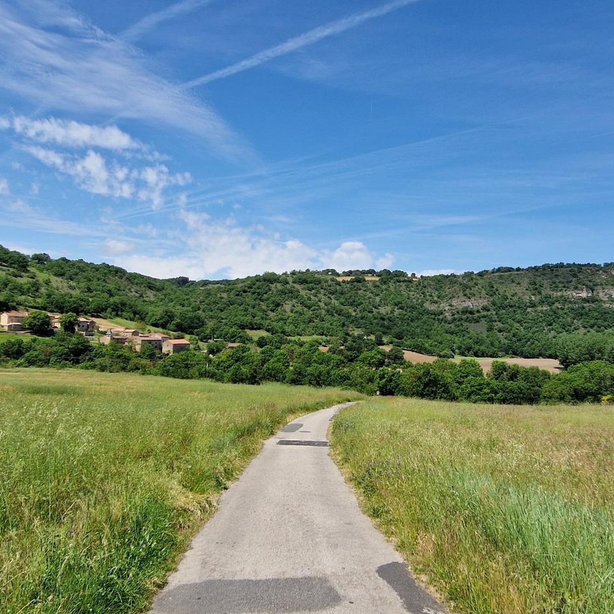
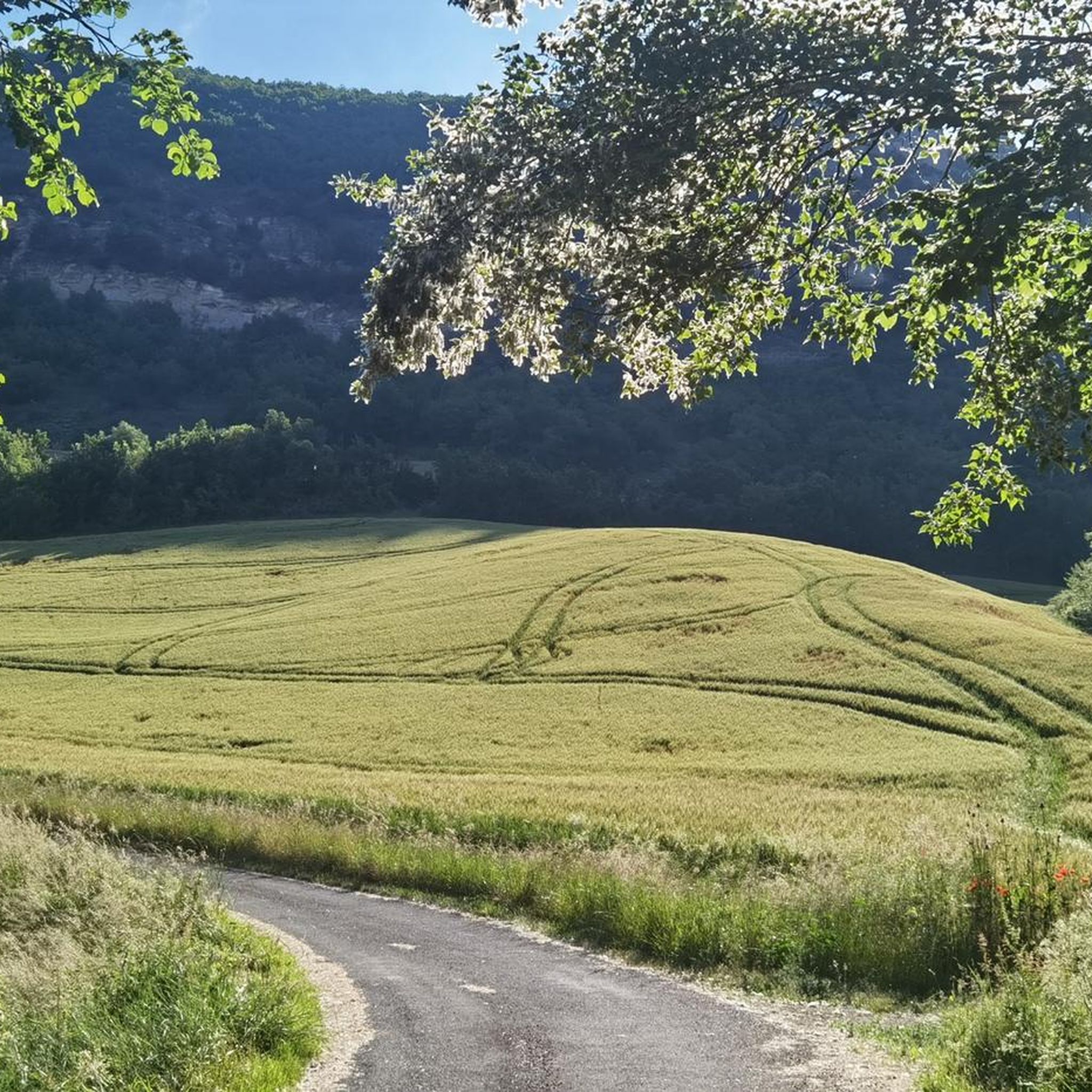
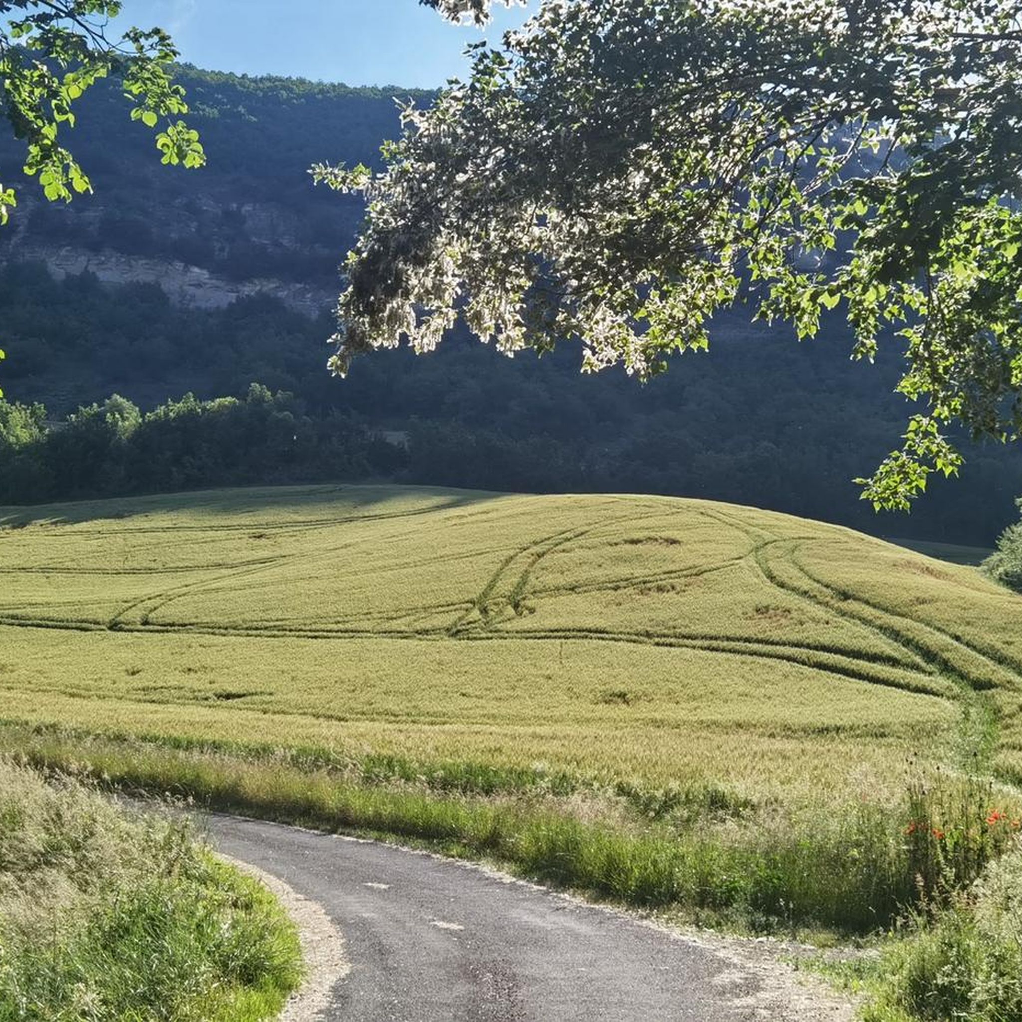
Mountain biking around Saint-Georges-De-Luzençon features a landscape of rolling hills, river valleys, and sections of dense forest, providing varied terrain for riders. The region is part of the Grands Causses Regional Natural Park, known for its limestone plateaus and gorges. These physical features create a mix of challenging climbs and flowing descents suitable for mountain biking.
Best mountain bike trails around Saint-Georges-De-Luzençon
- The most popular mountain bike trail is Navas Mountain Bike Loop, a 27.7 miles (44.6 km) trail…
Last updated: October 11, 2026
5.0
(6)
25
riders
44.6km
04:24
1,130m
1,140m
A difficult 27.7-mile mountain biking loop through the diverse landscapes and challenging terrain of the Parc naturel régional des Grands Ca
5.0
(5)
26
riders
36.4km
03:27
820m
830m
Moderate mountain bike ride. Good fitness required. Suitable for all skill levels.

4.0
(25)
112
riders
28.9km
01:45
210m
210m
Easy mountain bike ride. Great for any fitness level. Suitable for all skill levels.
4.5
(13)
60
riders
46.9km
03:18
560m
560m
Moderate mountain bike ride. Good fitness required. Advanced riding skills necessary.
8
riders
Moderate mountain bike ride. Good fitness required. Suitable for all skill levels.
Get access to more routes and recommendations from other explorers.
Already have an account?
Our route recommendations are based on thousands of hikes, rides, and runs completed by other people on komoot.
Start today with a free account
Your next adventure awaits.

Tips from the Community

Built between 1818 and 1821, the Lerouge bridge became one of the main structures for crossing the Tarn in Millau. It replaced the Pont Vieux, several arches of which had been destroyed by a flood in 1758, leaving the town without a permanent bridge for over sixty years. During this long period, crossing the Tarn was mainly done by ferry. The project was launched on the initiative of the prefect of Aveyron, d’Estourmel. The plans were drawn up by Pierre-Jacques Le Rouge, an engineer for the district. The first stone was laid on June 20, 1818, and the bridge was opened to traffic in January 1821. Its name therefore comes from its designer, not from the color of its stones. A curious detail: its construction was largely financed by private individuals, and a toll was collected until 1875. This tax even caused tensions with the inhabitants of Creissels, some of whom continued to cross the Tarn on foot or by boat to avoid paying it.
3
0
This place is the starting point of the Voie Verte which runs along the Tarn and leads to Creissels. You can discover the troglodytic village of Peyre in particular, a very pleasant forest section which, in places, forms a real green tunnel. Further on, you can enjoy a magnificent view of the Millau Viaduct.
2
0
From the Larzac plateau, the Brunas site offers a vast panorama of the Millau valley. Stretched between the two banks of the Tarn, the viaduct with its seven concrete piers appears in its entirety. Behind it unfolds the entire causse Rouge, a large limestone plateau whose undulations dominate the valley. Then, the Puech d’Andan is distinguished by its wooded silhouette, cut in two by a clear central notch. Further to the right stands the Pouncho d'Agast, a pyramidal promontory marking the beginning of the causse Noir at an altitude of 841 m. Brunas is also a true site for free flight. The take-off area is located directly on the plateau; the site is mainly used with a north wind and allows paragliders to take off and then land in the vicinity of the same sector, with approximately 370 m of elevation difference down to the valley. The spectacle of the sails evolving in front of the viaduct adds a particular dimension to this panorama.
2
0
Perched at an altitude of about 730 meters, the Cap de Coste viewpoint overlooks the eastern end of the Boundoulaou cirque. It reveals a vast panorama of the Millau basin and its surrounding massifs. To the left, the easily recognizable Millau Viaduct spans the Tarn valley to connect the Larzac to the Causse Rouge. Further to the right stretches the latter: a large limestone plateau whose undulations dominate the valley. Then, the Puech d’Andan stands out with its wooded silhouette, cut in two by a clear central notch. Finally, further away, the Pouncho d’Agast, an emblematic relief of the Causse Noir, is easily recognized by its profile like a true limestone pyramid.
3
0
Perché at an altitude of approximately 730 meters, the Cap de Coste viewpoint overlooks the eastern end of the Boundoulaou cirque. It reveals a vast panorama of the Millau basin and its surrounding massifs. To the left, the easily recognizable Millau Viaduct spans the Tarn valley, connecting the Larzac to the Causse Rouge. Further to the right stretches the latter: a large limestone plateau whose undulations dominate the valley. Then, the Puech d’Andan stands out with its wooded silhouette, cut in two by a clear central notch. Finally, further away, the Pouncho d’Agast, an emblematic relief of the Causse Noir, is easily recognized by its profile like a true limestone pyramid.
2
0
From this point at the foot of the structure, the regular succession of piers and guyed pylons can be particularly well distinguished. The deck, 2,460 m long, crosses the valley at a height of approximately 270 m above the Tarn. Pier P2, the tallest, culminates at 245 m, while the assembly formed by the pier and its pylon reaches 343 m: a height greater than that of the Eiffel Tower. This perspective also recalls the technical feat that the construction of the viaduct represented. The metal deck was assembled in sections from either side of the valley, then progressively launched across the void. The joining of the two parts was carried out on May 28, 2004, 268 m above the Tarn, before the official inauguration a few months later. An interesting detail can be discerned here: despite its exceptional dimensions, the structure appears remarkably light. This impression is not accidental. The viaduct was specifically designed to blend into the valley by limiting the visual impact of its structure, with a very slender deck and piers that branch out in a "Y" shape.
2
0

Absolutely worth seeing - view it from below and definitely join the architecture tour.
0
0

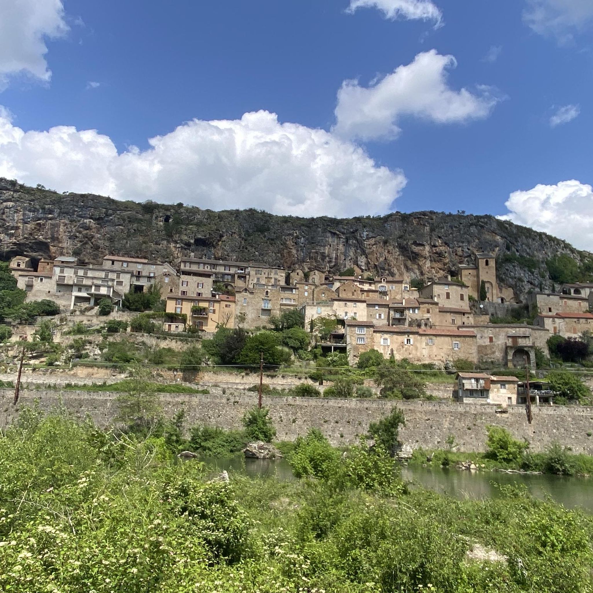
Classified among "The Most Beautiful Villages of France", Peyre stands on the right bank of the Tarn, leaning against the cliff of Causse Rouge, and is distinguished by its light-colored stone troglodyte houses, carved into the tuff rock, offering a breathtaking view of the famous Millau Viaduct.
0
0
Frequently Asked Questions
How many mountain bike trails are available around Saint-Georges-De-Luzençon?
There are over 150 mountain bike trails in the Saint-Georges-De-Luzençon area. These routes offer a diverse range of experiences, from moderate paths to more challenging rides, catering to various skill levels.
Are there any easy or beginner-friendly mountain bike trails in Saint-Georges-De-Luzençon?
Yes, Saint-Georges-De-Luzençon offers a selection of easier trails suitable for beginners. There are 19 routes specifically graded as easy, providing a gentle introduction to mountain biking in the region's scenic landscape.
What kind of terrain can I expect on mountain bike trails in Saint-Georges-De-Luzençon?
The terrain around Saint-Georges-De-Luzençon is characterized by rolling hills, river valleys, and dense forest sections. As part of the Grands Causses Regional Natural Park, you'll also encounter limestone plateaus and gorges, offering a mix of challenging climbs and flowing descents.
Are there any challenging mountain bike routes for experienced riders?
Absolutely. For experienced riders seeking a challenge, there are 40 difficult mountain bike routes. Trails like Navas Mountain Bike Loop, at 27.7 miles (44.6 km) with significant elevation changes, offer demanding rides through varied terrain. Another option is Sargels and the Heights of Roquef, a 21.8-mile (35.2 km) trail with elevated sections.
What are the typical lengths and durations of mountain bike trails in this region?
Trail lengths vary significantly. For example, the Dolmen de Tiergues et Rocher de Caylus – boucle dans le Parc naturel régional des Grands Causses is a moderate 14.5 miles (23.3 km) route taking about 4 hours. Longer, more difficult trails like Navas Mountain Bike Loop can extend to 27.7 miles (44.6 km) and take over 4 hours.
Are there mountain bike trails that form a loop?
Yes, many mountain bike trails in the area are designed as loops, allowing you to start and finish at the same point. Examples include the Navas Mountain Bike Loop and the Dolmen de Tiergues et Rocher de Caylus – boucle dans le Parc naturel régional des Grands Causses, which both offer circular routes.
What can I see along the mountain bike trails in Saint-Georges-De-Luzençon?
Many trails offer views of the region's natural beauty and landmarks. You might pass by significant viewpoints like View from Pouncho d'Agast or Viewpoint overlooking Le Monna and the Dourbie Valley. Some routes also lead near cultural highlights such as the Pas Destrech Cross or offer glimpses of the famous Millau Viaduct.
What do other mountain bikers enjoy most about the trails in Saint-Georges-De-Luzençon?
The mountain bike trails in Saint-Georges-De-Luzençon are highly rated by the komoot community, with an average score of 4.4 stars from over 300 reviews. Riders often praise the varied terrain, the stunning views of the Grands Causses Regional Natural Park, and the well-maintained paths that cater to different skill levels.
Are there any specific attractions or landmarks to look out for while mountain biking?
Yes, the region is rich in natural and historical points of interest. You could encounter geological formations like Giant's Foot Rock, or enjoy panoramic views from summits such as Le Combalou and Pic d'Andan. The iconic Millau Viaduct is also a prominent landmark visible from several routes.
What is the best time of year for mountain biking in Saint-Georges-De-Luzençon?
The region generally offers good mountain biking conditions from spring through autumn. Spring brings lush greenery and comfortable temperatures, while autumn provides vibrant foliage. Summer can be warm, so early morning or late afternoon rides are often preferred. Always check local weather conditions before heading out.
Are there any trails that pass through or near villages or towns where I can find refreshments?
While specific cafes on trails are not detailed, some routes, like the Peyre Village – Millau Viaduct loop from Peyre, start or pass through villages such as Peyre, where you may find local amenities. The town of Millau is also nearby and offers various options for refreshments and services.
Most popular routes around Saint-Georges-De-Luzençon
Most popular attractions around Saint-Georges-De-Luzençon

Get inspired with the komoot mobile app


Explore more
Browse the best MTB trails in other regions.
