The best running trails around Saulce-Sur-Rhône
4.6
(64)
2,791
runners
305
runs
Jogging around Saulce-Sur-Rhône offers diverse natural landscapes, with routes along the Rhône River providing flat, scenic paths. Inland, the hills of Cliousclat and Mirmande present more challenging terrain, often featuring trails suitable for trail running. The region also includes forests like Marsanne and Mirmande, offering shaded, immersive natural settings. This rural landscape, characterized by agricultural zones and woodlands, provides a variety of running environments.
Best jogging routes around Saulce-Sur-Rhône
- The most popular jogging route is View of the Château des…
Last updated: July 1, 2026
30
runners
13.3km
01:23
20m
20m
Moderate run. Good fitness required. Mostly paved surfaces. Suitable for all skill levels.
24
runners
17.8km
01:51
150m
150m
Hard run. Very good fitness required. Mostly paved surfaces. Suitable for all skill levels.

Sign up for free
14
runners
Moderate run. Good fitness required. Mostly paved surfaces. Suitable for all skill levels.
6
runners
5.50km
00:36
90m
90m
Moderate run. Good fitness required. Mostly paved surfaces. Suitable for all skill levels.
8
runners
5.92km
00:39
100m
100m
Moderate run. Good fitness required. Mostly paved surfaces. Suitable for all skill levels.
Get access to more routes and recommendations from other explorers.
Sign up for free
Already have an account?
Our route recommendations are based on thousands of hikes, rides, and runs completed by other people on komoot.
Start today with a free account
Your next adventure awaits.
Login or Signup
Tips from the Community

The La Cruas power plant on the banks of the Rhône impresses with its industrial architecture and mighty cooling towers. Guided tours offer exciting insights into power generation and safety technology. The surroundings invite you to stroll along the riverbank. A fascinating place for technology enthusiasts and photography lovers alike.
0
0
The suspension bridge over the La Payre River near Le Pouzin in the Ardèche is a functional structure that primarily serves as a pedestrian bridge. It connects the southern bank of the La Payre with the western part of the village and is a useful crossing for hikers and cyclists. The bridge is part of the "Voie douce de la Payre," a former railway line now used as a cycling and hiking path.
0
0
The suspension bridge over the La Payre River near Le Pouzin in the Ardèche is a functional structure that primarily serves as a pedestrian bridge. It connects the southern bank of the La Payre with the western part of the village and is a useful crossing for hikers and cyclists. The bridge is part of the "Voie douce de la Payre," a former railway line now used as a cycling and hiking path.
0
0
The "Voie Douce de la Payre" railway cycle path connects Le Pouzin to Privas in the Ardèche and follows the route of the former Pouzin–Privas railway line. Opened in 1861, this line was the first railway connection in the Ardèche department. Initially used to transport iron ore, it later also carried passengers and freight before being closed in 1994. Today, the approximately 20 km long cycle path is fully paved and runs almost level along the Payre River, a tributary of the Rhône. The path leads through tunnels and over viaducts, offering impressive views of the surrounding gorges and villages such as Chomérac and Alissas. Its easy accessibility makes it ideal for family outings and connects the ViaRhôna with the Dolce Via, two other popular cycle paths in the region.
0
0
The "Voie Douce de la Payre" railway cycle path connects Le Pouzin to Privas in the Ardèche and follows the route of the former Pouzin–Privas railway line. Opened in 1861, this line was the first railway connection in the Ardèche department. Initially used to transport iron ore, it later also carried passengers and freight before being closed in 1994. Today, the approximately 20 km long cycle path is fully paved and runs almost level along the Payre River, a tributary of the Rhône. The path leads through tunnels and over viaducts, offering impressive views of the surrounding gorges and villages such as Chomérac and Alissas. Its easy accessibility makes it ideal for family outings and connects the ViaRhôna with the Dolce Via, two other popular cycle paths in the region.
1
0

This ford is only passable on hot days and when the water is low. Because of the risk of falling, it is safer to use the suspension bridge next to it.
0
0
Another modern suspension bridge that sways over the river la Payre. Next to it is a ford that is probably only passable at low water.
0
0

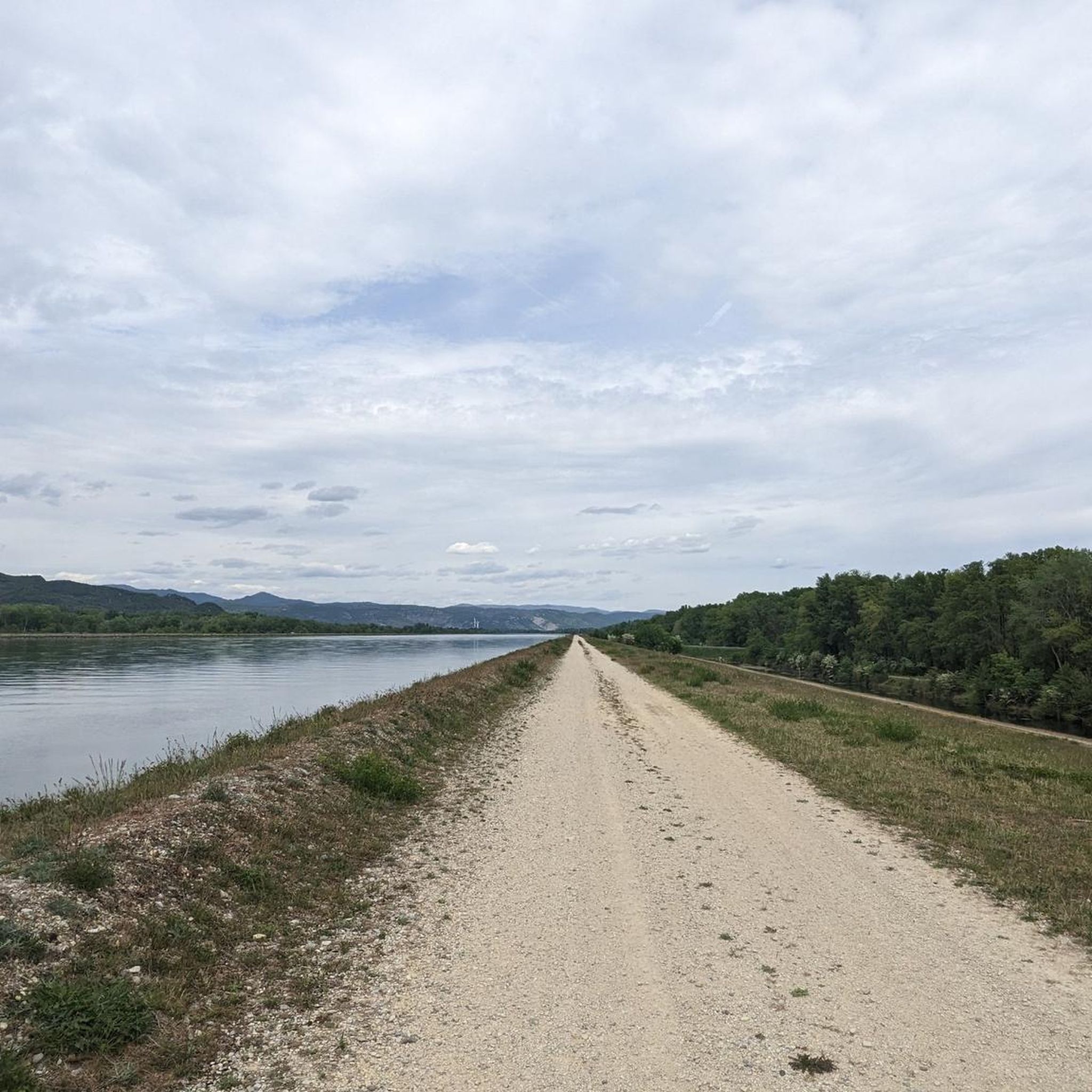
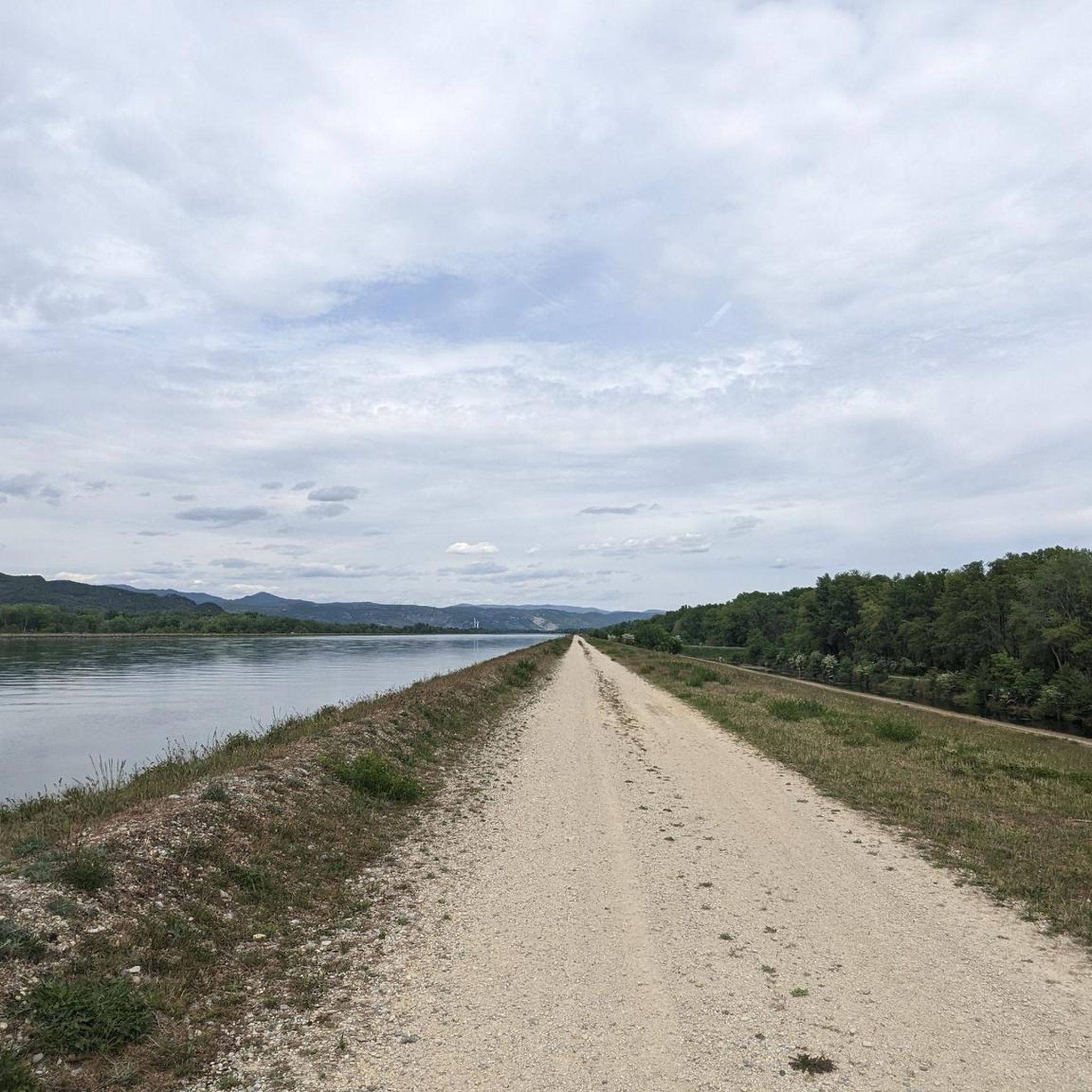
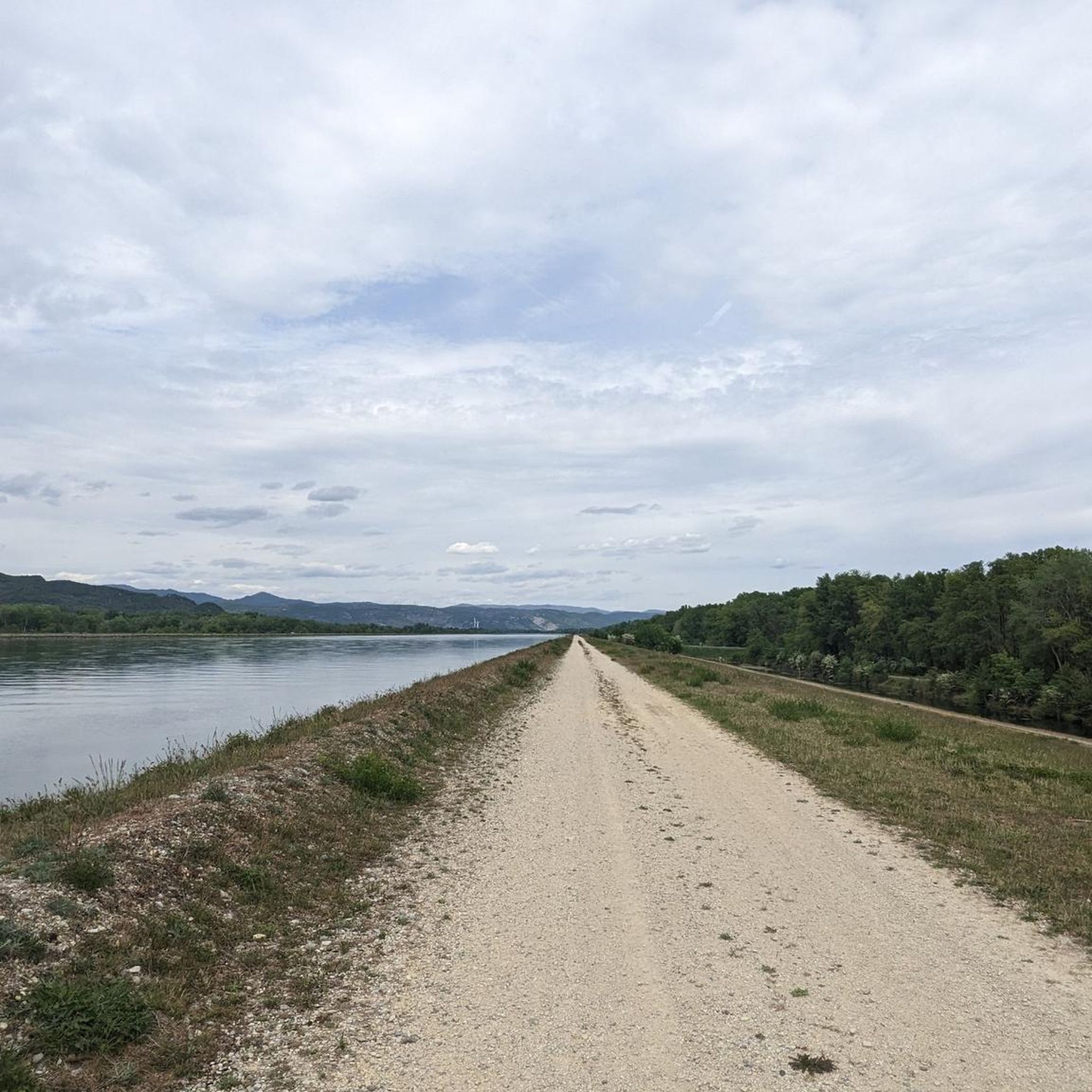
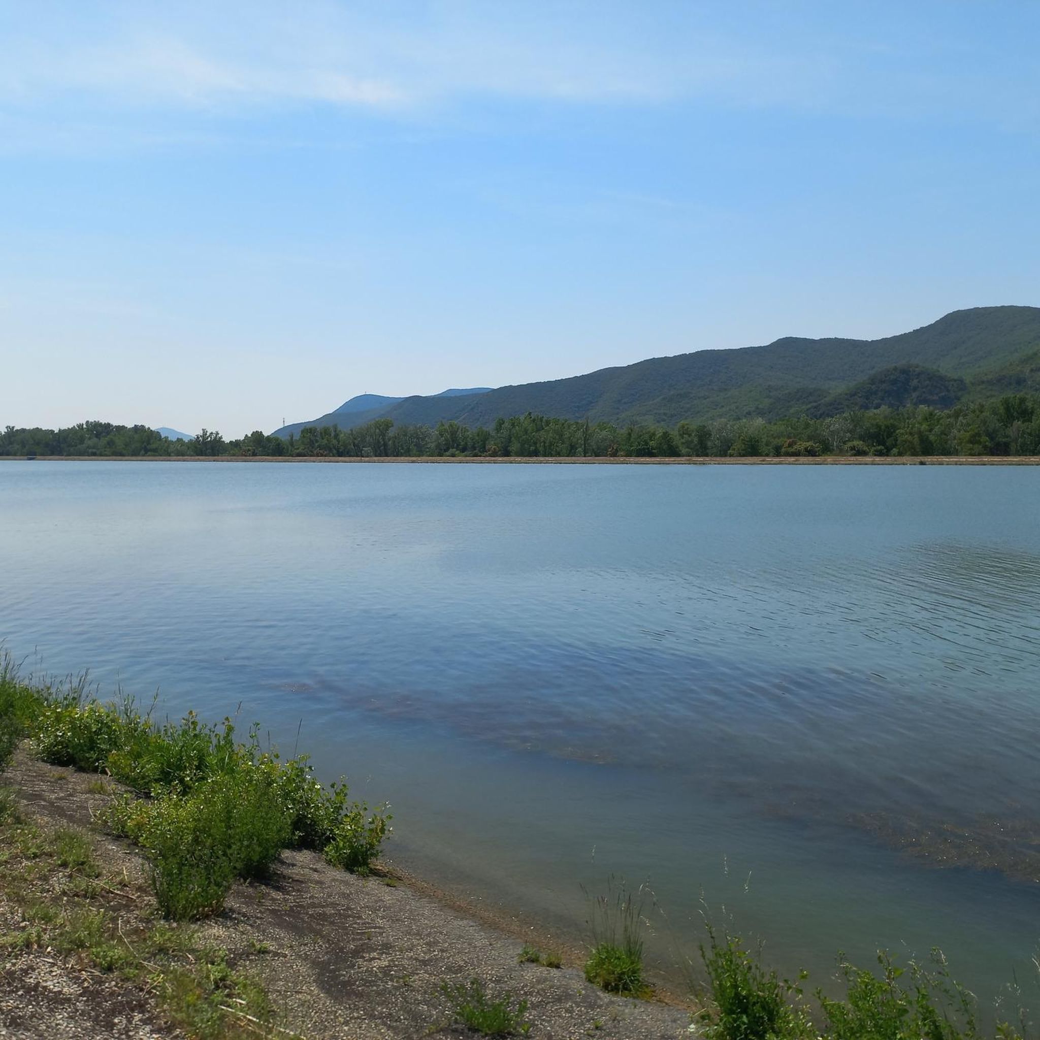
The Cruas nuclear power plant on the right (western) bank of the Rhône.
0
0
Frequently Asked Questions
How many running routes are available around Saulce-Sur-Rhône?
There are over 300 running routes around Saulce-Sur-Rhône, offering a wide variety of options for all skill levels. These include everything from easy riverside paths to more challenging trail runs through the hills.
What kind of terrain can I expect on the jogging routes in Saulce-Sur-Rhône?
You'll find a diverse range of terrain. Many routes follow the Rhône River, providing flat and scenic paths. Inland, the hills of Cliousclat and Mirmande offer more challenging, rewarding trails with significant elevation. Additionally, shaded forest tracks can be found in the forests of Marsanne and Mirmande, providing an immersive natural setting.
Are there any easy or beginner-friendly running routes in the area?
Yes, Saulce-Sur-Rhône offers 21 easy routes perfect for beginners or those looking for a relaxed run. These often include flat paths along the Rhône River or through rural landscapes, such as the tranquil routes through agricultural zones and orchards.
Can I find routes with significant elevation for a more challenging run?
Absolutely. The region features 67 difficult routes, many of which ascend into the hills of Cliousclat and Mirmande. For example, the Magnificent Views loop from Le Pouzin is a challenging path with substantial elevation gain, rewarding runners with expansive views of the surrounding landscapes, including the Ardèche and Vercors mountains.
Are there any circular running routes around Saulce-Sur-Rhône?
Many of the running routes in the area are circular, allowing you to start and finish at the same point. An example is the View of the Château des Moines loop from Cruas, which offers scenic views along the river.
What kind of natural features or landmarks can I see while running?
The routes often feature picturesque views along the Rhône River. You might also encounter charming villages like Mirmande, known for its beauty, or explore the verdant setting of the Parc municipal de l'Olivette. For specific points of interest, consider routes near La Voulte-sur-Rhône or the Payre Greenway.
Are there any rail-trail running options in the region?
Yes, the area includes routes that utilize converted railway lines. The Rail-trail cycle path in Le Pouzin – Payre Greenway loop from Le Pouzin is a great example, offering a relatively flat and well-maintained surface for running.
What do other runners say about the trails in Saulce-Sur-Rhône?
The running routes in Saulce-Sur-Rhône are highly rated by the komoot community, with an average score of 4.5 stars from over 50 reviews. Runners often praise the variety of terrain, from quiet riverside paths to challenging hill climbs, and the beautiful natural settings.
Are there any routes that offer views of the surrounding mountains?
Yes, particularly the more challenging routes in the hills. The trails in the hills of Cliousclat and Mirmande provide breathtaking views of the surrounding landscapes, including the majestic Ardèche and Vercors mountains. These routes are ideal for those seeking panoramic vistas during their run.
Are there shaded running paths for warmer days?
Yes, the region's forests, such as those of Marsanne, Condillac, and Mirmande, offer numerous shaded forest tracks and paths. These wooded areas provide a cooler, immersive natural environment, perfect for running during warmer periods.
Are there any routes suitable for families or those looking for a shorter run?
For shorter, more relaxed runs, the Parc municipal de l'Olivette within Saulce-Sur-Rhône offers a verdant and shaded setting. Additionally, many of the easy routes along the Rhône River are suitable for families due to their flat and accessible nature.
What is the best time of year to go running in Saulce-Sur-Rhône?
Saulce-Sur-Rhône is suitable for running throughout much of the year due to its diverse terrain. Spring and autumn offer pleasant temperatures for exploring both riverside paths and hilly trails. In summer, the shaded forest routes provide a welcome escape from the heat, while milder winter days can still be enjoyable on the lower elevation paths.
Most popular routes around Saulce-Sur-Rhône
Most popular attractions around Saulce-Sur-Rhône

Get inspired with the komoot mobile app


Explore more
Browse the best Running Trails & Routes in other regions.
