Top 20 Mountain Passes around Büssing
Best mountain passes around Büssing are primarily located within the Vosges mountains of France, a region often associated with the historic Col de Bussang. This Büssing geographical location is known for its historical importance as a trade route and its scenic beauty. The area features diverse terrain, from dense forests to mountain summits, offering various exploration opportunities. The Vosges mountains, including the Col de Bussang, provide a rich natural landscape for outdoor activities.
Best mountain passes around Büssing
- The most…
Last updated: September 29, 2026
Markstein
Highlight • Mountain Pass
A renowned farm inn is located nearby, ideal for a lunch break between two cycling trips.
Translated by Google •
Tip by

Col de Bramont
Highlight • Mountain Pass
Showing Translation
Tip by

Sign up now to discover places like this
Get recommendations on the best single tracks, peaks, & plenty of other exciting outdoor places.
Col du Bramont (Southwest)
Highlight (Segment) • Mountain Pass
With a length of 7 kilometers, this pass has a drop of 385 meters, with a maximum gradient of 7%.
Translated by Google •
Tip by
Oderen Pass
Highlight • Mountain Pass
Translated by Google •
Tip by

Ballon de Servance
Highlight • Summit
The highest point in the Haute-Saône department, the Ballon de Servance is partly …
Translated by Google •
Tip by
Sign up for free to discover even more mountain passes around Büssing.
Already have an account?
Start today with a free account
Your next adventure awaits.


Tips from the Community

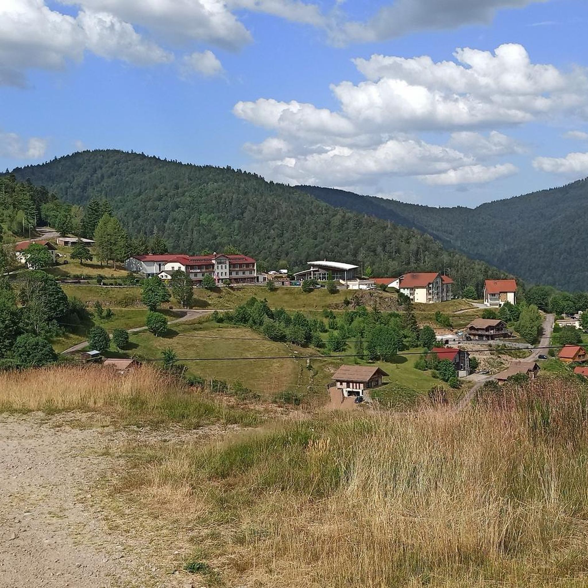
Le Markstein (1184 m) is meer dan alleen een kruispunt op de Route des Crêtes. Het is echter een echte bergpas en het hoogste punt van de oversteek tussen het Lauch- en Thurdal. Het ligt in het hart van het Vogezenmassief, midden een populair wintersportgebied dat nauw verbonden is met de Grand Ballon
4
0
There are no restaurants or cafes at the summit of the Col de Bramont itself. However, the pass serves as a strategic junction. From the summit, you can directly connect to the famous Route des Crêtes (the D431), which links the main mountain peaks of the Vosges. This allows you to easily cycle or hike to larger attractions nearby, such as the Col de la Schlucht, the Hohneck, or the Grand Ballon. The climb is enjoyable due to its 12 hairpin bends on the southern flank (Kruth).
5
0
The climb starts relatively calmly; the first 4.5 kilometers hardly show any significant incline, while the road runs slightly undulating along the Lac de Kruth-Wildenstein reservoir. Only after that does the real climbing work begin over a distance of about 3.5 to 4 kilometers. From that moment on, the road winds its way up via 12 characteristic hairpin bends. The gradient during this section is very constant and fluctuates almost continuously around 5 to 6%, making the climb ideal for finding a steady rhythm. The road is well-asphalted and leads entirely through a dense pine forest. This allows you to cycle delightfully in the shade, although due to the dense vegetation at the top and during the climb, there are few sweeping views of the valley. Once at the top (955m), you can descend directly to the north side towards La Bresse or join the well-known Route des Crêtes to extend the ride to, for example, the Col de la Schlucht or the Grand Ballon.
4
0
The Col d' Oderen is an 8.2 kilometer climb. This is a category 3 climb. It is located in Cornimont, Lorraine, France. The average gradient of this climb is 3.9% with a maximum of 6%. The Col d' Oderen rises from 573 meters at the start to 885 meters at the top, with a total of 312 meters of elevation gain.
5
0
The end of the climb is somewhat disappointing. There is nothing marked. No photo opportunity. You have a small parking lot, a closed military road, and a picnic spot well hidden under the trees. At the two yellow signs (mainly for hikers) there is the only indication that you are at the Ballon de Servance and at 1158 m. The climb is "cozy". No cars, completely shaded, a few kilometer markers.
5
0

Brilliant ascent to the pass relatively quiet with a pleasant gradient
4
0

This is the starting point for many hikes.
3
1

Frequently Asked Questions
What is the historical significance of the mountain passes in the Vosges mountains?
The mountain passes in the Vosges, including the Col de Bussang, have significant historical importance. They served as crucial trade routes between Flanders and Italy from ancient times, especially during the Middle Ages. The surrounding area also has a rich history of forestry and mining activities.
Which mountain passes offer the best scenic views in the Vosges?
For panoramic views, Markstein is an excellent choice. It's a mountain pass and viewpoint located on the Route des Crêtes, offering broad vistas. The Ballon d'Alsace also provides beautiful scenery with wide roads.
Are there mountain passes suitable for challenging cycling in the Vosges?
Yes, the Ballon d'Alsace is historically significant for cycling, featuring three driveways and good road surfaces for training ascents and descents. The Col de Bramont also offers a mix of challenging climbs and thrilling descents through dense forests.
What outdoor activities can I do near the mountain passes in the Vosges?
The region offers a variety of outdoor activities. You can find numerous hiking trails, such as the 'Source de la Moselle – Petit Drumont summit loop' or the 'Bussang Pass – Petit Drumont summit loop'. For cyclists, there are road cycling routes like the 'Col du Page Memorial – Col du Bramont loop' and mountain biking trails like the 'Mosel Quellbrunnen – Col du Page Memorial loop'. You can explore more options in the hiking guide, road cycling guide, and MTB trails guide for the area.
Which mountain pass is less known but offers a unique, quiet experience?
The Ballon de Servance is much less known than other 'balloons' in the Vosges. It offers a very beautiful ascent in the middle of lonely nature on a narrow, paved road with very little traffic, providing a quiet and serene experience.
What is the altitude of the Col de Bussang?
The Col de Bussang is located at an altitude of 727 meters (2,385 feet) in the Vosges mountains.
Are there any mountain passes that are important hubs for exploring different directions?
Markstein serves as an important hub with good parking, allowing visitors to easily explore different directions along the Route des Crêtes and surrounding areas.
What kind of terrain can I expect when visiting mountain passes in the Vosges?
The Vosges mountains offer diverse terrain, ranging from dense forests and meadows, as seen around Col de Bramont, to mountain summits and wide roads. You'll encounter a mix of challenging climbs and descents.
What do visitors appreciate most about the mountain passes in this region?
Visitors appreciate the combination of historical significance, challenging climbs, and scenic viewpoints. The region's mountain passes are well-regarded by the komoot community for their diverse exploration opportunities and natural beauty.
Is it possible to find mountain passes with good parking facilities?
Yes, Markstein is noted for having good parking space, making it convenient for visitors to park their cars and then embark on cycling or hiking tours in the area.
Are there any specific passes known for their gradient or length for cyclists?
The Col du Bramont (Southwest), rising to 956 meters, has a length of 7 kilometers with a drop of 385 meters and a maximum gradient of 7%, making it a notable climb for cyclists.
Most popular routes around Büssing
Most popular attractions around Büssing

Get inspired with the komoot mobile app


Explore more
See even more epic mountain passes by checking out these guides around Büssing:
