The best walks and hikes around Saint-Jorioz
4.6
(376)
3,196
hikers
63
hikes
Hiking around Saint-Jorioz offers diverse landscapes situated between Lake Annecy and the surrounding mountains. The region features wooded slopes, green valleys, and the Laudon River, which flows into Lake Annecy. Notable natural features include the Marais de l'Enfer (marshes) and views towards peaks like Mont Veyrier and Mont Baron. This varied terrain provides a range of hiking experiences from lakeside paths to more challenging mountain ascents.
Best hiking trails around Saint-Jorioz
- The most popular hiking route is Hiking loop from Saint-Jorioz, a 8.6 miles (13.9 km) trail that takes 4 hours 4 minutes to complete. This moderate route offers varied scenery and views of the surrounding area.
- Another top favourite among local hikers is Crêt de Chatillon – Crêt de l'Aigle loop from Quintal, a moderate 8.1 miles (13.1 km) path. This trail provides panoramic views from elevated points.
- Local hikers also love the Bridge over the Laudon River loop from Saint-Eustache, a 7.7 miles (12.4 km) trail leading through rural landscapes along the Laudon river, often completed in about 3 hours 51 minutes.
- Hiking around Saint-Jorioz is defined by Lake Annecy, surrounding mountains, forests, and the Laudon River. The network offers options for easy, moderate, and difficult trails suitable for different ability levels.
- The routes in Saint-Jorioz are highly rated by the komoot community with an average score of 4.6 stars from over 300 reviews. Nearly 3,000 hikers have used komoot to explore Saint-Jorioz's varied terrain.
Last updated: June 25, 2026
4.2
(21)
85
hikers
13.4km
04:03
430m
430m
Moderate hike. Good fitness required. Easily-accessible paths. Suitable for all skill levels.
4.7
(27)
160
hikers
14.0km
04:05
390m
390m
Moderate hike. Good fitness required. Easily-accessible paths. Suitable for all skill levels.

Sign up for free
4.5
(13)
101
hikers
10.5km
02:42
40m
40m
Moderate hike. Good fitness required. Easily-accessible paths. Suitable for all skill levels.
4.8
(15)
113
hikers
Moderate hike. Good fitness required. Easily-accessible paths. Suitable for all skill levels.
4.7
(11)
112
hikers
10.4km
05:04
790m
790m
Hard hike. Very good fitness required. Sure-footedness, sturdy shoes and alpine experience required.
Get access to more routes and recommendations from other explorers.
Sign up for free
Already have an account?
Our route recommendations are based on thousands of hikes, rides, and runs completed by other people on komoot.
Start today with a free account
Your next adventure awaits.
Login or Signup
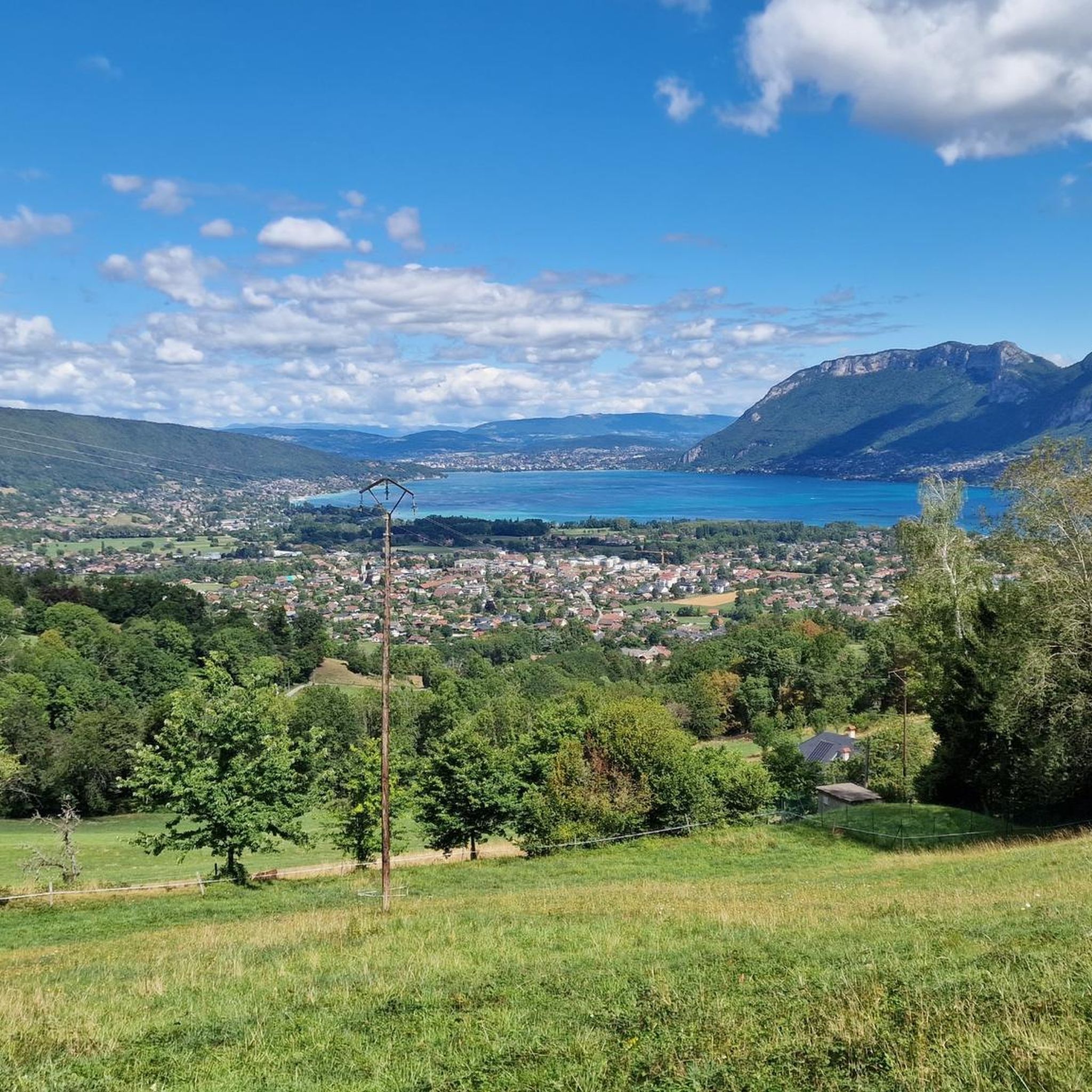
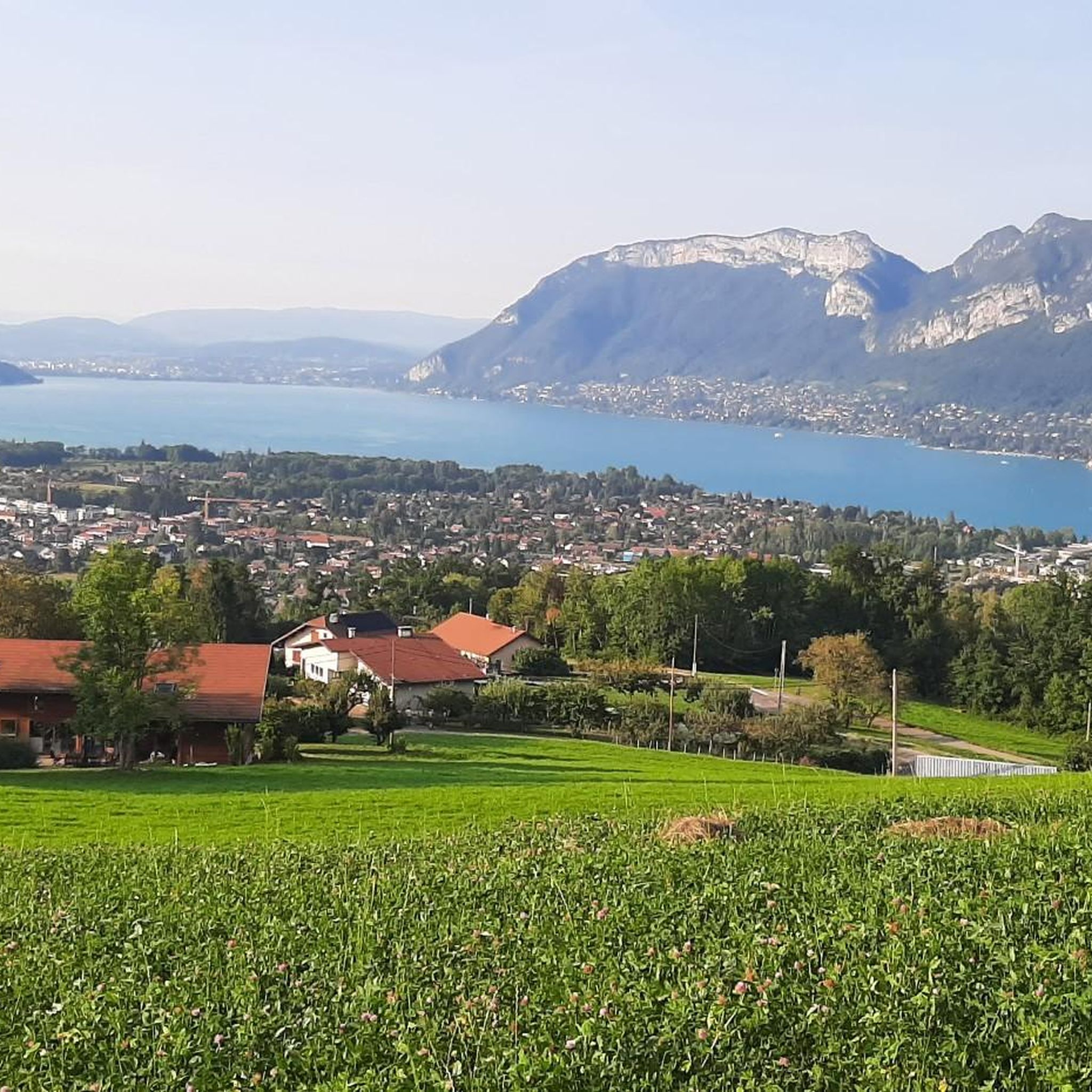
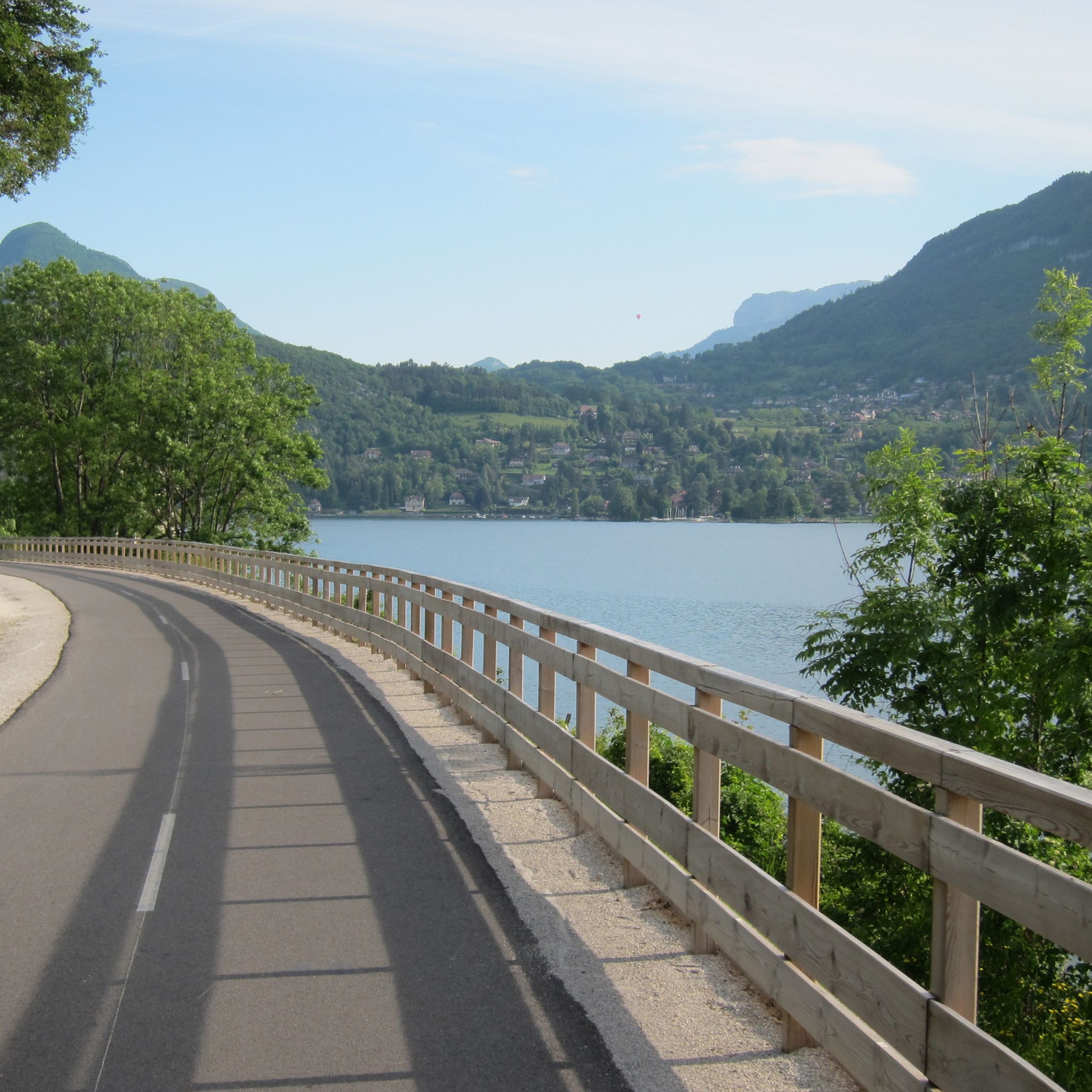
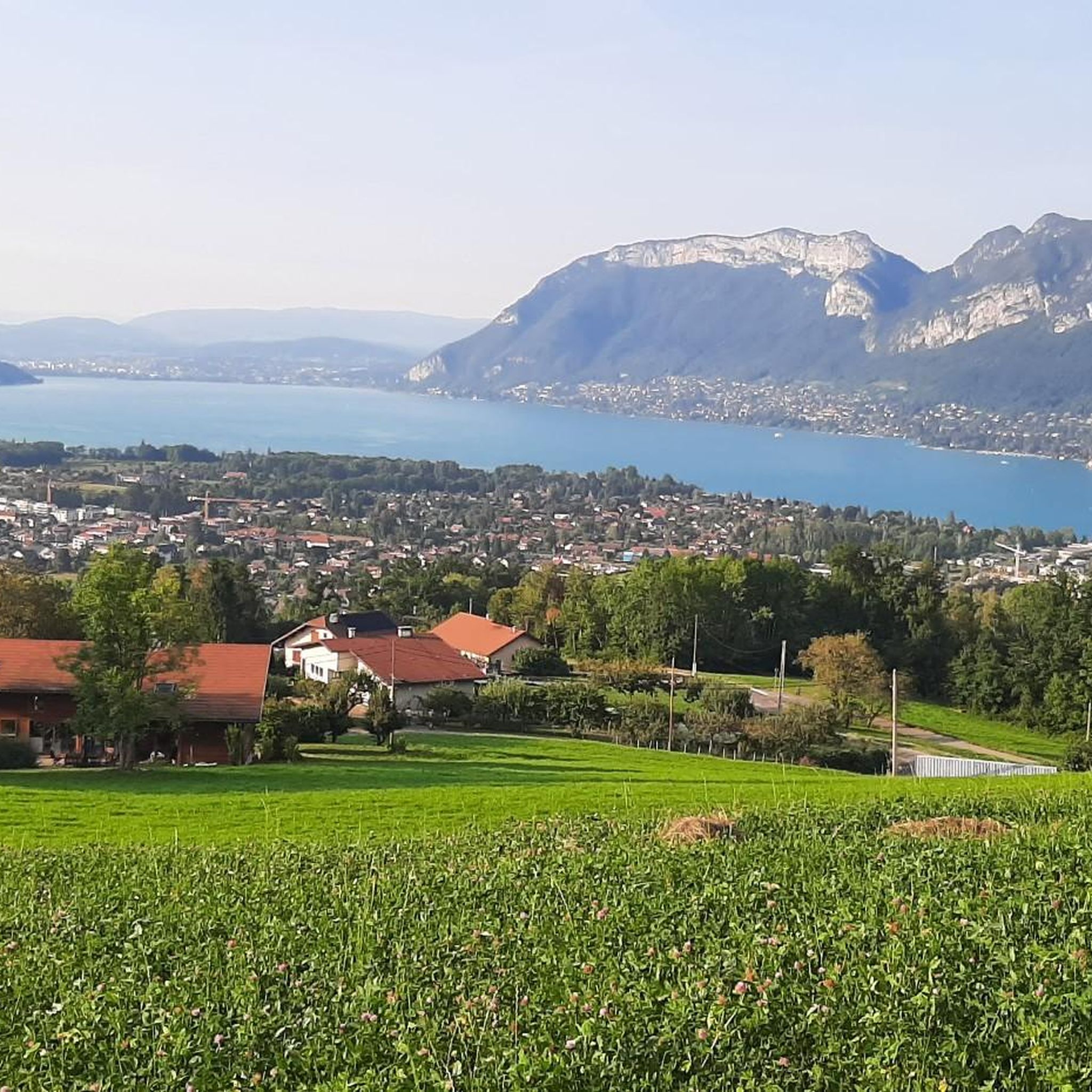


Tips from the Community

Small church worth seeing, next to the mayor and the fountain.
1
0
Location near the Lac d'Annecy, between the railway cycle path and the main road.
1
0
Beautiful church in the village.
0
1
Beautiful cycle path with lake view Cycle path on a former railway line and great reuse.
2
0

A sumptuous panorama of Mont-Blanc
0
0

Saint-Jorioz is a French commune located in Haute-Savoie, on the west bank of Lake Annecy. In brief Natural setting: Between lake and mountains (Bauges massif), offering exceptional landscapes. Tourism & Leisure: Highly popular for its large sandy beach, its marina, its cycle paths (greenway) and its hiking trails. Label: Recognized for the quality of its waters and its environment, notably through the Blue Flag. It is a dynamic residential and tourist town, ideally located just 9 km from Annecy.
0
0
Cyclist café located on the Annecy to Albertville greenway. Coffee break, meal, or brunch to recharge your batteries... or for mechanical repairs if needed.
0
0

Frequently Asked Questions
How many hiking trails are available around Saint-Jorioz?
Saint-Jorioz offers a wide variety of hiking experiences with over 60 trails. These include nearly 30 easy routes, 24 moderate options, and 10 more challenging paths, catering to all skill levels.
What kind of terrain can I expect on hikes in Saint-Jorioz?
The terrain around Saint-Jorioz is highly diverse, ranging from easy lakeside paths along Lake Annecy to wooded slopes, green valleys, and more challenging mountainous ascents. You'll find a mix of open forests, flower meadows, and paths along the Laudon River and the unique Marais de l'Enfer (marshes).
Are there any family-friendly hiking trails in Saint-Jorioz?
Yes, Saint-Jorioz has several easy and enjoyable trails suitable for families. The Roselières Trail is a good option, offering panoramic lake views and a chance to discover local flora. Another very easy path is the 4.1 km route through the Marais de l'Enfer, which is excellent for birdwatching and offers beautiful views over the reed beds.
Where can I find circular hiking routes in the area?
Many trails around Saint-Jorioz are circular. For example, the Hiking loop from Saint-Jorioz is a moderate 13.9 km route offering varied scenery. Another option is the Bridge over the Laudon River loop from Saint-Eustache, which takes you through rural landscapes.
What are some notable landmarks or viewpoints I can see while hiking?
Hikers can enjoy stunning views of Lake Annecy and the surrounding mountains, including glimpses of Mont Blanc. Specific viewpoints include the 'Bench with a view of Lake Annecy' (highlight). You might also spot historic structures like the Château de Duingt or the View of Menthon-Saint-Bernard Castle from certain trails.
Are there any challenging hikes for experienced trekkers?
Yes, for more experienced trekkers, the area offers challenging ascents. The View of Lake Annecy – Entrevernes Mountain loop from Les Rosières is a difficult 10.3 km route with significant elevation gain. The Mont Veyrier and Mont Baron hike is another popular choice for those seeking expansive views from higher elevations. The region also connects to the GR96, a long-distance trail.
What do other hikers say about the trails in Saint-Jorioz?
The trails in Saint-Jorioz are highly regarded by the komoot community, holding an average rating of 4.6 stars from over 300 reviews. Nearly 3,000 hikers have explored the varied terrain, often praising the diverse landscapes and stunning views of Lake Annecy and the mountains.
Can I access hiking trails in Saint-Jorioz using public transport?
Saint-Jorioz is generally accessible by public transport, particularly bus services connecting to Annecy. While specific trailheads might require a short walk from bus stops, the village's central location on Lake Annecy's western shore makes it a feasible starting point for many routes.
What is the best season for hiking in Saint-Jorioz?
The best season for hiking in Saint-Jorioz is typically spring through autumn. During these months, the weather is pleasant, the landscapes are vibrant with colorful flower meadows, and all trails, including higher mountain paths, are generally accessible. Summer offers the added benefit of combining hikes with lake activities.
Are there any trails that offer views of the Laudon River?
Yes, the Laudon River is a prominent natural feature in Saint-Jorioz. The Bridge over the Laudon River loop from Saint-Eustache is a rural walk that follows the river, offering varied viewpoints and glimpses of old rural roads and orchards.
Are there any trails suitable for birdwatching?
The Marais de l'Enfer (marshes of hell) offers a unique environment ideal for birdwatching. This very easy 4.1 km path traverses the marshes and follows the lakeshore, providing beautiful views over the reed beds where various bird species can be observed.
Are there any trails that lead to mountain passes or summits?
For those interested in mountain passes and summits, the region offers access to several. You can find trails leading to the Col de la Forclaz or the Leschaux Pass. The Col du Semnoz summit is also within reach for more ambitious hikers.
Most popular routes around Saint-Jorioz
Most popular attractions around Saint-Jorioz

Get inspired with the komoot mobile app


Explore more
Browse the best Hikes in other regions.
