The best road cycling routes around Courcouronnes
4.3
(346)
7,420
riders
553
rides
Road cycling around Courcouronnes, located in the Essonne department of France, offers diverse landscapes for cyclists. The region features a network of routes that traverse green spaces, forests, and areas along the Seine River and various lakes. Cyclists encounter varied terrain, including plateaus and valleys with contrasting reliefs, providing a range of experiences. The area's natural environment includes lush forests and picturesque villages, contributing to the scenic quality of the routes.
Best road cycling routes around Courcouronnes
- The most popular…
Last updated: July 2, 2026
46
riders
66.8km
02:51
420m
420m
Moderate road ride. Good fitness required. Mostly well-paved surfaces and easy to ride.
4.0
(1)
31
riders
Moderate road ride. Good fitness required. Mostly well-paved surfaces and easy to ride.

Sign up for free
3.0
(2)
19
riders
58.1km
02:20
270m
270m
Moderate road ride. Good fitness required. Some segments of this route may be unpaved and difficult to ride.
15
riders
48.2km
01:54
130m
130m
Moderate road ride. Great for any fitness level. Some segments of this route may be unpaved and difficult to ride.
15
riders
79.5km
03:12
340m
340m
Moderate road ride. Good fitness required. Mostly well-paved surfaces and easy to ride.
Get access to more routes and recommendations from other explorers.
Sign up for free
Already have an account?
Our route recommendations are based on thousands of hikes, rides, and runs completed by other people on komoot.
Start today with a free account
Your next adventure awaits.
Login or Signup


Tips from the Community

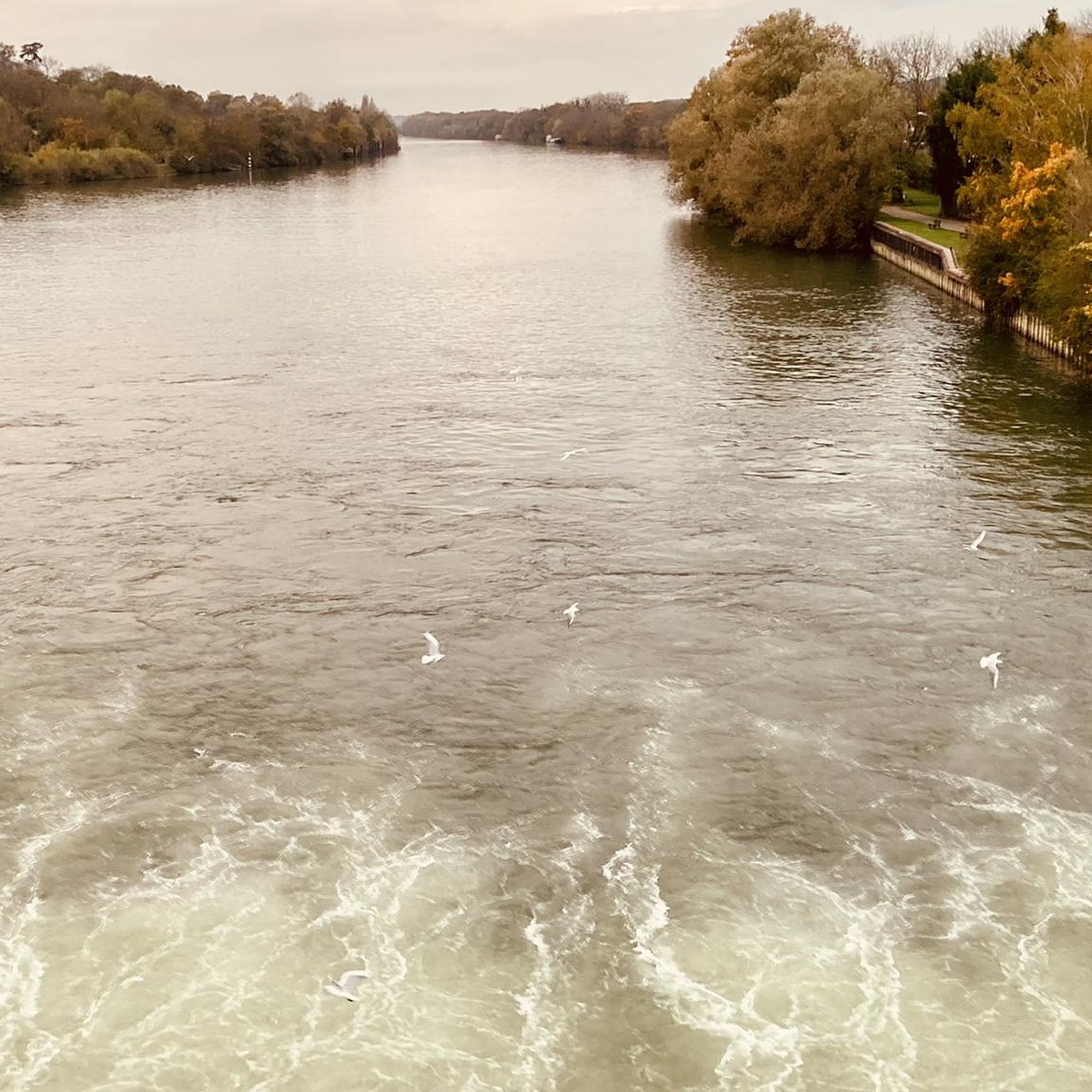
so as not to forget that other nations came to help us stay free
0
0
Ah, the Montaigne hill, when it's at the end of the course it can hurt, but it also tells us that we're almost there.
0
0

The mill is said to be over two thousand years old. Joan of Arc stayed there and Louis XI is said to have donated it to his advisor Olivier le Daim.
0
0

Former market square in the heart of Milly-la-Forêt.
1
0

The construction of the church dates from the 13th century. The church was extensively restored after the Hundred Years' War and its orientation was changed in the mid-18th century. The building was restored again in the 19th century. During these restorations, the local priest died in 1818. Since a decree of March 27, 1926, the church has been listed as a historical monument. A porch was demolished in the 1970s.
0
0
The church is a synthesis of different architectural types. The oldest part, the bell tower, dates from the end of the 11th – beginning of the 12th century. Towards the end of the 12th – beginning of the 13th century, a nave with two bays, vaulted on ribbed vaults, was added to it. For aesthetic reasons, three buttresses were leveled above the vaults. The remains of this first church are still visible. At the end of the 15th century, after the Hundred Years' War, the increase in population led to the enlargement of the nave, which brought the number of bays to five, and to the creation of the side aisles. This well-proportioned building deserves a thorough visit.
0
0

The trail moves on to the main essentials The hall In 1479, by a special grace from Louis The North-South facing Hall, 46 m long, 16 m wide and 13 m high, covers a total surface area of 730 m2. 48 oak pillars, resting on “dice”-cut stone bases, support a chestnut frame typical of Ile-de-France at that time; this frame presents to the north (on the rue Langlois side) a “pavilion” farm. Today, La Halle is still the site of a market on Thursday afternoons. The square, the houses gathered all around, bear witness to the great commercial activity which already reigned in the region 500 years ago. La Halle has been classified as a Historic Monument since 1923. Bonde Castle is located near the town center of Milly-la-Forêt, Built near an artificial island in the l'École river to the west of the Notre-Dame collegiate church, its park is bordered to the west by the course of the river which forms a moat to the north protecting the châtelet. History Built in the 12th century by the lords of Milly, the castle was ruined during the English siege in 1432. At the end of the 15th century around 1475, owned by Admiral Louis Malet de Graville, it was rebuilt and enlarged. What was then the keep became the entrance gatehouse, the drawbridge was replaced by a permanent stone bridge and a gate closed access between the northern defense tower and the governor's house. A square courtyard was surrounded by a wall and had in the center a chapel dedicated to Saint Valentine. The castle was successively the property of Hugues III de Bouville, Olivier V de Clisson, Jean II de Montmorency, Jean-François de Faudoas d'Averton, Marc-Antoine Front de Beaupoil de Saint-Aulaire and Pierre Marie of Lau d’Allemans. In the 19th century, the towers of the chatelet were enhanced with brick battlements and a slender roof. In 1859 the Corne bridge was rebuilt near the castle washhouse which served as a watering trough for the animals. At the end of the 20th century the mills along the river were demolished. In 1964, the Bonde washhouse downstream of the river which was part of the estate was rehabilitated. On December 20, 1972, the castle was partly listed as a historic monument. The park was listed in 1991 for its fences, canals and paths. the house of Jean Cocteau. Entrance to the J. Cocteau house [This 17th century residence, flanked by turrets, was formerly called the Governor's House. It corresponds to an old outbuilding of the castle in front of which the vassals came to pay homage and faith to their lord. Jean Cocteau bought this house with Jean Marais in 1947 and lived there until his death. Notre-Dame de l’Assomption Church Founded in the 11th century, the former chapel of the castle, it was rebuilt around 1485 on the orders of Admiral de Graville in the Gothic style of the 13th and 14th centuries. The bell tower, 57 meters high, dates from the 11th century in its lower part and from the 12th and 13th centuries in its upper part. The arch of the main portal in the primitive Romanesque style comes from an old church in Milly (Saint-Pierre or Saint-Jacques). On the east side of the bell tower - Place Grammont side - the arms of Admiral de Graville are still visible. Many works of sacred art are found inside the church. The church was listed as a Historic Monument in 1926. The dovecote; Located on the old triangular square of the dovecote cul de sac, this old building was part of the Domaine du Moustier, property of Fulbert I, lord of Milly and officer at the court of Dagobert I in the 7th century. Destroyed in 1432 or 1433, the complex included a vast farm. According to a count in 1792 it had around 1200 niches. Only the lords held the right to build these premises designed for breeding. The Moustier de Péronne gate is one of the oldest vestiges of Milly and dates from the 7th century. It provided access to the moustier (monastery in old French) owned by Fulbert I, who obtained the land of Milly from Dagobert I. His son Wulfran was born there around the year 635. Entering religion, he became the apostle of the frieze (Netherlands), then bishop of Sens before retiring to Saint Wandrille where he died in 720.
1
0
Frequently Asked Questions
How many road cycling routes are available around Courcouronnes?
There are over a dozen dedicated road cycling routes around Courcouronnes, with 15 routes listed in this guide. The area offers a diverse network of paths, primarily moderate in difficulty, catering to various skill levels.
What kind of terrain can I expect on road cycling routes in the Essonne department?
The Essonne department, where Courcouronnes is located, features varied terrain. You'll encounter contrasting reliefs of vast plateaus and valleys with steep slopes, alongside routes that traverse green spaces, lush forests, and areas along the Seine River and various lakes. This mix provides a dynamic cycling experience.
Are there any easy road cycling routes suitable for beginners or families in Courcouronnes?
While most routes in this guide are moderate, the region does offer options for varying ability levels. For an easier experience, look for routes described as suitable for all fitness levels, such as the 'Evry lock – Seine Riverside Path loop from Orangis - Bois de l'Épine' mentioned in regional research, which typically features less elevation and more paved surfaces.
What are some notable landmarks or points of interest I might see while road cycling near Courcouronnes?
Many road cycling routes pass by or lead to interesting sites. You can explore historical attractions like Montauger Castle or Montlhéry Tower. Natural highlights include the Rut Pond and the Sequoia Avenue at Villeroy Park. Routes often follow the scenic Seine River or pass by lakes like Lac de Courcouronnes.
Are there any long-distance road cycling routes available from Courcouronnes?
Yes, for those seeking longer rides, routes like the Chamarande Estate – Château de Courances loop from Bois Briard cover approximately 88.6 km. The region's network also connects to more extensive journeys, such as routes connecting Fontainebleau to Paris along the Seine, offering significant distances for experienced cyclists.
What do other road cyclists enjoy most about cycling in Courcouronnes?
The area is highly rated by the komoot community, with an average score of 4.3 stars from over 240 reviews. Cyclists often praise the diverse landscapes, including green spaces, forests, and routes along the Seine River and various lakes, as well as the varied terrain that offers a range of experiences.
Can I find circular road cycling routes around Courcouronnes?
Yes, many of the road cycling routes around Courcouronnes are designed as loops, allowing you to start and end at the same point. Examples include the Tower gate loop from Traité de Rome and the L'Étang Fleuri – Étangs de Vert-Le-Petit loop from Traité de Rome, providing convenient options for your ride.
Are there road cycling routes that pass by lakes or rivers in the area?
Absolutely. The region is characterized by its proximity to the Seine River, with many routes following its banks. You'll also find routes around various lakes, such as the Lac de Courcouronnes and the Étangs de Vert-Le-Petit, offering picturesque views and waterside cycling experiences. The Montauger Castle – Étangs de Vert-Le-Petit loop from Traité de Rome is one such example.
What is the best time of year for road biking in Courcouronnes?
While cycling is possible year-round, the region is particularly popular in June, suggesting pleasant weather conditions. Spring and early autumn generally offer comfortable temperatures and beautiful scenery, making them ideal for road cycling. Winter cycling is possible but may require appropriate gear for colder conditions.
Are there any advanced or challenging road cycling routes near Courcouronnes?
While this guide primarily lists moderate routes, the varied terrain of the Essonne department, with its plateaus and valleys featuring steep slopes, can offer challenging sections. Longer routes, such as the 88.6 km Chamarande Estate – Château de Courances loop from Bois Briard, provide significant elevation gain and distance for more advanced cyclists.
Are there opportunities to combine road cycling with exploring natural parks?
Yes, the region provides access to larger natural areas like the Gâtinais Français Regional Natural Park, known for its rich fauna and flora. While specific road cycling routes directly within the park may vary, the surrounding areas offer connections and opportunities to explore this diverse natural environment.
What are the typical distances for road cycling routes in Courcouronnes?
The road cycling routes around Courcouronnes vary in length. You can find routes ranging from approximately 30 km, like the Montauger Castle – Étangs de Vert-Le-Petit loop from Traité de Rome, to longer excursions of nearly 90 km, such as the Chamarande Estate – Château de Courances loop from Bois Briard, catering to different preferences for ride duration.
Most popular routes around Courcouronnes
Most popular attractions around Courcouronnes

Get inspired with the komoot mobile app


Explore more
Browse the best Road cycling routes in other regions.
