The best mountain hikes around Saint-Jean-D'Aulps
4.6
(53)
304
hikers
32
hikes
Mountaineering routes around Saint-Jean-D'Aulps traverse a diverse and dramatic natural landscape in the French Alps. The region features challenging peaks, rugged ridges, and dramatic cliffs, alongside dense pine forests and lush alpine meadows. Its location between lakes and mountains provides varied terrain suitable for different levels of mountaineering. This area is characterized by its mountainous terrain, offering extensive opportunities for exploration.
Best mountaineering routes around Saint-Jean-D'Aulps
- The most popular mountaineering route is Pointe de Chalune – Col de Vésinaz loop from Praz de Lys Sommand, a 4.8 miles (7.7 km) trail that takes 2 hours 59 minutes to complete. This moderate route offers expansive views of the surrounding alpine landscape.
- Another top favourite among local mountaineers is Pointe de Chalune – Col de Foron loop from Les truites, a difficult 7.8 miles (12.6 km) path. It features sustained climbs through varied mountain terrain, often taking around 5 hours 4 minutes.
- Local mountaineers also love the Pointe de Ratti – Col de la Basse loop from Col de l'Encrenaz, a 4.4 miles (7.1 km) trail leading through alpine meadows and offering panoramic vistas, often completed in about 2 hours 37 minutes.
- Mountaineering around Saint-Jean-D'Aulps is defined by challenging peaks, rugged ridges, and dense pine forests. The network offers options for different ability levels, from moderate ascents to more demanding routes.
- The routes in Saint-Jean-D'Aulps are highly rated by the komoot community with an average score of 4.7 stars from over 50 reviews. More than 300 mountaineers have used komoot to explore Saint-Jean-D'Aulps's varied terrain.
Last updated: July 3, 2026
13
hikers
7.56km
02:58
530m
530m
Moderate mountaineering route. Good fitness required. Easily-accessible paths. Suitable for all skill levels.
5.0
(1)
10
hikers
12.5km
05:03
860m
860m
Hard mountaineering route. Very good fitness required. Mostly accessible paths. Sure-footedness required.

Sign up for free
5.0
(2)
8
hikers
13.8km
06:33
1,100m
1,100m
Hard mountaineering route. Very good fitness required. Sure-footedness, sturdy shoes and alpine experience required.
5.0
(2)
8
hikers
7.65km
03:13
490m
490m
Moderate mountaineering route. Good fitness required. Mostly accessible paths. Sure-footedness required.
7
hikers
11.1km
05:35
1,040m
1,040m
Hard mountaineering route. Very good fitness required. Sure-footedness, sturdy shoes and alpine experience required.
Get access to more routes and recommendations from other explorers.
Sign up for free
Already have an account?
Our route recommendations are based on thousands of hikes, rides, and runs completed by other people on komoot.
Start today with a free account
Your next adventure awaits.
Login or Signup

Tips from the Community

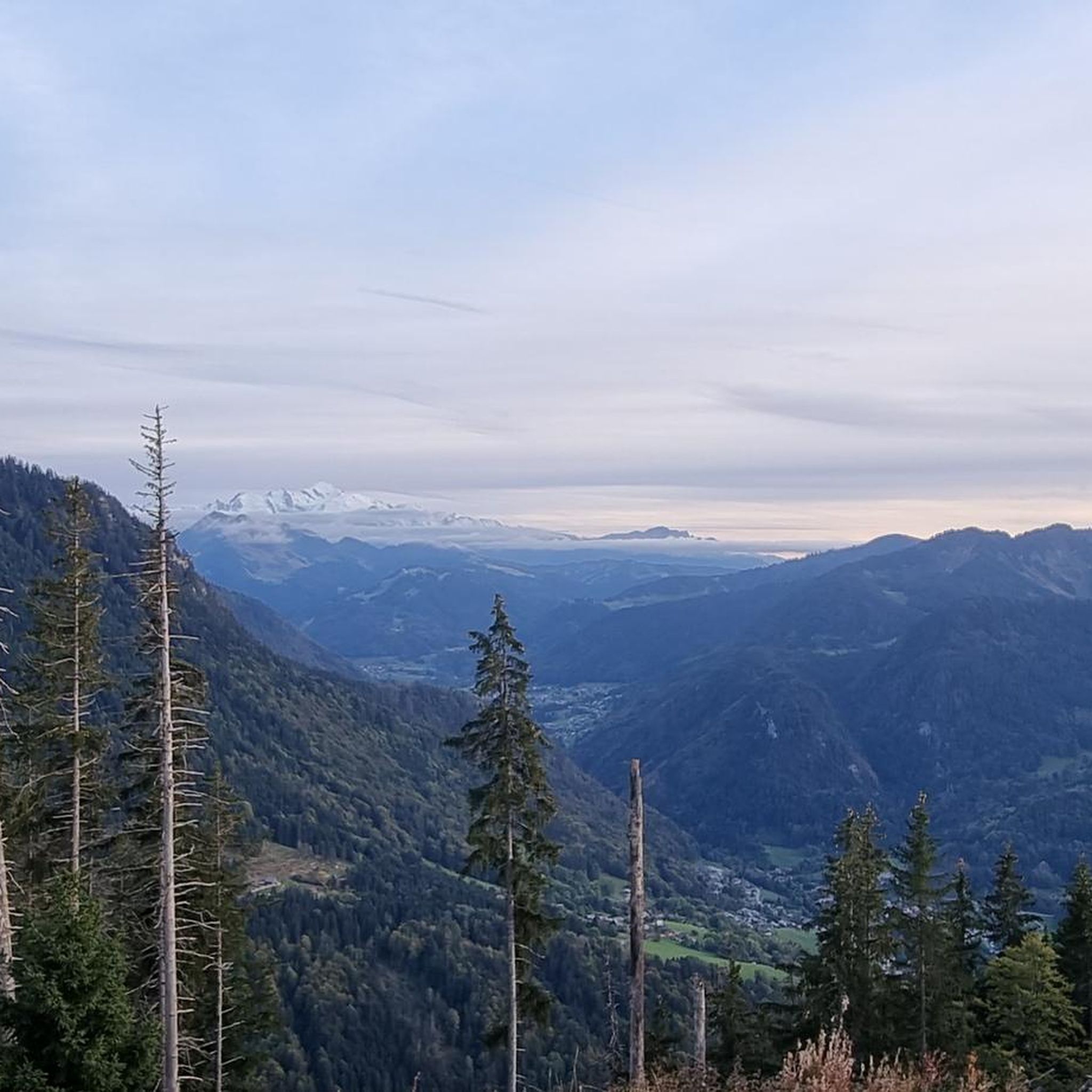
From here, you have a fantastic panoramic view. You can see the Swiss mountains from Dom, across the Matterhorn, to Mont Blanc.
0
0

One of the most beautiful views of the valley, with a rather unusual view overlooking the mole. It is then possible to cross the ridges to Pointe du Haut Fleury but be careful at Pas de l'Ane which is quite exposed despite the handrail. Strictly not recommended in case of dizziness.
0
0


A summit with some of the best views of the surrounding alps.
0
0

Superb point of view at the top (360 °). We discover the Cornettes de Bises, the Dents du midi, the Mont Blanc ... On a clear day, we can see the Jura, La Vanoise and several 4000s in Switzerland. Hallucinating panorama and we no longer want to go back down.
0
0
Frequently Asked Questions
How many mountaineering routes are available around Saint-Jean-D'Aulps?
There are nearly 40 mountaineering routes around Saint-Jean-D'Aulps, offering a wide range of options for different skill levels. The komoot community has rated these routes highly, with an average score of 4.7 stars.
Are there easy mountaineering routes suitable for beginners in Saint-Jean-D'Aulps?
While many routes in Saint-Jean-D'Aulps offer a challenge, there are options for beginners. For instance, the Pointe de Ratti – Col de la Basse loop from Col de l'Encrenaz is a moderate 4.4-mile (7.1 km) trail through alpine meadows, offering rewarding views without extreme difficulty. It's a great way to experience the region's beauty.
What are some challenging mountaineering ascents in the area?
For experienced mountaineers seeking a challenge, Saint-Jean-D'Aulps offers several demanding routes. The Pointe de Chalune – Col de Foron loop from Les truites is a difficult 7.8-mile (12.6 km) path featuring sustained climbs through varied mountain terrain. Another challenging option is the View of the Belair Mountains – Mont de Grange loop from Mont de Grange, which includes over 1000 meters of elevation gain.
Are there circular mountaineering routes in Saint-Jean-D'Aulps?
Yes, many of the mountaineering routes around Saint-Jean-D'Aulps are circular, allowing you to start and end at the same point. Examples include the popular Pointe de Chalune – Col de Vésinaz loop from Praz de Lys Sommand and the more challenging Pointe de Savolaire – Pointe des Lanchettes loop from Prétairié.
What natural attractions can I see along the mountaineering routes?
The region is rich in natural beauty. You can expect to traverse dense pine forests and lush alpine meadows. Many routes offer panoramic views of majestic peaks like Mont Blanc, Lake Geneva, and the Chablais mountains. Keep an eye out for local wildlife such as chamois and marmots. The area also features beautiful lakes like Lake Vernays and the stunning Lac Vert.
What is the best season for mountaineering in Saint-Jean-D'Aulps?
The best time for mountaineering in Saint-Jean-D'Aulps is typically during the warmer months, from late spring to early autumn. During this period, the trails through pine forests and alpine meadows are particularly stunning, and the weather conditions are generally more favorable for high-altitude exploration. Some routes may also be accessible for ski touring during winter with appropriate gear and guidance.
Can I find family-friendly mountaineering trails in the area?
While many mountaineering routes are demanding, some trails are more accessible for families, especially those with some hiking experience. Look for routes described as 'moderate' with shorter distances and less extreme elevation gains. The region's diverse landscape means there are always options for enjoying the alpine environment with children, though specific 'family-friendly mountaineering' routes might require careful selection based on your family's capabilities.
What are some notable peaks or viewpoints accessible through mountaineering?
Saint-Jean-D'Aulps is surrounded by impressive peaks offering incredible vistas. The Pointe de Chalune provides expansive views of the alpine landscape. Other notable peaks in the broader region include Pointe de Nantaux, Roc d'Enfer, and Mont Ouzon, all offering breathtaking panoramas of the Alps, including Mont Blanc and Lake Geneva on clear days.
Are there any specific climbing or via ferrata opportunities near the mountaineering routes?
Yes, beyond traditional mountaineering, the Saint-Jean-D'Aulps area is known for its climbing and via ferrata options. Prominent spots include the 'Elephant's Head' and Rocher de la Chaux, which offer numerous climbing routes. Several via ferrata routes, such as the challenging 'Eye Route' and the aerial 'Elephant's Head Route' at Rocher de la Chaux, provide a thrilling experience combining hiking and climbing elements.
What do other mountaineers say about the routes in Saint-Jean-D'Aulps?
The mountaineering routes in Saint-Jean-D'Aulps are highly rated by the komoot community, with an average score of 4.7 stars from over 50 reviews. Mountaineers often praise the diverse and dramatic natural landscape, the challenging peaks, and the rewarding panoramic views of Mont Blanc and Lake Geneva. Many appreciate the variety of terrain, from dense forests to rugged ridges.
Are there any permits required for mountaineering in Saint-Jean-D'Aulps?
Generally, permits are not required for standard mountaineering and hiking routes in the Saint-Jean-D'Aulps area. However, it's always advisable to check local regulations, especially if you plan to venture into protected areas or undertake highly technical ascents. For specific climbing or via ferrata routes, there might be access restrictions or safety guidelines to follow.
Most popular routes around Saint-Jean-D'Aulps
Most popular attractions around Saint-Jean-D'Aulps

Get inspired with the komoot mobile app


Explore more
Browse the best Mountain Hikes & Routes in other regions.
