The best road cycling routes around Coulombiers
4.4
(16)
529
riders
30
rides
Road cycling routes around Coulombiers, located in the Vienne department of Nouvelle-Aquitaine, traverse a landscape characterized by rolling plains and wooded areas. The terrain features a gently undulating profile, with altitudes ranging from 127m to 156m, making it accessible for various skill levels. The region includes the Forêt de l'Épine, a 600-hectare forest with small ponds, offering varied routes. Silty soils are prevalent on the plateaus of the Poitou threshold.
Best road cycling routes around Coulombiers
- The most popular road…
Last updated: July 4, 2026
5.0
(1)
19
riders
120km
05:48
1,610m
1,610m
Hard road ride. Very good fitness required. Mostly well-paved surfaces and easy to ride.
10
riders
Moderate road ride. Good fitness required. Mostly well-paved surfaces and easy to ride.

Sign up for free
16
riders
125km
06:27
1,710m
1,710m
Hard road ride. Very good fitness required. Some segments of this route may be unpaved and difficult to ride.
7
riders
94.2km
04:35
1,240m
1,240m
Hard road ride. Very good fitness required. Mostly well-paved surfaces and easy to ride.
7
riders
57.9km
02:31
390m
390m
Moderate road ride. Good fitness required. Mostly well-paved surfaces and easy to ride.
Get access to more routes and recommendations from other explorers.
Sign up for free
Already have an account?
Our route recommendations are based on thousands of hikes, rides, and runs completed by other people on komoot.
Start today with a free account
Your next adventure awaits.
Login or Signup
Tips from the Community

Riding up there by bike was quite strenuous, but the view from the top was worth the effort. It was well worth it.
0
0

11th Century Church Worship was abolished in the parish of Chevain. The church was sold for 31,700 livres to the citizen of Villeray on 6 Vendémiaire, Year VII (September 27, 1799). The Chevain church, having been donated by Madame du Hameau de Villeray to the commune by notarial deed dated April 16, 1827, was restored to worship there on January 15, 1827. The parish was established as a branch parish.
0
0
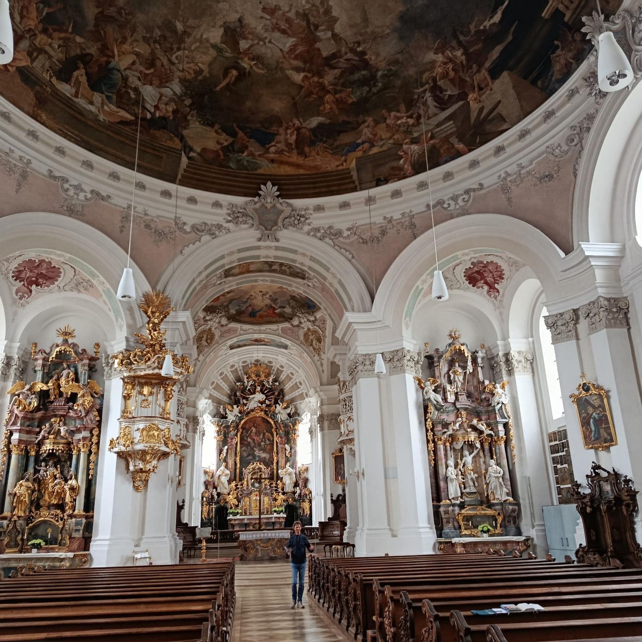
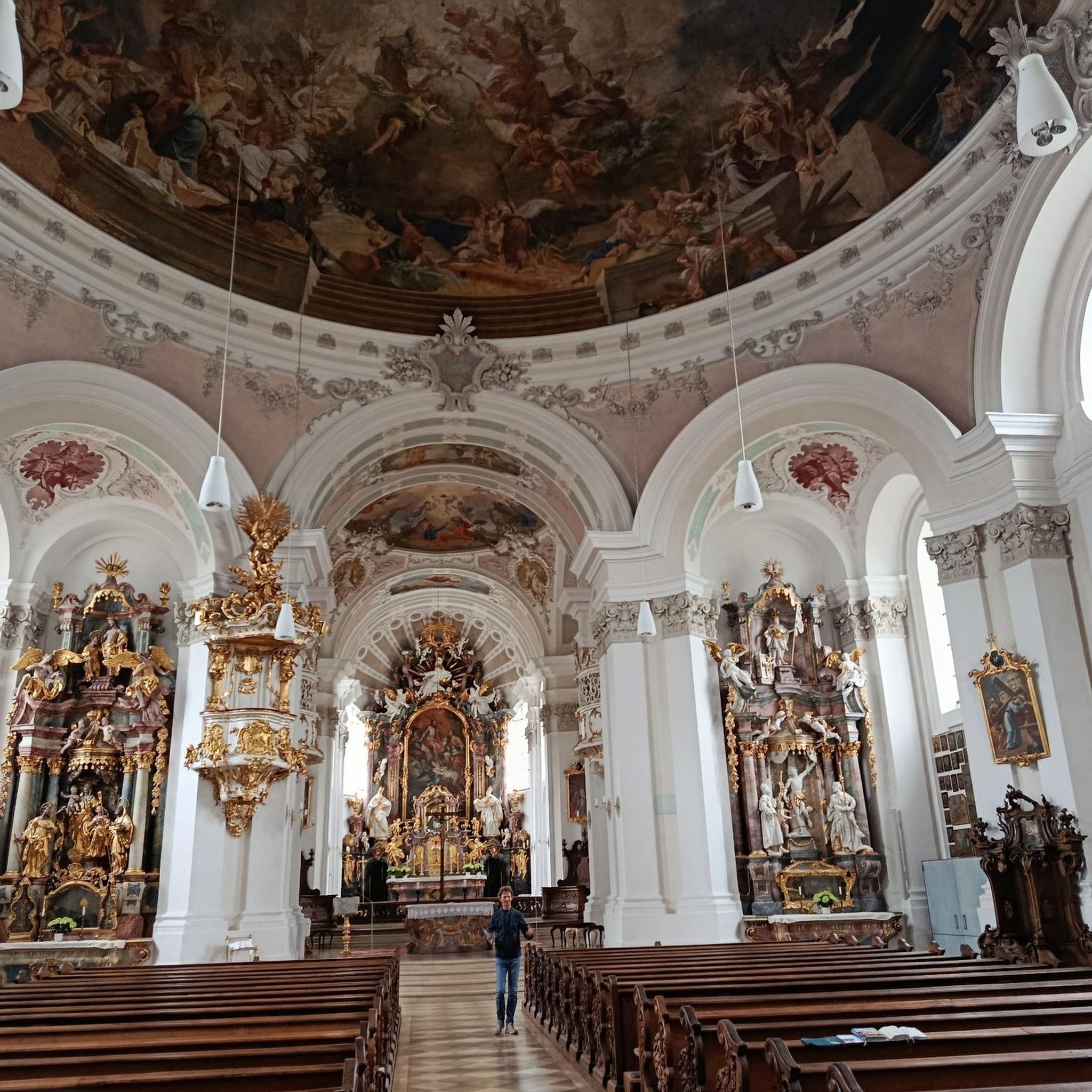
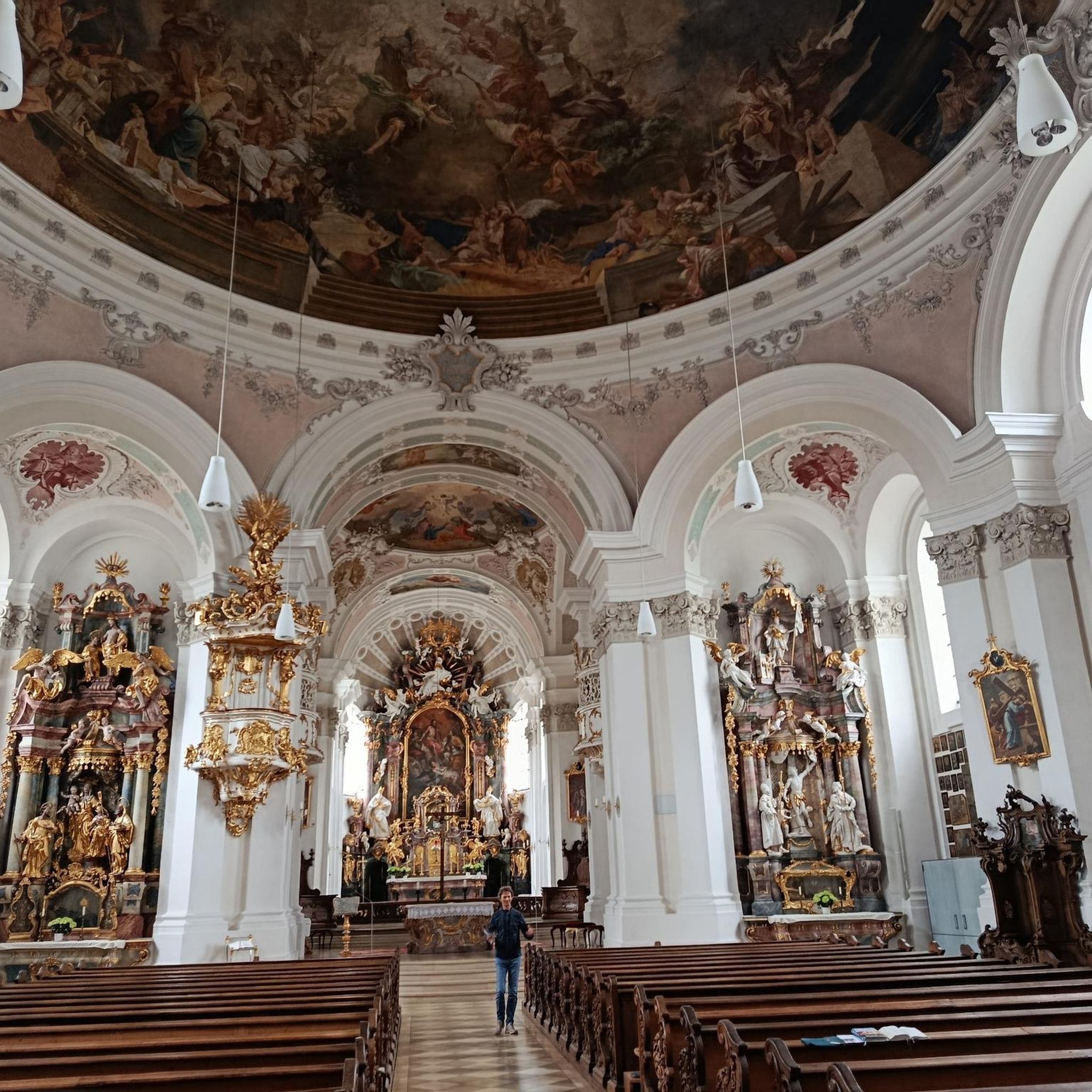
Built at the end of the 12th century, the church belonged to the former diocese of Saintes. It has been restored several times, notably in the 15th century. Rectangular building with a straight chevet. A single nave with a ribbed vault. Sculpted column capitals. In the transept, a dome on pendentives. Chancel with a ribbed vault and a large 13th-century chevet window. On the north side of the chancel, a large pointed arch gives access to a ribbed vaulted chapel. The western façade dates from the 13th century, with a pointed arch portal with three arches on round columns. Two chamfered pilasters separate the portal from the blind doors and rise to the top of the façade. Above this ground floor and set back are three pointed arch arcades with sculpted figures (seated Virgin, shepherds guided by an angel, three wise men). On each side, twin arcades with pointed arches with heads, fantastic animals, diamond points and crockets. On the transept rises a square bell tower.
0
0

very varied and pleasant hike
0
0

Far from the high Alpine passes, here is a small climb in the Sarthe countryside. On the program, 1.8 kilometers at an average of 4.5% coming from Montreuil-le-Chétif, or 2.1 kilometers at an average of 5.2% from Pezé-le-Robert.
3
0

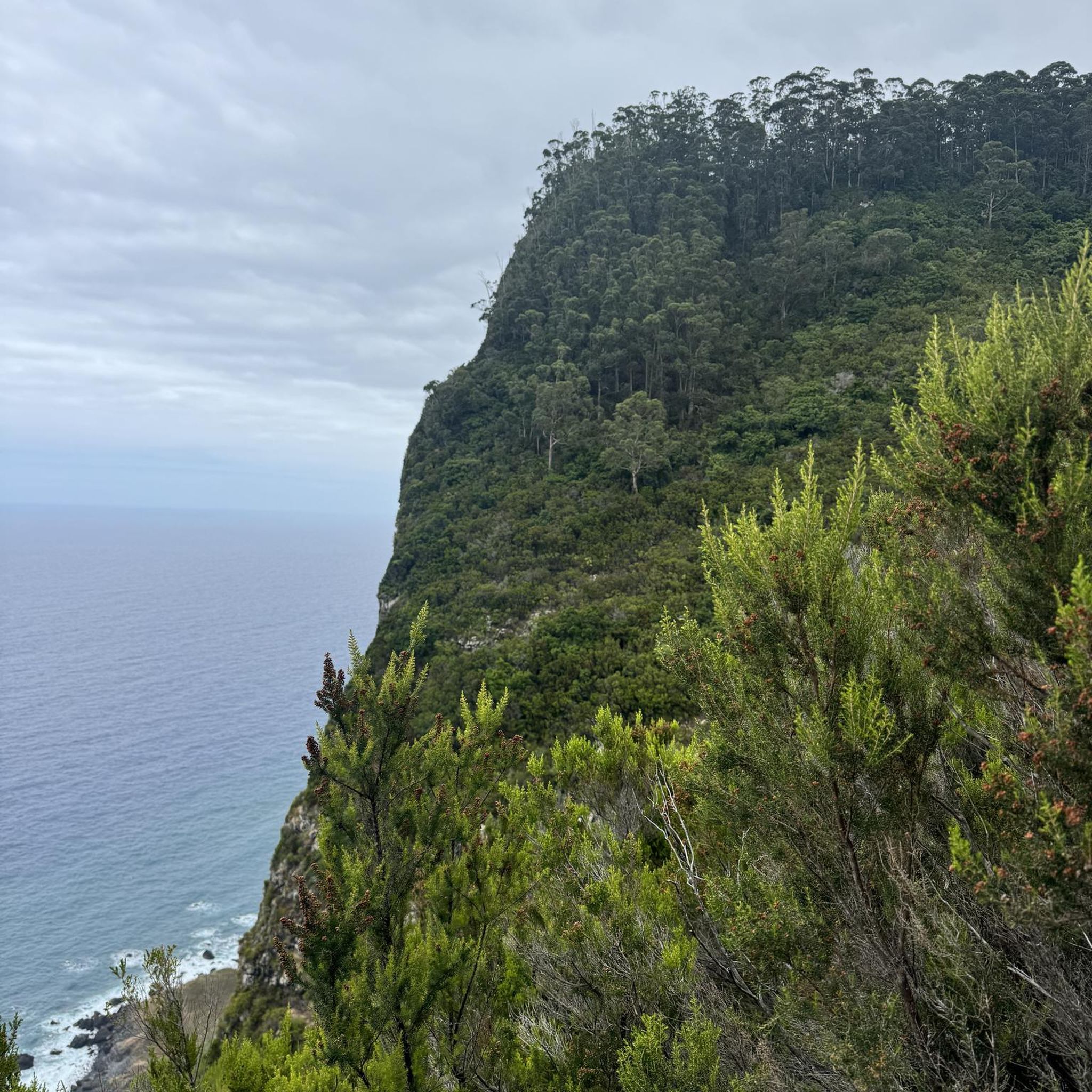
Beautiful 360 degree view
1
0
The Chapitrel is the name given to the entrance gate. The period door is in the Renaissance style. This construction had several functions: It was reserved for catechumens who were not allowed to enter the church and served as a warehouse for farmers who sold at the market on Sunday mornings. The saddleback tower dates from 1545. It is 28 m high. It is square and has four levels. Each floor is separated by an external Roussard belt called a "larmier" which overhangs quite widely, preventing water from running off. At the top of the roof are two granite crosses, each topped with a copper weather vane representing a crowned dragon's head.
0
0
Saint-Martin Chapel. It dates from the 12th or 13th century. It is made of granite, roussard sandstone and brick. This small chapel is lost in the middle of the fields. It is a simple rectangular nave which has a Romanesque window at its chevet.
0
0
Frequently Asked Questions
What kind of terrain can I expect on road cycling routes around Coulombiers?
The road cycling routes around Coulombiers, located in the Vienne department, feature a landscape of rolling plains and wooded areas. You'll encounter a gently undulating profile, with altitudes generally ranging from 127m to 156m. The region includes the Forêt de l'Épine, a 600-hectare forest, offering varied routes across silty soils on the plateaus of the Poitou threshold.
Are there road cycling routes suitable for beginners in Coulombiers?
Yes, Coulombiers offers a good range of routes for various skill levels. Out of approximately 30 road cycling routes, 7 are classified as easy, making them suitable for beginners or those looking for a more relaxed ride. Additionally, there are 15 moderate routes if you're ready for a slightly greater challenge.
What do other road cyclists enjoy most about road cycling in Coulombiers?
The road cycling experience in Coulombiers is highly rated by the komoot community, with an average score of 4.4 stars from over 22 reviews. Cyclists often praise the varied terrain, which includes rolling plains and wooded areas, and the options available for different ability levels, from moderate to difficult routes.
Are there any challenging road cycling routes for experienced riders?
Absolutely. For experienced road cyclists seeking a challenge, Coulombiers offers 8 difficult routes. One notable option is the Col de la Source – Saint-Cénéri-le-Gérei loop from La Hutte - Coulombiers, a 120 km trail with significant elevation gain, typically taking nearly 6 hours to complete. Another demanding route is the Fresnay-sur-Sarthe Castle – Saint-Cénéri-le-Gérei loop from La Hutte - Coulombiers, covering over 126 km with more than 1700 meters of ascent.
What kind of landmarks or attractions can I see along the road cycling routes?
While cycling around Coulombiers, you can explore several interesting landmarks. Consider routes that pass near historical sites like the Château de Fresnay-sur-Sarthe or the Saint Mathurin Gate and Chapel. You might also encounter the Beaumont-sur-Sarthe Roman Bridge, adding a touch of history to your ride.
How long are the road cycling routes around Coulombiers?
The road cycling routes around Coulombiers vary significantly in length. You can find shorter, more accessible rides, as well as longer, more challenging excursions. For example, the Castle of the Dukes of Alençon – Saint-Cénéri-le-Gérei loop from La Hutte - Coulombiers is about 72 km, while the Col de la Source – Saint-Cénéri-le-Gérei loop from La Hutte - Coulombiers extends to nearly 120 km.
What is the best time of year for road biking in Coulombiers?
Given the region's generally mild climate, road biking in Coulombiers is enjoyable for much of the year. Spring and autumn offer pleasant temperatures and beautiful scenery, making them ideal. Summer can also be great, though it's advisable to start earlier in the day to avoid the midday heat. Winter cycling is possible, but be prepared for cooler temperatures and potentially wet conditions.
Are there any routes that pass through the Forêt de l'Épine?
Yes, the Forêt de l'Épine is a significant natural feature in the region, covering 600 hectares. Many road cycling routes are designed to traverse or pass near this forest, allowing cyclists to enjoy its varied landscapes and small ponds. These routes often provide a refreshing change of scenery from the open plains.
Can I find moderate difficulty road cycling routes in Coulombiers?
Yes, moderate routes are the most common type available. There are 15 moderate road cycling routes around Coulombiers, offering a balanced challenge for those with some cycling experience. An example is the Saint-Cénéri-le-Gérei – Saint-Léonard-des-Bois loop from La Hutte - Coulombiers, which is about 90 km long with over 800 meters of ascent.
What are the typical elevation gains on road cycling routes in Coulombiers?
Elevation gains vary significantly depending on the route's length and difficulty. While the region has a gently undulating profile, some routes feature substantial ascents. For instance, a moderate route like the Saint-Cénéri-le-Gérei – Saint-Léonard-des-Bois loop from La Hutte - Coulombiers has over 800 meters of ascent, while a difficult one like the Col de la Source – Saint-Cénéri-le-Gérei loop from La Hutte - Coulombiers can involve over 1600 meters of climbing.
Are there any specific points of interest related to local culture or history?
Beyond the natural beauty, the region offers glimpses into its history. While cycling, you might pass through charming settlements like René, or discover historical structures such as Les Halles de René, which provide a sense of the local heritage and architecture.
Most popular attractions around Coulombiers

Get inspired with the komoot mobile app


Explore more
Browse the best Road cycling routes in other regions.
