The best walks and hikes around La Prétière
4.5
(21)
127
hikers
23
hikes
Hiking around La Prétière offers exploration within the Doubs department of eastern France, characterized by its extensive forested areas. The region features varied terrain, including river valleys and plateaus, providing a natural setting for outdoor activities. La Prétière is situated within the broader Doubs Baumois area, which includes a network of marked trails traversing diverse landscapes. This environment supports a range of hiking experiences, from gentle strolls to more challenging routes.
Best hiking trails around La Prétière
- The most popular…
Last updated: July 6, 2026
3.8
(5)
19
hikers
7.41km
01:56
60m
60m
Easy hike. Great for any fitness level. Easily-accessible paths. Suitable for all skill levels.
4.0
(4)
5
hikers
Moderate hike. Good fitness required. Easily-accessible paths. Suitable for all skill levels.

Sign up for free
12
hikers
8.93km
02:17
30m
30m
Moderate hike. Good fitness required. Easily-accessible paths. Suitable for all skill levels.
2
hikers
14.5km
03:58
230m
230m
Moderate hike. Good fitness required. Easily-accessible paths. Suitable for all skill levels.
4.0
(1)
3
hikers
11.9km
03:21
240m
240m
Moderate hike. Good fitness required. Easily-accessible paths. Suitable for all skill levels.
Get access to more routes and recommendations from other explorers.
Sign up for free
Already have an account?
Our route recommendations are based on thousands of hikes, rides, and runs completed by other people on komoot.
Start today with a free account
Your next adventure awaits.
Login or Signup


Tips from the Community

Very beautiful cave to see at the bend in the main path near Villers sous Saulnot
0
0

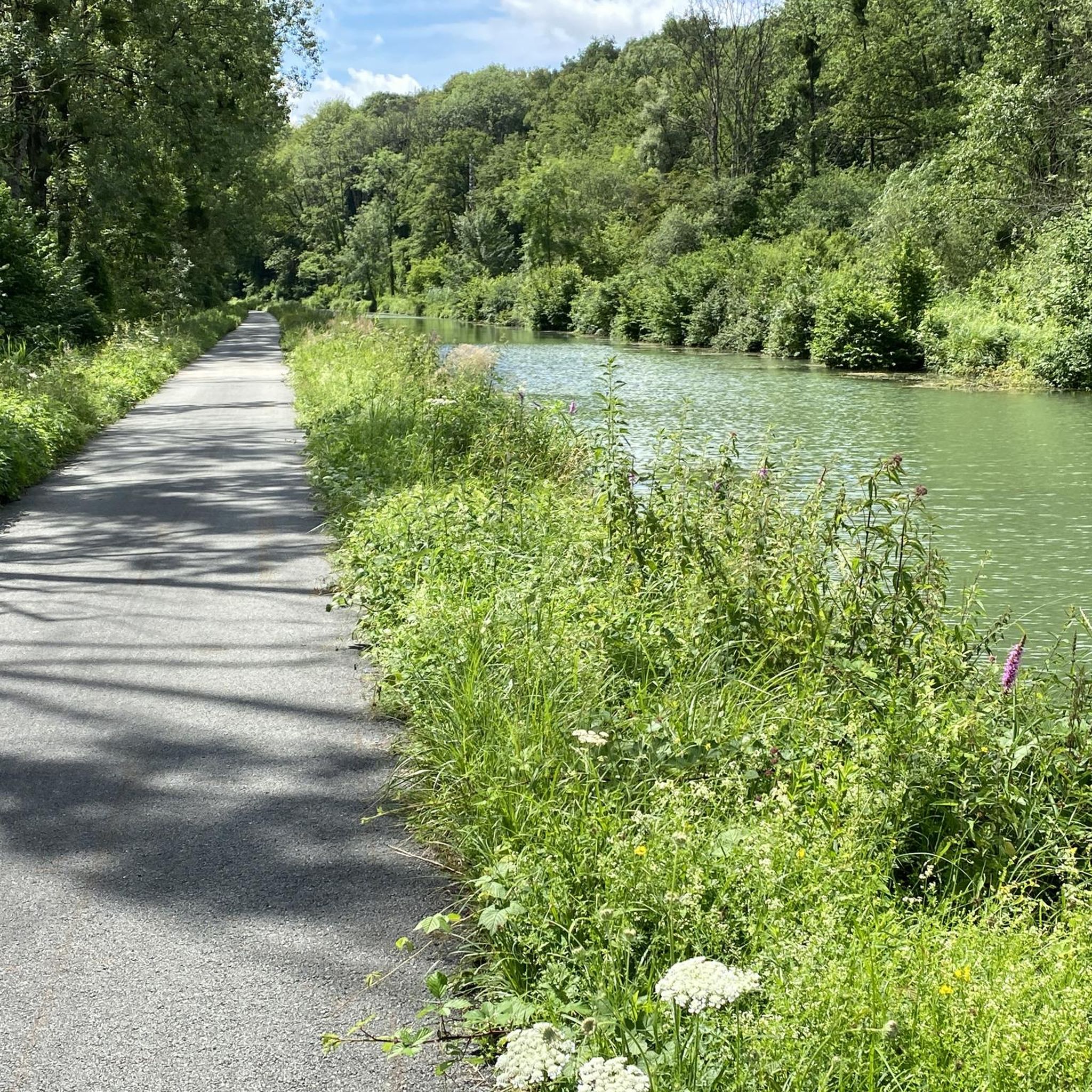
The banks of the Doubs are a wonderful place for a bike ride. At this loop, the river is paralleled by the pretty Rhone-Rhine canal.
2
0

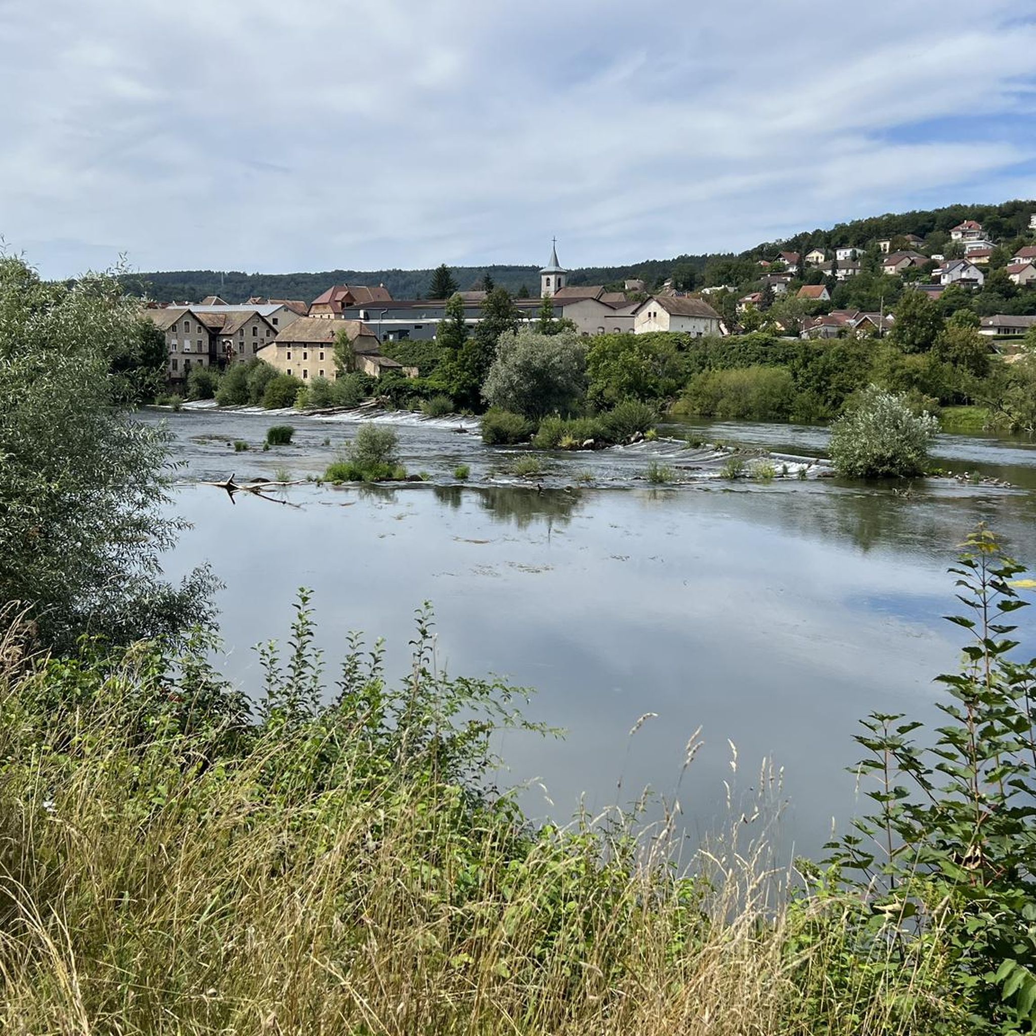
Quaint view across the old canal locks in this historic town on the Doubs river.
1
1

If you're looking for a peaceful, scenic hike in the countryside, you can visit the Étang des Princes, a series of ponds that were once part of the Duchy of Montbéliard. You can admire the changing colors of the trees and the reflections of the water as you walk around the ponds.
2
1
The St Julien washhouse is a historic fountain-washhouse-watering trough, located in the center of the village of Saint-Julien-Lès-Montbéliard. You will be able to admire the architecture and history of this site which dates back to the 12th century. You can also enjoy the greenery and old stones of the village, which has a temple on the heights and a rural charm.
2
1

Nice little place sm bike path.
2
0


The cave is now called Réseau de la Sapoise.
0
1
Frequently Asked Questions
How many hiking trails are available around La Prétière?
The region around La Prétière offers a good selection of routes, with over 20 hiking trails available. These range from easy strolls to more challenging excursions, catering to various fitness levels.
What kind of landscapes can I expect to see while hiking near La Prétière?
Hiking around La Prétière means exploring diverse landscapes. You'll find extensive forested areas, river valleys, and plateaus. The broader Doubs Baumois area, where La Prétière is located, features a network of trails traversing valleys, ridges, and charming small villages, offering a balance of natural beauty.
What do other hikers enjoy most about the trails in La Prétière?
The trails in La Prétière are highly rated by the komoot community, with an average score of 4.3 stars. Hikers often praise the varied terrain, the quiet forested surroundings, and the picturesque river valleys, making for enjoyable outdoor experiences.
Are there easy hiking trails suitable for beginners or casual walkers?
Yes, there are plenty of easy options. About 14 of the available routes are classified as easy. An example is the Lavoir de St Julien – Princes' Pond loop from Sainte-Marie, which is 7.4 km long and takes about 2 hours to complete, passing through forests and by water features.
Can I find more challenging hikes around La Prétière?
While most routes are easy to moderate, there are a couple of more challenging trails for those seeking a greater workout. The broader Doubs Baumois area also offers more strenuous athletic endeavors within its extensive network of marked trails.
Are there any circular hiking routes in the area?
Yes, many of the trails around La Prétière are circular, allowing you to start and end at the same point. For instance, the Hiking loop from L'Isle-sur-le-Doubs is a moderate 10.3 km circular path exploring the local landscape.
Are there any notable natural attractions or landmarks to see on the trails?
Yes, the region offers several points of interest. You can explore the Gonvillars Cave, or visit L'Isle-sur-le-Doubs, a nearby settlement. Many trails also feature the Doubs River and the Princes' Pond.
Can I find hikes with good viewpoints in the region?
Yes, the area offers scenic views. Trails like 'La Roche du Châtelard' near Lanthenans provide views over the Lomont and the Doubs Valley. Further afield in the Haut-Doubs region, Mont d'Or offers breathtaking panoramic views, including distant glimpses of the Alps.
Are there any trails that follow rivers or pass by water features?
Absolutely. The presence of the Doubs River is a recurring feature in the region's hiking. The L'Isle-sur-le-Doubs Lock – Le Doubs loop, for example, leads along the Doubs River. You'll also find routes passing by the Princes' Pond.
What are the nearest towns with amenities for hikers?
For amenities, you can head to nearby towns like L'Isle-sur-le-Doubs or Baume-les-Dames. These towns offer cafes, pubs, and accommodation options, providing convenient stops before or after your hike.
Is public transport available to reach hiking starting points?
While La Prétière itself is a small commune, public transport options may be available to larger nearby towns like L'Isle-sur-le-Doubs or Baume-les-Dames. From there, you might need to arrange local transport or start your hike directly.
Are the hiking trails around La Prétière suitable for families with children?
Yes, many trails are suitable for families. The region offers routes ranging from easy strolls to more moderate paths, with several family-friendly walks available within the extensive network of marked trails in the Doubs Baumois area.
What is the best time of year to hike in La Prétière?
The region is enjoyable for hiking throughout much of the year. Spring and autumn offer pleasant temperatures and beautiful foliage, while summer provides warm weather for exploring. Winter hiking is also possible, especially in the forested areas, but requires appropriate gear.
Most popular routes around La Prétière
Most popular attractions around La Prétière

Get inspired with the komoot mobile app


Explore more
Browse the best Hikes in other regions.
