The best walks and hikes around Sainte-Hélène-Sur-Isère
4.5
(251)
3,350
hikers
151
hikes
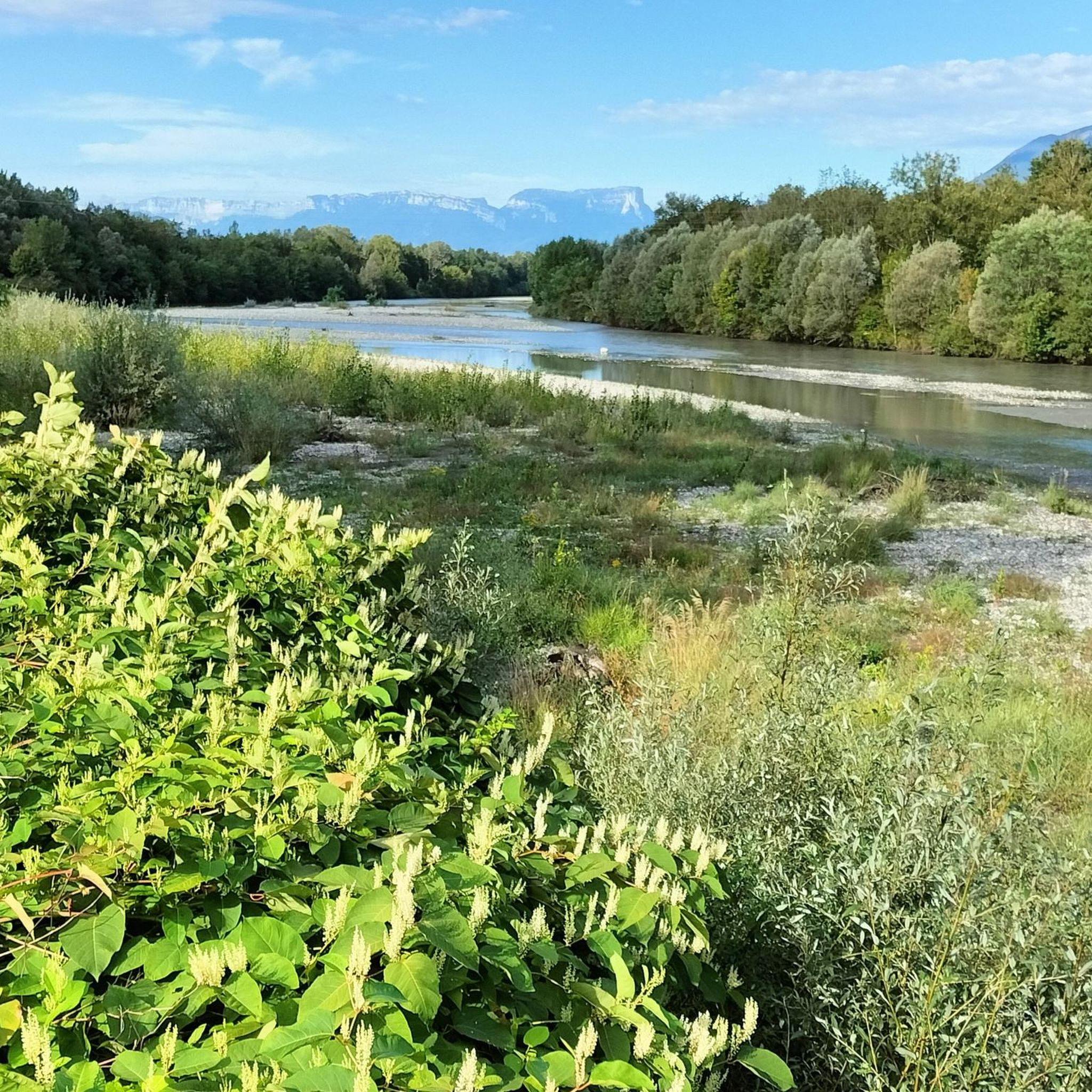
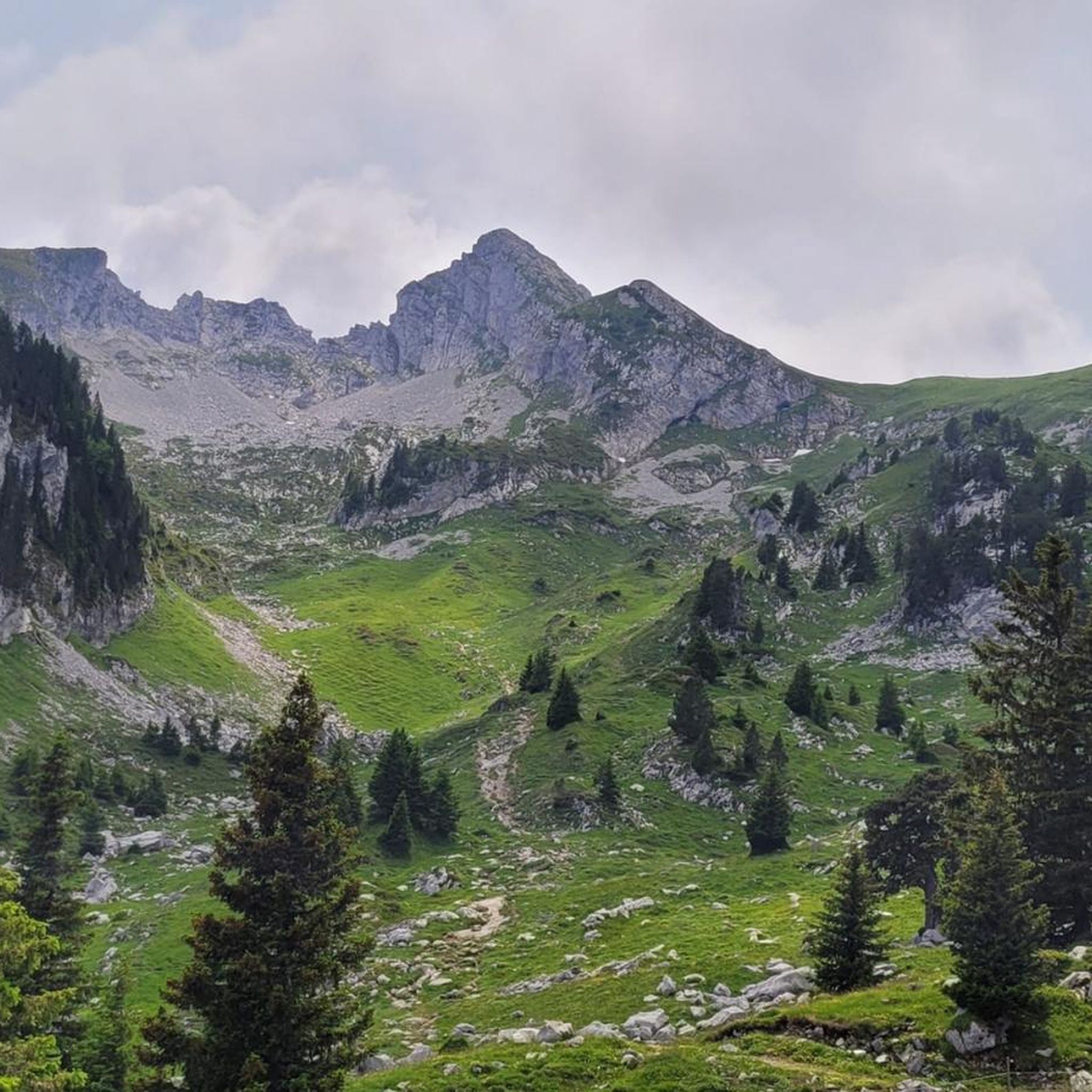
Hiking around Sainte-Hélène-Sur-Isère offers diverse terrain within the French Alps, ranging from 300 meters in the village to 2200 meters in the mountains. The region is characterized by majestic peaks, lush forests, and the winding Isère River. Hikers can explore expansive alpine pastures and encounter serene altitude lakes, providing varied landscapes for outdoor activity.
Best hiking trails around Sainte-Hélène-Sur-Isère
- The most popular hiking route is Dent du Corbeau (2280 m) – Le Grand Arc loop from L'Ébaudiaz, a 9.6…
Last updated: October 18, 2026
4.0
(1)
23
hikers
5.74km
02:35
450m
450m
Hard hike. Good fitness required. Sure-footedness, sturdy shoes and alpine experience required.
5.0
(1)
7
hikers
Hard hike. Good fitness required. Sure-footedness, sturdy shoes and alpine experience required.

4
hikers
8.85km
04:22
710m
720m
Hard hike. Good fitness required. Sure-footedness, sturdy shoes and alpine experience required.
5.0
(1)
9
hikers
9.27km
04:26
690m
690m
Hard hike. Good fitness required. Sure-footedness, sturdy shoes and alpine experience required.
5.0
(1)
12
hikers
10.4km
05:58
1,170m
1,170m
Hard hike. Very good fitness required. Mostly accessible paths. Sure-footedness required.
Get access to more routes and recommendations from other explorers.
Already have an account?
Our route recommendations are based on thousands of hikes, rides, and runs completed by other people on komoot.
Start today with a free account
Your next adventure awaits.
Popular around Sainte-Hélène-Sur-Isère

Tips from the Community

A superb cabin in an idyllic panorama. A stove will be there to warm you up. The cabin is super well equipped, with mattresses upstairs, kitchen utensils etc. It's really the ideal place to try a first night in a cabin in winter.
1
0

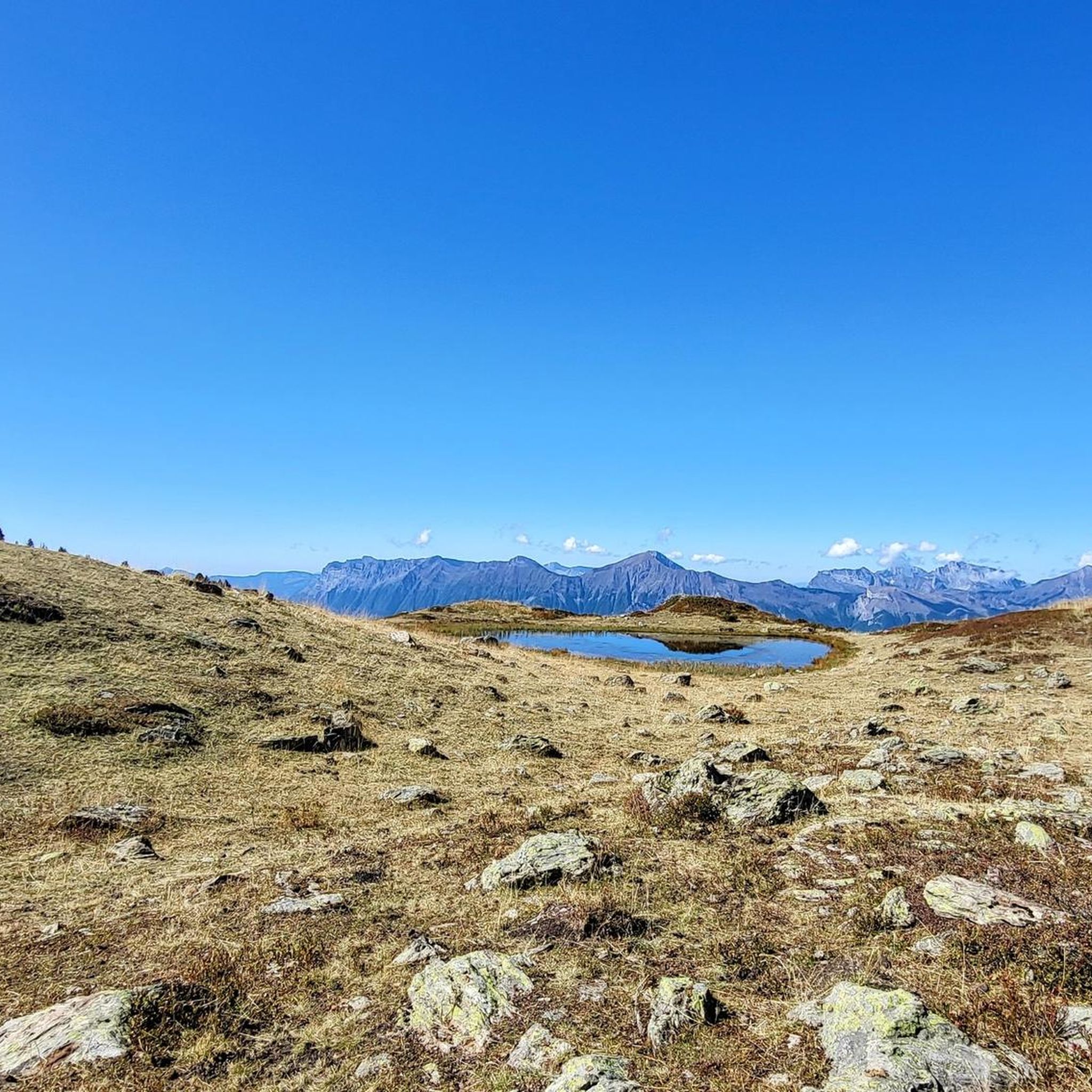
A small mountain lake with clear waters located near the Refuge de la Thuile.
0
0
The Grand Arc is located at 2,484 meters. From here there are splendid views of Mont Blanc, Vanoise and Bauges.
0
0


Magnificent ridge trail in the Lauzière massif
0
0

Refuge hut - Great place for a coffee stop in the middle of nowhere. Will do lunch but you need to phone ahead.
0
0
Great 360 degree views. West across the large open Valley towards Chambery. Brilliant views East/South East looking up towards the Vanoise and Courchevel with a clear sight of the Dent du Villard and Courchevel 1650 from a far.
0
0
Frequently Asked Questions
How many hiking trails are available in Sainte-Hélène-Sur-Isère?
Sainte-Hélène-Sur-Isère offers a wide selection of routes, with over 150 hiking trails to explore. These range from easier paths to challenging mountain ascents, catering to various fitness levels.
Are there hiking trails suitable for beginners or families in Sainte-Hélène-Sur-Isère?
Yes, the region provides options for all abilities. While many routes are challenging, there are approximately 33 easy trails perfect for beginners or family outings. The Sentier du Petit Mont Blanc, for example, is a family-friendly trail that meanders through lush forests and offers stunning views, taking about three hours to complete.
What kind of landscapes can I expect to see while hiking in this region?
Hikers in Sainte-Hélène-Sur-Isère will encounter diverse landscapes, from verdant forests and expansive alpine pastures to majestic mountain peaks. You can enjoy spectacular views of the Alps, including distant glimpses of Mont Blanc and Lac d'Annecy from higher points, as well as the winding Isère River and serene altitude lakes like Lac de Fontaine Claire.
Are there any circular hiking routes in Sainte-Hélène-Sur-Isère?
Yes, many routes in the area are circular, allowing you to start and end at the same point. Examples include the challenging Dent du Corbeau (2280 m) – Le Grand Arc loop from L'Ébaudiaz, or the slightly shorter Chalet de la Thuile – Dent du Corbeau (2280 m) loop from Massif du Grand Arc. The Saint-François Loop is another demanding circular option that passes through picturesque hamlets.
Can I bring my dog on the hiking trails around Sainte-Hélène-Sur-Isère?
While many trails in the French Alps are dog-friendly, it's always recommended to check specific route regulations, especially in protected areas or during certain seasons when livestock might be grazing in alpine pastures. Keep your dog on a leash to protect wildlife and respect other hikers.
What are some notable natural attractions or landmarks to look out for?
The region is rich in natural beauty and interesting landmarks. You might encounter features like Mont Pécloz with its distinct rock layers, or the challenging Col du Granier. Other points of interest include the Tamié Pass, Col d'Orgeval, and the serene La Belle-Étoile summit. The Notre-Dame de Tamié Abbey is also a significant cultural landmark nearby.
What do other hikers say about the trails in Sainte-Hélène-Sur-Isère?
The hiking routes in Sainte-Hélène-Sur-Isère are highly rated by the komoot community, with an average score of 4.6 stars from over 240 reviews. Hikers often praise the stunning panoramic views, the diverse terrain, and the opportunity to explore both lush forests and high alpine environments.
Are there any challenging hikes for experienced trekkers?
Absolutely. Sainte-Hélène-Sur-Isère is an excellent base for experienced hikers seeking a challenge. Many routes, particularly those ascending into the Grand Arc massif, are rated as difficult. For instance, the Dent du Corbeau (2280 m) – Le Grand Arc loop from L'Ébaudiaz involves significant elevation gain and high mountain terrain, taking over 7 hours to complete.
What is the best time of year to go hiking in Sainte-Hélène-Sur-Isère?
The best time for hiking typically spans from late spring to early autumn (May to October). During these months, the weather is generally milder, and the alpine pastures are lush. Higher altitude trails might still have snow in early spring, and autumn offers beautiful foliage. Always check local weather conditions before heading out.
Are there opportunities for multi-day hikes or exploring alpine pastures?
Yes, the region is ideal for exploring extensive alpine pastures. The Paths of the La Thuile Mountain Pasture allow you to discover areas with rich flora and ridge paths offering breathtaking views of the Bauges and Grand Arc massifs. These routes can include airy passages and reach points like the summit of La Thuile (2240m) and Col de Charvan (2160m), making them suitable for longer excursions.
Is parking available at the trailheads in Sainte-Hélène-Sur-Isère?
Parking availability varies by trailhead. Many popular starting points, especially for routes leading into the Grand Arc massif or from villages like L'Ébaudiaz, typically have designated parking areas. It's advisable to check specific route details on komoot for information on parking at your chosen trailhead.
Can I access hiking trails using public transport in Sainte-Hélène-Sur-Isère?
While Sainte-Hélène-Sur-Isère is well-connected, direct public transport access to all trailheads can be limited, especially for more remote mountain routes. It's best to research local bus services or consider carpooling for reaching specific starting points. The village itself serves as a good base, but a car often provides more flexibility for accessing diverse trails.
Most popular routes around Sainte-Hélène-Sur-Isère
Most popular attractions around Sainte-Hélène-Sur-Isère

Get inspired with the komoot mobile app


Explore more
Browse the best Hikes in other regions.
