The best running trails around Saint-Sorlin-D'Arves
4.6
(30)
2,346
runners
48
runs
Jogging routes around Saint-Sorlin-D'Arves traverse a diverse alpine landscape in the French Alps. The region is characterized by significant mountain passes like the Col de la Croix de Fer, high-altitude lakes such as Lac Bramant, and the varied terrain of the Arvan Valley. Running trails often feature substantial elevation changes, winding through meadows, sub-woods, and connecting traditional hamlets. This environment provides a range of running experiences, from challenging ascents to scenic loops with panoramic views of the Aiguilles d'Arves.
Best…
Last updated: October 18, 2026
99
runners
10.3km
01:19
250m
250m
Moderate run. Good fitness required. Mostly paved surfaces. Suitable for all skill levels.
4.5
(4)
99
runners
5.54km
01:00
350m
360m
Hard run. Very good fitness required. Sure-footedness, sturdy shoes and alpine experience required.

5.0
(1)
69
runners
14.8km
01:54
600m
600m
Hard run. Very good fitness required. Sure-footedness, sturdy shoes and alpine experience required.
137
runners
22.2km
03:55
1,450m
1,440m
Hard run. Very good fitness required. Sure-footedness, sturdy shoes and alpine experience required.
55
runners
37.9km
06:23
2,510m
2,510m
Hard run. Very good fitness required. Sure-footedness, sturdy shoes and alpine experience required.
Get access to more routes and recommendations from other explorers.
Already have an account?
Our route recommendations are based on thousands of hikes, rides, and runs completed by other people on komoot.
Start today with a free account
Your next adventure awaits.
Popular around Saint-Sorlin-D'Arves

Écrins, Belledonne and Vercors – HexaTrek, Hautes-Alpes

Legendary passes of the Tour de France
Hiking around Saint-Sorlin-D'Arves
Road Cycling Routes around Saint-Sorlin-D'Arves
Cycling around Saint-Sorlin-D'Arves
MTB Trails around Saint-Sorlin-D'Arves

Mountain Hikes around Saint-Sorlin-D'Arves
Gravel biking around Saint-Sorlin-D'Arves
Other adventures around Saint-Sorlin-D'Arves


Tips from the Community

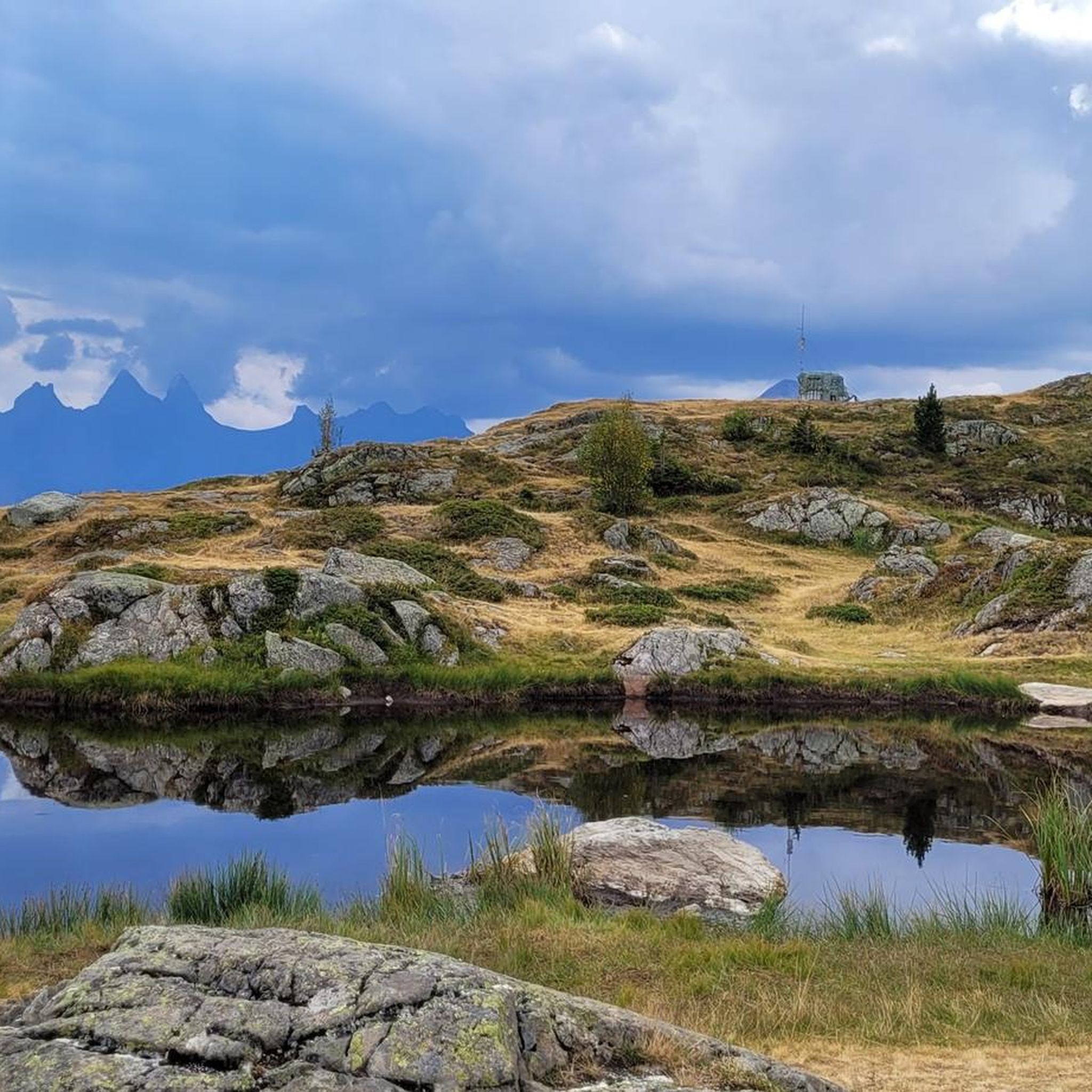
Superb view of the lake of Laitelet and the Aiguilles d'Arves during the ascent of the Col de la Croix de Fer.
0
0


The Col de la Croix de Fer culminates at an altitude of 2063 meters. It is the big neighbor of the Col du Glandon, another crossing point between the Maurienne and Oisans valleys. The Tour de France has used this pass 21 times. It is one of the most beautiful in France, a must-visit point for any mountain-loving cyclist!
1
0

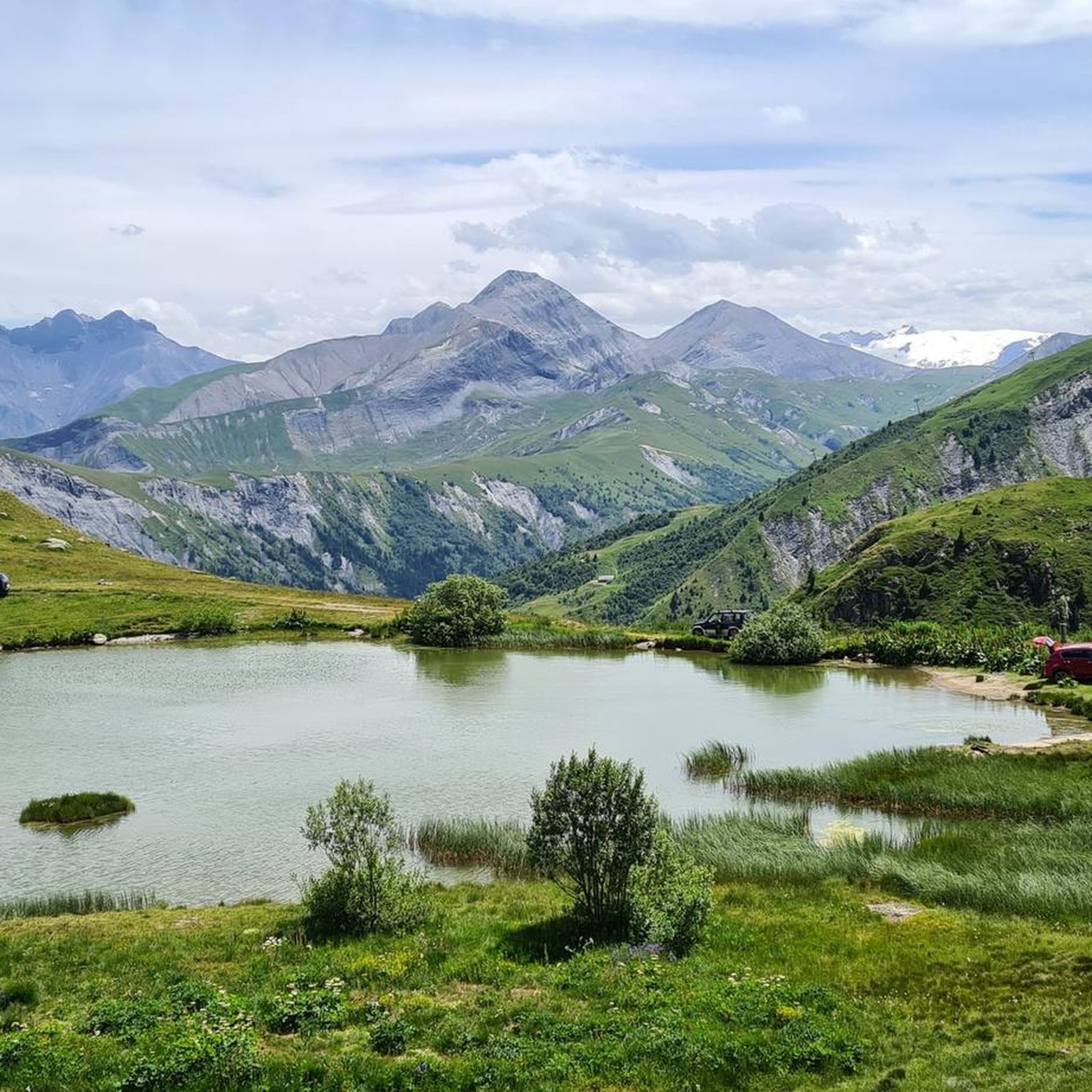
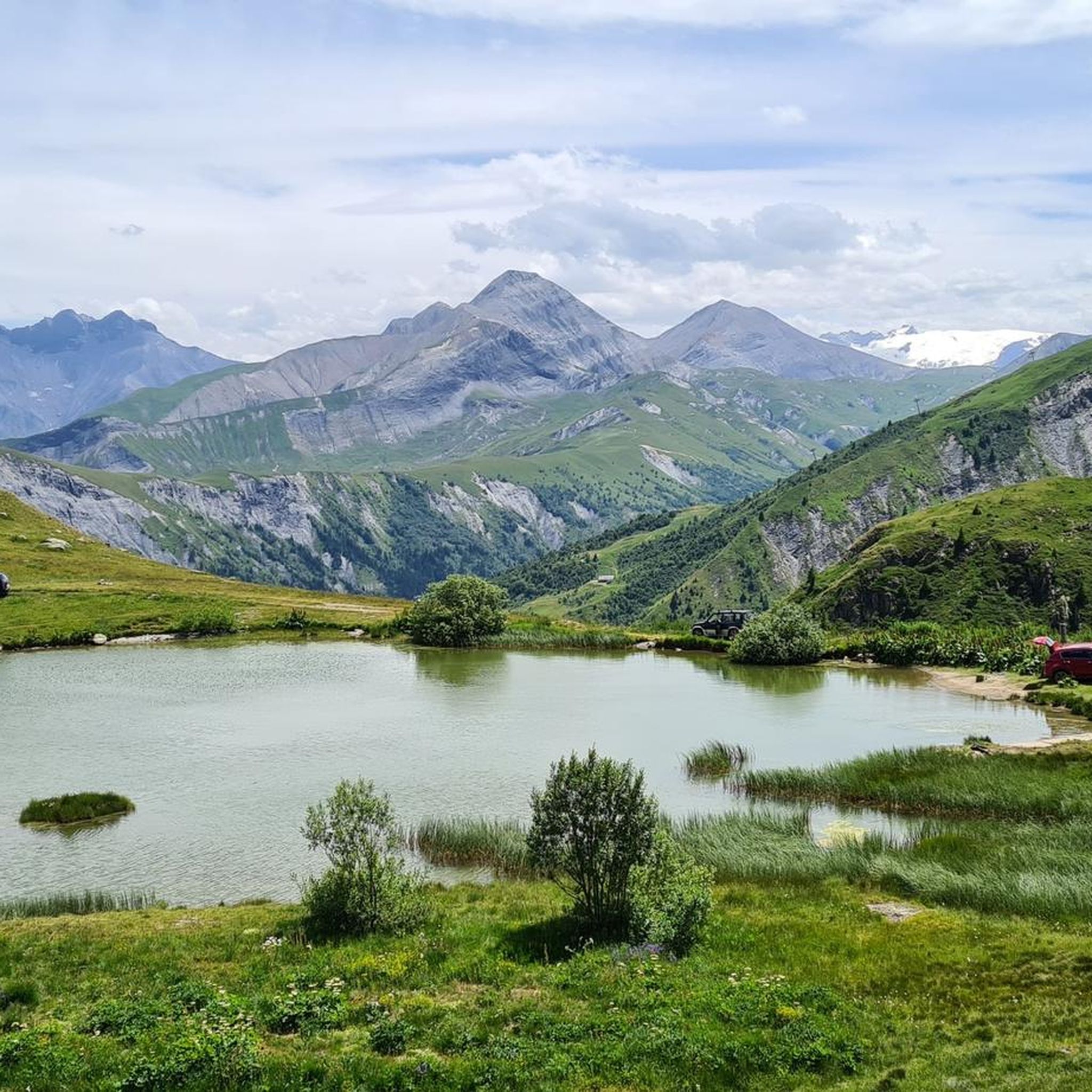
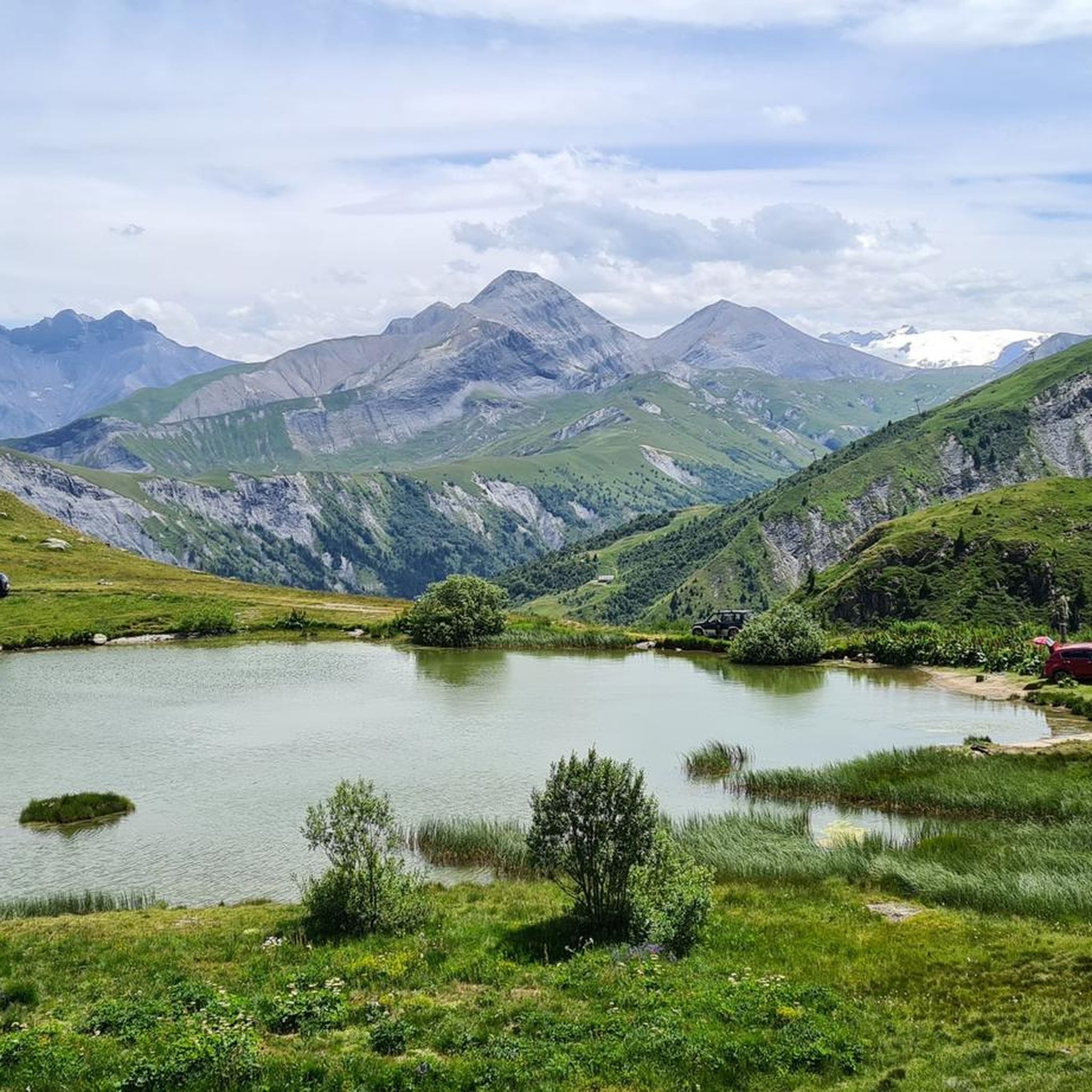
The Grand Lac or Lac Bramant is a natural lake enhanced by small structures. The relatively easy access, the large size and the presence of 4 species of fish from the salmonid family make it a must in Savoie.
0
0

Beautiful lake with an amazing view of the valley below. Good spot for a picnic (however there is no shade).
0
0

There are three different ways to climb to the top of the Col de la Croix de Fer. The most famous is the climb from the Verney dam in the Oisans valley, because it is the slope used in the Marmotte (except the last kilometers). It is 27.5 kilometers long with an elevation gain of 1292 meters. The average slope is 4.7% with maximum slopes of 11.1%. The Col de la Croix de Fer from Saint-Jean-de-Maurienne is 28.2 kilometers with an elevation gain of 1475 meters. The average gradient is 5.23% with maximum gradients of 9.6% The final ascent is via the Col du Glandon. After the summit of Glandon it remains approximately 2 kilometers to the summit.
6
1

The refuge is managed by the French Federation of Alpine and Mountain Clubs. You can find running water, cooking equipment, toilets, duvets, and a catering service... And a magnificent setting! For more information, you can visit the refuge website https://refugedeletendard.ffcam.fr/
2
0
Frequently Asked Questions
How many running trails are available in Saint-Sorlin-D'Arves?
Saint-Sorlin-D'Arves offers a wide network of over 35 dedicated running trails. The region is part of the "Espace Trail Pays des Aiguilles d'Arves," which boasts nearly 400 kilometers of marked routes, catering to various fitness levels.
What kind of terrain can I expect on running routes in Saint-Sorlin-D'Arves?
You can expect a diverse alpine landscape. Trails often traverse significant mountain passes like the Col de la Croix de Fer, wind through high-altitude lakes such as Lac Bramant, and explore the varied terrain of the Arvan Valley. Routes frequently feature substantial elevation changes, passing through meadows, sub-woods, and connecting traditional hamlets.
Are there running routes suitable for beginners or those looking for an easier run?
While many routes in Saint-Sorlin-D'Arves are considered difficult due to significant elevation, there are options for moderate runs. The broader "Espace Trail Pays des Aiguilles d'Arves" network includes trails for various fitness levels, so it's possible to find less strenuous options, though dedicated easy jogging routes are fewer.
What do other runners say about the trails in Saint-Sorlin-D'Arves?
The running routes in Saint-Sorlin-D'Arves are highly rated by the komoot community, with an average score of 4.5 stars from over 16 reviews. More than 1600 runners have used komoot to explore the varied terrain, often praising the challenging ascents and dramatic alpine scenery.
Can I find circular running routes in the area?
Yes, many running routes in Saint-Sorlin-D'Arves are designed as loops, offering a complete experience without retracing your steps. An example is the challenging Col de la Croix de Fer – Lac du Laitelet loop from Saint-Sorlin-d'Arves, which covers about 11.4 kilometers.
Are there running trails that pass by lakes or offer scenic views?
Absolutely. The region is known for its high-altitude lakes and panoramic vistas. The Lac Belan – Grand Lac Bramant loop from Saint-Sorlin-d'Arves is an extensive route that incorporates these beautiful alpine lakes. Many trails also offer exceptional panoramas, including views of the Aiguilles d'Arves and Mont-Blanc, especially from ridge lines overlooking the stations.
Are there any waterfalls I can see along the running routes?
Yes, the region features several beautiful waterfalls that can be incorporated into or viewed from running routes. Notable waterfalls include Cascade de la Fare, Pissou Waterfall, and La Fare Waterfall. These natural features add to the scenic beauty of your run.
Are the running routes in Saint-Sorlin-D'Arves suitable for families?
While many routes are challenging, the region offers varied terrain. For a lighter option that families might enjoy, consider the edutainment route "In the Footsteps of Sorlinette." This playful and thematic walk allows visitors to discover pastures and the Beaufort cheese industry, offering an interactive experience that could be suitable for a gentle jog or walk with children.
Can I find running routes with significant elevation gain for a challenge?
Saint-Sorlin-D'Arves is ideal for challenging runs with substantial elevation. The region is renowned for its mountain passes, which are excellent for experienced joggers. For example, the Pointe de L'Ouillon – Col de la Croix-de-Fer loop from Saint-Sorlin-d'Arves features over 1400 meters of elevation gain over 20 kilometers.
Are there any specific landmarks or points of interest near the running trails?
Beyond the natural beauty, you can encounter several notable landmarks. The Col de la Croix de Fer is a prominent mountain pass, frequently part of the Tour de France. The Chalet at Col du Glandon is another point of interest in the vicinity. Running through the Arvan Valley also offers glimpses of traditional village life in the 14 hamlets that make up Saint-Sorlin-D'Arves.
What is the best time of year to go running in Saint-Sorlin-D'Arves?
The best time for running is typically during the warmer months when the mountain passes are clear of snow and trails are fully accessible. While prepared winter walks exist, snow conditions can make many trails unsuitable for jogging. Summer and early autumn offer the most favorable conditions to enjoy the diverse alpine landscape.
Are there any long-distance running options available?
Yes, Saint-Sorlin-D'Arves offers several extensive routes for long-distance runners. The Lac Belan – Grand Lac Bramant loop from Saint-Sorlin-d'Arves is a difficult 23.7-kilometer path, perfect for those seeking a longer challenge with dramatic alpine scenery.
Most popular routes around Saint-Sorlin-D'Arves
Most popular attractions around Saint-Sorlin-D'Arves

Get inspired with the komoot mobile app


Explore more
Browse the best Running Trails & Routes in other regions.
