The best walks and hikes around Mazeirat
4.5
(95)
830
hikers
68
hikes
Hiking around Mazeirat offers diverse landscapes within the Creuse department of Nouvelle-Aquitaine, France. The region is characterized by the Creuse river valley, with elevations ranging from 330 to 459 meters. The terrain features a mix of agricultural prairies, covering nearly half the land, and significant forest areas, providing varied environments for exploration. This blend of open fields and woodlands creates a serene setting for hikers.
Best hiking trails around Mazeirat
- The most popular hiking route is Nice view of fort.…
Last updated: July 1, 2026
4.4
(8)
52
hikers
6.93km
02:03
210m
210m
Moderate hike. Good fitness required. Easily-accessible paths. Suitable for all skill levels.
4.8
(4)
37
hikers
Moderate hike. Good fitness required. Easily-accessible paths. Suitable for all skill levels.

Sign up for free
4.4
(5)
23
hikers
10.7km
02:59
190m
190m
Moderate hike. Good fitness required. Easily-accessible paths. Suitable for all skill levels.
4.5
(4)
22
hikers
10.8km
02:58
180m
180m
Moderate hike. Good fitness required. Easily-accessible paths. Suitable for all skill levels.
5.0
(2)
35
hikers
7.53km
02:13
210m
210m
Moderate hike. Good fitness required. Easily-accessible paths. Suitable for all skill levels.
Get access to more routes and recommendations from other explorers.
Sign up for free
Already have an account?
Our route recommendations are based on thousands of hikes, rides, and runs completed by other people on komoot.
Start today with a free account
Your next adventure awaits.
Login or Signup


Tips from the Community


Located in the heart of the Chabrières forest, this animal park is dedicated to the wolf. It accommodates around forty specimens in semi-freedom in its natural space.
0
0
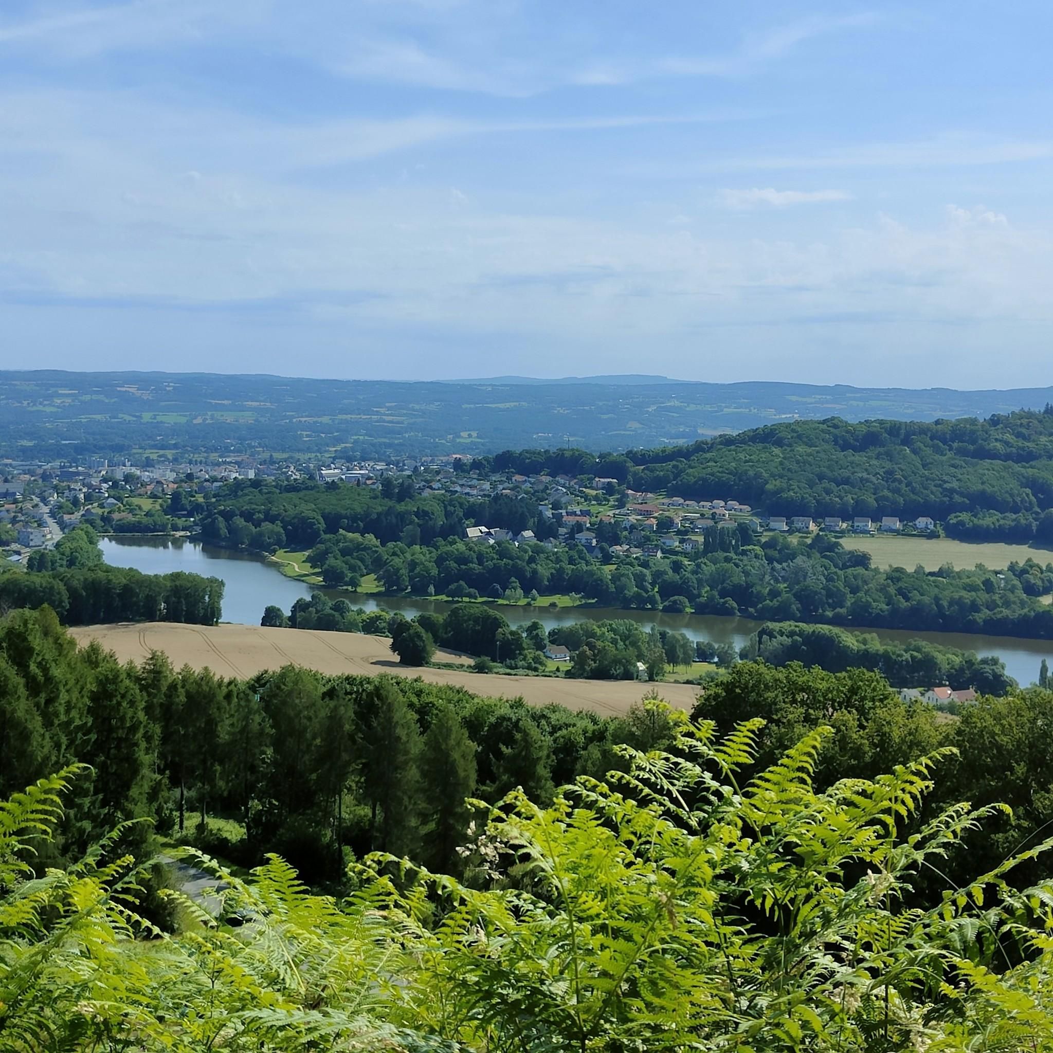
The historic character of the place makes Puy Gaudy unique. Inhabited since prehistoric times, the puy offers a strategic position. Today there are still some traces of the oppidum, notably the ruins of a mill and granite sarcophagi. Another interest, the splendid 360 degree view rewards the effort made to climb up here.
0
0

The view from this Puy is fantastic and thanks to the arc of vision you will know what you are looking at.
3
0

Shortened course, to do in full, because convinced that there are still things to discover.
0
0
In the town of Guéret 23000. Possibility of access by car at the start. Take the path for 300m. The remains of the medieval Mill first, the Neolithic Dolmen and the Necropolis. On the return, the orientation table with a superb view of the Guéretoise countryside. google.com/search?q=oppidum+du+puy+de+gaudy&tbm=isch&ved=2ahUKEwjsxbWVnMb3AhUaAmMBHQISBroQ2-cCegQIABAA&oq=oppidum+du+puy+de+gaudy&gs_lcp=CgNpbWcQARgBMgcIIxDvAxAnMgcIIxDvAxAnUABYAGDFF2gAcAB4AIABMogBMpIBATGYAQCqAQtnd3Mtd2l6LWltZ8ABAQ&sclient=img&ei=uKNyYuyJHJqEjLsPgqSY0As&bih=835&biw=1078&rlz=1C1CHBD_frFR877FR878
0
0

Woods, paths and roads What a foot
0
0
Frequently Asked Questions
What kind of landscapes can I expect to see while hiking around Mazeirat?
The region around Mazeirat is characterized by the picturesque Creuse river valley. You'll find a diverse mix of agricultural prairies, covering nearly half the land, alongside significant forest areas. The elevation ranges from 330 to 459 meters, offering varied topography for exploration, from serene open fields to tranquil woodlands.
How many hiking routes are available in the Mazeirat area?
There are over 60 hiking routes available around Mazeirat, catering to various preferences and fitness levels. This includes a good mix of easy, moderate, and challenging trails.
What are the difficulty levels of the hiking trails around Mazeirat?
The trails around Mazeirat offer a range of difficulties. You'll find approximately 28 easy strolls, 31 moderate hikes, and 5 more difficult routes, ensuring options for all experience levels.
Are there any family-friendly hiking options in Mazeirat?
Yes, there are several easy trails suitable for families. For example, The Roman Bridge loop from Moutier-d'Ahun is an easy 3.1 km route that takes just over an hour, perfect for a leisurely family walk.
What historical sites or landmarks can I discover on hikes near Mazeirat?
Hikers can encounter several historical and natural landmarks. The region features the ruins of Bear Castle, offering panoramic views, and the 12th-century church within Mazeirat. You might also pass by the Château de Sainte-Feyre or the impressive Glénic Viaduct.
Are there any circular hiking routes around Mazeirat?
Yes, many of the trails around Mazeirat are circular, allowing you to start and end at the same point. An example is the Wolves of Chabrières – Chabriere loop from Sainte-Feyre, a moderate 8.8 km route that takes about 2 hours 30 minutes.
What do other hikers say about the trails in Mazeirat?
The hiking trails around Mazeirat are highly regarded by the komoot community, with an average rating of 4.3 stars from over 70 reviews. Hikers often praise the varied terrain, from open fields to forested sections, and the scenic river views.
Are there any specific viewpoints or natural features to look out for?
Absolutely. The region is known for its scenic river valleys, particularly along the Creuse river. The Puy du Gaudy offers elevated perspectives, and the tranquil Courtille Pond provides a peaceful natural setting for walks.
Is there parking available at the trailheads around Mazeirat?
While specific parking details vary by trailhead, many routes in the region, especially those starting from villages like Félinas or Moutier-d'Ahun, typically have designated parking areas nearby. It's advisable to check the individual route details on komoot for the most precise information.
Can I reach hiking trailheads around Mazeirat using public transport?
Public transport options directly to every trailhead in the rural Mazeirat area may be limited. While some larger towns in the Creuse department are served by regional buses or trains, reaching specific, more remote trail starting points might require a car. For detailed information on public transport to specific locations, local tourist information centers can provide the best advice.
What is the longest hike available in the Mazeirat area?
One of the longer and more challenging options is the Puy du Gaudy – Wolves of Chabrières loop from Sainte-Feyre. This difficult trail spans 20.7 km and typically takes around 6 hours 7 minutes to complete, leading through diverse terrain with significant elevation changes.
Most popular attractions around Mazeirat

Get inspired with the komoot mobile app


Explore more
Browse the best Hikes in other regions.
