The best walks and hikes around Peyrat-La-Nonière
4.5
(84)
374
hikers
43
hikes
Hiking around Peyrat-La-Nonière offers diverse landscapes within the Creuse department of Nouvelle-Aquitaine, France. The region features unspoiled natural surroundings, including verdant valleys like the Tardes and Voueize, and serene bodies of water such as the Étang de Chaux. Trails traverse varied terrain, from riverbanks to areas with historical structures, providing options for different hiking preferences.
Best hiking trails around Peyrat-La-Nonière
- The most popular hiking route is Pinaud Pond Circuit, a 11.3 miles (18.1 km) trail that takes 4 hours…
Last updated: October 19, 2026
18.1km
04:42
110m
110m
Hike the moderate 11.3-mile Etang de Pinaud loop, exploring a tranquil ZNIEFF with 356 feet of gain and scenic views of Pinaud Pond.
4.3
(3)
17
hikers
10.3km
02:44
110m
110m
Moderate hike. Good fitness required. Easily-accessible paths. Suitable for all skill levels.

5.0
(2)
4
hikers
4.36km
01:10
50m
50m
Easy hike. Great for any fitness level. Easily-accessible paths. Suitable for all skill levels.
3.5
(2)
6
hikers
15.3km
04:05
170m
170m
Moderate hike. Good fitness required. Easily-accessible paths. Suitable for all skill levels.
4.5
(4)
7
hikers
4.63km
01:14
50m
50m
Easy hike. Great for any fitness level. Easily-accessible paths. Suitable for all skill levels.
Get access to more routes and recommendations from other explorers.
Already have an account?
Our route recommendations are based on thousands of hikes, rides, and runs completed by other people on komoot.
Start today with a free account
Your next adventure awaits.


Tips from the Community


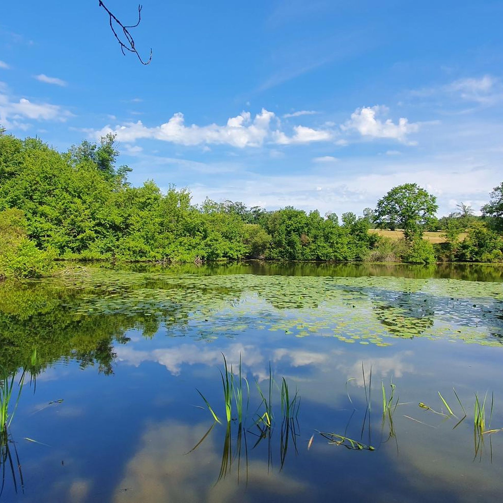
This pond is small in size but large in flora and fauna. It constitutes a natural area of ecological, faunal and floristic interest (ZNIEFF).
2
0

Medieval city of Chénérailles, whose ramparts can still be seen in the old quarter. Do not miss the Café Charcuterie Norre, which is a real institution.
1
0

an interesting walk without too many cars. several ponds and small corners to visit
0
0

The Pinaud pond takes its name from the mill, located on the north shore of the lake. This pond is a calm place, ideal for resting in the middle of nature. It is also possible to fish there.
0
0

The estate consists of the remains of an initial fortress: a Marchois manor house and a fortified barn linked together by curtain walls. website: https://chateauetangsannes.wixsite.com/etangsannes-fr
1
0
Frequently Asked Questions
What types of landscapes can I expect to see while hiking around Peyrat-La-Nonière?
The region is characterized by unspoiled natural surroundings, including verdant valleys like the Tardes and Voueize, and serene bodies of water such as the Étang de Chaux. You'll find a mix of riverbanks, woodlands, and open countryside, often with glimpses of historical structures.
Are there many easy hiking trails suitable for beginners or families?
Yes, Peyrat-La-Nonière offers several easy routes. Out of 30 available trails, 11 are classified as easy. An example is the Castle loop from Balzine, which is 4.6 km long with minimal elevation gain, making it ideal for a relaxed walk.
What natural features or landmarks can I discover on the trails?
Hikers can explore the picturesque Tardes and Voueize valleys, and discover the cascades of Bonlieu along the Tardes river. The Pinaud Pond is a notable natural feature, and the larger Étang de Chaux offers a pleasant environment for various activities and serves as a starting point for hikes.
Are there any historical sites or castles to see along the hiking routes?
Yes, many trails in the area pass by historical sites. For instance, the 'Ronde des Poulaillers' route is noted for passing by three well-preserved castles. The Chiroux Castle – Château de la Vaureille loop from Peyrat-la-Nonière specifically leads through areas featuring local castles. The Abbaye de Bonlieu and Château du Mazeau are also notable attractions that can be discovered along some routes.
What is the best time of year to go hiking in Peyrat-La-Nonière?
The region is beautiful throughout the warmer months, from spring to autumn, when the verdant valleys are at their most vibrant. Spring offers wildflowers, while autumn brings colorful foliage. Summer is also popular, especially around the ponds for swimming and picnics.
Are there any circular hiking routes available?
Yes, many of the trails around Peyrat-La-Nonière are circular, allowing you to start and end at the same point. Examples include the popular Pinaud Pond Circuit and the Château de la Vaureille – Chiroux Castle loop from Montelladonne.
What do other hikers enjoy most about hiking in Peyrat-La-Nonière?
The area is highly rated by the komoot community, with an average score of 4.6 stars from over 60 reviews. Hikers often praise the diverse landscapes, the serene ponds, and the charming historical castles encountered along the routes. The well-maintained and varied network of trails is also frequently highlighted.
Are the hiking trails in Peyrat-La-Nonière suitable for dogs?
Generally, the natural trails and rural paths in the Creuse department are dog-friendly, provided dogs are kept under control, especially near livestock or in nature reserves. It's always advisable to check local signage for any specific restrictions, particularly around protected areas like the Étang des Landes Nature Reserve.
What is the typical elevation gain on hikes in this region?
The elevation gain varies across routes. Many trails are relatively gentle, such as the 'Ronde des Poulaillers' with 135 meters of positive elevation. However, some routes like 'Between Tardes and Voueize' can have up to 240 meters of positive elevation, offering a bit more challenge while still being manageable for most hikers.
Is there public transport available to access the hiking trails?
Peyrat-La-Nonière is a rural area, and public transport options directly to trailheads may be limited. It is generally recommended to use a car to access the starting points of most hiking routes. Parking is usually available in villages or designated areas near popular trails.
Are there any specific trails that offer good viewpoints?
While specific designated 'viewpoints' might not be explicitly marked on every trail, the diverse landscapes of the Tardes and Voueize valleys, combined with the region's gentle hills, offer numerous picturesque settings and scenic vistas, especially from higher points along routes like 'Between Tardes and Voueize' which reaches a maximum altitude of 501 meters.
Can I combine hiking with other activities in the area?
Absolutely! The Étang de Chaux is a versatile recreational hub where you can combine hiking with unsupervised swimming, fishing, picnics, and even enjoy a playground or pétanque courts. Many trails also pass through charming villages where you might find local amenities.
Most popular attractions around Peyrat-La-Nonière

Get inspired with the komoot mobile app


Explore more
Browse the best Hikes in other regions.
