The best walks and hikes around Mornac-Sur-Seudre
4.6
(510)
5,610
hikers
12
hikes
Hiking around Mornac-Sur-Seudre offers routes through diverse landscapes. The region is characterized by extensive salt marshes, the Seudre riverbanks, and nearby forests like the Forêt des Combôts d'Ansoine. These areas feature flat terrain, with minimal elevation changes, and provide opportunities to observe specialized flora and a variety of bird species. The village itself, with its historical architecture, is often integrated into walking trails.
Best hiking trails around Mornac-Sur-Seudre
- The most popular hiking route is Mornac-sur-Seudre Marshes Loop, a 5.1…
Last updated: October 10, 2026
4.3
(11)
44
hikers
8.20km
02:05
20m
20m
This moderate 5.1-mile (8.2 km) loop hike explores the historic village of Mornac-sur-Seudre, its medieval gate, and surrounding marshlands.
3.9
(13)
116
hikers
Moderate hike. Good fitness required. Easily-accessible paths. Suitable for all skill levels.

5.0
(3)
31
hikers
Easy hike. Great for any fitness level. Easily-accessible paths. Suitable for all skill levels.
4.5
(2)
11
hikers
Easy hike. Great for any fitness level. Easily-accessible paths. Suitable for all skill levels.
4.2
(5)
13
hikers
Easy hike. Great for any fitness level. Easily-accessible paths. Suitable for all skill levels.
Get access to more routes and recommendations from other explorers.
Already have an account?
Our route recommendations are based on thousands of hikes, rides, and runs completed by other people on komoot.
Start today with a free account
Your next adventure awaits.

Tips from the Community

The Halles of Mornac first appeared in the Middle Ages. It was only in 1664 that the first written proof attested to their existence. They are likely older and could date back to the 1550s. The Halles are generally timber-framed shelters supported by stone pillars and covered with tiles. It can be assumed that, like those of Cozes and Pisany, they suffered the vicissitudes of the Wars of Religion and were damaged, or even destroyed, then rebuilt when peace returned. The site of the Halles of Mornac was a renowned fairground and allowed the inhabitants to sell their products in exchange for a fee paid to the Lord. It was an important source of income for him, which also obliged him to maintain these Halles in perfect condition. An act engaging the Lord and the seller sealed a contract signifying the rights to sell unpacked goods and the maintenance of the said Halles.
0
0

The SAINT-PIERRE church dominates the village from its fortified bell tower. Original in many ways, the Romanesque building houses a holy water font made of a real shell. From the side, you reach the small garden of the chevet, well hidden. Stone sarcophagi (Merovingian or Carolingian depending on the source) bear witness to the archaeological excavations that the church has undergone. There are many stories in Mornac but that of the fire of August 2, 1943 marked the identity of the village. Indeed, the bell tower has not always had this appearance. It had the more traditional shape of a spire until lightning struck it. Many young students come to Mornac-sur-Seudre to participate in the clearing and the excavations that follow. Seduced by the local atmosphere, many of them stayed and opened the first craft workshops in the village, some of which are still present, such as pottery and leather.
0
0
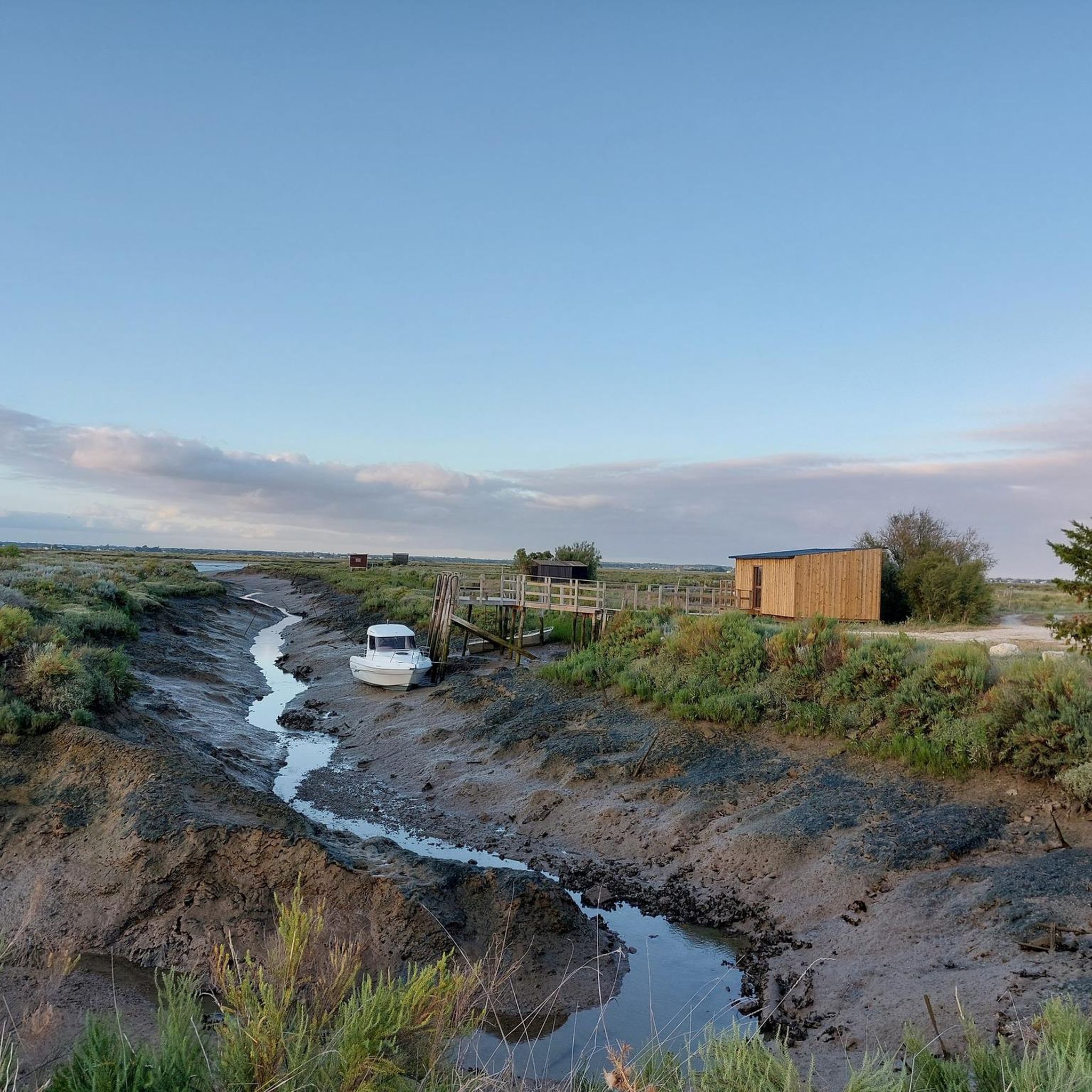
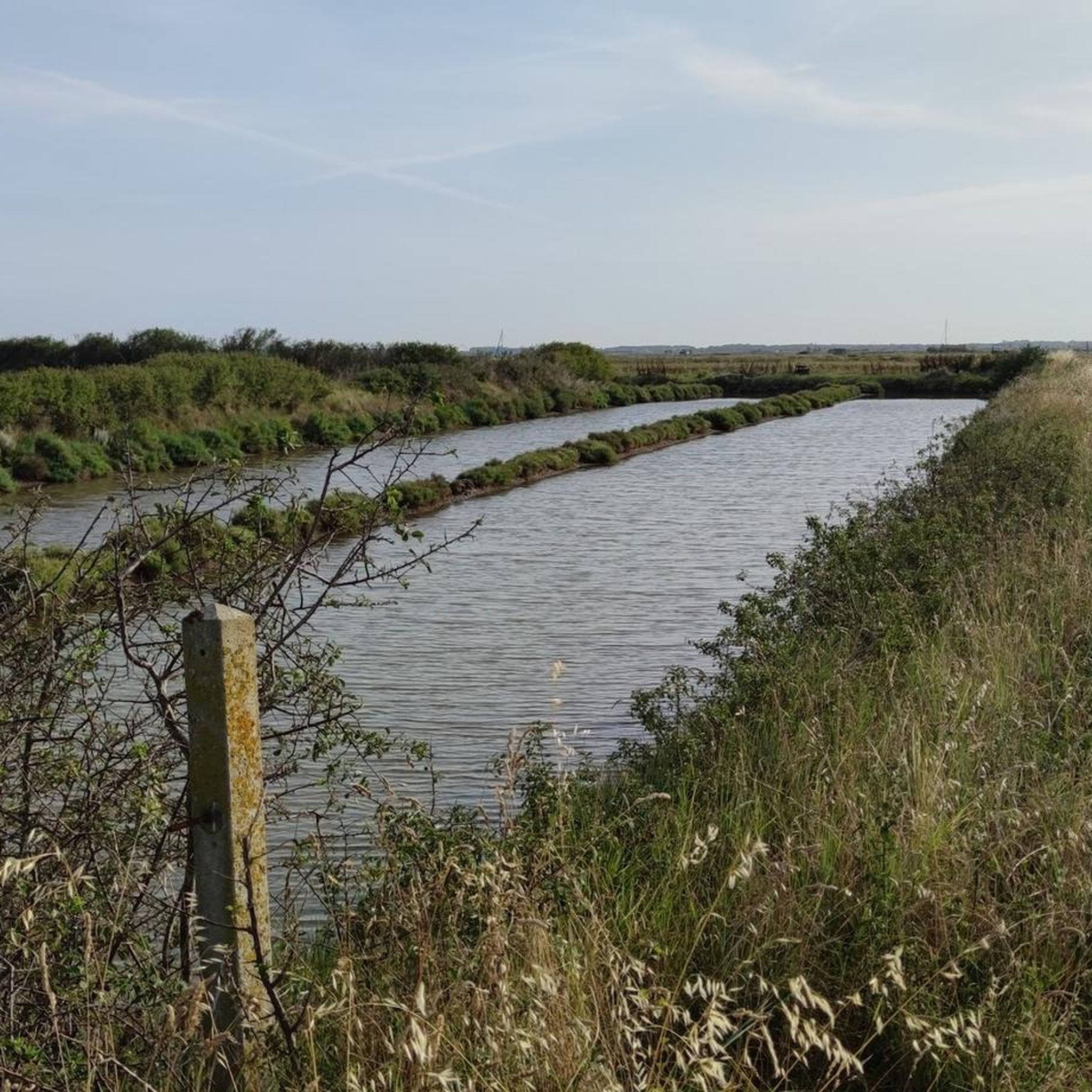
The Seudre marshes, which thus form a structuring component of the communal landscape, have a unique appearance, made up of mudflats with grey-blue reflections, punctuated by reed hedges and wild grasses. In the commune, they are delimited by the Seudre itself, with the Mouillelande bank which forms the boundary with Le Gua, its tributary the Liman, but also by the channels of Coulonges (administrative boundary with Chaillevette), Téger, Mornac (along which is the port), Plordonnier, Agnoux and Fontbedeau. Mornac being part of the Marennes-Oléron oyster basin, they are home to numerous oyster beds, or "claires", refining basins where the oysters acquire a particular flavour and colour under the action of a pigment (marennine) produced by a microscopic algae called blue navicula. From Roman times to the 18th century, the Seudre estuary and the outlet of the Liman were occupied by saltworks. The commune has rehabilitated this tradition and now preserves a small salt marsh, where salt is harvested in an artisanal way. The marshes are crisscrossed with small picturesque paths and observation posts that allow you to better understand this very rich natural space, where many birds come to stop and nest. Here more than anywhere else, you become aware of the almost island character of the commune, with this subtle interweaving of land and water and an infinite sky, often blue because swept by sea breezes where human activity tries to preserve the existing fauna and flora for the greatest pleasure of all.
0
0
There are many shelters for hunting wild ducks in the marshes (some very well installed with all the comforts) right next to bodies of water where ducks are enthroned which serve as decoys in order to attract their fellows within rifle range. We find similar huts in Gironde for wood pigeon shooting but with much more rusticity.
0
0
The line was opened to traffic in 1876 by the Compagnie du chemin de fer de la Seudre, and then extended to the channel of La Grève at La Tremblade. In 1880, the line was bought by the State Railways Administration, which absorbed the bankrupt Compagnie des chemins de fer de l'Ouest in 1908. The State Network, after its merger with the other national railway companies in 1938, became the Société nationale des chemins de fer français (SNCF). In 1939, the line was closed to passenger traffic, but continued its activity for the transport of goods until 1980. Tourist service In 1984, the association of the Seudre Tourist Railway (CFTS) started running a tourist train again but stopped tourist operation in 2002. The infrastructure (track, stations and Chaillevette depot) was then bought by the department of Charente-Maritime. Between 2004 and 2006, the operation of the line was entrusted to CFTA, a subsidiary of Véolia Transport, but ceased in 2007. In 2008, the association Trains & Traction was entrusted with the operation of the line, and has continued the activity since then. Tourist operation takes place from the beginning of May to the end of September with daily traffic in July and August. Some special trains are organized in season or out of season like the "Train des Loupiottes1" or the "Train Éclade de moules". Most recently, the Train des Mouettes has opened up to gastronomy with refined meals with its restaurant train the "Seudre Océan Express", reviving the myth of rail travel for the time of a refined meal (reservation required by telephone). The office is at the Saujon Chemin Vert station, and the workshop is in Chaillevette, in the middle of the line. The following equipment is currently operated by volunteers Steam locomotives • Schneider (no. 2503), 1891 - Arrived at Chaillevette in 1984. In service since 2004. • Henschel, 1912 - Arrived at Chaillevette in 1984. Inaugurated (being heated) on 20 June 2015. • Fives-Lille (no. 3716), 1910 - Out of service (undergoing complete restoration). • Borsig (type T 3 Prussian (de)), 1906 - Out of service (undergoing complete restoration). Diesel locomotives • Decauville, 1960 - Operational • Blanc-Misseron, 1958 - Out of service (undergoing complete restoration). • SACM (no. 10019), 1956 - Operational • Moyse, 1968 – Operational • Brissonneau and Lotz, 1971 - Operational • CFD, 1965 - Operational • CFD, 1965 - Out of service (undergoing complete restoration). • SACM/Alstom/CAFL, 1956 Decauville, 1967 – Out of service (undergoing complete restoration).Baudet, Donon and Roussel – Shunter rebuilt to SACM plans in 1961 with a Baudouin engine. - Operational • Decauville, 1967 – Shunter Operational Accumulator locomotive • Orenstein & Koppel no. 320 13-ton accumulator locomotive, from a foundry in Niederbronn-les-Bains. Railcars • X 5822 - Out of service (undergoing complete restoration). • Billard railcar no. 902, type A 75 D built in 1947, ex-CFD of Indre-et-Loire, entrusted by the FACS; • X 2208 ex-Limoges depot, entrusted under agreement with the SNCF, on loan to the Central Brittany railways; • X 2251 ex-Limoges depot, entrusted under agreement with the SNCF, on loan to the Central Brittany railways.
0
0
Succeeding a Merovingian church whose remains were discovered in 1951 (as well as a cemetery dating from the 6th century), the foundation of the current church could date back to the 10th or 11th century. with a modernization in the 12th century, where it takes more or less its current appearance. The bell tower was destroyed during the Hundred Years' War and then rebuilt with the facade in the 15th century. A fire due to a violent storm affected the bell tower in 1943. The upper part was reinterpreted by the addition of square bays giving it a defensive character. The slate spire has not gone up. The Saint-Pierre church is a Romanesque building with certain archaic features. The facade, of great severity, dates from the 15th century. Almost devoid of ornamentation, it consists of a broken arched portal with prismatic moldings, confined by a Gothic niche (on the right) and surmounted by a narrow bay. The nave, formerly divided into 5 bays, now has only 4, separated by columns backed by pilasters. The whole was originally covered with ribbed vaults, destroyed in 1837, replaced by an arched vault and subsequently dismantled in turn. The nave is covered with an exposed framework. Large transept arches delimit the square of the transept, covered with a barlong dome on squinches. The crosspieces are covered with a pointed barrel vault, and are extended by apsidioles. Semi-circular arcades, supported by fine columns with capitals decorated with plant or geometric motifs, punctuate the walls of the apse, covered with an oven bottom where traces of frescoes dating from the 12th century are visible, although degraded. century. The walls of the nave, the transept and part of the choir retain traces (from the 17th century) of the funeral liter of a lord of Mornac. The exterior offers, on the north wall, the remains of a Romanesque portal (11th century). The bedside, typical of the Saintongeais Romanesque, is made up of 3 horizontal registers, delimited by cords. The last level is made up of an arcade formed of arched arcades carried by columns with capitals decorated with plant, animal or geometric motifs. The whole is surmounted by a cornice with modillions where animals and human or demonic faces are represented. Buttress columns topped with capitals decorated with interlacing and stylized plants punctuate the walls
0
0
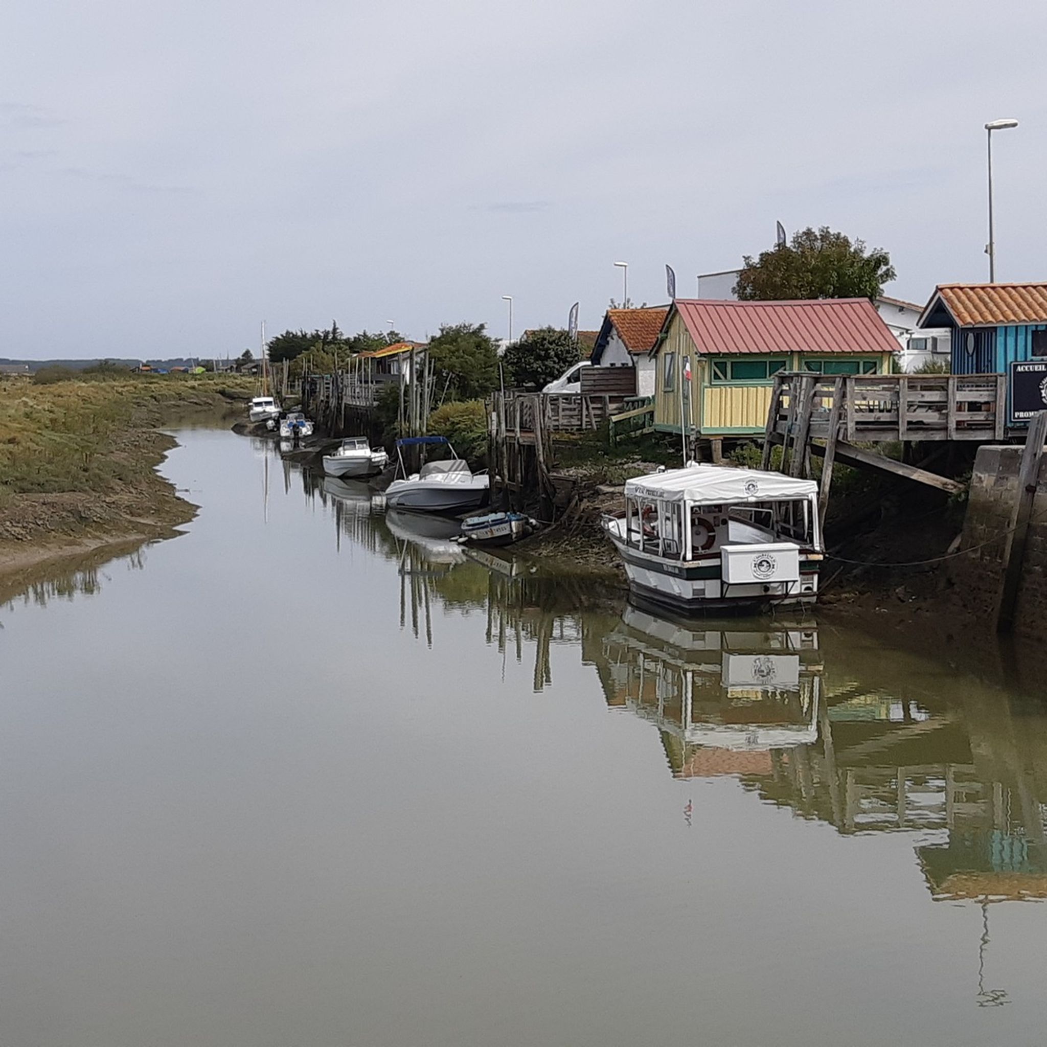
Nestled in the heart of the marshes of the Presqu’Île d’Arvert, Mornac-sur-Seudre is a small village with a dual face: oyster farming by tradition and artisanal by passion. It is a “Village of Stones & Water” (as the Charente-Maritime label promises) and is one of the “Most Beautiful Villages of France®”, and it also has the “Ville et Métiers d’” label. Art",. Mornac is a village where you have to take your time to soak up its atmosphere and charm. So you park your car in the large car park and visit it on foot to savor every detail and exchange with locals generous with anecdotes and craftsmen eager to share their know-how. Here, everything is on a human scale. We discover the village through the Place des Halles. The shelter, made of wood and supported by stone pillars, is ideal for meeting and resting. The terraced houses replace the old fortifications which protected the town in the Middle Ages. From Les Halles the main street takes you to the port. However, you should not hesitate to stroll through the small streets and alleys of the old town where you can literally get lost! This spiral part of Mornac is called the “Arab quarter”. The church dominates the village from its fortified bell tower. Original in many ways, the Romanesque building houses a font made of real shell. On August 2, 1943, lightning caused a fire which changed the appearance of the bell tower. The port is bordered by traditional and typical cabins. Each one has different colors. There is something for every taste. The small Seudre road allows you to follow them to the foot of the estuary. We arrive, at the very end, at the “goule de l’ach’neau”. We feel alone in the world. Everything is flat, horizontal. It’s time to tell you: the name Mornac means “calm waters”. From the port, possibility of a sea trip..... depending on the tide!!! For those on land, from Chemin de la Corderie, you can take the marked Détours® loops, between April and October, on the embankments of the pedestrian cutoffs. Possibility of taking advantage of guided tours of the village during the season. Mornac and its marshes can also be visited by bike using the shared Chemins de la Seudre routes. If the walk seems too long to you, you can combine the bike ride with the Train des Mouettes (Mornac-sur-Seudre is a stopover station for the tourist train)
0
0

The market hall on the Place des Halles, which was probably built in the 16th century, consists of three naves that are divided by pillars made of quarry stone masonry. The open hall is closed by an octagonal tiled roof, which was renewed in the 20th century.
2
0
Frequently Asked Questions
How many hiking trails are available in Mornac-Sur-Seudre?
There are over 150 hiking routes around Mornac-Sur-Seudre, offering a wide variety of options for all skill levels. The komoot community has explored more than 150 routes in the area.
What kind of terrain can I expect on hikes around Mornac-Sur-Seudre?
The terrain around Mornac-Sur-Seudre is predominantly flat, characterized by extensive salt marshes, the picturesque Seudre riverbanks, and nearby maritime pine forests like the Forêt des Combôts d'Ansoine. You'll find minimal elevation changes, making most trails accessible and enjoyable.
Are there any circular hiking routes in Mornac-Sur-Seudre?
Yes, Mornac-Sur-Seudre offers several well-defined circular hiking loops. A popular option is the Mornac-sur-Seudre Marshes Loop, which is a moderate 8.2 km trail exploring both the village and its surrounding marshlands. Another is the Mornac-sur-Seudre Marshes – Mornac-sur-Seudre Market loop, an 8.0 km path connecting the salt marshes with the village market.
Are the hiking trails in Mornac-Sur-Seudre suitable for families with children?
Many trails in Mornac-Sur-Seudre are suitable for families, particularly the easy-rated routes with minimal elevation. For example, the Mornac-sur-Seudre Market – Mornac-sur-Seudre Marshes loop is an easy 3.5 km trail that can be completed in under an hour, offering a pleasant walk through the salt marshes and village.
What kind of wildlife can I expect to see while hiking?
The salt marshes and Seudre riverbanks are rich in biodiversity. Hikers can observe a wide variety of bird species, including herons, egrets, storks, and avocets. The Forêt des Combôts d'Ansoine is also home to hundreds of bird species and various wild orchids. You'll also encounter specialized flora adapted to the saline environment, such as glasswort and obione.
Are there any historical or cultural sights to see along the trails?
Yes, many trails integrate the village's rich heritage. You can discover charming white houses with colorful shutters, the Romanesque church of Saint-Pierre, and centuries-old covered market halls. The colorful oyster huts along the channel leading to the Seudre river are also a characteristic sight, adding to the picturesque scenery.
What nearby attractions can I visit after a hike?
Beyond the trails, you can explore several interesting attractions. Consider visiting Chay Beach or Conche de Gilet for coastal views. For history enthusiasts, the German Bunkers of La Grande Côte offer a glimpse into the past. The Port of Royan is also a notable nearby destination.
What do other hikers say about the trails in Mornac-Sur-Seudre?
The routes in Mornac-Sur-Seudre are highly rated by the komoot community, with an average score of 4.5 stars from over 400 reviews. Hikers often praise the unique landscapes of the salt marshes, the tranquility of the riverbanks, and the charm of the village itself.
What are the difficulty levels of the hikes in Mornac-Sur-Seudre?
Mornac-Sur-Seudre offers a range of difficulty levels. There are nearly 100 easy routes, 53 moderate routes, and a few more challenging options. The flat terrain ensures that most trails are accessible, with moderate routes typically involving longer distances rather than significant elevation changes.
Is public transport available to reach the trailheads?
While specific public transport details for trailheads vary, the scenic "Train des Mouettes" (seagull train) offers breathtaking views of the landscape and can be combined with hiking. You can disembark at Mornac-Sur-Seudre to explore the village and marshes on foot after a scenic train journey.
Where can I park when hiking in Mornac-Sur-Seudre?
Mornac-Sur-Seudre, being a popular tourist destination, offers various parking options within or near the village center, especially close to the port and market areas. These spots often serve as convenient starting points for many of the local hiking loops.
What is the best time of year to go hiking in Mornac-Sur-Seudre?
Mornac-Sur-Seudre is enjoyable for hiking throughout much of the year. Spring and autumn offer pleasant temperatures and vibrant natural colors, making them ideal for birdwatching in the marshes. Summer is also popular, though it can be warmer, while winter provides a quieter experience with unique atmospheric views of the wetlands.
Most popular routes around Mornac-Sur-Seudre
Most popular attractions around Mornac-Sur-Seudre

Get inspired with the komoot mobile app


Explore more
Browse the best Hikes in other regions.
