The best walks and hikes around Bouziès
4.6
(1260)
7,669
hikers
17
hikes
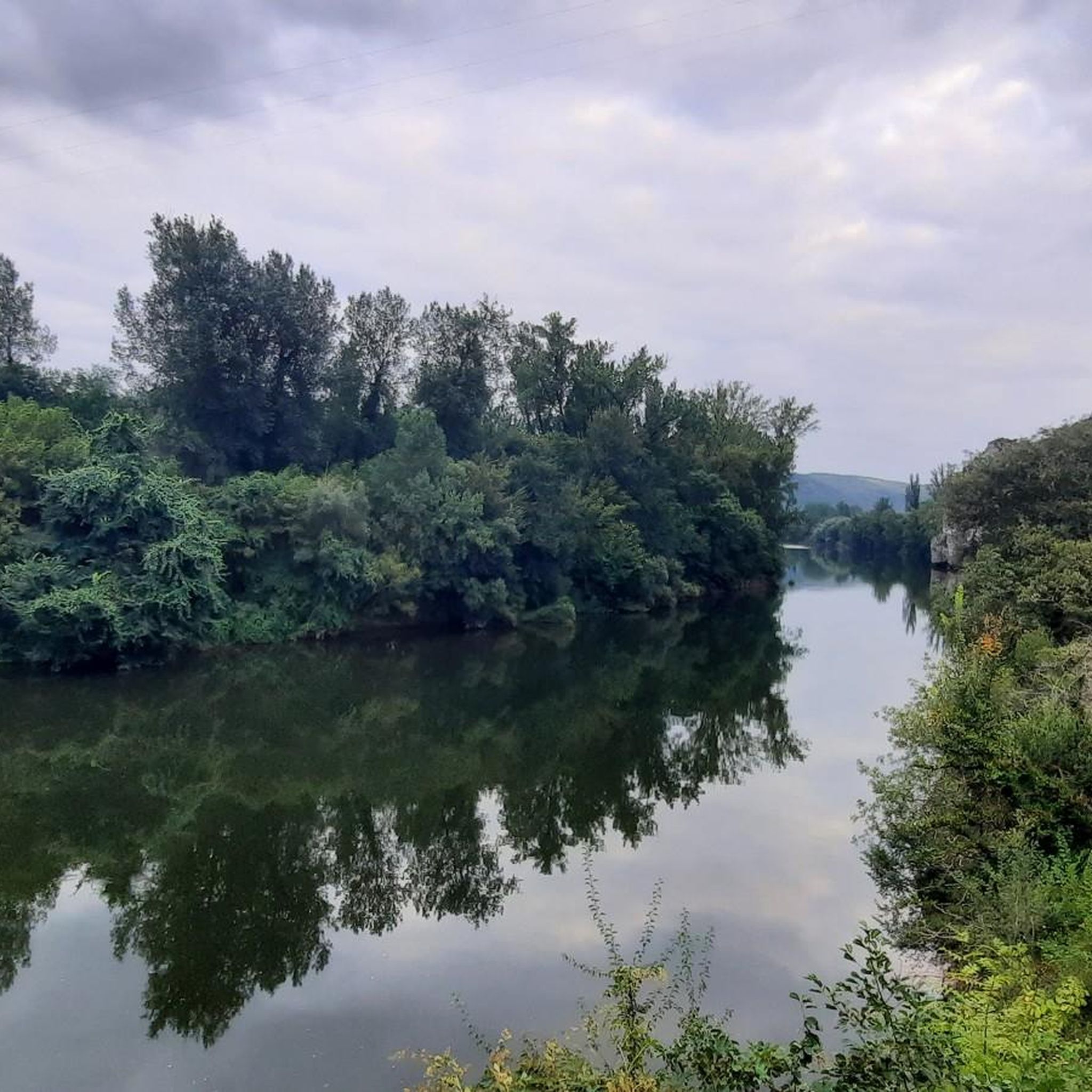
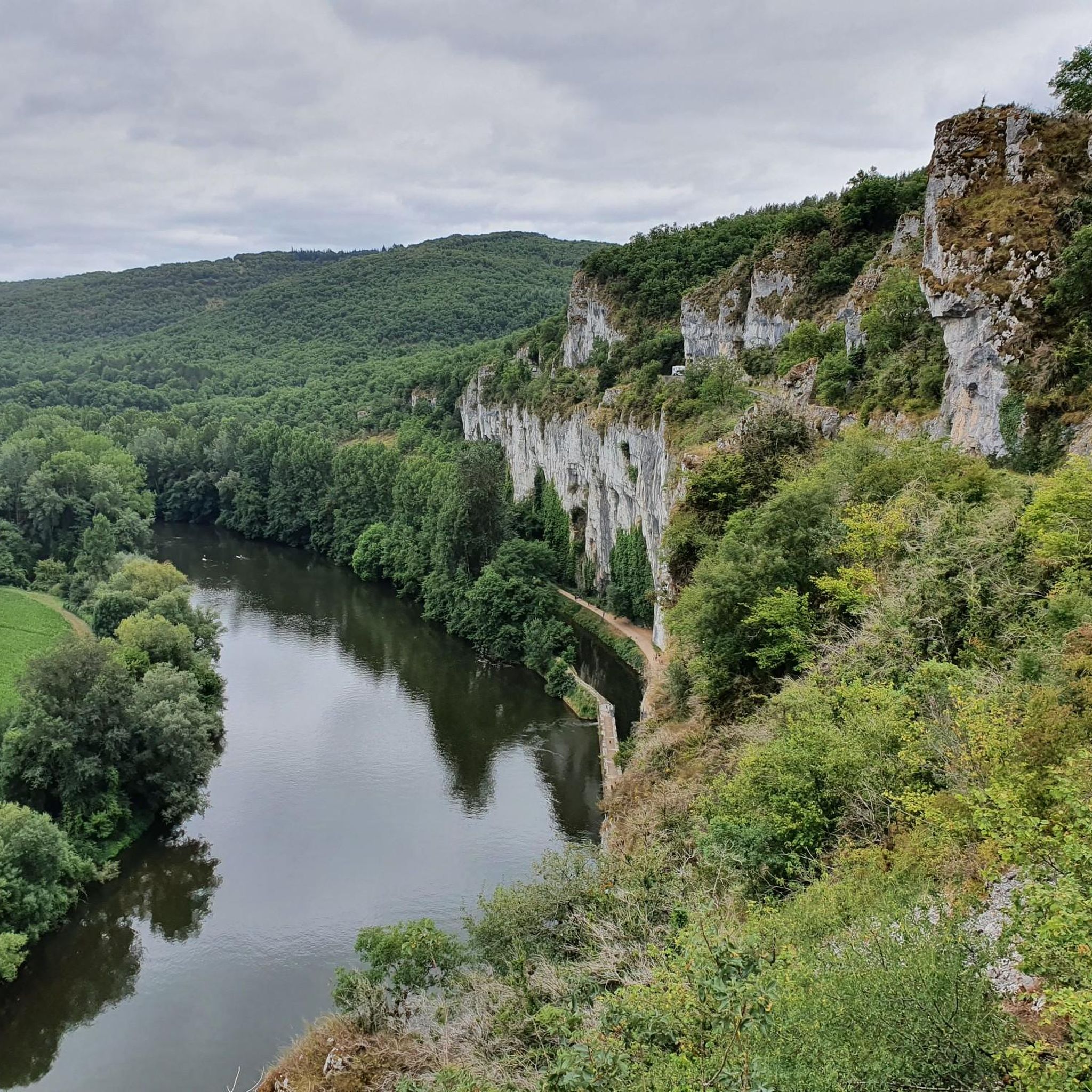
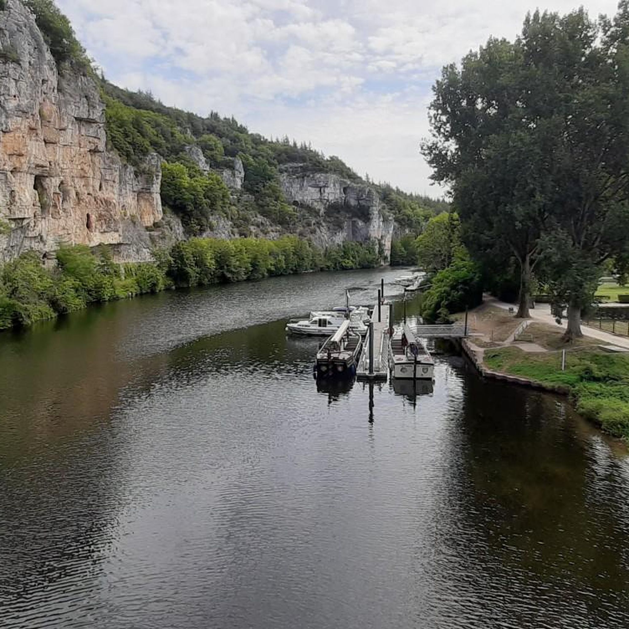
Hiking around Bouziès offers access to the dramatic landscapes of the Lot and Célé Valleys within the Causses du Quercy Regional Natural Park. The region is characterized by towering limestone cliffs, river gorges, and preserved natural beauty. These features provide a diverse terrain for outdoor activities, ranging from riverside paths to elevated viewpoints.
Best hiking trails around Bouziès
- The most popular hiking route is On the trails of André Breton — loop from Bouziès in the Parc Naturel Régional des Causses du Quercy, a 6.1 miles (9.8 km) trail that takes 2 hours 48 minutes to complete, exploring the natural park.
- Another top favourite among local hikers is Cliffs Along the Lot River – Saint-Cirq-Lapopie loop from Bouziès, a moderate 5.6 miles (9.1 km) path offering views of the Lot River and leading towards Saint-Cirq-Lapopie.
- Local hikers also love the Viewpoint – Cliffs Along the Lot River loop from Bouziès, a 6.8 miles (10.9 km) trail leading through dramatic limestone cliffs, often completed in about 3 hours 18 minutes.
- Hiking around Bouziès is defined by dramatic limestone cliffs, the Lot and Célé Valleys, and the preserved environment of the Causses du Quercy Regional Natural Park. The network offers options for easy, moderate, and difficult ability levels.
- The routes in Bouziès are highly rated by the komoot community with an average score of 4.6 stars from over 1000 reviews. More than 6000 hikers have used komoot to explore Bouziès's varied terrain.
Last updated: October 10, 2026
4.7
(189)
1,032
hikers
9.81km
02:48
230m
230m
Moderate hike. Good fitness required. Easily-accessible paths. Suitable for all skill levels.
4.6
(43)
166
hikers
10.6km
03:10
330m
330m
Moderate hike. Good fitness required. Mostly accessible paths. Sure-footedness required.

4.6
(8)
91
hikers
17.7km
05:18
450m
450m
Hard hike. Very good fitness required. Mostly accessible paths. Sure-footedness required.
4.7
(14)
92
hikers
28.3km
07:58
550m
550m
Hard hike. Very good fitness required. Mostly accessible paths. Sure-footedness required.
4.4
(9)
55
hikers
18.7km
05:53
700m
700m
Hard hike. Very good fitness required. Mostly accessible paths. Sure-footedness required.
Get access to more routes and recommendations from other explorers.
Already have an account?
Our route recommendations are based on thousands of hikes, rides, and runs completed by other people on komoot.
Start today with a free account
Your next adventure awaits.

Tips from the Community

La Maison André Breton (historically known as Auberge des Mariniers) is the oldest inhabited building in the medieval village of Saint-Cirq-Lapopie in the Lot. Purchased in 1951 by the poet and theorist of surrealism André Breton, it was his summer refuge until his death in 1966 and the gathering place for many major artists of the time (such as Max Ernst, Man Ray or Joan Miró).
0
0
In the Middle Ages, the village was a major stronghold in the Quercy region. The site was shared between three major noble dynasties (the Lapopie, the Gourdon, and the Cardaillac), each of whom owned their own castle at the top of the rock. The name comes from Saint Cyr (a young Christian martyr from the 4th century) and the noble Lapopie family, who gave their name to the steep rock (la popa meaning "the breast" in Occitan, evoking the shape of the cliff).
0
0
In the Middle Ages, the village was a major stronghold in the Quercy region. The site was shared between three major feudal dynasties (the Lapopie, the Gourdon, and the Cardaillac), each of whom owned their own castle at the top of the rock. The name comes from Saint Cyr (a young Christian martyr from the 4th century) and the feudal family of Lapopie, who gave their name to the steep rock (la popa meaning "the breast" in Occitan, evoking the shape of the cliff).
0
0
The magnificent corniche road overlooking the meanders of the river is located in the spectacular Lot valley, particularly on the heights of the limestone causse and cliffs. In Saint-Cirq-Lapopie: The Lapopie rock and the Bancourel dovecote offer a spectacular 360-degree plunging view over the river.
0
0
The Ganil towpath: Carved directly into the limestone cliff rock in 1845, it once allowed horses to tow barges up the Lot river. Between 1985 and 1989, the artist Daniel Monnier sculpted an impressive bas-relief there, depicting local fauna and flora. The path connects Bouziès to Saint-Cirq-Lapopie over approximately 4 to 5 km of easy walking.
0
0
The Ganil towpath: Carved into the limestone cliff face in 1845, it once allowed horses to tow barges up the Lot. Between 1985 and 1989, artist Daniel Monnier sculpted an impressive bas-relief here depicting local fauna and flora. The path connects Bouziès to Saint-Cirq-Lapopie over about 4 to 5 km of easy walking.
0
0
In the heart of the Causses du Quercy Regional Natural Park. Located at the confluence of the Lot and Célé valleys, the village of Bouziès, with around 90 inhabitants, is world-renowned for its spectacular natural and historical heritage. The Château des Anglais: Fortifications from the 11th and 12th centuries anchored directly into the vertical cliff face overlooking the road and the river. This site once served as a fortified refuge for the inhabitants during conflicts.
0
0
In the heart of the Causses du Quercy Regional Natural Park. Located at the confluence of the Lot and Célé valleys, the village of Bouziès, with around 90 inhabitants, is world-renowned for its spectacular natural and historical heritage. The English Castle: Fortifications from the 11th and 12th centuries anchored directly into the vertical cliff face overlooking the road and the river. This site once served as a fortified refuge for the inhabitants during conflicts.
0
0
Frequently Asked Questions
What types of hiking trails are available around Bouziès?
Bouziès offers a diverse range of hiking trails, from easy riverside paths to more challenging routes with significant elevation changes. You'll find approximately 19 trails in total, with options for all skill levels: 4 easy, 10 moderate, and 5 difficult routes. The landscape is characterized by dramatic limestone cliffs, the Lot and Célé Valleys, and the preserved environment of the Causses du Quercy Regional Natural Park.
Are there family-friendly hiking options in Bouziès?
Yes, Bouziès is an excellent destination for families. The most notable family-friendly option is the iconic 4 km Bouziès Towpath (Chemin de Halage), carved directly into the cliffside along the Lot River. This easy and accessible route connects Bouziès to Saint-Cirq-Lapopie and features a unique 30-meter-long low-relief sculpture. Many of the 4 easy routes available are also suitable for families.
Can I bring my dog on hikes in Bouziès?
Generally, dogs are welcome on most hiking trails in the Bouziès area, especially within the Causses du Quercy Regional Natural Park. However, it's always recommended to keep them on a leash, particularly in protected natural areas, near livestock, or in crowded sections like the towpath. Please ensure you clean up after your pet to preserve the natural environment for everyone.
Are there many circular hiking routes available around Bouziès?
Yes, many of the hiking routes around Bouziès are designed as loops, allowing you to start and finish in the same location. For example, the popular route On the trails of André Breton — loop from Bouziès is a 9.8 km circular trail exploring the natural park. Another great option is the Viewpoint – Cliffs Along the Lot River loop from Bouziès, which offers dramatic cliff views over 10.9 km.
What natural features or landmarks can I see while hiking near Bouziès?
Hiking around Bouziès offers stunning natural beauty and historical landmarks. You'll encounter dramatic 80-meter-high limestone cliffs, the scenic Lot and Célé Valleys, and the preserved environment of the Causses du Quercy Regional Natural Park. Notable attractions include the manually operated Ganil lock and towpath, the formidable English Castle of Bouziès anchored in the rock, and the impressive Cliffs Along the Lot River. You can also visit the charming village of Saint-Cirq-Lapopie, often reached via the towpath.
When is the best time of year to go hiking in Bouziès?
The best times to hike in Bouziès are typically spring (April to June) and autumn (September to October). During these seasons, the weather is generally mild and pleasant, ideal for outdoor activities. Spring brings lush greenery and wildflowers, while autumn offers beautiful fall foliage. Summer can be quite warm, especially in July and August, so early morning or late afternoon hikes are recommended during those months.
What do other hikers enjoy most about the trails in Bouziès?
The hiking trails in Bouziès are highly rated by the komoot community, with an average score of 4.6 stars from over 1000 reviews. Hikers frequently praise the dramatic limestone cliffs, the unique experience of the towpath carved into the rock, and the stunning views of the Lot River. The proximity to the picturesque village of Saint-Cirq-Lapopie is also a major highlight for many.
Are there any longer, more challenging hikes available from Bouziès?
Yes, for those seeking a greater challenge, there are several longer and more difficult routes. One such option is the St-Cirq-Lapopie Heights – Cliffs Along the Lot River loop from Bouziès, a moderate 14.2 km trail with significant elevation gain. While not starting directly from Bouziès, the Cliffs Along the Lot River – Saint-Cirq-Lapopie loop from Saint-Géry is a difficult 28 km route that offers an extensive exploration of the region's dramatic landscapes.
Is there public transport or parking available for hikers in Bouziès?
Bouziès is a small village, and while specific public transport details for hikers are limited, it is generally accessible by car. There is typically parking available within or near the village, especially for visitors looking to access the popular towpath or other local trails. It's advisable to arrive early during peak season to secure a spot.
What is the famous towpath near Bouziès, and what can I expect on it?
The Bouziès Towpath (Chemin de Halage) is a renowned 4 km path connecting Bouziès to Saint-Cirq-Lapopie. It's unique because it's carved directly into the cliffside along the Lot River. Originally used by horses to pull barges, it now offers an easy, flat, and accessible route. Along the path, you'll encounter a remarkable 30-meter-long low-relief sculpture by artist Daniel Monnier, depicting local flora, fauna, and fossils, adding an artistic touch to the natural scenery.
Are there any viewpoints offering panoramic vistas of the Lot Valley?
Absolutely. The region is known for its dramatic cliffs and offers several opportunities for panoramic views. The Viewpoint – Cliffs Along the Lot River loop from Bouziès is specifically designed to lead you to such vistas. Additionally, the village of Saint-Cirq-Lapopie itself, perched high above the Lot, provides breathtaking views of the valley and surrounding landscape.
What is the 'Causses du Quercy Regional Natural Park' mentioned, and how does it relate to hiking in Bouziès?
Bouziès is located within the expansive Causses du Quercy Regional Natural Park, an area celebrated for its preserved environment and unique geological features. The park is known for its dramatic limestone plateaus (causses), deep river valleys like the Lot and Célé, and remarkable biodiversity. Hiking in Bouziès means you are directly exploring this protected natural area, benefiting from its well-maintained trails and stunning, unspoiled landscapes. The park is also recognized for its 'Black Triangle' of low light pollution, offering incredible night sky views.
Most popular attractions around Bouziès

Get inspired with the komoot mobile app


Explore more
Browse the best Hikes in other regions.
