The best running trails around Saint-Cirq-Lapopie
4.6
(26)
872
runners
19
runs
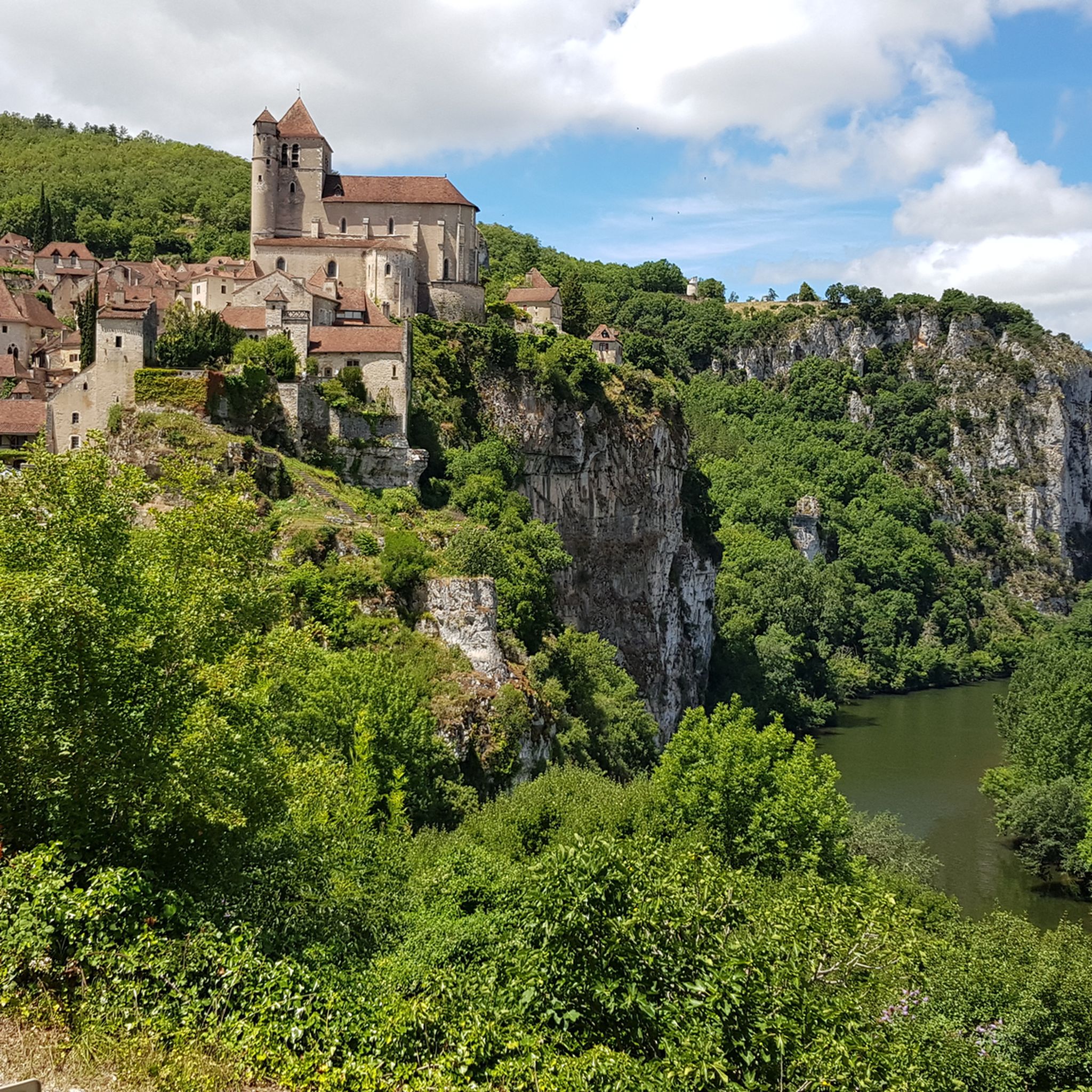
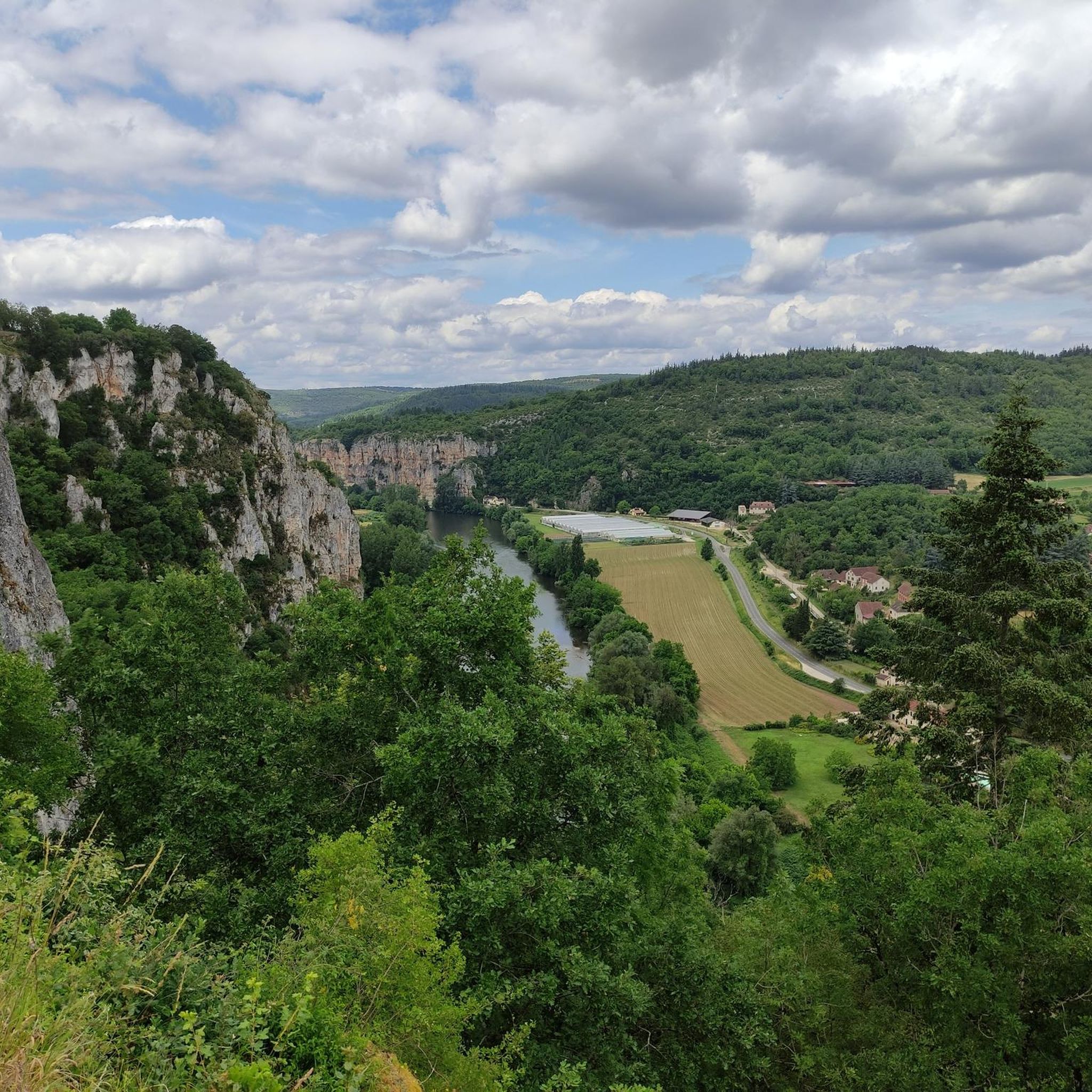
Jogging routes around Saint-Cirq-Lapopie traverse a varied landscape, characterized by the Lot River and its towpath, dramatic limestone cliffs, and the expansive Causses du Quercy Regional Natural Park. The region offers a mix of relatively flat riverbank paths and more demanding hilly trails. This diverse topography provides numerous opportunities for active exploration, with routes winding through valleys and along elevated viewpoints.
Best jogging routes around Saint-Cirq-Lapopie
- The most popular jogging route is Running loop from Saint-Cirq-Lapopie, a 4.2 miles…
Last updated: September 1, 2026
4.5
(2)
42
runners
Moderate run. Good fitness required. Mostly paved surfaces. Suitable for all skill levels.
20
runners
16.8km
02:12
500m
500m
Hard run. Very good fitness required. Sure-footedness, sturdy shoes and alpine experience required.

Sign up for free
4.0
(2)
164
runners
9.66km
01:09
210m
210m
Moderate run. Good fitness required. Mostly accessible paths. Some sure footedness required.
23
runners
24.8km
03:07
580m
580m
Hard run. Very good fitness required. Sure-footedness, sturdy shoes and alpine experience required.
12
runners
7.73km
00:49
70m
70m
Moderate run. Good fitness required. Mostly paved surfaces. Suitable for all skill levels.
Get access to more routes and recommendations from other explorers.
Sign up for free
Already have an account?
Our route recommendations are based on thousands of hikes, rides, and runs completed by other people on komoot.
Start today with a free account
Your next adventure awaits.
Login or Signup

Tips from the Community

Pleasant walking spot, although touristy
0
0

Beautiful to do, it's worth a look
1
1


Superb passage - A little damp if the Lot is large ;0)
0
0
Superb passage - A little damp if the Lot is large ;0)
1
0

Preceded upstream by the mill and the lock keeper's house, then by the lock, this towpath is dug into the limestone rock face. Its construction began in 1847, the men began to dig the rock using mine bars. This path made it easier for barges to pass through this difficult sector. At that time, these trading boats came up the river from Bordeaux, loaded with fish, manufactured products and salt. This site constitutes one of the most spectacular courses in the valley.
0
0

Here, the cliffs and the Lot play against each other. The reflections of the cliffs are simply magical!
2
0

There is a beautiful forest path above the old towpath that can be hiked on the way back.
2
0
Frequently Asked Questions
How many running routes are available around Saint-Cirq-Lapopie?
There are over 20 diverse running routes around Saint-Cirq-Lapopie, catering to various fitness levels. These trails traverse the picturesque Lot Valley, limestone cliffs, and the Causses du Quercy Regional Natural Park.
What is the general difficulty level of running trails in Saint-Cirq-Lapopie?
The running trails in Saint-Cirq-Lapopie offer a good mix of difficulties. You'll find a few easy routes, around 10 moderate options, and about 10 more challenging trails with significant elevation changes, ensuring there's something for every runner.
Are there any easy running routes suitable for beginners or casual joggers?
Yes, for an easier run, consider the flat and scenic towpath along the Lot River, which offers a gentle 10 km round trip between Saint-Cirq-Lapopie and Bouziès. While most routes are moderate to difficult, this path provides a relaxing experience with beautiful river views.
Can I find challenging running trails with significant elevation gain in the area?
Absolutely. Saint-Cirq-Lapopie is known for its dramatic limestone cliffs and varied topography, offering several challenging routes. For instance, the Crégols Village loop from Crégols is a difficult 16.8 km trail with nearly 500 meters of elevation gain, perfect for experienced runners seeking a demanding workout.
What do other runners say about the trails in Saint-Cirq-Lapopie?
The running routes in Saint-Cirq-Lapopie are highly rated by the komoot community, holding an average score of 4.6 stars from over 19 reviews. More than 680 runners have explored the area using komoot, often praising the stunning natural beauty, varied terrain, and panoramic views of the Lot Valley.
Are there running routes with scenic views of the Lot River or the village?
Many routes offer breathtaking scenic views. The towpath along the Lot River provides continuous vistas of the river, cliffs, and charming villages. For panoramic views of Saint-Cirq-Lapopie itself, consider trails that ascend to higher viewpoints, such as the Village viewpoint – Cliffs along the Lot loop from Saint-Cirq-Lapopie, a difficult 12.7 km path.
Are there any circular running trails around Saint-Cirq-Lapopie?
Yes, many of the running routes in the area are circular, allowing you to start and end in the same location. A popular moderate option is the Running loop from Saint-Cirq-Lapopie, which is 6.7 km long and offers great views of the village and its surroundings.
What kind of natural features can I expect to see along the running routes?
You'll encounter a rich variety of natural features, including the winding Lot River, dramatic limestone cliffs, and the diverse landscapes of the Causses du Quercy Regional Natural Park. Expect to see ancient dry stone huts ('cazelles') and enjoy continuous changing vistas of the river and valleys.
Are there any historical landmarks or points of interest along the running trails?
Yes, the region is rich in history. You might pass by historical sites like the ruins of castles atop the cliffs or the 16th-century Church of Saint-Cirq. The towpath itself features intricate carvings from the mid-1800s. For specific historical highlights, look for routes near The English Castle of Bouziès or the Ganil lock and towpath.
Are the running routes in Saint-Cirq-Lapopie suitable for families?
While some routes can be challenging, the flatter sections along the Lot River towpath are generally suitable for families looking for a less strenuous run or walk. Always check the route's difficulty and length to ensure it matches your family's capabilities.
Is there parking available near the running trailheads in Saint-Cirq-Lapopie?
Parking is generally available in and around Saint-Cirq-Lapopie, particularly in designated village car parks. From these points, you can typically access various trailheads leading into the surrounding natural areas. It's advisable to arrive early during peak season.
What is the best time of year for running in Saint-Cirq-Lapopie?
The spring and autumn months generally offer the most pleasant conditions for running, with milder temperatures and beautiful scenery. Summer can be warm, so early morning or late afternoon runs are recommended. The diverse landscapes are enjoyable year-round, but always check local weather conditions.
Most popular routes around Saint-Cirq-Lapopie
Most popular attractions around Saint-Cirq-Lapopie

Get inspired with the komoot mobile app


Explore more
Browse the best Running Trails & Routes in other regions.
