The 16 Most Amazing Peaks around Rochefort-Montagne
Best mountain peaks around Rochefort-Montagne are found in the Puy-de-Dôme department of France, nestled in a region rich with volcanic peaks. The area lies at the gates of Sancy, between the Dômes mountains and the Dore mountains, presenting a medium-mountain environment. This landscape offers diverse opportunities for hikers and nature enthusiasts to explore.
Best mountain peaks around Rochefort-Montagne
- The most popular mountain peaks is La Banne d'Ordanche, a summit that is the remnant of a volcano rising to 1,515…
Last updated: July 7, 2026
La Banne d'Ordanche
Highlight • Summit
Translated by Google •
Tip by

Puy Loup
Highlight • Summit
Translated by Google •
Tip by

Sign up now to discover places like this
Get recommendations on the best single tracks, peaks, & plenty of other exciting outdoor places.
Sign up for free
Puy de Lassolas
Highlight • Volcano
Translated by Google •
Tip by
Puy Gros
Highlight • Summit
From its summit, you can observe the entire …
Translated by Google •
Tip by
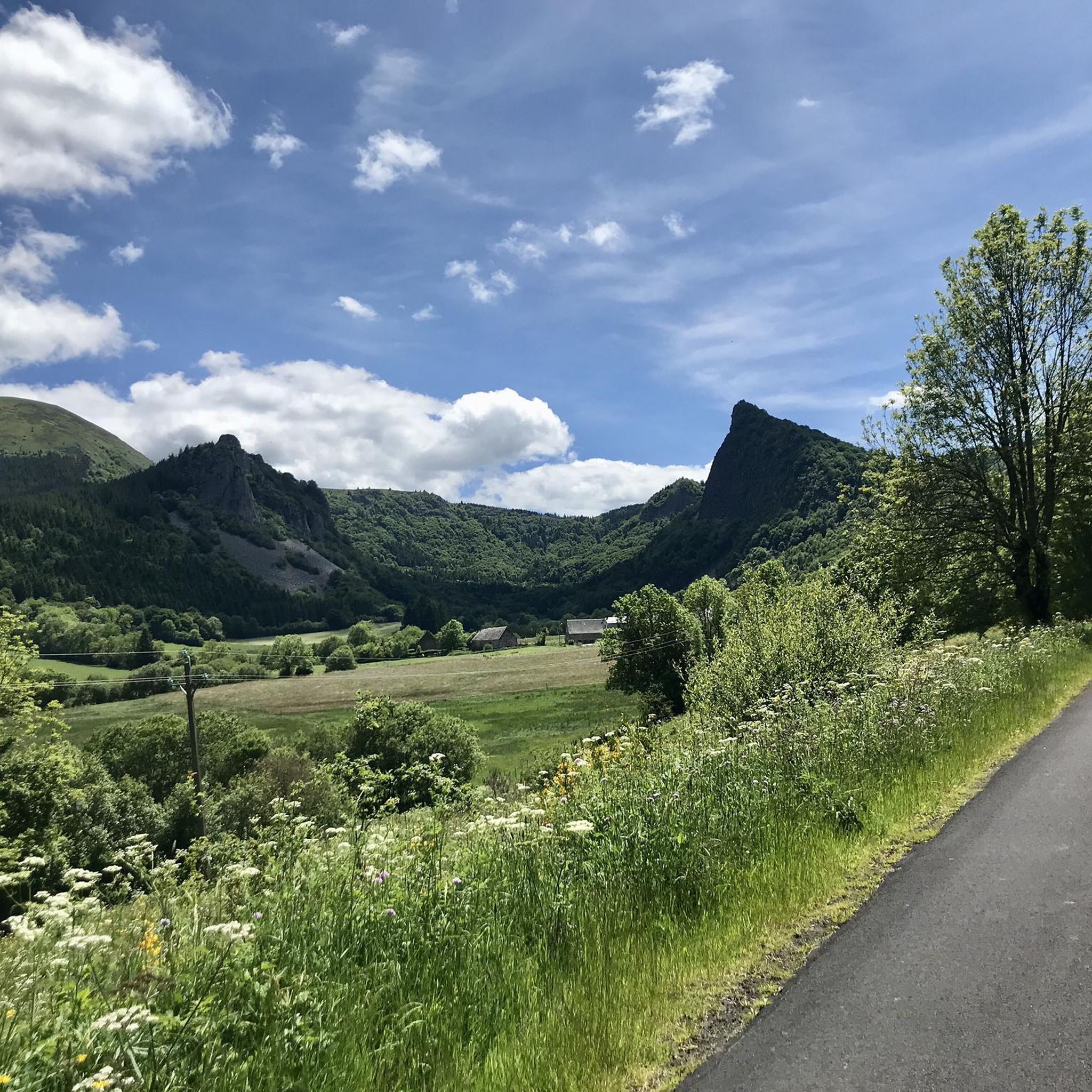
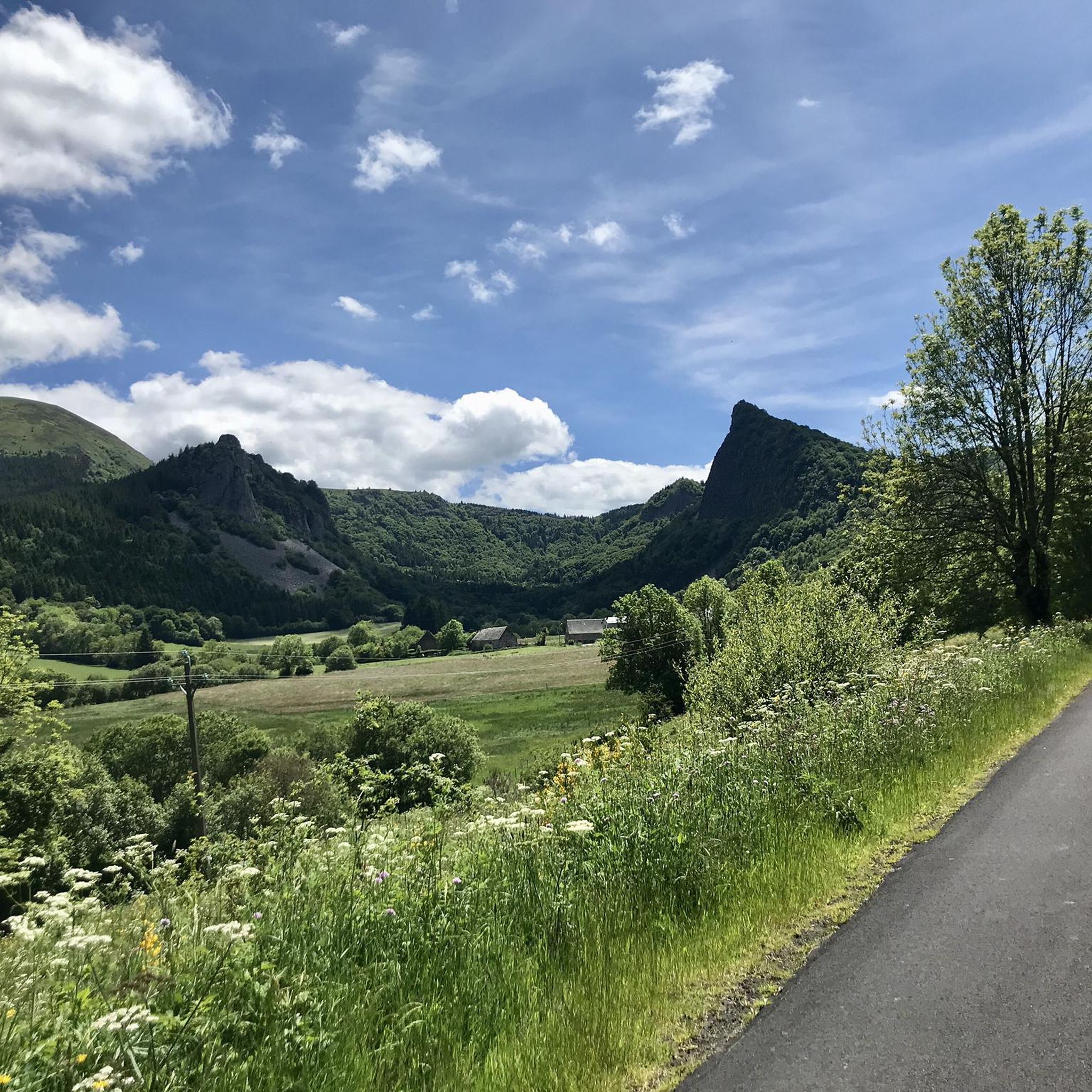
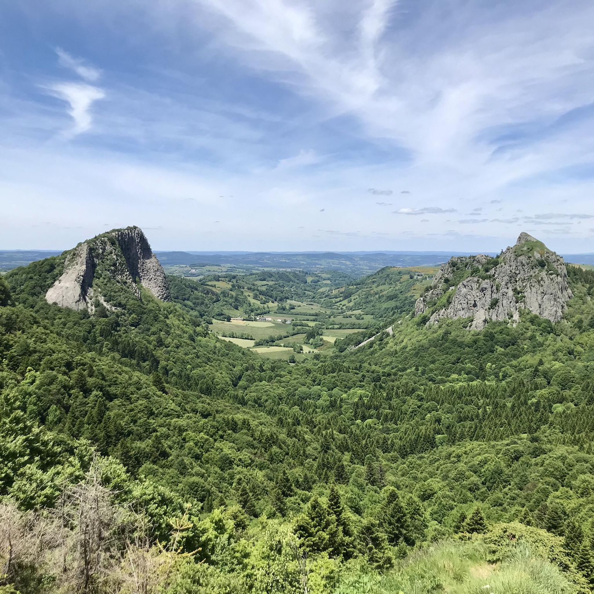
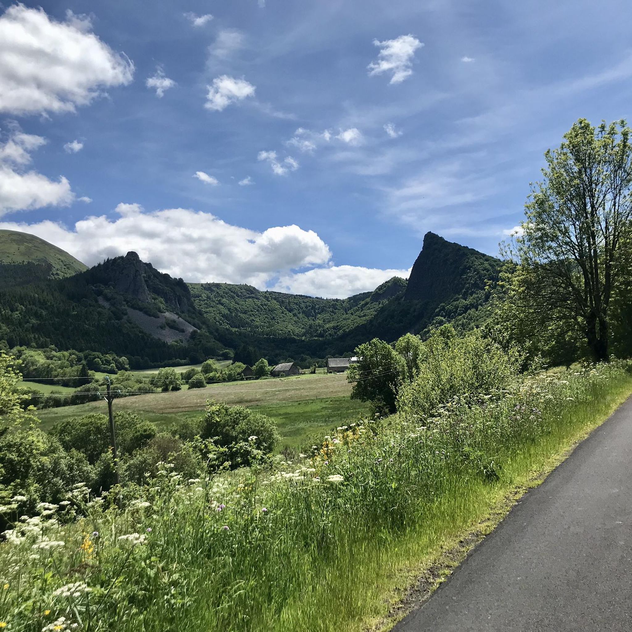
View of Sanadoire rock
Highlight • Summit
This rock is the remains of an old volcano eroded by a glacier. The rock …
Translated by Google •
Tip by

Sign up for free to discover even more peaks around Rochefort-Montagne.
Sign up for free
Already have an account?
Start today with a free account
Your next adventure awaits.
Login or Signup


Tips from the Community


The Banne d'Ordanche is a 1515 m high volcanic peak in the shape of a neck-shaped crater head. It solidified about 2 million years ago before being planed down by glaciers (https://www.sancy.com/) The views in all directions are phenomenal and the summit is easy to reach - the last part is comfortably via wooden stairs. Due to several nearby car parks, you are rarely alone here in good weather.
3
1
At just over 1480m, the Puy Loup offers a great view in all directions. The small refuge on the summit used to be a tower that belonged to a gliding base that was located on the ridge at the beginning of the 20th century: 'Centre national de vol sans moteur de LA BANNE D'ORDANCHE', https://www.anciens-aerodromes.com/
2
1


La Banne d'Ordanche is a peak of volcanic origin in the Dore Mountains in the Puy-de-Dôme department. It culminates at an altitude of 1,512 m and overlooks the town of La Bourboule. Easily accessible from the Col de Guéry, there is a wonderful 360° panoramic view (orientation table above) of the Puys chain, the Puy de Sancy, but also of the Cantal mountains. Source: Wikipedia
2
1

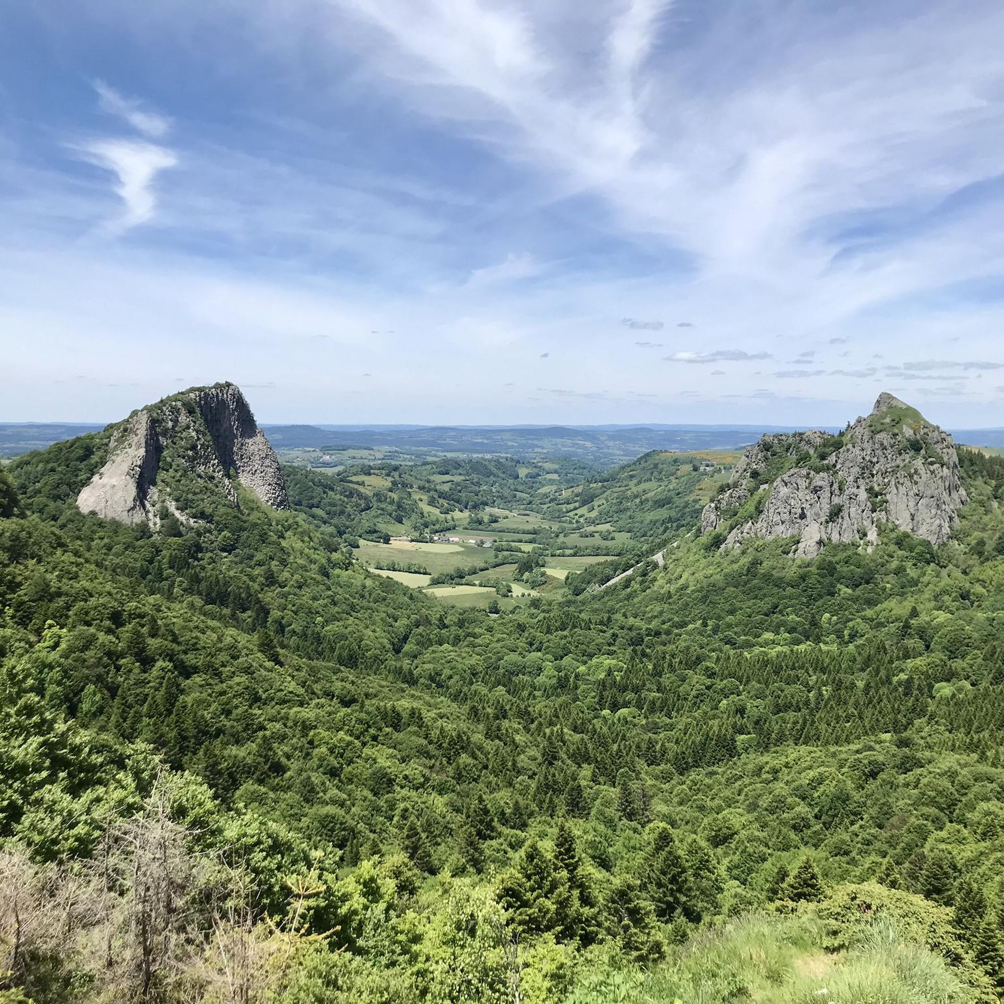
The Sanadoire rock marks the limit between the Dores mountains and the Banne d'Ordanche massif. This rock is the remains of an old volcano eroded by a glacier. The rock emerges as if by magic in the Cirque du Chausse located at the foot of the Col du Guéry. The glacier that occupied the circus has indeed completely eroded the volcano leaving only two bases of lava: the chimney also called Tuilière and the cone called Sanadoire.
0
0

Puy Gros is one of the many extinct volcanoes that shapes the Auvergne region. It culminates at 1,485 meters above sea level. From its summit, you can observe the entire route of the Dordogne between Mont-Dore and La Bourboule. To the south, you will easily guess the steep summit of the roof of Auvergne: the Puy de Sancy.
1
1
La Banne d'Ordanche is the remnant of a volcano that rises to 1,515 meters above sea level. Frozen in the Pleistocene period two million years ago, its neck-shaped summit offers a spectacular panorama over the Dordogne valley. You will find an orientation table which indicates the three volcanic massifs of the Regional Natural Park of the Volcanoes of Auvergne: the Dômes chain, the Monts Dore chain and the Cantalien massif.
6
1
Frequently Asked Questions
What are some of the most popular mountain peaks to visit around Rochefort-Montagne?
The region offers several popular peaks. La Banne d'Ordanche is a highly-rated summit, known for its spectacular panorama over the Dordogne valley. Another favorite is Puy Loup, recognized for its historical marker and impressive 360° views. Visitors also frequently enjoy Puy de Lassolas, which offers a unique perspective of the Chaîne des Puys.
What kind of landscapes can I expect to see when exploring the mountain peaks in this region?
The Rochefort-Montagne area is characterized by its rich volcanic history. You'll encounter remnants of ancient volcanoes, such as La Banne d'Ordanche, and distinct volcanic cones like Puy Gros and Puy d'Ébert. The landscape features a medium-mountain environment with stunning panoramas over valleys, forests, and the three volcanic massifs of the Regional Natural Park of the Volcanoes of Auvergne: the Chaîne des Puys, the Monts Dore chain, and the Cantalien massif.
Are there any peaks known for exceptional panoramic views?
Yes, many peaks in the area offer superb panoramic views. La Banne d'Ordanche provides a spectacular panorama over the Dordogne valley. Puy Gros offers views of the entire course of the Dordogne river and the prominent Puy de Sancy. Puy de Lassolas boasts an exceptional 360-degree view of the Chaîne des Puys, while Puy de Baladou also offers superb 360° panoramas of the Sancy mountains and the Dômes chain.
Are there family-friendly mountain walks around Rochefort-Montagne?
While specific 'family_friendly' tags aren't always present, many peaks offer accessible circular routes suitable for families. For instance, Puy d'Ébert is accessible via a short circular route, and La Banne d'Ordanche is noted for being 'easily accessible' with remarkable views, making it a good option for families.
What are the hiking difficulty levels for the peaks in the Rochefort-Montagne area?
Hiking difficulties vary across the peaks. Some, like Puy d'Ébert, offer short, accessible circular routes. Others, such as Puy des Crebasses, are considered challenging, rising to 1,762 meters and forming part of longer, more demanding horseshoe routes. Many peaks, like Puy de Baladou, offer moderate hikes that can be completed in half a day, traversing pastures, forests, and peaks.
When is the best time of year to hike the mountain peaks near Rochefort-Montagne?
The region is generally best enjoyed during the warmer months, from spring to autumn, when trails are clear and weather conditions are more stable for hiking. This allows for comfortable exploration of the volcanic landscapes and enjoyment of the expansive views. Winter hiking is possible but requires specific safety precautions due to snow and ice.
Are there any unique geological features among the peaks?
Yes, the region is rich in unique geological formations due to its volcanic past. La Banne d'Ordanche is a remnant of a volcano, frozen two million years ago. Roche Tuilière is another ancient volcano remnant, eroded by a glacier, with a distinctive chimney-like structure. Roche Branlante is known for its precariously balanced rock formation. Additionally, View of Sanadoire rock marks the limit between the Dores mountains and the Banne d'Ordanche massif, being the remains of an old volcano eroded by a glacier.
What outdoor activities, besides hiking, can I do near the mountain peaks of Rochefort-Montagne?
Beyond hiking, the area around Rochefort-Montagne offers various outdoor activities. You can explore numerous mountain biking trails, with options ranging from moderate to difficult, such as 'The Banks of the Sioule' or 'Lake Servières'. Road cycling is also popular, with routes like the 'Col de Ceyssat – Guéry Pass loop' offering scenic rides. For more details on cycling, you can check the Cycling around Rochefort-Montagne guide.
Are there specific routes recommended for mountain biking around Rochefort-Montagne's peaks?
Yes, there are several mountain biking routes in the vicinity. You can find trails like 'The Banks of the Sioule - Chantegrelet' (moderate, 16.5 km) or the more challenging 'Lake Servières – Lake Servières loop' (44.6 km). For a comprehensive list of routes, refer to the MTB Trails around Rochefort-Montagne guide.
Can I find road cycling routes that offer views of the mountain peaks?
Absolutely. The region provides scenic road cycling routes that often include views of the surrounding peaks. Examples include the 'Guéry Pass loop from Perpezat' (moderate, 30.6 km) or the longer 'Col de Ceyssat – Guéry Pass loop from Orcival' (difficult, 122.7 km). These routes allow you to experience the volcanic landscapes from your bike. More options are available in the Road Cycling Routes around Rochefort-Montagne guide.
What is special about Puy Loup?
Puy Loup is notable for its summit, which is marked by the 'terminal of the 4 lords.' This historical monument signifies the junction point of four municipalities and former lordships: Mont-Dore, Laqueuille, Perpezat, and Murat-le-Quaire. It offers a highest point with impressive 360° views.
What do visitors particularly enjoy about the mountain peaks around Rochefort-Montagne?
Visitors consistently praise the exceptional and breathtaking views from the summits, with many describing them as 360° panoramas over the Auvergne region. The unique volcanic landscapes, including ancient eroded volcanoes and distinct cones, are also a major draw. The accessibility of many peaks, combined with the diverse hiking experiences, from moderate walks to more challenging routes, contributes to a highly appreciated outdoor experience.
Most popular routes around Rochefort-Montagne
Most popular attractions around Rochefort-Montagne

Get inspired with the komoot mobile app


Explore more
See even more amazing summits around Rochefort-Montagne with these guides:
