The best walks and hikes around Sarrant
4.3
(48)
260
hikers
41
hikes
Hiking around Sarrant offers exploration of a verdant and undulating landscape in the heart of the Lomagne countryside. The region is characterized by green hills and valleys, with extensive fields of crops such as wheat and sunflowers, alongside vineyards and orchards. Trails often traverse tranquil rural settings, with some sections running alongside the Gimone river. This area provides diverse terrain for outdoor activities.
Best hiking trails around Sarrant
- The most popular hiking route is Église de Mauvezin – Mauvezin loop…
Last updated: October 12, 2026
5.0
(1)
15
hikers
9.28km
02:31
130m
130m
Moderate hike. Good fitness required. Easily-accessible paths. Suitable for all skill levels.
3.0
(2)
8
hikers
14.0km
03:40
110m
110m
Moderate hike. Good fitness required. Easily-accessible paths. Suitable for all skill levels.

3.0
(2)
6
hikers
14.7km
03:55
170m
170m
Moderate hike. Good fitness required. Easily-accessible paths. Suitable for all skill levels.
5.0
(1)
6
hikers
12.5km
03:23
180m
180m
Moderate hike. Good fitness required. Easily-accessible paths. Suitable for all skill levels.
4.0
(2)
3
hikers
11.4km
03:04
140m
140m
Moderate hike. Good fitness required. Easily-accessible paths. Suitable for all skill levels.
Get access to more routes and recommendations from other explorers.
Already have an account?
Our route recommendations are based on thousands of hikes, rides, and runs completed by other people on komoot.
Start today with a free account
Your next adventure awaits.


Tips from the Community

Mauvezin, built on a rocky outcrop, dominates the Arratz valley. You will find many shops and services there.
1
0

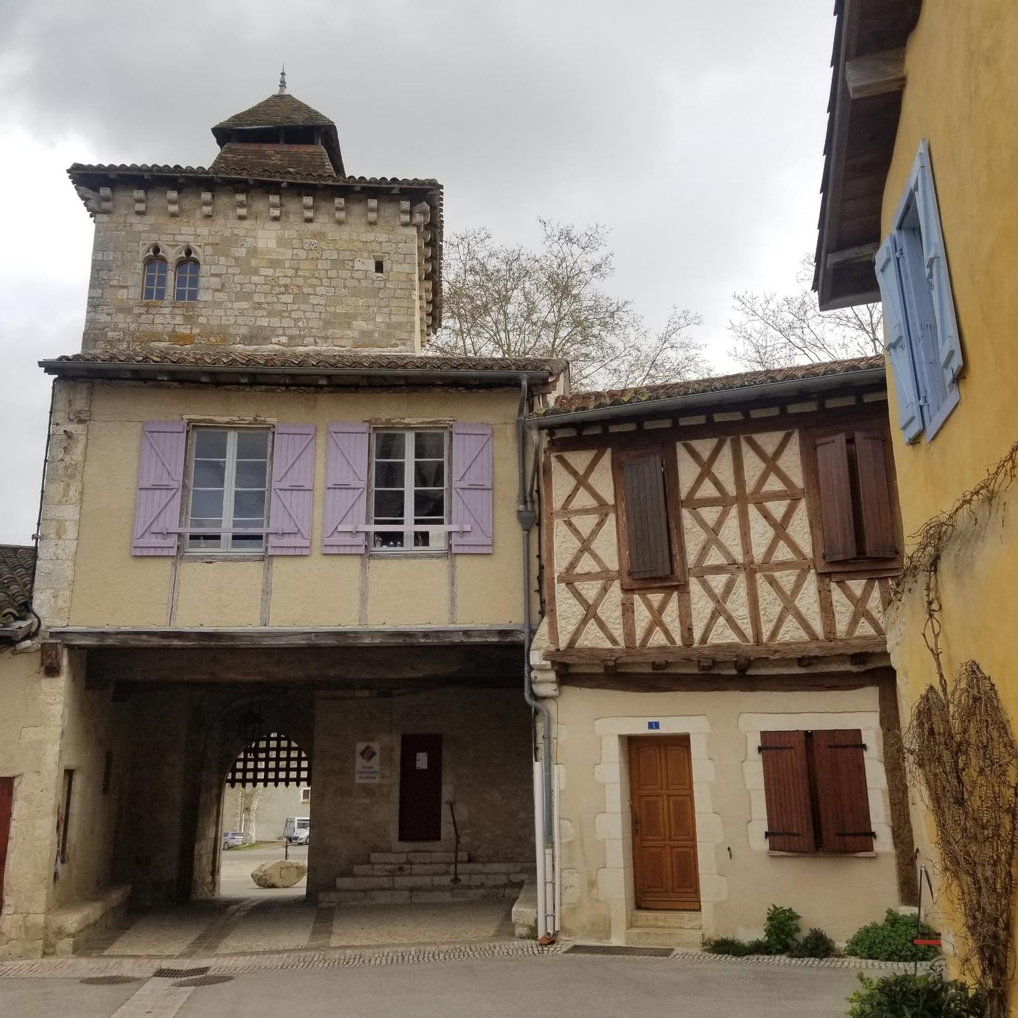
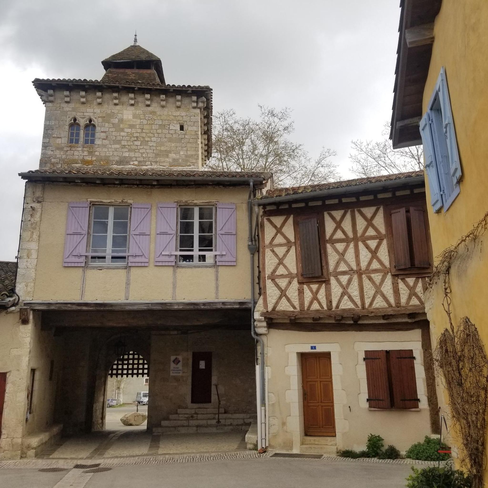
Medieval village classified among the "most beautiful villages of France". You enter the village through a very beautiful arched doorway to discover small streets lined with tall, colorful stone and half-timbered houses built around the Saint-Vincent church. Do not miss the bookstore which is a nugget and which serves delicious sandwiches!
0
0

Pretty medieval village between Toulouse and Montauban. You can have a coffee and take a break. Be careful, on Sunday very few shops are open
0
0

A super nice little old town which has been lovingly restored.
0
0


Frequently Asked Questions
How many hiking trails are available around Sarrant?
There are over 40 hiking routes around Sarrant, offering a variety of experiences. Most of these, around 37, are considered moderate in difficulty, with a few easy and difficult options also available.
What kind of landscape can I expect to see while hiking near Sarrant?
The Sarrant area, located in the Lomagne countryside, is characterized by a verdant and undulating terrain. You'll hike through green hills and valleys, passing extensive fields of crops like wheat and sunflowers, as well as vineyards and orchards. Some trails also feature sections alongside the Gimone river.
Are there any family-friendly hiking options in Sarrant?
Yes, Sarrant offers trails suitable for families. The 8-kilometer Le Sentier des Pigeonniers is an easy loop starting directly from the village, guiding hikers through fields and country paths to discover historical dovecotes. This trail is also suitable for cyclists and even donkey rides.
Are there any circular hiking routes around Sarrant?
Many of the trails around Sarrant are designed as loops. For instance, the Le Sentier des Pigeonniers is an easy 8-kilometer circular route. Other options include the Église de Mauvezin – Mauvezin loop from Mauvezin (9.5 km) and the Château de Laréole loop from Laréole (10.2 km), both offering moderate challenges.
What historical landmarks or attractions can I see while hiking in the Sarrant area?
Beyond the natural beauty, you can explore several historical sites. The village of Sarrant itself is a medieval gem with a 14th-century fortified gate and an ancient church. Trails like Le Sentier des Pigeonniers lead to historical dovecotes. You might also encounter highlights such as the Bastide and Cologne hall or the Medieval village of Sarrant.
What do other hikers say about the trails in Sarrant?
The hiking routes in Sarrant are highly rated by the komoot community, with an average score of 4.3 stars from over 40 reviews. Hikers often praise the tranquil rural settings, the well-maintained paths, and the picturesque views of the Lomagne countryside.
Are there any trails that pass by water features?
Yes, some trails in the vicinity of Sarrant include sections that run alongside the Gimone river, adding a riparian element to the hiking experience. While there are no major waterfalls, the river offers a pleasant natural feature.
What is the best time of year to go hiking in Sarrant?
The Lomagne countryside around Sarrant is beautiful throughout much of the year. Spring and early autumn are particularly pleasant, with mild temperatures and vibrant landscapes, including fields of sunflowers in summer. The paths are generally well-maintained for year-round enjoyment.
Are there any longer hiking routes for experienced hikers?
While most routes are moderate, the broader Lomagne Gersoise area offers 21 marked pedestrian circuits with varying distances. The region is also crossed by the GR de Pays Coeur de Gascogne, a substantial 165-kilometer loop that begins in Auch, providing a more strenuous, multi-day option for experienced hikers.
Can I find parking easily for hiking trails in Sarrant?
Sarrant is a small village, and parking is generally available within or near the village center, especially for trails that start directly from Sarrant, such as Le Sentier des Pigeonniers. For routes further afield, specific parking information would typically be detailed on the individual route pages.
What are some other interesting places to explore near Sarrant?
Beyond Sarrant, you can visit nearby attractions such as the charming village of Cologne, the Cadours Market Hall, or enjoy the tranquility of Thoux Saint-Cricq Lake. These offer additional cultural and natural points of interest in the region.
What is the typical difficulty level of hikes around Sarrant?
The majority of hikes around Sarrant are classified as moderate. These routes typically involve some elevation changes through the undulating countryside but are generally manageable for most hikers. There are also a few easy and difficult options to suit different fitness levels.
Most popular attractions around Sarrant

Get inspired with the komoot mobile app


Explore more
Browse the best Hikes in other regions.
