The best walks and hikes around Pontamafrey-Montpascal
4.6
(479)
4,379
hikers
19
hikes
Hiking around Pontamafrey-Montpascal offers diverse landscapes within the Maurienne Valley of Savoie, France. The area features mountainous terrain, with Pontamafrey situated along the Arc river and Montpascal perched between the Col du Chaussy and the Grand Coin mountain range. Trails traverse varied environments, including riverine paths, shaded routes through hamlets, and higher mountain trails. The region's natural features include alpine flora and extensive views of the French Alps.
Best hiking trails around Pontamafrey-Montpascal
- The most popular hiking route is Les…
Last updated: July 1, 2026
4.9
(15)
72
hikers
5.50km
01:53
280m
280m
Easy hike. Great for any fitness level. Easily-accessible paths. Suitable for all skill levels.
4.0
(5)
60
hikers
6.69km
02:26
410m
410m
Moderate hike. Good fitness required. Easily-accessible paths. Suitable for all skill levels.

Sign up for free
4.0
(4)
40
hikers
4.99km
01:46
280m
280m
Easy hike. Great for any fitness level. Easily-accessible paths. Suitable for all skill levels.
4.5
(2)
17
hikers
10.5km
06:10
1,110m
1,100m
Hard hike. Very good fitness required. Mostly accessible paths. Sure-footedness required.
9
hikers
Easy hike. Great for any fitness level. Easily-accessible paths. Suitable for all skill levels.
Get access to more routes and recommendations from other explorers.
Sign up for free
Already have an account?
Our route recommendations are based on thousands of hikes, rides, and runs completed by other people on komoot.
Start today with a free account
Your next adventure awaits.
Login or Signup
Popular around Pontamafrey-Montpascal


Other adventures around Pontamafrey-Montpascal

Tips from the Community

Orderly ascent, nice pass with chapel and bar/restaurant. Some water points, but not many.
1
0
Church worth seeing in Montvernier.
2
0

Discovery trail to see...
0
0
The path may seem difficult but it is done quietly.
0
0
Frequently Asked Questions
How many hiking trails are available around Pontamafrey-Montpascal?
There are nearly 20 hiking routes available in the Pontamafrey-Montpascal area, offering a diverse range of experiences from easy walks to more challenging mountain treks. These trails are highly rated by the komoot community, with an average score of 4.6 stars from almost 500 reviews.
What kind of terrain can I expect on hikes in Pontamafrey-Montpascal?
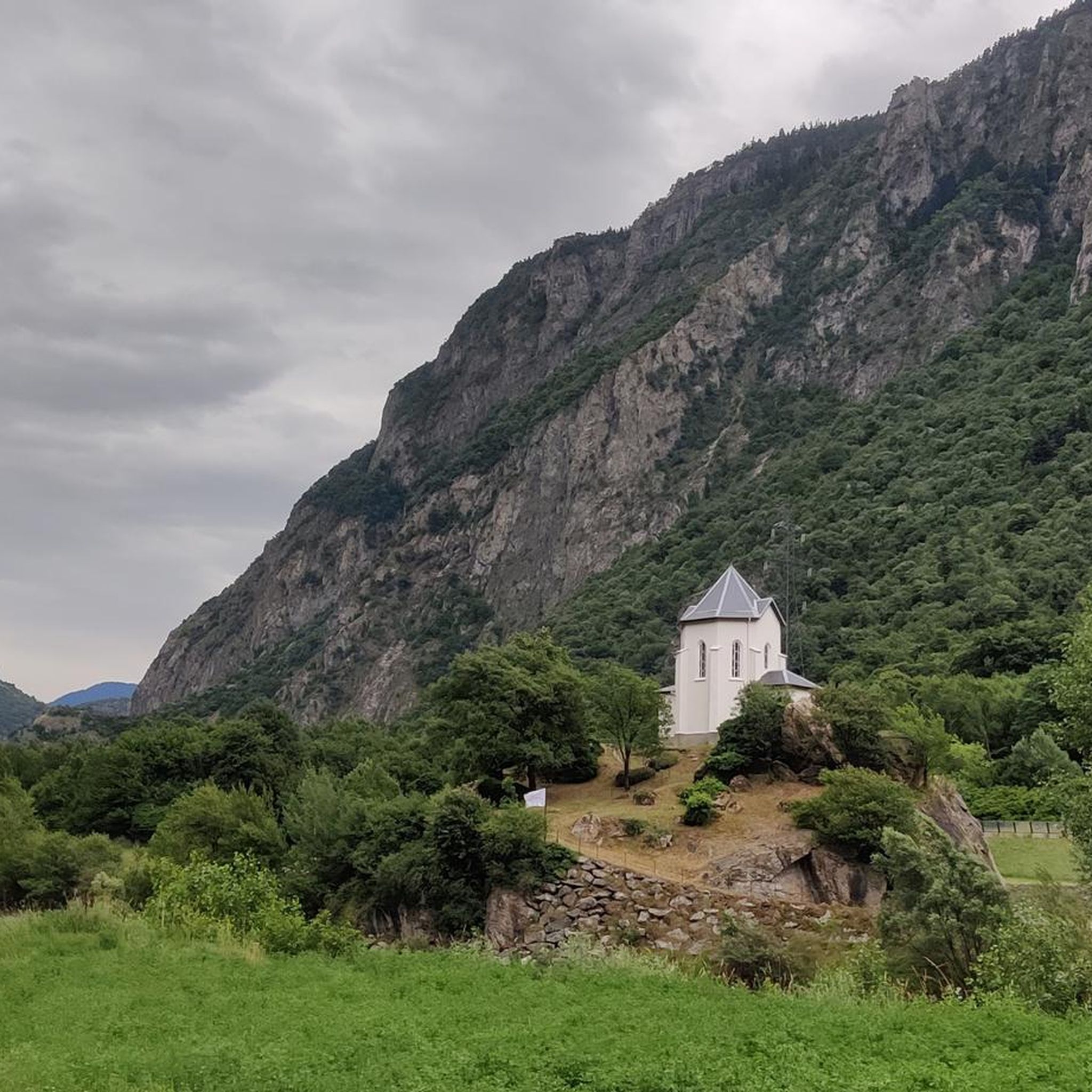
The terrain around Pontamafrey-Montpascal is quite varied. You'll find paths along the Arc river, shaded routes through charming hamlets, and higher mountain trails. The region is part of the French Alps, so expect a mix of verdant valleys and majestic mountainous backdrops. Some trails may include paved sections with low traffic, while others are natural paths.
Are there easy hiking options suitable for beginners or families?
Yes, Pontamafrey-Montpascal offers several easy hiking options. A popular choice is the Les Lacets de Montvernier loop from Pontamafrey-Montpascal, which is 3.4 miles (5.5 km) long and takes under two hours. Another easy option is the Col de Chaussy – Col du Chaussy 🌞 loop from Col du Chaussy, which is 3.1 miles (5.0 km) and provides access to the Col du Chaussy area with moderate elevation gain.
What notable landmarks or natural features can I discover along the trails?
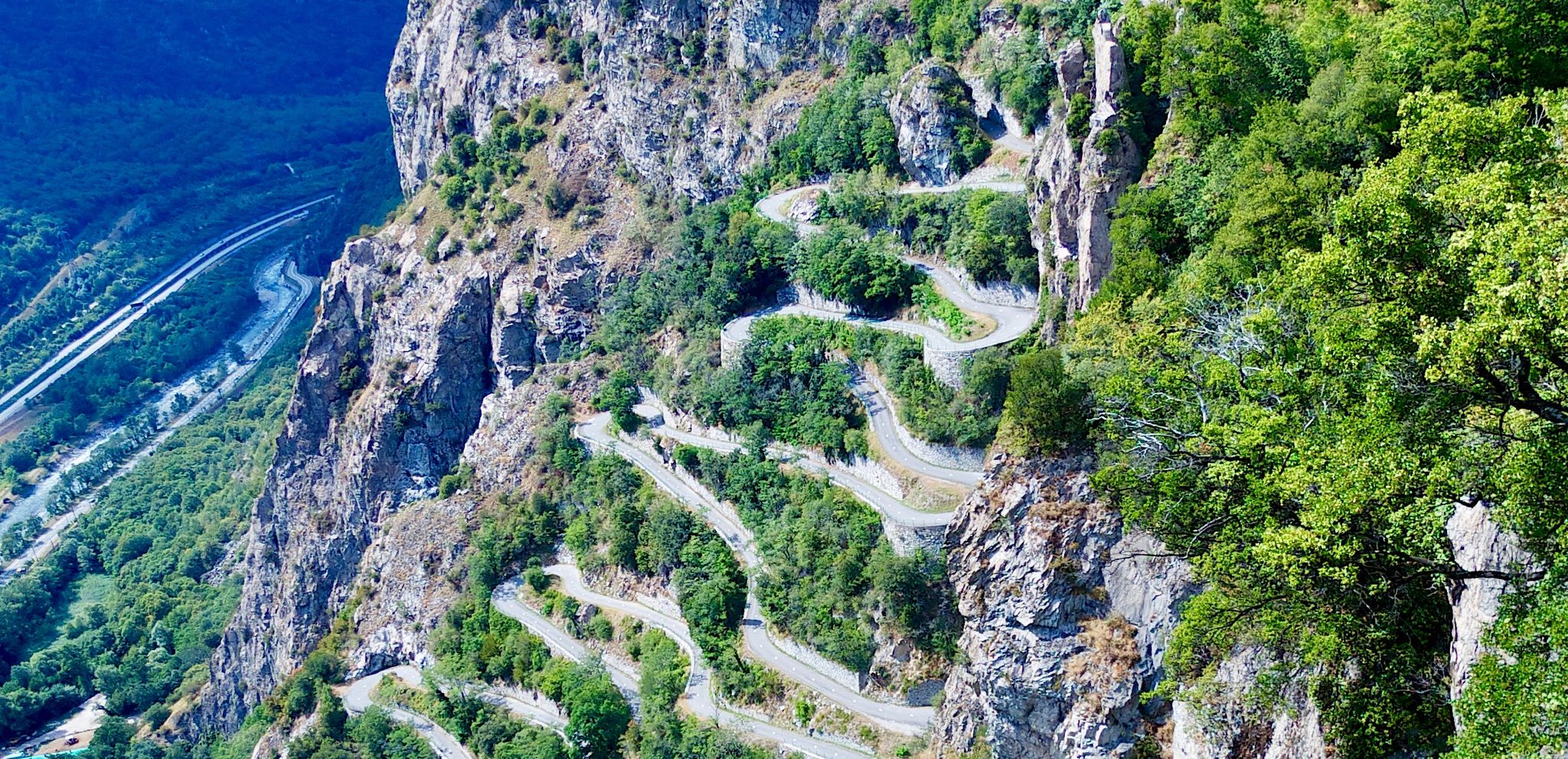
Hikers can explore several interesting features. The Les Lacets de Montvernier loop offers views of the unique 'Lacets de Montvernier' road and the Bérold tower. The region is also characterized by the Arc river, and you might spot vibrant orange lilies in early summer or crocuses in August on certain grassy ledges. For more adventurous sights, the 'Via ferrata La Passerelle' is also in Pontamafrey-Montpascal.
Are there any challenging hikes for experienced trekkers?
Yes, for those seeking a more strenuous adventure, there are challenging routes available. The Grand Coin – Col de Chaussy loop from Col du Chaussy is an 8.4 miles (13.5 km) trail leading through mountainous terrain, typically taking almost 7 hours to complete. Another difficult option is the Col de Chaussy – Crêt Lognan loop from Col du Chaussy, which covers over 10 km and involves significant elevation changes.
What is the best time of year to go hiking in Pontamafrey-Montpascal?
The region offers pleasant hiking conditions for much of the year. Early summer is particularly vibrant with orange lilies, and some trails feature crocuses in August. Shaded paths, like those on the 'Lac du Loup' hike, are enjoyable even in warm weather. Always check local weather conditions before heading out, especially for higher mountain routes.
Are there circular hiking routes in the area?
Yes, many of the trails around Pontamafrey-Montpascal are designed as circular routes, allowing you to start and end at the same point. Examples include the popular Les Lacets de Montvernier loop from Pontamafrey-Montpascal and the Col de Chaussy loop from Col du Chaussy.
Can I find mountain passes or peaks to explore near Pontamafrey-Montpascal?
Absolutely. The region is rich in mountain passes and peaks. You can explore the Col du Chaussy, which is a starting point for several hikes. Other notable passes include the Col de la Madeleine and Col d'Arves. For peaks, consider destinations like the La Toussuire Summit or Crêt Morandet.
What do other hikers enjoy most about the trails in Pontamafrey-Montpascal?
Hikers consistently rate the trails in Pontamafrey-Montpascal highly, with an average score of 4.6 out of 5 stars. Reviewers often praise the diverse landscapes, from riverine paths to stunning mountain views, and the variety of routes suitable for different fitness levels. The blend of natural beauty and charming hamlets along the way is also frequently highlighted.
Are there any specific trails that offer great viewpoints?
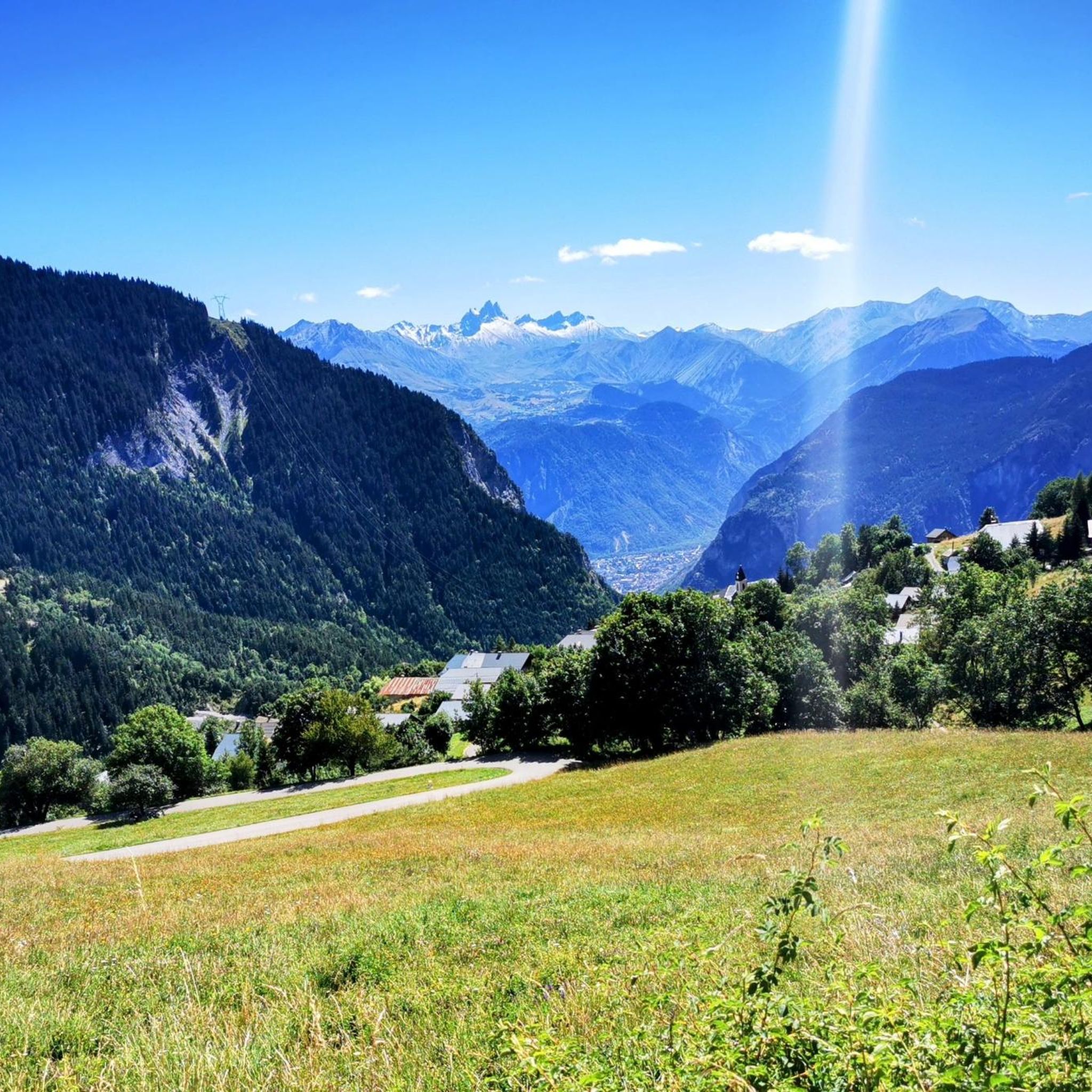
Many trails in Pontamafrey-Montpascal provide extensive views of the surrounding Maurienne Valley and the French Alps. The Les Lacets de Montvernier loop offers scenic vistas, including the unique 'Lacets de Montvernier' road. Hikes that ascend towards the Col du Chaussy or Grand Coin areas also typically feature splendid panoramic views of the valley and distant peaks.
Is it possible to access hiking trails using public transport in Pontamafrey-Montpascal?
While specific public transport links directly to trailheads might be limited, Pontamafrey-Montpascal is situated in the Maurienne Valley, which has some regional transport options. For detailed information on bus services or other public transport to reach starting points, it's advisable to consult local tourist information or the Maurienne Tourisme website: maurienne-tourisme.com.
Are there facilities like cafes or restaurants near the hiking routes?
Pontamafrey-Montpascal and the surrounding hamlets offer some local amenities. While specific cafes or restaurants directly on every trailhead are not guaranteed, you will find options in the villages themselves. It's a good idea to plan your route and check for facilities in the hamlets you pass through or at your starting/ending point.
Most popular routes around Pontamafrey-Montpascal
Most popular attractions around Pontamafrey-Montpascal

Get inspired with the komoot mobile app


Explore more
Browse the best Hikes in other regions.
