The best road cycling routes around Lagardère
4.0
(4)
316
riders
92
rides
Road cycling around Lagardère, France, is characterized by its rural setting within the Gers department of the Occitanie region. The area features rolling hills, extensive vineyards, and agricultural lands, providing a varied terrain for road cyclists. The average elevation in the commune is around 201 meters (659 ft), indicating a landscape with gentle ascents and descents rather than dramatic climbs. This geography offers a network of routes suitable for exploring the French countryside.
Best road cycling routes around Lagardère
- The…
Last updated: July 9, 2026
3.0
(3)
42
riders
46.0km
02:01
380m
380m
Moderate road ride. Good fitness required. Mostly well-paved surfaces and easy to ride.
5
riders
52.7km
02:40
810m
810m
Moderate road ride. Good fitness required. Mostly well-paved surfaces and easy to ride.

Sign up for free
5
riders
42.1km
02:08
630m
630m
Moderate road ride. Good fitness required. Mostly well-paved surfaces and easy to ride.
4
riders
50.5km
02:14
480m
480m
Moderate road ride. Good fitness required. Mostly well-paved surfaces and easy to ride.
5
riders
44.4km
02:06
500m
500m
Moderate road ride. Good fitness required. Mostly well-paved surfaces and easy to ride.
Get access to more routes and recommendations from other explorers.
Sign up for free
Already have an account?
Our route recommendations are based on thousands of hikes, rides, and runs completed by other people on komoot.
Start today with a free account
Your next adventure awaits.
Login or Signup


Tips from the Community

Condom, a former episcopal city crossed by the Baïse River, is renowned for its Saint-Pierre Cathedral and its Armagnac-related past. In front of the cathedral stands the famous statue of the Four Musketeers (D'Artagnan and his companions), a tribute to Alexandre Dumas' novel and the famous captain's Gascon roots.
0
0

Accessible and fairly hilly route. For a first timer, it's quite good for warming up.
0
1
33 kilometers from Eauze to Condom on the old railway line that connected the two towns. Only a 3.6 kilometer section uses small roads to bypass the Pomiro railway tunnel which is closed. The entire route is paved. Excellent alternative to the main road, with its much too dense traffic.
1
0
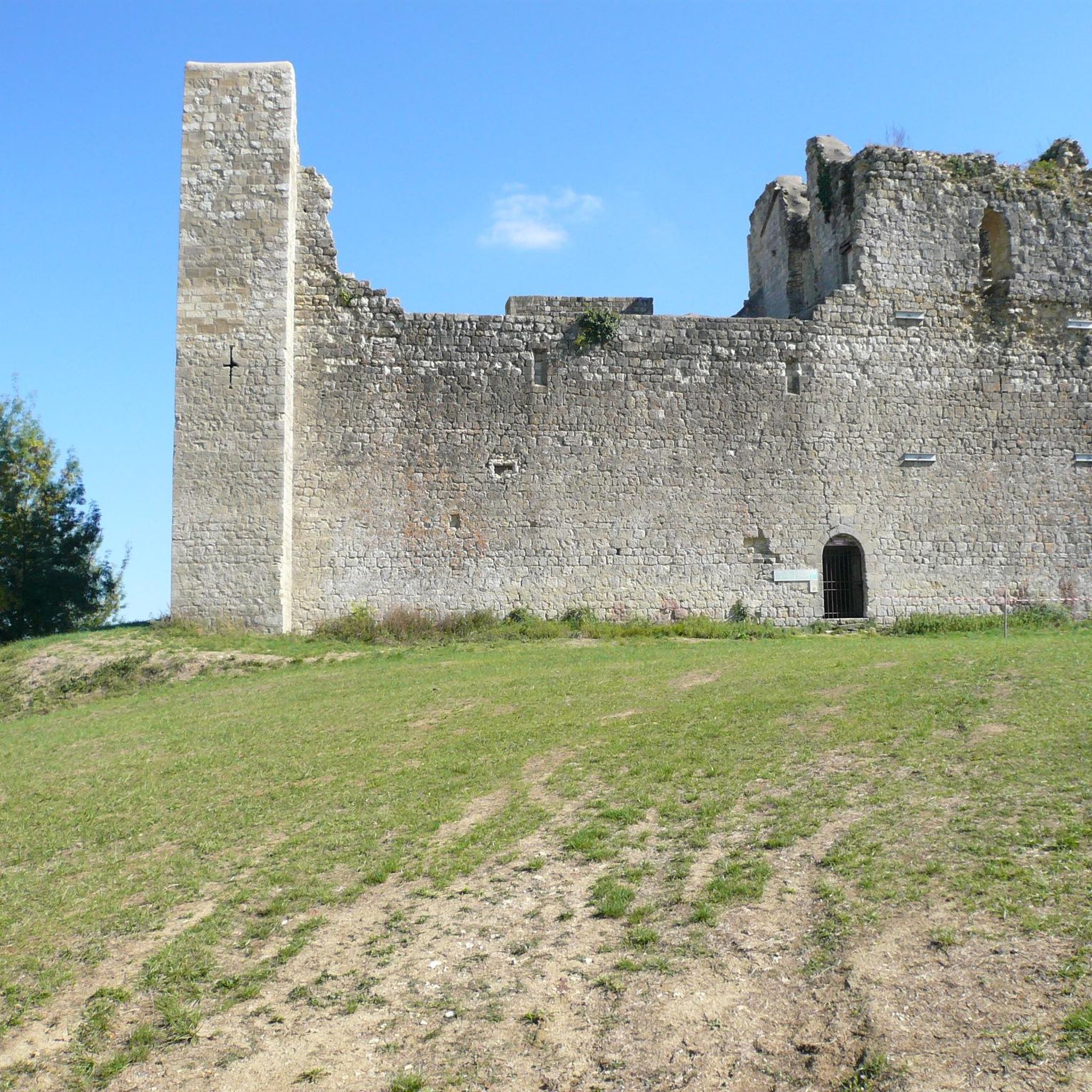
Cezan is a fortified village. The outer walls of the village houses form a surrounding wall. There are two towers left. There are few tourists who discover the place. There are so many castles and old villages or towns in the Gers.
0
0
For the arcaded square in front of Saint Luperc Cathedral and the small streets in the surrounding area.
0
0


Frequently Asked Questions
What kind of terrain can I expect when road cycling around Lagardère?
The Lagardère area, situated in the Gers department of Occitanie, is characterized by its rural landscape. Cyclists can expect rolling hills, extensive vineyards, and agricultural lands. The average elevation is around 201 meters (659 ft), meaning routes generally feature gentle ascents and descents rather than dramatic climbs, offering a varied and pleasant cycling experience.
How many road cycling routes are available in the Lagardère region?
There are over 100 road cycling routes available around Lagardère on komoot. These routes cater to various skill levels, including easy, moderate, and difficult paths, ensuring options for every cyclist.
Are there any easy road cycling routes suitable for beginners or families?
Yes, there are 12 easy road cycling routes around Lagardère. These routes are generally shorter and have less elevation gain, making them suitable for beginners or families looking for a more relaxed ride through the countryside. While specific family-friendly routes are not detailed, the overall gentle terrain is conducive to such rides.
What are some notable historical sites or landmarks I can see while cycling in Lagardère?
The region around Lagardère offers several historical sites. You could cycle past the impressive Flaran Abbey, or explore the perfectly preserved medieval fortified village of Larressingle Fortified Village. The town of Vic-Fezensac is also a historical site you might encounter on your rides.
Are there any routes that incorporate dedicated cycle paths or greenways?
Yes, some routes integrate dedicated cycle paths. For example, the Carmes bridge – Voie Verte de l'Armagnac loop from Courrensan includes a section of the Armagnac Greenway, offering a smoother and potentially car-free cycling experience.
What do other cyclists say about road cycling in Lagardère?
The road cycling routes in Lagardère are highly rated by the komoot community, with an average score of 3.0 stars from over 3 reviews. Over 300 road cyclists have used komoot to explore the varied terrain, often praising the quiet rural landscapes and the opportunity to discover historical sites.
Can I find challenging road cycling routes with significant elevation gain?
While the region is known for rolling hills, there are 4 difficult routes available for those seeking more challenging rides. For instance, the Lavardens Castle – Lavardens Village loop from Rozès features significant elevation gain, with over 800 meters of climbing, making it a good option for experienced cyclists.
Are there any circular road cycling routes around Lagardère?
Many of the road cycling routes in Lagardère are designed as loops, allowing you to start and finish at the same point. Examples include the Vic-Fezensac – Vic-Fezensac loop from Justian and the Lavardens Village – Lavardens Castle loop from Valence-sur-Baïse, which are popular choices for exploring the rural landscapes.
What is the best time of year to go road cycling in Lagardère?
The Gers department, where Lagardère is located, generally experiences pleasant weather for cycling during spring and autumn. These seasons offer milder temperatures and beautiful scenery with blooming fields or changing foliage. Summer can be warm, while winter might be cooler and wetter, so checking local weather forecasts is always recommended.
Are there routes that pass by specific villages or points of interest where I could stop for a break?
Yes, many routes are designed to pass through or near charming villages and points of interest. For example, the Lavardens Castle – Lavardens Village loop from Bezolles takes you past Lavardens Castle and through local villages, providing opportunities for breaks, refreshments, or exploring local culture.
What are the typical distances and durations for road cycling routes in this area?
The routes vary in length and duration. For instance, the Carmes bridge – Voie Verte de l'Armagnac loop from Courrensan is about 46 km (28.6 miles) and takes approximately 2 hours. Longer routes like the Vic-Fezensac – Vic-Fezensac loop from Justian cover around 67 km (41.8 miles) and can take closer to 2 hours 46 minutes, depending on your pace.
Most popular attractions around Lagardère

Get inspired with the komoot mobile app


Explore more
Browse the best Road cycling routes in other regions.
