The best walks and hikes around Montigny-Saint-Barthélemy
4.6
(170)
985
hikers
55
hikes
Hiking around Montigny-Saint-Barthélemy offers a network of trails through varied terrain. The region is characterized by its rural landscapes, featuring woodlands, open fields, and gentle elevation changes. Many routes follow paths alongside local waterways and through small hamlets, providing a mix of natural and cultural points of interest.
Best hiking trails around Montigny-Saint-Barthélemy
- The most popular hiking route is Le château de Thil — loop from Précy-sous-Thil in the parc naturel régional du Morvan, a 8.5 miles (13.6 km)…
Last updated: July 6, 2026
4.6
(9)
21
hikers
Moderate hike. Good fitness required. Easily-accessible paths. Suitable for all skill levels.
4.8
(10)
40
hikers
7.56km
02:01
80m
80m
Moderate hike. Good fitness required. Easily-accessible paths. Suitable for all skill levels.

Sign up for free
5.0
(3)
22
hikers
6.14km
01:39
70m
70m
Easy hike. Great for any fitness level. Easily-accessible paths. Suitable for all skill levels.
4.0
(3)
28
hikers
6.78km
01:49
80m
80m
Easy hike. Great for any fitness level. Easily-accessible paths. Suitable for all skill levels.
4.4
(5)
12
hikers
11.6km
03:04
120m
120m
Moderate hike. Good fitness required. Easily-accessible paths. Suitable for all skill levels.
Get access to more routes and recommendations from other explorers.
Sign up for free
Already have an account?
Our route recommendations are based on thousands of hikes, rides, and runs completed by other people on komoot.
Start today with a free account
Your next adventure awaits.
Login or Signup



Tips from the Community

Semur-en-Auxois can be reached by a cycle path and also by the Burgundy Canal.
0
0

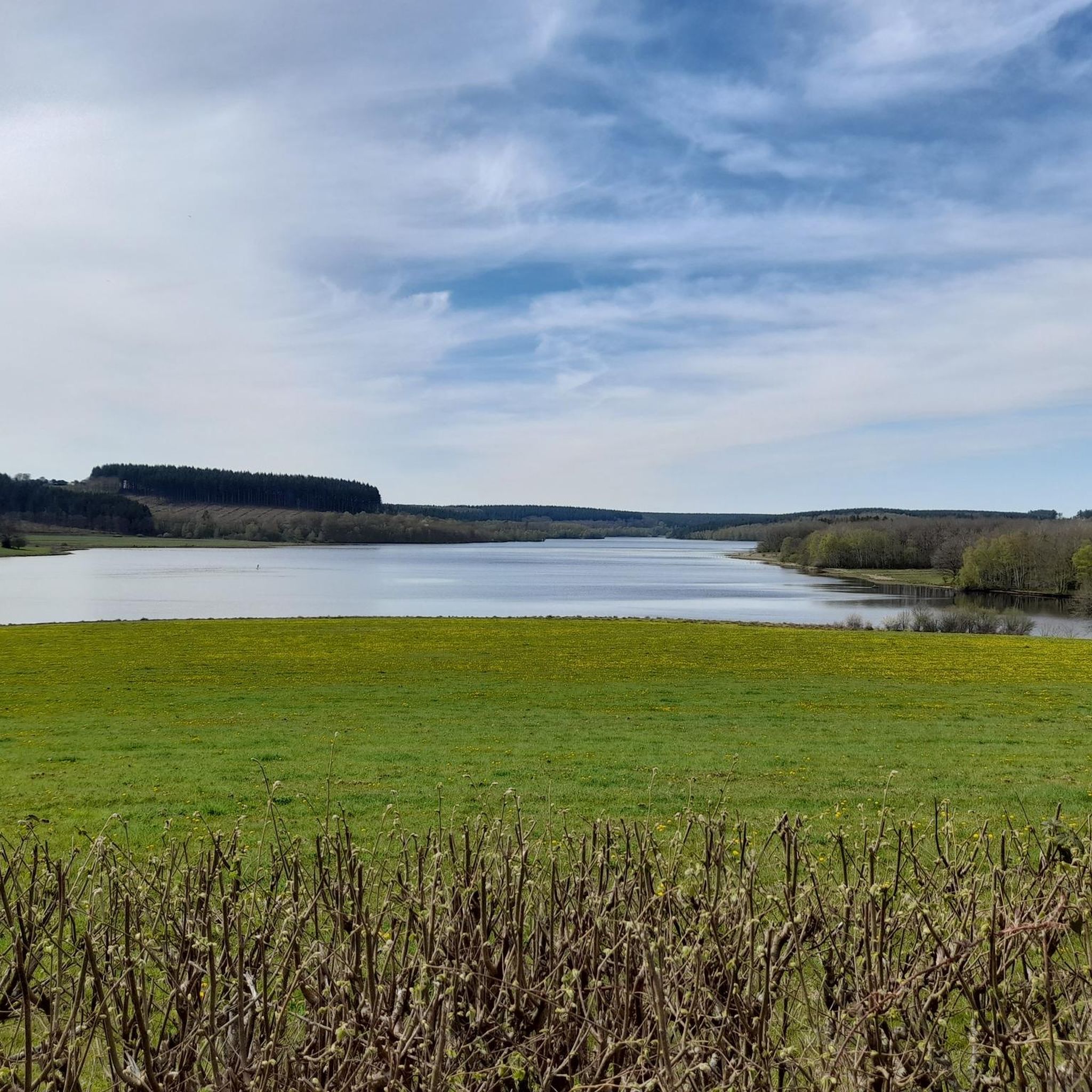
Small cute village with access to Lake Armançon, There is a beach and a nautical base where you can rent a boat or a kayak. There is also a small park in front of the lake where you can take a short break.
0
0

Unfortunately the chateau is closed. Lt. Signage throughout 2023
0
0

The Armancon dam is a truly amazing work of architecture and the trek to the top is a pleasure.
2
0
Thil Castle is not open at the moment, but it is still a sight to enjoy while strolling around. Although in ruins, it remains impressive.
2
0

Just three kilometers from Semur-en-Auxois, the L'Armancon dam is located above Pont-et-Massène. The dam wall is accessible, offers a beautiful view of the lake and you can include it in a hiking tour around the lake. The dam serves to regulate the water flow and as a reservoir for the Canal de Bourgogne.
1
0
Small nice sandy beach, directly at the dam. There are changing rooms, a small restaurant on the beach 🏖 and a mobile snack sale at the entrance.
1
0

Swim or rent a kayak. Unfortunately no snacks or drinks but a proper restaurant.
0
0
Frequently Asked Questions
How many hiking trails are available in Montigny-Saint-Barthélemy?
There are over 50 hiking routes in and around Montigny-Saint-Barthélemy, offering a variety of distances and difficulty levels to explore the region's diverse landscapes.
Are there easy hiking trails suitable for beginners or families?
Yes, Montigny-Saint-Barthélemy offers a good selection of easy trails. Approximately 32 routes are classified as easy, perfect for beginners or families. An example is the Pont-et-Massène Dam – Pont Lake Beach loop from Flée, which is 4.1 miles (6.6 km) long and features pleasant lakeside scenery.
What kind of scenery can I expect on the hiking trails?
The trails in Montigny-Saint-Barthélemy traverse varied terrain, including tranquil woodlands, open fields, and gentle elevation changes. Many routes also follow paths alongside local waterways and through charming small hamlets, offering a mix of natural beauty and cultural points of interest.
Can I bring my dog on the hiking trails?
Generally, dogs are welcome on most hiking trails in the Montigny-Saint-Barthélemy region. However, it's always recommended to keep them on a leash, especially when passing through agricultural areas or near wildlife, and to respect local signage.
Are there any circular walks available?
Yes, many of the routes in Montigny-Saint-Barthélemy are designed as circular walks, allowing you to start and end at the same point. For instance, the Le château de Thil — loop from Précy-sous-Thil is a popular circular route that offers views of the Château de Thil.
What interesting landmarks or attractions can I see along the trails?
The region features several points of interest. You might encounter historical sites like the Ramparts Walk or natural features such as the Lac de Pont and the Pont-et-Massène Dam. Some trails also highlight the area's industrial heritage, as seen on the Washhouse – Old Forges of the Serein loop from Précy-sous-Thil.
When is the best time of year to go hiking in Montigny-Saint-Barthélemy?
Spring and autumn are generally ideal for hiking in Montigny-Saint-Barthélemy, with pleasant temperatures and beautiful natural colors. Summer also offers good conditions, though it can be warmer. Winter hiking is possible, but some paths might be muddy or require appropriate gear.
Is parking available at the trailheads?
In this rural region, parking is typically available near trailheads, especially in or near the small villages and hamlets where many routes begin. Look for designated parking areas or suitable roadside spots.
What do other hikers enjoy most about the trails in Montigny-Saint-Barthélemy?
The trails in Montigny-Saint-Barthélemy are highly regarded by the komoot community, with an average rating of 4.6 stars. Hikers often praise the peaceful rural landscapes, the well-maintained paths, and the opportunity to discover both natural beauty and historical sites.
Are there any longer, more challenging hikes for experienced hikers?
While the region is known for its moderate and easy trails, there are options for longer distances. For example, the Hiking loop from Précy-sous-Thil covers 7.2 miles (11.5 km) and offers a good workout through varied terrain.
Can I reach the trailheads using public transport?
Public transport options to specific trailheads in Montigny-Saint-Barthélemy may be limited due to its rural nature. It is generally advisable to travel by car to access the starting points of most hikes. However, some larger villages might have bus connections, so it's best to check local schedules for specific routes.
Most popular routes around Montigny-Saint-Barthélemy
Most popular attractions around Montigny-Saint-Barthélemy

Get inspired with the komoot mobile app


Explore more
Browse the best Hikes in other regions.
