The best MTB trails around Brandonnet
4.4
(61)
370
riders
62
rides
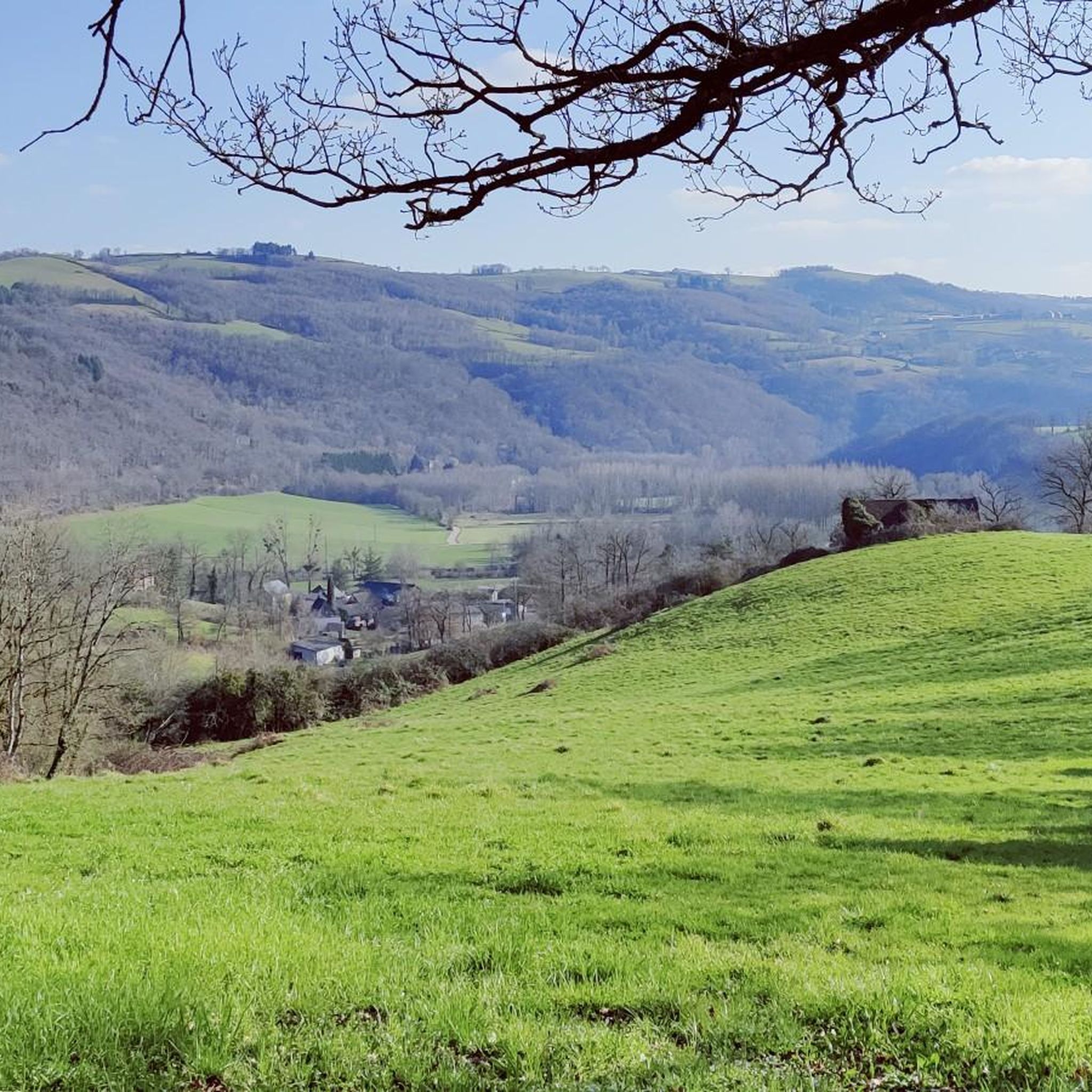
Mountain biking around Brandonnet offers diverse terrain characterized by a hilly landscape and small gorges carved by the Alzou river. The region features deep limestone canyons and varied topography, providing an engaging backdrop for outdoor pursuits. Mountain bike trails in Brandonnet often follow paths and forest tracks, ensuring varied routes with technical sections, descents, and climbs. This area of the Aveyron department is well-suited for mountain biking across different skill levels.
Best mountain bike trails around Brandonnet
- The most popular…
Last updated: October 13, 2026
5.0
(1)
9
riders
38.2km
03:18
790m
790m
This 23.8-mile mountain biking loop near Villefranche-de-Rouergue offers moderate difficulty and scenic views along the Aveyron River.
4.3
(3)
14
riders
Moderate mountain bike ride. Good fitness required. Suitable for all skill levels.

3.0
(1)
13
riders
35.1km
02:43
470m
470m
Moderate mountain bike ride. Good fitness required. Advanced riding skills necessary.
5.0
(2)
15
riders
36.9km
03:26
960m
960m
Hard mountain bike ride. Very good fitness required. Suitable for all skill levels.
4.8
(4)
9
riders
44.7km
03:19
480m
480m
Moderate mountain bike ride. Good fitness required. Suitable for all skill levels.
Get access to more routes and recommendations from other explorers.
Already have an account?
Our route recommendations are based on thousands of hikes, rides, and runs completed by other people on komoot.
Start today with a free account
Your next adventure awaits.



Tips from the Community

Very nice small town with mighty architecture.
1
0
Thursday is market day, highly recommended.
2
0

Typical and beautiful village in Occitania.
1
0

Villeneuve is a picturesque commune located in the Aveyron department, in the Occitanie region, in the south of France. Here are some key facts and attractions of this charming locality: General Information: Department: Aveyron Arrondissement: Villefranche-de-Rouergue Population: 1,988 inhabitants as of January 1, 2019 Postal Code: 12260 Points of Interest: Historical Heritage: Medieval Bastide: Villeneuve is renowned for its medieval character, with picturesque streets and old buildings that recall its past. The town was founded in the 13th century, and its streets reflect the typical town planning of medieval bastides. Saint-Pierre Church: The parish church of Saint-Pierre is a fine example of local religious architecture. With its Romanesque and Gothic elements, it is a point of interest for those interested in history and religious architecture. Why visit Villeneuve? Historical Heritage: Villeneuve offers a fascinating glimpse into the medieval past with its streets, church and historic buildings. Natural Beauty: The commune is surrounded by beautiful natural landscapes, perfect for outdoor and nature lovers. Authenticity: With its tranquil atmosphere and rich heritage, Villeneuve is an ideal destination for those looking for an authentic and relaxing experience in the South of France. In short, Villeneuve is a commune that combines history, nature and traditions, offering an enriching experience for visitors and residents alike.
2
1

Villeneuve d'Aveyron, or simply Villeneuve, is a beautiful town made up of an 11th century salvage and a 13th century bastide. It is a pleasant place for a break with something to refresh and eat and a remarkable architectural heritage.
2
0
Villefranche-de-Rouergue is a sub-prefecture of Aveyron. It is labeled "Grand Site d'Occitanie" and "Pays d'Art et d'Histoire". The city was founded in 1252. Among the architectural heritage of the bastide, there is the Collegiate Church and its porch, the arcades that go around the Place Notre-Dame, the alleys, the beautiful period residences and the Chartreuse Saint - 15th century saviour.
1
0
Here is a nice place for a picnic break, with tables, shade and toilets. The environment is pleasant on the banks of the Assou.
1
0

Bannac lake with campsite, restaurant. Possibility to go around (5kms)
0
0
Frequently Asked Questions
How many mountain bike trails are available around Brandonnet?
Brandonnet and its surrounding area offer a wide selection of mountain bike trails, with over 50 routes available for exploration. These trails cater to various skill levels, from easy paths to more challenging rides.
Are there easy mountain bike trails suitable for beginners or families in Brandonnet?
Yes, Brandonnet has several easy mountain bike trails perfect for beginners or families looking for a less strenuous ride. There are 9 easy routes, often following paths and forest tracks through the hilly landscape, providing a pleasant introduction to the region's terrain.
What kind of landscapes and natural features can I expect to see while mountain biking in Brandonnet?
Mountain biking in Brandonnet offers diverse and scenic landscapes. You'll encounter a hilly topography, often interspersed with small gorges carved by the Alzou river. The region is known for its deep limestone canyons and varied terrain, providing an engaging backdrop of natural beauty and sometimes challenging environments.
Are there challenging mountain bike routes for experienced riders in Brandonnet?
Absolutely. For experienced mountain bikers seeking a challenge, Brandonnet offers 13 difficult routes. These trails often feature technical sections, exhilarating descents, and demanding climbs, taking advantage of the region's varied and rugged terrain. An example of a challenging route is the Pont du Cayla – Les Martinets du Lézert loop from Le Bas Ségala, which covers 44.0 km with over 1000 meters of elevation gain.
What historical landmarks or points of interest can I discover along the mountain bike trails?
The region around Brandonnet is rich in history. Many trails pass by or near significant landmarks. For instance, the Pont du Cayla – Les Martinets du Lézert loop from Le Bas Ségala leads past the historic Pont du Cayla, an ancient stone bridge. You might also encounter remnants of old mills along the Alzou river, such as La Gineste, Berteille, and Bousquet, adding a cultural dimension to your ride. Nearby, you can explore the Villeneuve-d'Aveyron Medieval Town Center or the Collegiate Church of Notre-Dame of Villefranche-de-Rouergue.
Are there circular mountain bike routes available in Brandonnet?
Yes, many mountain bike routes in Brandonnet are designed as loops, allowing you to start and finish at the same point. For example, the Villefranche-de-Rouergue – Les Martinets du Lézert loop from Villefranche-de-Rouergue is a moderate 36.2 km circular path, and the Pont du Cayla loop from Le Bas Ségala offers a 34.1 km moderate ride.
What is the best time of year to go mountain biking in Brandonnet?
The Aveyron region, including Brandonnet, generally offers good mountain biking conditions for much of the year. Spring and autumn are often ideal, with pleasant temperatures and vibrant scenery. Summer can also be suitable, though it's advisable to ride earlier in the morning or later in the afternoon to avoid the midday heat. The varied terrain means trails can be enjoyed across different seasons, but always check local weather conditions.
Is Brandonnet suitable for mountain biking with dogs?
While many trails in natural areas are dog-friendly, it's always best to check specific local regulations for each route. Generally, if your dog is well-behaved and kept under control, especially around livestock or other trail users, you should be able to enjoy many of the paths. Be mindful of the terrain, potential for slippery sections near rivers, and ensure your dog has access to water.
What do other mountain bikers say about the trails in Brandonnet?
The mountain bike trails around Brandonnet are highly rated by the komoot community, with an average score of 4.4 stars from over 40 reviews. Riders often praise the varied terrain, the mix of forest tracks and open sections, and the engaging backdrop of the hilly landscape and gorges. Over 300 mountain bikers have used komoot to explore this area, highlighting its appeal.
Are there options for parking near the mountain bike trailheads in Brandonnet?
Yes, many trailheads in and around Brandonnet, especially those starting from towns like Villefranche-de-Rouergue or Le Bas Ségala, offer designated parking areas. It's common to find parking available in or near the starting points of popular routes, making access convenient for mountain bikers.
Can I find places to eat or stay near the mountain bike trails in Brandonnet?
Brandonnet and the wider Aveyron region offer various options for accommodation and dining. You can find gîtes, chambres d'hôtes (bed and breakfasts), and small hotels in nearby villages and towns. Many of these places are accustomed to outdoor enthusiasts. Local cafes and restaurants provide opportunities to refuel after your ride, often serving regional specialties.
What is the typical elevation gain on mountain bike trails in Brandonnet?
Due to Brandonnet's hilly landscape and gorges, mountain bike trails often feature significant elevation changes. Moderate routes can see elevation gains of 600-850 meters, while more difficult trails can exceed 1000 meters of ascent. For example, the Villefranche-de-Rouergue and route has an elevation gain of approximately 790 meters over 38.2 km.
Most popular routes around Brandonnet
Most popular attractions around Brandonnet

Get inspired with the komoot mobile app


Explore more
Browse the best MTB trails in other regions.
