The best walks and hikes around Semur-En-Auxois
4.5
(158)
785
hikers
33
hikes
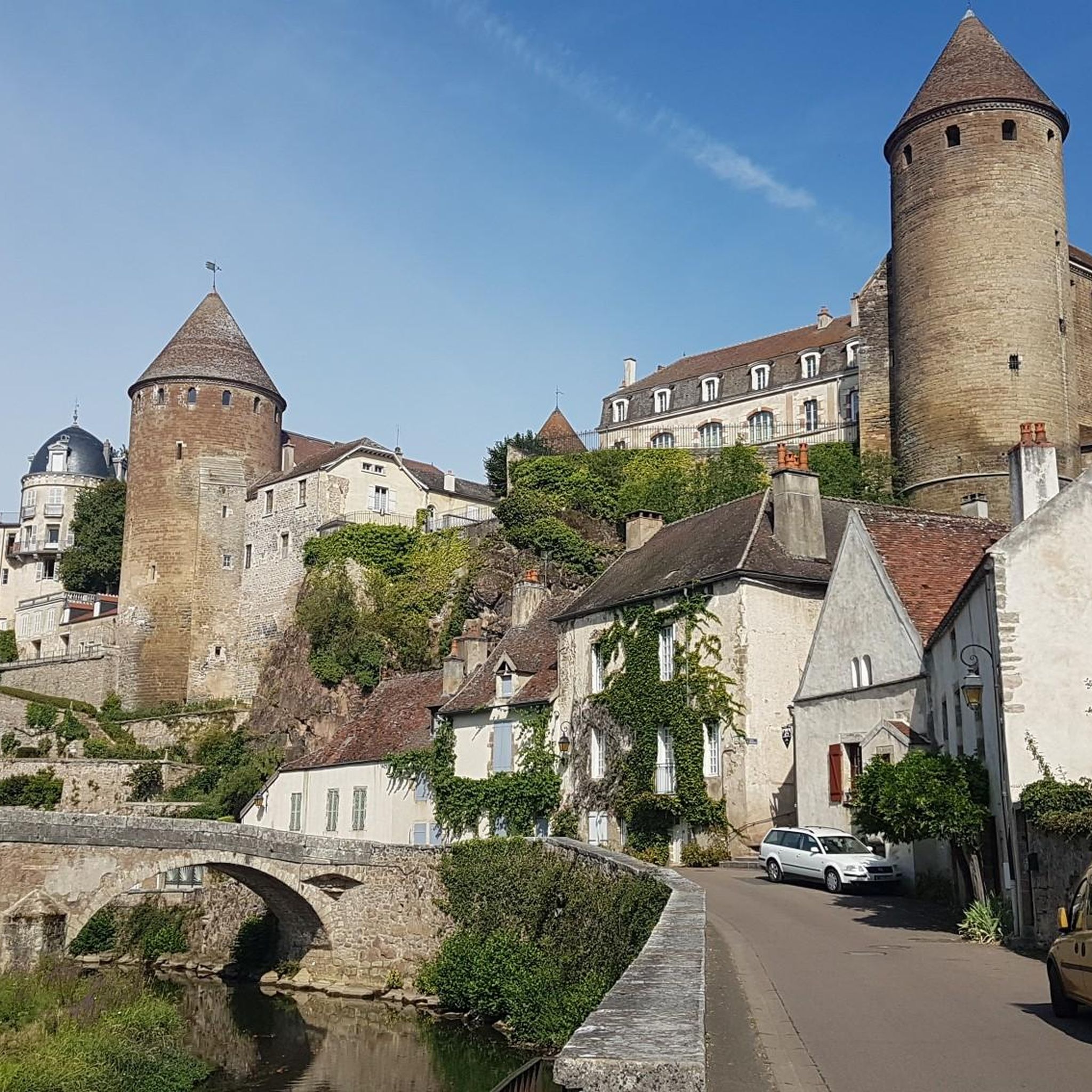
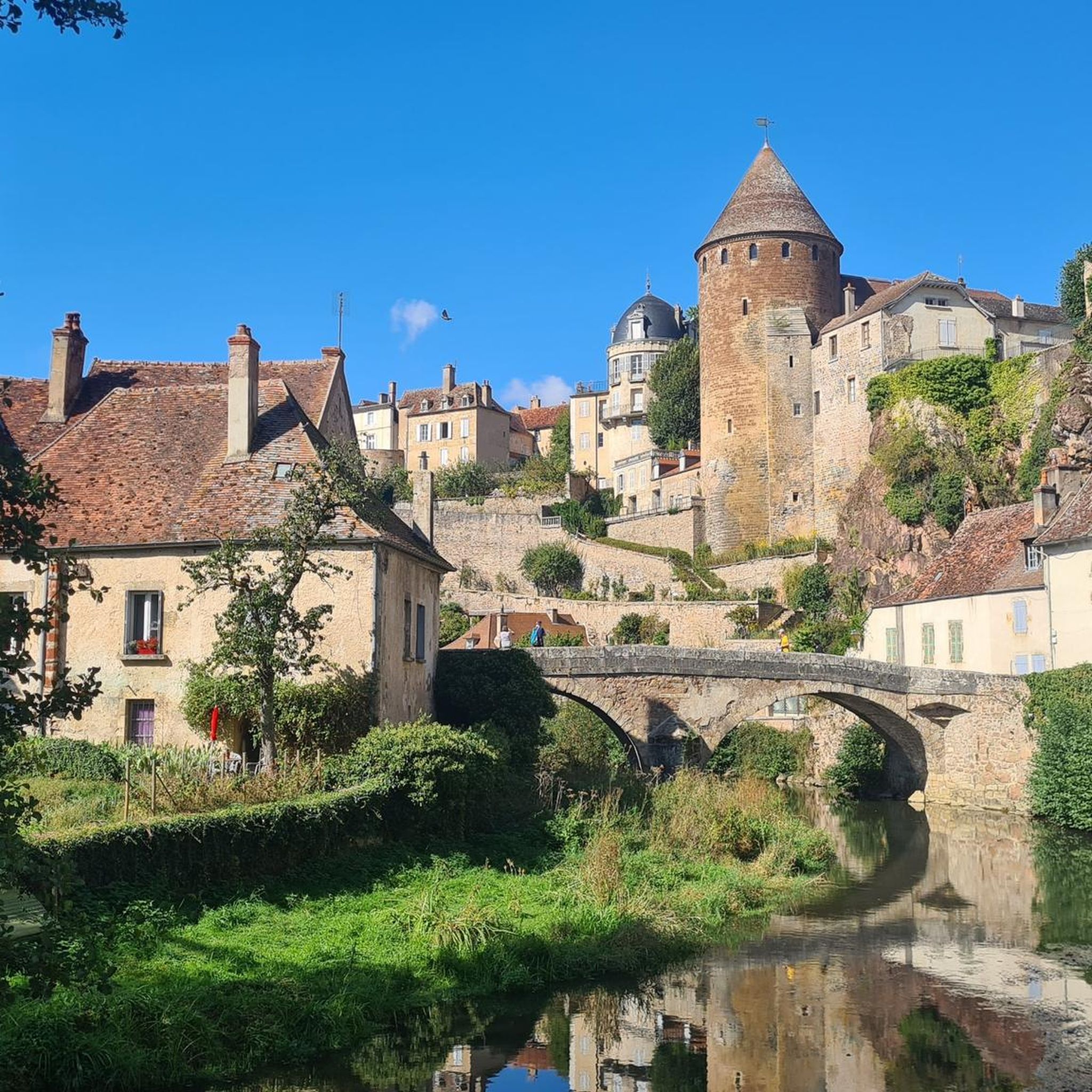
Hiking around Semur-En-Auxois offers diverse terrain, characterized by its dramatic position on a pink granite outcrop, almost entirely encircled by the Armançon River. The region features a scenic river valley, extensive forests, and nearby lakes like Lac de Pont. Trails often incorporate views of the town's medieval ramparts and historic bridges, providing a blend of natural and cultural exploration.
Best hiking trails around Semur-En-Auxois
- The most popular hiking route is Semur-en-Auxois — loop, a 6.6 miles (10.6 km) trail that takes 2 hours 52 minutes to complete. This moderate route offers views of the Armançon River and the town's historic fortifications.
- Another top favourite among local hikers is Pont Pinard – Ramparts Walk loop from Semur-en-Auxois, an easy 3.1 miles (5.0 km) path. This trail winds through the medieval town and along its well-preserved ramparts.
- Local hikers also love the Pont-et-Massène Dam – Lac de Pont loop from Semur-en-Auxois, a 7.9 miles (12.7 km) trail leading through the Lac de Pont area, often completed in about 3 hours 20 minutes.
- Hiking around Semur-En-Auxois is defined by the Armançon River valley, pink granite formations, and surrounding forests and lakes. The network offers options for easy strolls to more challenging routes, catering to various ability levels.
- The routes in Semur-En-Auxois are highly rated by the komoot community with an average score of 4.5 stars from over 100 reviews. More than 600 hikers have used komoot to explore Semur-En-Auxois's varied terrain.
Last updated: October 12, 2026
4.2
(6)
23
hikers
10.6km
02:52
140m
140m
Moderate hike. Good fitness required. Easily-accessible paths. Suitable for all skill levels.
4.7
(24)
65
hikers
4.98km
01:23
90m
90m
Easy hike. Great for any fitness level. Easily-accessible paths. Suitable for all skill levels.

5.0
(6)
12
hikers
13.1km
03:29
130m
140m
Moderate hike. Good fitness required. Easily-accessible paths. Suitable for all skill levels.
4.3
(3)
13
hikers
3.08km
00:49
30m
30m
Easy hike. Great for any fitness level. Easily-accessible paths. Suitable for all skill levels.
4.3
(3)
10
hikers
2.09km
00:34
30m
30m
Easy hike. Great for any fitness level. Easily-accessible paths. Suitable for all skill levels.
Get access to more routes and recommendations from other explorers.
Already have an account?
Our route recommendations are based on thousands of hikes, rides, and runs completed by other people on komoot.
Start today with a free account
Your next adventure awaits.
Tips from the Community

The restored Pont Pinard bridge
1
0

City sports to the medieval center
1
0
This part of the walk is really beautiful
1
0
Semur-en-Auxois is often called one of the most beautiful medieval towns in Burgundy. This Highlight explains why.
1
0

Nearby is Abbaye de Fontanay, which is also worth seeing.
1
0

The Armancon dam is a truly amazing work of architecture and the trek to the top is a pleasure.
2
0
Run along the surrounding wall of the fortress, from where you will have a good view of the Armancon and the interesting defensive architecture.
3
0
The bridge was built in 1756. It offers a magnificent view of the 14th century towers of Semur-en-Auxois. Dare I say it's worth stopping to take a photo on your run?
3
0
Frequently Asked Questions
How many hiking trails are available around Semur-en-Auxois?
There are over 30 hiking routes around Semur-en-Auxois, offering a variety of experiences from easy strolls to more challenging treks. The komoot community has recorded 34 tours in the area.
What kind of terrain can I expect on hikes in Semur-en-Auxois?
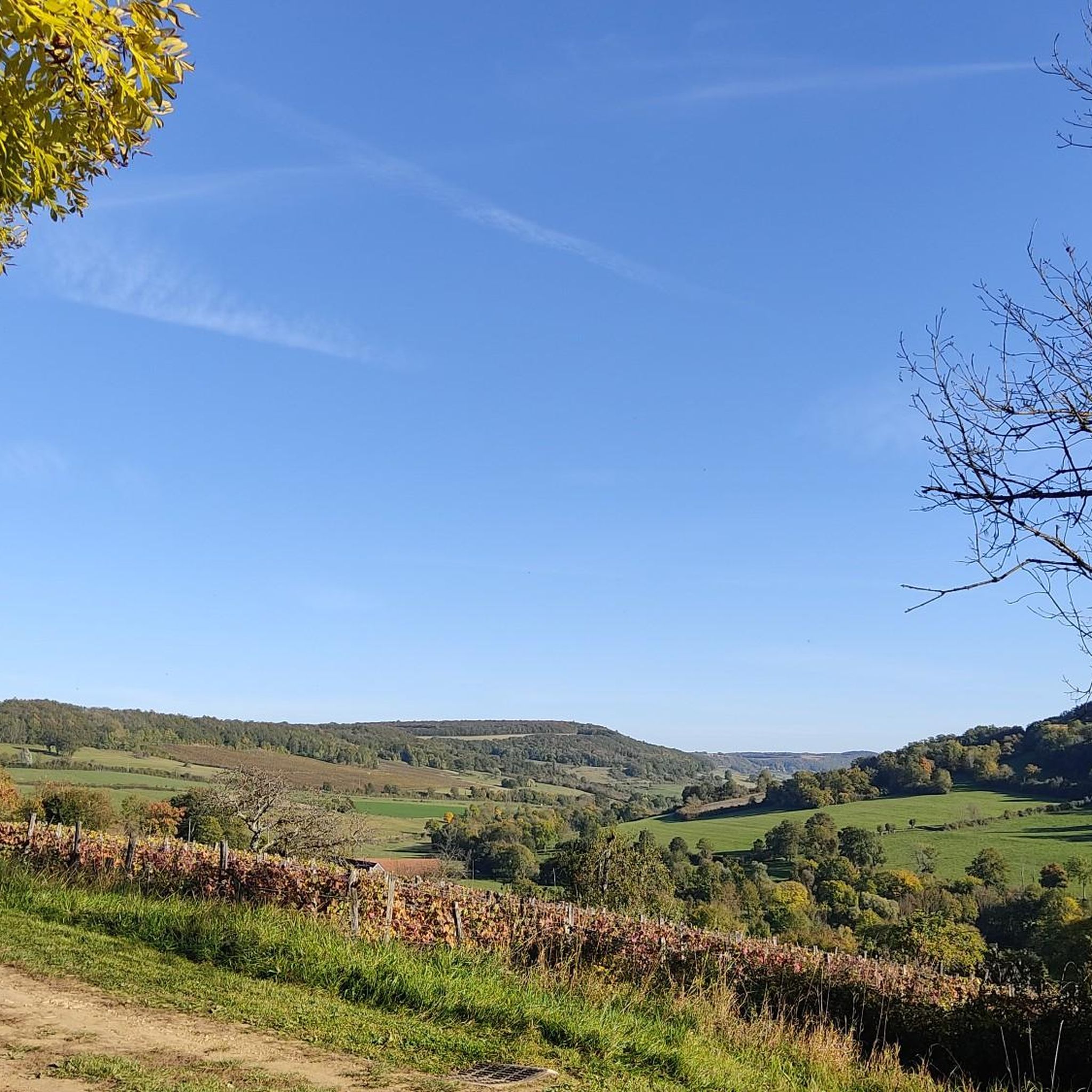
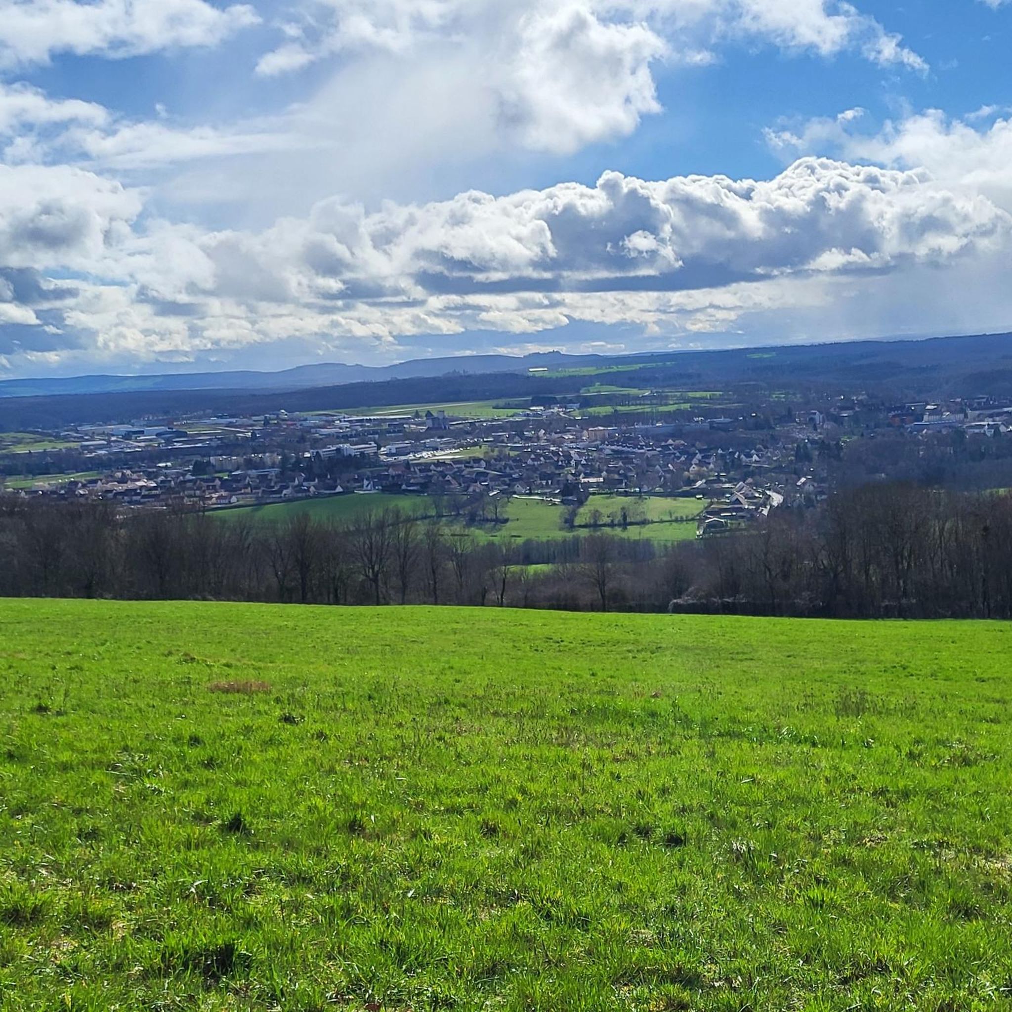
Hiking around Semur-en-Auxois features diverse terrain. You'll encounter paths along the scenic Armançon River valley, trails through forests, and routes around lakes like Lac de Pont. The town itself is perched on a distinctive pink granite outcrop, so some paths may include rocky sections or offer views of these geological formations.
Are there easy hiking routes suitable for beginners or families?
Yes, Semur-en-Auxois offers many easy hiking routes perfect for beginners or families. For example, the Pont Pinard – Ramparts Walk loop from Semur-en-Auxois is an easy 5 km path that winds through the medieval town and along its well-preserved ramparts, offering great views without significant elevation gain. There are 23 easy routes in total.
Are there any circular hiking routes available?
Yes, many routes around Semur-en-Auxois are circular. A popular option is the Semur-en-Auxois — loop, a 10.6 km trail that offers views of the Armançon River and the town's historic fortifications. Another great circular option is the Pont-et-Massène Dam – Lac de Pont loop from Semur-en-Auxois, which takes you around Lac de Pont.
What natural features or landmarks can I see while hiking?
While hiking, you can explore the dramatic Armançon River valley, the town's medieval ramparts, and historic bridges like Pont Pinard. The wider region features the picturesque Lac de Pont and sections of the Canal de Bourgogne and Its Locks. You might also encounter the unique pink granite formations that define the area.
Can I bring my dog on the hiking trails in Semur-en-Auxois?
Many hiking trails in the natural areas around Semur-en-Auxois are generally dog-friendly, especially those through forests and along the river. However, it's always recommended to keep your dog on a leash, particularly near livestock, in protected areas, or when passing through populated sections of the town. Check specific trail regulations if available.
What is the best time of year to go hiking in Semur-en-Auxois?
The best time for hiking in Semur-en-Auxois is typically from spring through autumn (April to October). During these months, the weather is generally pleasant, and the natural landscapes are vibrant. Spring brings blooming wildflowers, while autumn offers beautiful fall foliage. Summer can be warm, but riverside and forest trails provide shade.
Are there any challenging hikes in Semur-en-Auxois?
While most routes are easy to moderate, there is one difficult hiking trail around Semur-en-Auxois for those seeking a greater challenge. These routes may involve steeper ascents, longer distances, or more rugged terrain. Always check the specific trail details and your fitness level before attempting a difficult hike.
How long do hikes typically take around Semur-en-Auxois?
Hikes around Semur-en-Auxois vary in length and duration. Easy routes, like the Rue Buffon – Pont Pinard loop (6.7 km), can take around 2 hours. Longer, moderate trails, such as the Pont Lake Beach – Pont-et-Massène Dam loop (11 km), might take 3 to 3.5 hours to complete.
Where can I find parking for hiking trails in Semur-en-Auxois?
Parking is generally available in and around Semur-en-Auxois, especially near the town center and at popular starting points for trails. Look for designated parking areas within the town or near major attractions like Lac de Pont. Specific route descriptions on komoot often provide details on recommended starting points and parking options.
What do other hikers enjoy most about the trails in Semur-en-Auxois?
The trails in Semur-en-Auxois are highly rated by the komoot community, with an average score of 4.5 stars from over 100 reviews. Hikers often praise the blend of historical charm with natural beauty, the stunning views of the medieval town from the riverbanks and ramparts, and the peaceful atmosphere of the surrounding forests and lakes.
Most popular routes around Semur-En-Auxois
Most popular attractions around Semur-En-Auxois

Get inspired with the komoot mobile app


Explore more
Browse the best Hikes in other regions.
