The best walks and hikes around Montliard
4.7
(101)
454
hikers
72
hikes
Hiking around Montliard offers diverse landscapes at the limit between the Beauce and Gâtinais regions in the Loiret department of France. The area features rolling paths through woods, ponds, and agricultural fields, providing varied scenery for walkers. Montliard is situated north of the extensive Orléans Forest, which offers numerous opportunities for immersion in nature. The wider Loiret department also includes over 300 km of waterways, including the Loire River and canals, suitable for walking.
Best hiking trails around Montliard
- The…
Last updated: July 4, 2026
4.3
(4)
13
hikers
7.09km
01:49
20m
30m
Easy hike. Great for any fitness level. Easily-accessible paths. Suitable for all skill levels.
5.0
(1)
1
hikers
9.04km
02:19
30m
30m
Moderate hike. Good fitness required. Mostly accessible paths. Sure-footedness required.

Sign up for free
4.3
(6)
26
hikers
12.2km
03:08
60m
60m
Moderate hike. Good fitness required. Easily-accessible paths. Suitable for all skill levels.
10
hikers
7.90km
02:02
30m
40m
Moderate hike. Good fitness required. Easily-accessible paths. Suitable for all skill levels.
5.0
(1)
5
hikers
12.9km
03:18
40m
40m
Moderate hike. Good fitness required. Easily-accessible paths. Suitable for all skill levels.
Get access to more routes and recommendations from other explorers.
Sign up for free
Already have an account?
Our route recommendations are based on thousands of hikes, rides, and runs completed by other people on komoot.
Start today with a free account
Your next adventure awaits.
Login or Signup

Tips from the Community

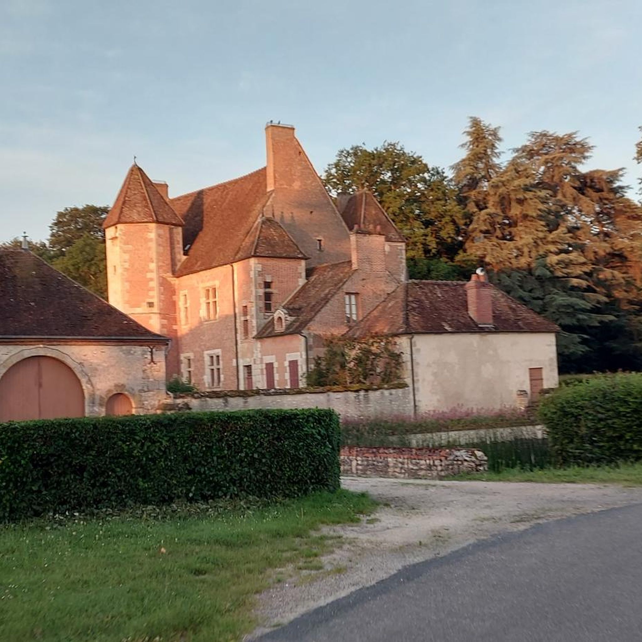
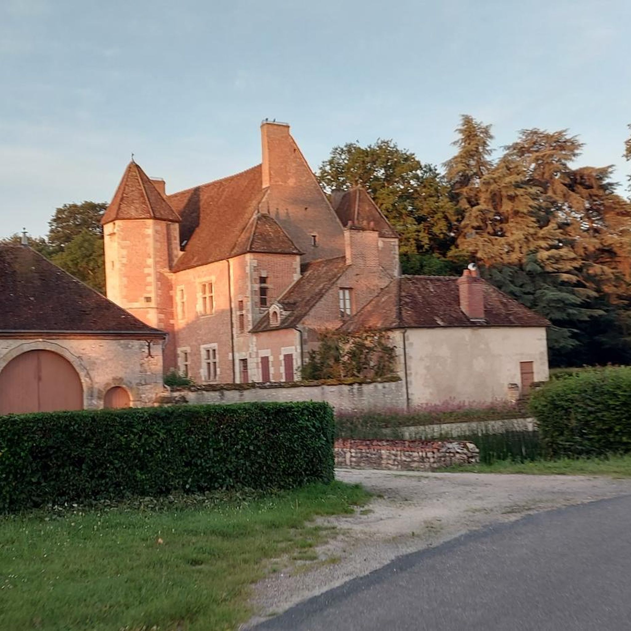
These remains, all in all impressive with their red brick and stone curtain walls as well as their ten towers, transport you back to 1544, the date when Hallier Castle was built by Charles de l'Hospital. It is seen as a very good example of transition between the fortified castle and the pleasure residence. Henri IV found Henriette d'Entragues there, his mistress to whom he had made a promise of marriage without ever keeping it. Always linked to the loves of kings, Nibelle, where this castle is located, would take its name from Charles IX, who offered Le Hallier to his mistress saying "Here is your nest, Belle..."
1
0

The Caillettes belvedere is located in the heart of the Ingrannes massif. This 24 meter high lookout tower stands on the Caillettes hill at the highest point of the Orléans forest. It offers a breathtaking view of the entire surrounding massif and the forest canopy. An orientation table allows you to orient yourself when reading the surrounding points of interest.
0
0
Keep and its pretty turrets, built between the 14th and 18th centuries and surrounded by a moat. Access to the exterior is free and is definitely worth a look when the rose gardens are in bloom in May-June.
0
0
Very old cemetery in which we find a certain number of historical remains, notably a Renaissance door, a gallery dating from the 12th or 13th century and the Saint-Lazare chapel which we discover from the street, built in bricks at the beginning of the 16th century (period during which the town of Boiscommun was fortified with brick ramparts).
0
0
Fountain whose origin is today unknown. She takes the name of Radegonde, the wife of Clotaire I (son of Clovis) and therefore queen of Franks, who, it seems, created this source with a kick of her heel.
0
0

A beautiful place to be on the canopy of the forest of Orleans. There are beautiful tracks to discover around.
1
0

Bellegarde, high place of the rose
1
0
Frequently Asked Questions
What kind of landscapes can I expect on hikes around Montliard?
Hiking around Montliard offers a diverse mix of landscapes, situated at the edge of the Beauce and Gâtinais regions. You'll find rolling paths winding through dense woodlands, past tranquil ponds, and across expansive agricultural fields of wheat or corn. The area is also just north of the vast Forêt Domaniale d'Orléans, providing ample opportunities for immersion in nature, and benefits from the Loiret department's extensive network of canals and waterways.
Are there many hiking trails available in Montliard?
Yes, Montliard boasts a wide selection of trails. There are over 70 hiking routes available, catering to various preferences. The majority are classified as easy or moderate, making the area accessible for many hikers.
Are there any easy hiking routes suitable for beginners or a relaxed stroll?
Absolutely. Montliard offers over 30 easy hiking trails. A great option for a relaxed walk is the Sentier de la rose — Loop in Bellegarde, an easy 7.1 km path that allows you to explore the traditional town of Bellegarde and its moated castle.
What are some notable natural features or viewpoints to discover on a hike?
A significant natural highlight is the Belvédère des Caillettes, located about 7 km from Montliard. From its 24-meter height, it offers a stunning 360-degree panoramic view over the expansive Orléans forest. You can experience this on the Le Hallier – Caillettes Viewpoint loop from Nibelle trail. The region's numerous ponds and the extensive canal network also provide scenic natural beauty.
Are there any circular hiking routes in the Montliard area?
Yes, many of the trails around Montliard are designed as circular routes, offering varied scenery without retracing your steps. For instance, the Canal and Brin d'Amour Loop is a moderate 11.0 km circular trail that explores the local canal network and surrounding natural areas.
What do other hikers say about the trails in Montliard?
The hiking trails in Montliard are highly regarded by the komoot community, with an average rating of 4.8 out of 5 stars from over 80 reviews. Hikers often praise the varied terrain, the peaceful woodlands, and the well-maintained paths that make for an enjoyable outdoor experience.
Are there any historical or cultural attractions near the hiking trails?
Yes, you can combine your hike with cultural exploration. The Sentier de la rose — Loop in Bellegarde offers views of the traditional town of Bellegarde and its moated Château de Bellegarde. Other nearby points of interest include Combreux Castle and the charming village of Boiscommun.
Can I find trails that pass by water features like ponds or canals?
Definitely. The Montliard area is characterized by its water network. The Canal and Brin d'Amour Loop specifically explores the local canal network. You'll also find trails like the PR of the Mails and the Pond that lead through woods and past a pond, offering serene waterside views.
What is the typical duration for hikes in Montliard?
Hikes in Montliard vary in length and duration. Many popular routes, such as the PR of the Mails and the Pond (9.0 km), can be completed in about 2 hours 18 minutes. Longer moderate trails, like the Canal and Brin d'Amour Loop (11.0 km), typically take around 2 hours 49 minutes.
Are there any specific trails that offer views of the Orléans Forest?
Yes, for impressive views of the Orléans Forest, consider the Le Hallier – Caillettes Viewpoint loop from Nibelle. This moderate 12.1 km trail will lead you to the Belvédère des Caillettes, which provides a panoramic vista over the vast forest.
Are there any other outdoor activities besides hiking in the Montliard area?
Beyond hiking, the Montliard area and the wider Loiret department are also well-suited for cycling and horseback riding, offering various ways to explore the picturesque countryside and its extensive network of paths and waterways.
Most popular attractions around Montliard

Get inspired with the komoot mobile app


Explore more
Browse the best Hikes in other regions.
