The best walks and hikes around Maxilly-Sur-Saône
4.6
(29)
174
hikers
27
hikes
Hiking around Maxilly-sur-Saône offers access to the verdant landscapes of the Val de Saône region, characterized by its significant waterways and diverse natural environments. The area features the tranquil Saône River and its ecologically rich alluvial plain, alongside the Canal entre Champagne et Bourgogne. Hikers will find a network of trails, including greenways, that traverse flat terrain, wet meadows, and woodlands. The region's low elevation provides accessible routes suitable for various activity levels.
Best hiking trails around Maxilly-Sur-Saône
- The most…
Last updated: October 9, 2026
5.0
(2)
11
hikers
8.65km
02:11
10m
10m
Moderate hike. Good fitness required. Easily-accessible paths. Suitable for all skill levels.
5.0
(2)
10
hikers
Moderate hike. Good fitness required. Easily-accessible paths. Suitable for all skill levels.

15
hikers
10.3km
02:35
10m
10m
Moderate hike. Good fitness required. Easily-accessible paths. Suitable for all skill levels.
3
hikers
6.26km
01:35
10m
10m
Easy hike. Great for any fitness level. Easily-accessible paths. Suitable for all skill levels.
5.0
(1)
7
hikers
3.54km
00:53
0m
0m
Easy hike. Great for any fitness level. Easily-accessible paths. Suitable for all skill levels.
Get access to more routes and recommendations from other explorers.
Already have an account?
Our route recommendations are based on thousands of hikes, rides, and runs completed by other people on komoot.
Start today with a free account
Your next adventure awaits.


Tips from the Community

A good place to stay overnight if you can find a free room.
5
3

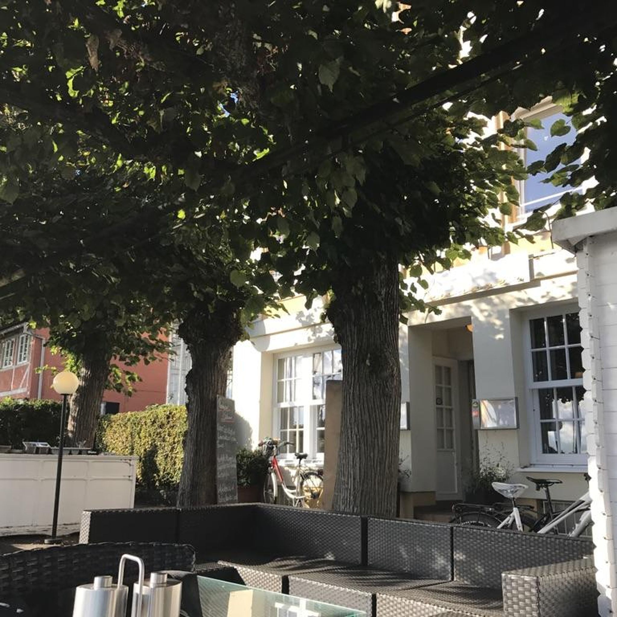
The town offers everything you need for a pleasant break: shops, refreshments at the bars, a safe swimming area at the beach, a charming marina, playgrounds for children, and a lovely view of the Saône.
2
0
Frequently Asked Questions
What kind of hiking trails can I expect around Maxilly-Sur-Saône?
The Maxilly-Sur-Saône area offers a variety of trails, primarily characterized by the tranquil Saône River, the Canal entre Champagne et Bourgogne, and its surrounding greenways. You'll find paths through wet meadows, along the canal, and into alluvial woodlands. The terrain is generally flat, making it accessible for various activity levels. There are 18 routes available, with an even split of easy and moderate options.
Are there any easy hiking trails suitable for beginners or families?
Yes, Maxilly-Sur-Saône is well-suited for easy hikes, with 9 routes classified as easy. These trails often follow the flat greenways alongside the Canal entre Champagne et Bourgogne or the Saône River, providing gentle walks perfect for beginners or families with children. For example, many sections of the 'Voie Verte' are ideal for a relaxed stroll.
What are the typical distances and durations for hikes in this region?
Hikes around Maxilly-Sur-Saône vary in length. For instance, the Ponds - Lamarche-sur-Saône loop from Lamarche-sur-Saône is about 11 km (6.8 miles) and takes around 2 hours 50 minutes. Shorter options like the Lock n°18 d'heuilley loop from Pontailler-sur-Saône cover about 8.5 km (5.3 miles) in just over 2 hours. The longest route listed is the Pontailler-sur-Saône – lock n°18 d'heuilley loop from Pontailler-sur-Saône, at 15.5 km (9.6 miles).
What natural features or landmarks can I see while hiking near Maxilly-Sur-Saône?
The region is rich in natural beauty, particularly along the Saône River and its alluvial plain, which is a protected natural area. You'll encounter wet meadows, islands, ponds, and diverse flora and fauna. The Canal entre Champagne et Bourgogne with its locks is also a prominent feature. For specific points of interest, consider visiting the Stone Bridge and Canal in Cheuge or the Swing Bridge on the Canal.
Are there any historical sites or charming villages to explore along the trails?
Yes, several trails pass through or near charming villages and historical sites. The 'Saône pond trail' (a regional route) guides hikers through villages featuring old churches and wash-houses, and past the castle at Athée. You can also explore the town of Pontailler-sur-Saône, or visit the nearby Forges of Pesmes, an old ironworks, and the classified historic garden of Château de Talmay.
What do other hikers say about the trails in Maxilly-Sur-Saône?
The hiking trails around Maxilly-Sur-Saône are highly regarded by the komoot community, with an average rating of 4.8 stars from over 20 reviews. Hikers often praise the peaceful canal-side paths, the natural beauty of the Saône River, and the well-maintained greenways that make for enjoyable and accessible walks.
Is Maxilly-Sur-Saône a good destination for circular walks?
Yes, many of the routes in the area are designed as loops, making them perfect for circular walks. For example, the Lock n°18 d'heuilley loop from Heuilley-sur-Saône is a popular circular option that follows the canal, offering a convenient way to explore without retracing your steps.
What is the best time of year to go hiking in Maxilly-Sur-Saône?
The region's verdant landscapes are enjoyable throughout much of the year. Spring and autumn offer pleasant temperatures and beautiful scenery, with spring bringing lush greenery and autumn showcasing vibrant foliage. Summer is also suitable, especially for walks along the waterways where breezes can provide some relief. Winter hikes are possible, though some paths might be muddy.
Are there any specific regulations for dog owners hiking in Maxilly-Sur-Saône?
While specific regulations for dogs on every trail are not detailed, generally, dogs are welcome on trails in France, especially on lead. Given the ecological richness of the Val de Saône and its protected areas, it's always advisable to keep dogs on a leash to protect local wildlife and ensure a pleasant experience for all hikers. Please ensure you clean up after your pet.
How can I get to the trailheads, and is parking available?
Maxilly-Sur-Saône is accessible by car, and parking is generally available in or near the villages that serve as starting points for many trails. For example, routes often begin from towns like Lamarche-sur-Saône, Heuilley-sur-Saône, or Pontailler-sur-Saône, where you can typically find local parking. Public transport options might be limited, so driving is often the most convenient way to reach various trailheads.
Are there any specific trails that offer views of the Saône River?
Many trails in the Maxilly-Sur-Saône area offer direct views of the Saône River. The region is defined by its proximity to this major waterway, and routes often run alongside its banks or through its alluvial plain. The 'Lock Trail' (Chemin des Écluses) and sections of the 'Voie Bleue' are particularly known for their scenic river views.
Where can I find more information about the natural heritage of the Val de Saône?
For more in-depth information about the ecological richness and natural heritage of the Val de Saône, including its wet meadows, islands, and alluvial woodlands, you can visit the official tourism website: tourisme-val-de-saone.fr. This resource provides valuable context about the protected natural areas you'll encounter on your hikes.
Most popular attractions around Maxilly-Sur-Saône

Get inspired with the komoot mobile app


Explore more
Browse the best Hikes in other regions.
