The best walks and hikes around Rouffiac
4.4
(70)
472
hikers
64
hikes
Hiking around Rouffiac offers diverse landscapes, characterized by river valleys, gentle hills, and extensive woodlands. The region features a mix of natural settings, including the Tarn River in one area and Lac de Rouffiac in another. Trails often traverse cultivated fields and provide views of historic towns and natural water bodies.
Best hiking trails around Rouffiac
- The most popular hiking route is Three Villages Trail, a 11.6 miles (18.7 km) trail that takes 4 hours 57 minutes to complete,…
Last updated: October 14, 2026
5.0
(1)
3
hikers
18.7km
04:57
180m
180m
Hike the moderate 11.6-mile Saint-Laurent-de-Cognac loop through vineyards and woodlands, featuring the historic Pont des Gaulois.
5.0
(3)
18
hikers
8.05km
02:11
120m
110m
Moderate hike. Good fitness required. Easily-accessible paths. Suitable for all skill levels.

5.0
(2)
14
hikers
7.99km
02:07
80m
80m
Moderate hike. Good fitness required. Easily-accessible paths. Suitable for all skill levels.
10
hikers
10.1km
02:40
80m
80m
Moderate hike. Good fitness required. Easily-accessible paths. Suitable for all skill levels.
4.0
(2)
8
hikers
13.5km
03:38
180m
180m
Moderate hike. Good fitness required. Easily-accessible paths. Suitable for all skill levels.
Get access to more routes and recommendations from other explorers.
Already have an account?
Our route recommendations are based on thousands of hikes, rides, and runs completed by other people on komoot.
Start today with a free account
Your next adventure awaits.



Tips from the Community

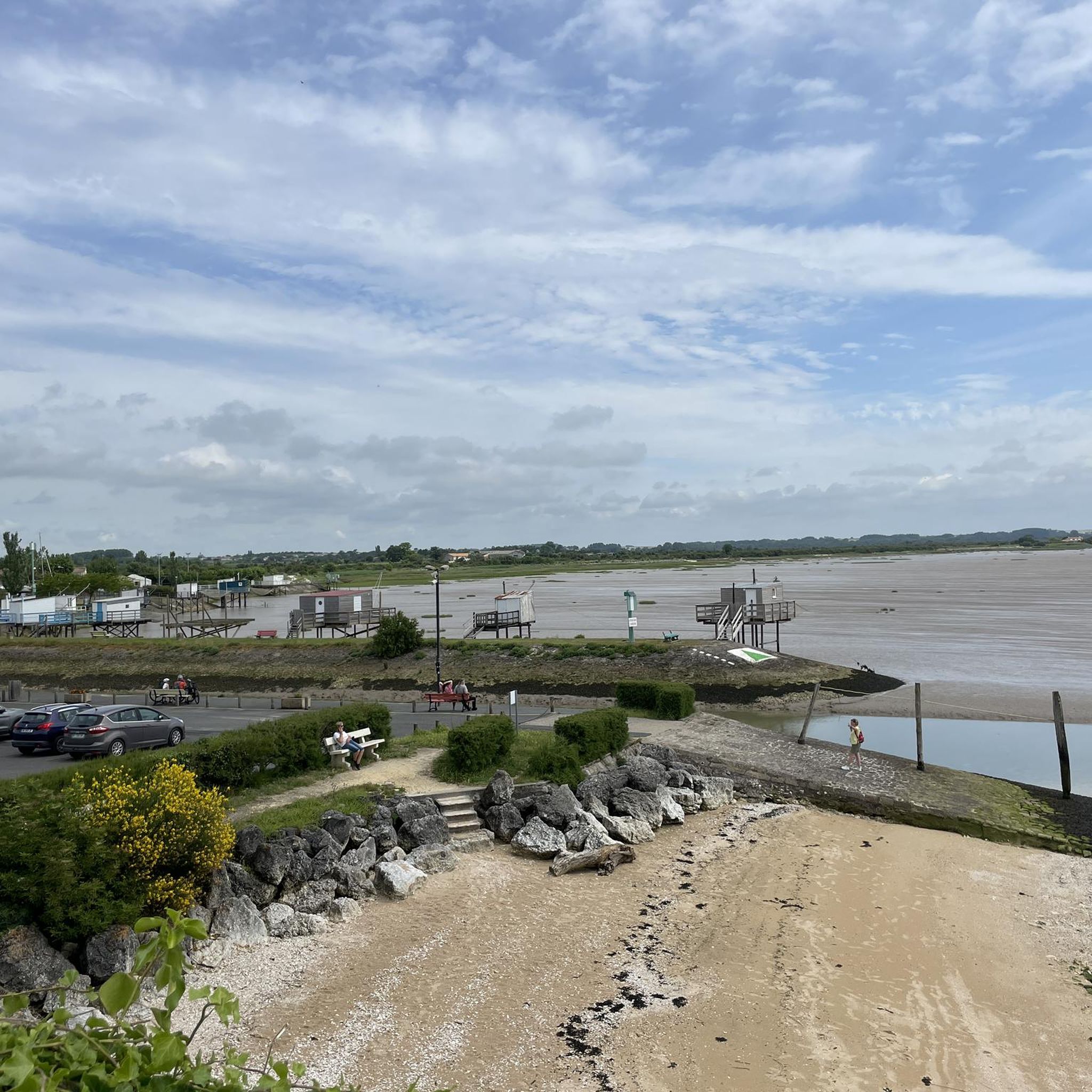
The Chaniers ferry (Charente-Maritime) is one of the last traditional river ferries still in operation in France. It allows crossing the Charente River between Chaniers and Courcoury, a few kilometers downstream from Saintes. A crossing used for centuries History of the Chaniers ferry The ferry crossing at Chaniers is very old: it dates back to the Middle Ages. In the mid-17th century, it was already an important crossing point on the Charente. It was not only used to cross the river: it also allowed residents to access the meadows on the other side, particularly for agricultural activities. In the early 20th century, the Chaniers ferry was part of a much larger network of crossings on the Charente. In 1909, thirteen ferries were still recorded in Charente-Inférieure, including the one in Chaniers. Ferries were essential at the time before the proliferation of bridges. Why "chain ferry"? The principle consists of holding the ferry on a chain connecting the two banks. The ferryman uses this chain to move the boat forward and keep it on its course despite the current. In Chaniers, the current ferry is motorized, unlike the ferry in Dompierre-sur-Charente, which is operated manually. The Tourist Office, however, still describes it as a "chain ferry," and the municipality as the traditional crossing method connecting Chaniers to Courcoury. The ferry today The crossing takes place between Le Communal in Chaniers and the Courcoury bank. It is free and can transport pedestrians, cyclists, and motorized vehicles. Its operation depends in particular on the flow of the Charente River. The municipality of Chaniers officially presents "the port of Chaniers and its chain ferry" as an element of its local heritage. Important point: I am correcting my previous message: the Chaniers ferry is not simply a "19th-century ferry." The crossing has been attested since the Middle Ages; it is its mode of operation and its equipment that have evolved over the centuries.
0
0

I really enjoyed this ride. I’m 46, I did it on a 40 year old road bike, it’s more suited to a cyclocross bike!
1
0

This cave is open during the opening hours of the paleosite which offers tours.
0
0
Great hike, to be done at the end of April, beginning of May for the colors or in the fall Appreciable tranquility
1
0

Built in the 11th and 12th centuries, this church, listed as a historic monument in 1912, is a spectacular work of art. Well worth the drive past when crossing town!
0
0
A particularity is located in the gallery of arcature which overhangs the portal. Indeed it has three arched windows on one side of the central window and two semicircular on the other. Note that the two bays on the right occupy the same width as the three on the left. The bell tower, like many others in the region, has a pyramidal roof. Simple columns come to partition the two windows which cover each face. Inside the church, archival documents prove that the nave with two bays was originally vaulted with warheads. Unfortunately, this vault was destroyed during religious wars. Still according to archival documents, it would seem that at the beginning of the 20th century, a narthex, where the catechumens were held, leaned on its facade. Today, it has completely disappeared. The church was classified as a historic monument in 1913. The building underwent a complete restoration in 1935. To admire just next to the church a magnificent and majestic period residence.
0
0

Take a closer look at the rocks to see the location of a Gallic medieval bridge.
2
0
It was in the 12th century that the church of Saint Césaire was built. It is a Saintonge Romanesque style church.
0
1
Frequently Asked Questions
How many hiking trails are available around Rouffiac?
There are over 45 hiking routes around Rouffiac, offering a diverse range of experiences. These include 12 easy trails and 37 moderate options, ensuring there's something for every skill level.
What kind of landscapes and natural features can I expect to see while hiking in Rouffiac?
Hiking around Rouffiac offers varied scenery depending on the specific location. In the Tarn department, you'll find trails through rolling landscapes with views of the Tarn River and gentle hills, often passing historic towns. In the Dordogne, particularly around Lac de Rouffiac, you can expect lush, wooded parkland, hillsides with breathtaking valley views, and cultivated fields. The 44-hectare Lac de Rouffiac itself is a prominent natural feature, with a pleasant 7 km loop trail around it.
Are there any easy hiking options suitable for beginners or casual walkers?
Yes, Rouffiac offers 12 easy hiking trails perfect for beginners or those seeking a relaxed stroll. These routes typically feature gentle terrain and are shorter in distance. For example, the 7 km loop around Lac de Rouffiac in the Dordogne is an easy and scenic option, featuring wooded areas and open views.
What do other hikers enjoy most about the trails in Rouffiac?
The hiking trails in Rouffiac are highly rated by the komoot community, with an average score of 4.3 stars from 36 reviews. Hikers often praise the diverse rural scenery, the blend of natural beauty with historic elements, and the well-maintained paths that cater to various abilities.
Are there any circular hiking routes in the Rouffiac area?
Yes, many routes around Rouffiac are circular, allowing you to start and end at the same point. A popular example is the St Sauvant loop from Saint-Sauvant, a moderate 7.9 km path that offers views of the local countryside. In the Dordogne, the 7 km loop around Lac de Rouffiac is also a great circular option.
Can I find family-friendly hiking trails in Rouffiac?
Yes, the Rouffiac region offers several family-friendly hiking options, particularly among the 12 easy trails available. The gentle hills and well-defined paths make them suitable for all ages. The 7 km loop around Lac de Rouffiac in the Dordogne is an excellent choice for families, combining natural beauty with opportunities for other leisure activities at the Rouffiac Leisure Center.
What kind of historical sites or landmarks can I see near the hiking trails?
The Rouffiac area is rich in historical sites. In the Tarn, routes often provide views of historic towns like Albi, including the notable Albi Cathedral and the Albi Old Bridge. You can also explore the area around Château de La Dixmerie. In the Dordogne, some trails lead to medieval castles, and you can discover old mills, such as those near Plassac-Rouffiac, offering a glimpse into local heritage.
What is the best time of year to go hiking in Rouffiac?
The best time for hiking in Rouffiac generally spans from spring to autumn. During these seasons, the weather is typically mild and pleasant, making for comfortable walking conditions. Spring brings blooming landscapes, while autumn offers beautiful foliage. Summer is also suitable, though it can be warmer, especially in the Tarn department.
Are there any amenities or places to eat near the hiking trails?
Yes, depending on your chosen hiking area, you'll find amenities. In the Tarn, routes near Albi offer access to the city's cafes, pubs, and accommodation. Around Lac de Rouffiac in the Dordogne, the Rouffiac Leisure Center provides various facilities. For trails in more rural settings, it's advisable to check local village offerings or pack your own provisions.
Are dogs allowed on the hiking trails in Rouffiac?
Generally, dogs are welcome on many hiking trails in the Rouffiac region, especially in rural and natural areas. However, it's always recommended to keep them on a leash, particularly in areas with livestock or wildlife, and to check for specific local regulations, especially within protected natural parks or near private properties.
Where can I park when accessing hiking trails around Rouffiac?
Parking availability varies by trailhead. For trails near towns like Albi in the Tarn, public parking lots are usually accessible. Around Lac de Rouffiac in the Dordogne, dedicated parking is available at the leisure center. For more remote routes, informal parking spots may be found near trailheads in villages or along country roads. Always ensure you park responsibly and do not obstruct access.
Are there any longer, more challenging routes for experienced hikers?
While Rouffiac primarily features easy to moderate trails, some longer routes offer a greater challenge. For instance, the Three Villages Trail is a moderate 18.7 km route that takes nearly 5 hours to complete, providing varied rural scenery and a good workout for experienced hikers.
Can I reach any trailheads using public transport?
Access to trailheads by public transport is more feasible in areas closer to larger towns. For example, trails near Albi in the Tarn may be accessible via local bus services or by train to Albi-Ville. In more rural parts of the Dordogne, public transport options might be limited, making a car more convenient for reaching specific trailheads.
Most popular attractions around Rouffiac

Get inspired with the komoot mobile app


Explore more
Browse the best Hikes in other regions.
