The best walks and hikes around Rancennes
4.4
(2823)
11,910
hikers
434
hikes
Hiking trails around Rancennes offer a diverse landscape within the French Ardennes, characterized by its position on a plateau overlooking the Meuse valley. The region features dense forests, dry grasslands, and steep escarpments carved by the river. As part of the Ardennes Regional Natural Park, the area provides a mix of rolling hills and unique geological features like sinkholes, making it suitable for varied outdoor exploration.
Best hiking trails around Rancennes
- The most popular hiking route is Mont d'Haurs —…
Last updated: October 13, 2026
4.5
(106)
484
hikers
4.39km
01:16
100m
100m
Moderate hike. Great for any fitness level. Mostly accessible paths. Sure-footedness required.
4.4
(17)
40
hikers
12.1km
03:39
390m
390m
Moderate hike. Good fitness required. Easily-accessible paths. Suitable for all skill levels.

4.6
(20)
80
hikers
6.08km
01:43
120m
120m
Moderate hike. Great for any fitness level. Mostly accessible paths. Sure-footedness required.
4.4
(11)
31
hikers
11.5km
03:02
110m
110m
Moderate hike. Good fitness required. Easily-accessible paths. Suitable for all skill levels.
4.5
(4)
26
hikers
20.3km
05:38
340m
340m
Hard hike. Very good fitness required. Mostly accessible paths. Sure-footedness required.
Get access to more routes and recommendations from other explorers.
Already have an account?
Our route recommendations are based on thousands of hikes, rides, and runs completed by other people on komoot.
Start today with a free account
Your next adventure awaits.

Tips from the Community


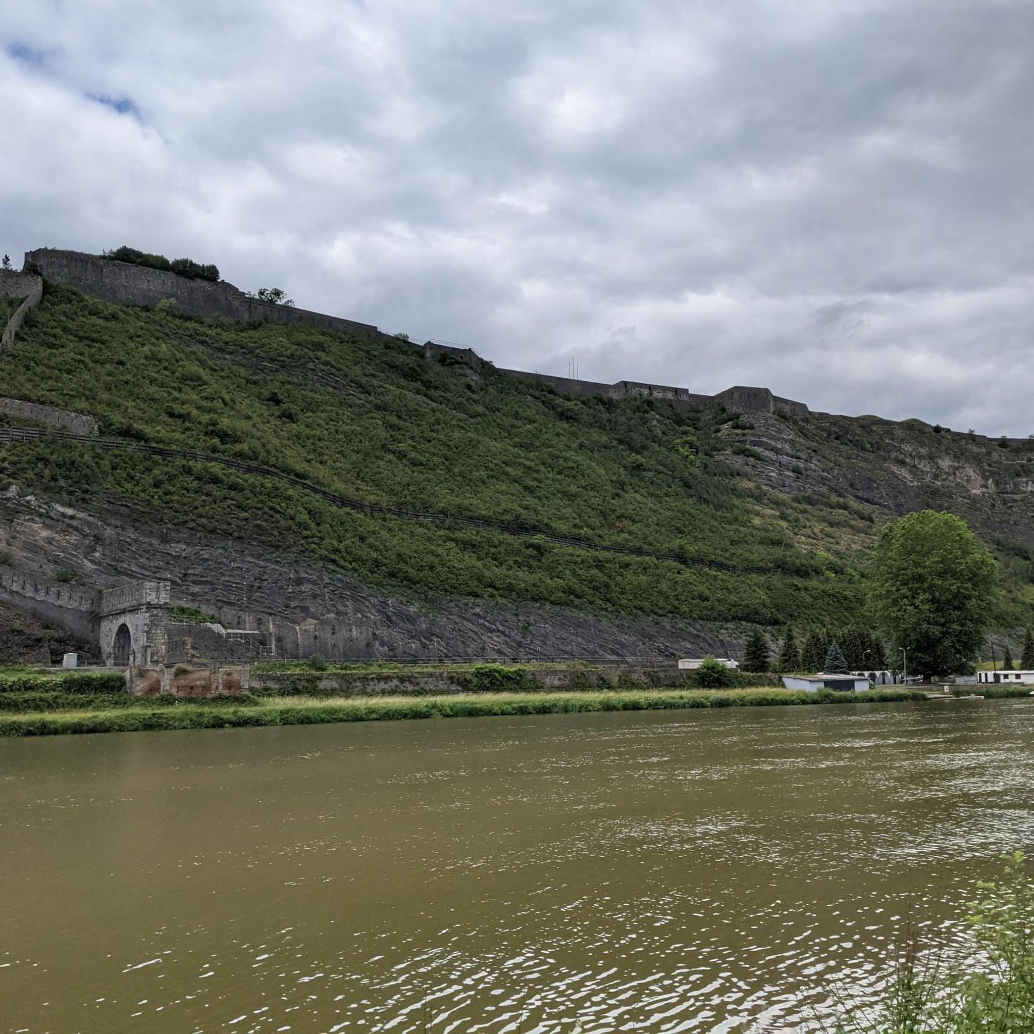
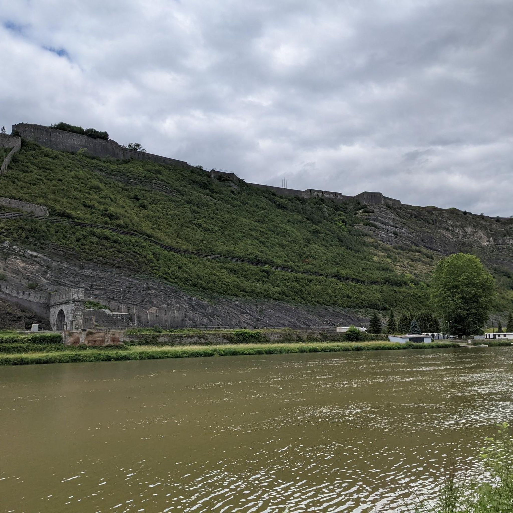
The construction of Fort Charlemont began in 1555 by order of Emperor Charles V. It dominates Givet and the Meuse valley. The fort and its defences have been modified several times. Between around 1600 and 1675, the Spanish expanded the fort. In 1678, it was conquered by the French army of King Louis XIV. The town fell to France in 1697. Vauban was commissioned to expand the complex and improve the works. In 1874, several forts on the border were modified based on the ideas of Séré de Rivières, including this fort. The bastions were rebuilt and an underground staircase with several hundred steps was dug into the rock. The staircase connects the fort to a railway tunnel. In this way, the fort could be supplied with ammunition, soldiers and equipment, all out of sight of the enemy and invulnerable to enemy artillery fire. In 2009, the French army transferred the fort to the municipality of Givet.
1
0
Givet belongs to the region of the French Ardennes and to the Calestienne. The pointe de Givet, consisting of Givet and its surroundings, is the only part of France where Walloon is spoken. Until the end of the 17th century, the area was part of the Southern Netherlands.
1
0


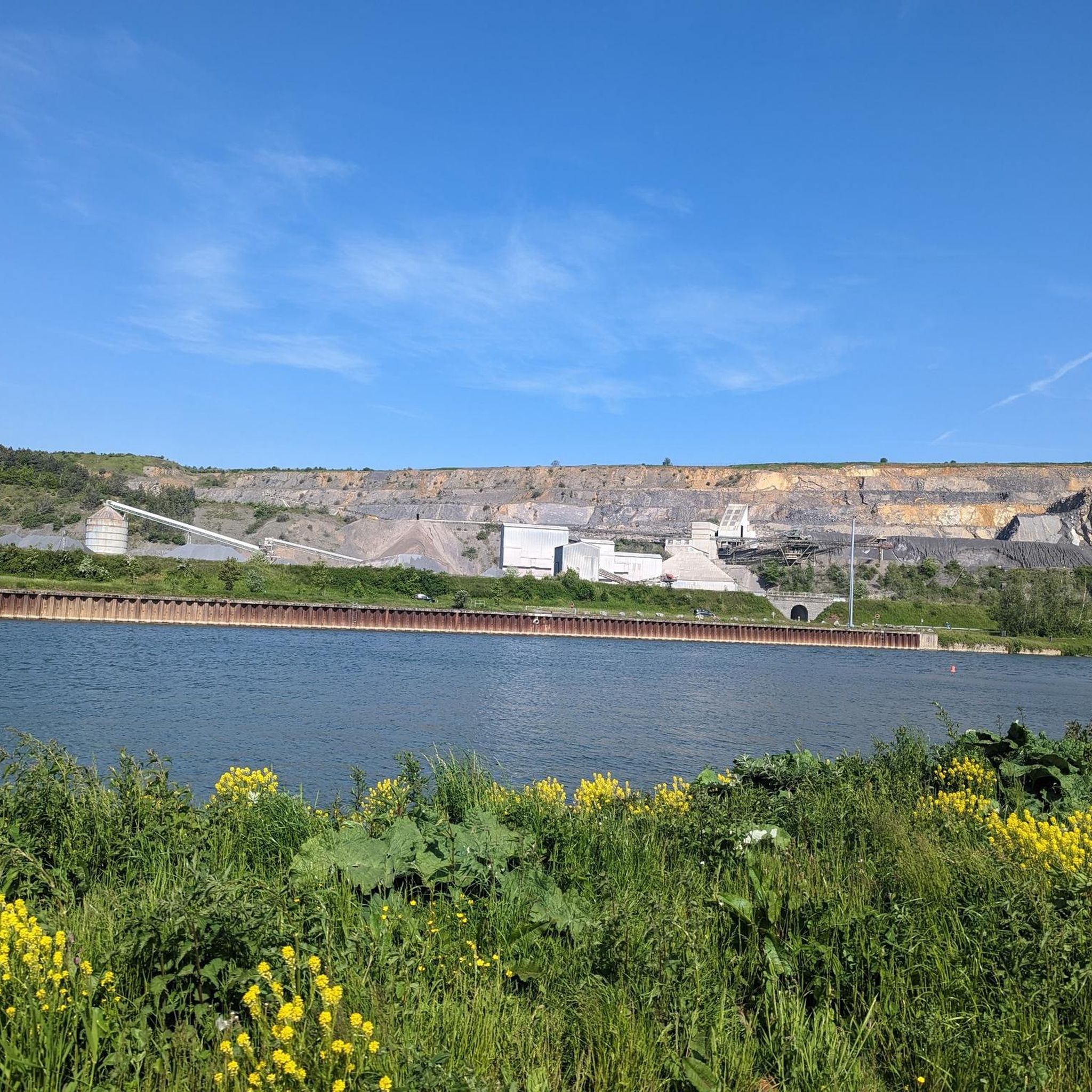
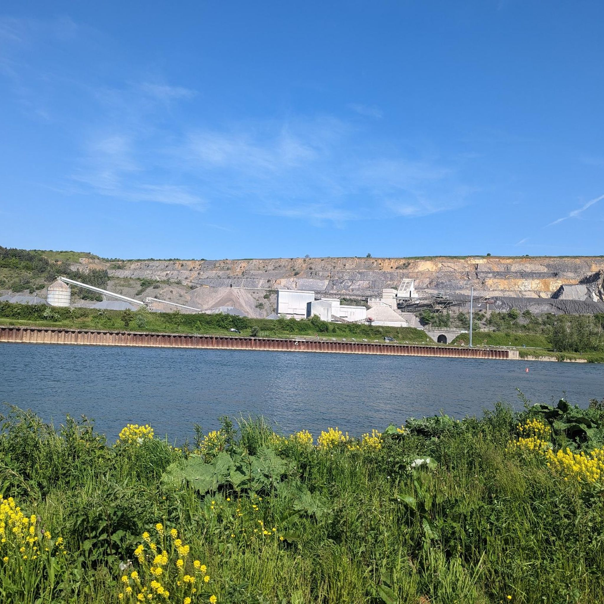
panoramic point with beautiful views over the beautiful landscape
0
0
beautiful view over the beautiful landscape
1
0
Frequently Asked Questions
How many hiking trails are available around Rancennes?
Rancennes offers a wide variety of hiking experiences, with over 400 routes available. These trails cater to all levels, from easy strolls to more challenging treks through the diverse landscapes of the French Ardennes.
What are the difficulty levels of hiking trails in Rancennes?
The hiking trails around Rancennes offer a range of difficulties. You'll find approximately 148 easy routes, 226 moderate paths, and 41 more challenging trails, ensuring options for every hiker's ability and preference.
Are there family-friendly hiking options near Rancennes?
Yes, Rancennes and the surrounding Ardennes Regional Natural Park offer many family-friendly hiking options. Look for trails marked as 'easy' for shorter distances and gentler terrain, perfect for walks with children. The Mont d'Haurs — loop from Givet is a shorter, accessible option that provides views of the Meuse valley.
Can I bring my dog on hikes around Rancennes?
Generally, dogs are welcome on most hiking trails in the Rancennes area, especially within the broader Ardennes Regional Natural Park. However, it's always advisable to keep them on a leash, particularly in nature reserves or areas with livestock, to protect local wildlife and ensure a pleasant experience for all hikers.
Are there circular hiking routes available in Rancennes?
Yes, many of the trails around Rancennes are designed as circular routes, allowing you to start and end at the same point without retracing your steps. Examples include the popular The heights of the Meuse valley — loop from Charnois and the Information Point – View of Fort de Charlemont loop from Givet, which offer varied terrain and scenic views.
What natural features or landmarks can I see while hiking near Rancennes?
Rancennes is rich in natural beauty and historical landmarks. You can explore the dramatic landscapes of the Pointe de Givet nature reserve, with its steep cliffs and dry grasslands. Don't miss the unique geological sinkhole known as Le Trou de la Noche. Additionally, many trails offer stunning views over the Meuse valley and the historic Fort de Charlemont in Givet.
When is the best time of year to go hiking in Rancennes?
The best time for hiking in Rancennes is typically from spring through autumn (April to October). During these months, the weather is generally mild and pleasant, and the natural landscapes are vibrant. Spring brings blooming wildflowers, while autumn offers spectacular fall foliage across the Ardennes forests. Winter hiking is possible but requires appropriate gear for colder temperatures and potentially icy conditions.
Is parking available for hikers in Rancennes?
Yes, parking is generally available in and around Rancennes, especially near trailheads and in the nearby town of Givet. Specific parking information can often be found on individual route descriptions or local tourist information boards. It's always a good idea to check for designated parking areas before starting your hike.
How accessible are the hiking trails by public transport?
While Rancennes itself is a smaller village, the nearby town of Givet serves as a more significant hub with public transport connections. From Givet, some trailheads may be accessible by local bus services, or you might consider a short taxi ride to reach specific starting points. The Trans-Ardennes cycle path, which follows the Meuse, is also accessible and suitable for walking, offering a flat and easy-going route.
Are any permits required for hiking in the Rancennes area?
No specific permits are generally required for hiking on public trails in the Rancennes area or within the Ardennes Regional Natural Park. However, always respect private property, stay on marked paths, and adhere to any local regulations, especially within nature reserves like the Pointe de Givet, to preserve the natural environment.
What do other hikers enjoy most about the trails around Rancennes?
The trails around Rancennes are highly rated by the komoot community, with an average score of 4.4 stars from over 2,100 reviews. Hikers frequently praise the stunning panoramic views over the Meuse valley, the tranquility of the dense forests, and the unique geological features like Le Trou de la Noche. The diverse terrain and well-maintained paths also contribute to a highly enjoyable outdoor experience.
Are there any viewpoints offering scenic vistas along the hikes?
Absolutely. Rancennes is known for its strategic location, often called the 'balcony' of the Pointe de Givet. Many trails offer impressive, plunging views over the town of Givet and the majestic Meuse valley. Look for routes that traverse the plateau south of Givet for the most spectacular scenic perspectives.
Can I find places to eat or drink near the hiking routes?
While Rancennes is a quiet village, the nearby town of Givet, just a few minutes away, offers a selection of cafes, restaurants, and shops where you can refuel before or after your hike. It's a good idea to plan your route to pass through or near Givet if you wish to stop for refreshments.
Most popular routes around Rancennes
Most popular attractions around Rancennes

Get inspired with the komoot mobile app


Explore more
Browse the best Hikes in other regions.
